Home

Portsmouth Place Names: Lawton’s Valley – Mills and Julia Ward Howe

1 Comment

1900s postcard of the falls at Lawton’s Valley

Lawton’s Valley was once a prominent picnic spot in Portsmouth.  We have newspaper clippings of church groups going there around 1900 and there is a lovely postcard of the fall at Lawton’s Valley.  I still make the corn chowder recipe that my dad learned when cooking over a Boy Scout campfire in Lawton’s Valley.  The coming of the reservoir in the Valley has changed the geography of the area, but its history is still part of Portsmouth’s great past.

Captain George Lawton (Layton), one of the signers of the Portsmouth Compact in 1638 and 1648 is probably the source of the name Lawton’s Valley.  Early records show him as owner of the property by the “Wading River” – now called Lawton’s Brook.  He built a mill on his property which was located on either side of what we call West Main Road.  The valley was the site of two mills.  One mill was for “carding and fulling” – a way to wash and prepare wool for use.  Another mill was for the manufacture of “Negro cloth.”  There were grist mills for grinding corn in the area as well.

Julia Ward Howe by a Lawton Valley Mill

Julia Ward Howe first came to Lawton’s Valley around 1850.  Her first home was right by the ravine on the west side of West Main Road.  After her husband sold that beloved property, Julia and her husband bought another home in the Lawton’s Valley area – Oak Glen on Union Street.

1850 map showing Lawton’s Valley

Lawton’s Valley had been a favorite spot for picnics, gatherings and camping.  When the Norman family (associated with the Newport Water Works) owned the property there were restrictions.  Barbara Norman Cook (known as Kittymouse) bought some of the property (perhaps the original 40 acres that George Lawton had) and opened it up to the public.

During World War II the Navy created a reservoir and pumping station to support the war effort.  Looking at maps from 1907 and today, it seems clear that some of the land on the east side of West Main Road was flooded for the reservoir.  This is now property of the City of Newport for a water supply for area residents.

It is difficult to get down into Lawton’s Valley today, so the days of church picnics and Boy Scout outings may be over.  The whole “Lawton Valley” area  still remains rich in Portsmouth history.

Portsmouth Place Names: McCorrie (McCurry) Point

1 Comment

McCorrie Point

I live in the McCorrie Point area, so I was curious to know how it was named.  There was even a one room schoolhouse on Schoolhouse Lane that was named McCorrie, so that name had to have some importance.

First I went to old maps, and I couldn’t find a McCorrie connection.  West’s land grant maps list the area as being owned by the Borden family.  Revolutionary War era maps list the point as “Sandy Point” and what we call Sandy Point Beach as “Little Sandy Point.”  Maps from 1870 that list property owners have the point listed as “McCurry Point” and the land as owned by someone named Fales.

So then I began to look up “McCorrie” in Portsmouth History.  One of my first tasks as a volunteer for the Portsmouth Historical Society was to transcribe a document that recorded the vote in 1788 of Portsmouth citizens on adopting the Constitution.  Rhode Island was the last of the thirteen states to ratify it and it was a struggle to get to a “yes” vote.   An “Andrew McCorrie” was one of the very few citizens that initially voted to ratify the constitution.  On a genealogical resource I found the record of a marriage of Andrew McCorrie and Ann Chase.  One source listed 1756 as the date – another 1765.  Both sources have Andrew as being born in 1735.    This Andrew might be the right age to be our Constitution voter.  This Andrew McCorrie held town offices in the late 1780s and through the 1790s.

The name “Andrew McCorrie” was passed down to Andrew (1771-1828) who married Phebe Cook.  A third “Andrew McCorrie” (1803-1878) was married to Susan Borden.  Did Susan Borden inherit the land from her family?  The Borden Family Genealogy “Historical and Genealogical Record of the Descendants of Richard and Joan Borden” comments that the Borden’s son Matthew must have been born on land “since known as the MacCorrie Farm.”

Part of McCorrie Point’s history is that noted Congregational minister Ezra Stiles who lived in Newport during the Revolutionary Era, wrote about a special stone found on the beach.  Edmund Delabarre writes in an article for the Rhode Island Historical Society that in the fourth volume of Stiles’ manuscript “Itineraries” Stiles writes “Visited & copied a markt Rock about half a m above Fogland Ferry on Rh. I on shore against or just below Mr. McCory’s Farm.”  Looking at maps today, that would probably be a half a mile to the south of McCurry Point.  Delabarre states “This Point is part of an estate still known as the McCorrie Farms.  In 1920 Delabarre tried to find this stone.  Stile’s drawing of this McCory’s Farm rock no longer exists, but Stiles recognized the letter Z and the letter S marked on the stone.  Stiles recorded another Indian Cup stone that was located at Arnold’s Point.  You can see this rock outside the Old Town Hall at the Portsmouth Historical Society.  The large rock has what looks like the Big Dipper carved into it.

I can never be certain how McCorrie Point got its name, but I do enjoy walking to the beach and recalling family times there.  When my grandsons visit, it is our favorite place to collect shells.

Portsmouth Place Names: The Glen

1 Comment

A “glen”is a secluded narrow valley. That is an apt description of the heart of our Glen district in Portsmouth. The “Glen” and Glen Road appear on colonial maps of Portsmouth. Early land grants gave the Glen area to William Brenton. His large farm grant stretched from just below McCorrie Point (they called it Sandy Point) to Hutchinson land at our Sandy Point (they called it Little Sandy Point). He called his farm “Middleford Farm” and Glen Road was the approach to it.  Early town records show a land sale by Brenton to Thomas Cooke on October 25, 1649. Brenton reserves the right to a “cart way” through the land to carry hay from the water to his farm. Cooke and his family had moved to Portsmouth in 1643. In 1648 Cook is listed in the Town Council records as receiving 30 acres of a land grant on which he built his house in the area we call “The Glen.”  This property ran

toward Mr. Burtun’s ferry which may be an early name for the Fogland Ferry near the foot of Glen Road. In 1649 Cooke bought the adjacent land from Brenton.  In 1655 Thomas Cooke Sr. builds his home on the site of the present day Glen Manor House. Cooke’s son and grandson bought land around it and the family was very active in Portsmouth life.  In 1657 Thomas Cooke, Jr. sold part of his land to Giles Slocum. The border of that property was called “the brook” and we know it as the stream that runs through the Glen.   John Randall also sells Slocum a piece of land he had bought from Thomas Cook Jr.  This land is around the Slocum graveyard and current Glen barns. In 1668 records show that the Cooke family ferries cattle, sheep and horses daily for grazing from what is now the Glen Manor House dock area to

Cook Lands and Ferry

The Cook family began to ferry their animals to Fogland to graze during the day.

Fogland in Tiverton.

The Glen’s first settlers, the Cooke family, gradually moved away and sold their land, but many of the Cooke daughters married into local families. It is hard to trace all the ownership of what is now the town owned Glen land, but we did discover information on some of those landowners. In 1720 John Cooke sells a portion of his land to James Sisson. By 1745 Sisson had a water powered grist mill to grind corn on the brook in the Glen. Revolutionary War era maps show the location of that mill as just east of Glen Farm Road and the barn complex. James Sisson then sells his mill and 46 acres around the brook to Joseph Cundall. What we call “the Glen” becomes commonly known as Cundall’s Mills. In 1706 Joseph Cundall had left his native England to become an indentured servant in America. Becoming an indentured servant was a way a young person could learn a trade and get an education in exchange for working for seven years or more. Cundall seems to have learned his trade well and was in a good position to buy land as an adult. Water from the stream powered the carding and fulling mills to wash and pull woolen fibers. Joseph Cundall added almost a hundred more acres to his land around the Glen before he died in 1760. Old local history books tell the tragic story of his son Joseph who got lost in a Christmas Eve snowstorm and died on his way home in 1811.

By 1815 the mills and the land are in the hands of Judge Samual Clarke, whose wife Barbary was a Cundall. The mill was still known as Cundall’s Mills and he advertised that he bought a new carding machine and could dye wool. He advertised that he could manufacture cashmeres, flannels and satinets. The land transfers are hard to follow, but by 1823 the mills were on the auction block and the inventory lists a gristmill and clothier works with looms and spinning machines.

Currier and Ives print of the Glen as picnic area

Local historian Rev. Edward Petersen wrote in 1853: “Cundall’s Mills is one of the most romantic spots on the island, and has become a general resort of strangers, who visit Newport in summer, to enjoy the salubrity of its climate and its picturesque scenery.” Artists Currier and Ives even illustrated a picnic at the Glen in 1860. Henry Wadsworth Longfellow’s diaries record an 1852 visit.: “Then we drove to the Glen, and walked down a lovely little valley, with a brown brook threading it and a silent mill, to the sea shore; a charming secluded nook.” The Glen was a popular spot to enjoy nature, take a walk, paint and even write poetry. Visitors would often enjoy a stop at Mrs. Durfee’s Tea House on the way home.

Down in the Glen today. Remains of Glen Farm power station in view.

The Glen land was divided and re-divided into small farms. On September 28, 1882 Halsey P. Coon sold his “Glen Farm” to H.A.C. Taylor. The land evidence records note that it was a parcel of land with “two dwelling houses, a grist mill, two barns, two cribs and other out buildings.” The tract of land was about 111 acres of land. The “Glen” is a traditional name for the area and Taylor continued to call it “Glen Farm.”  In the hands of the Taylor family, the farm grew in value, prestige and land area. What H.A.C. Taylor did in his land purchases, was to make a large gentleman’s farm from all the smaller farms in the area.  The Taylors would go on to buy the farms or house lots of Howard Smith, Harriet Smyth, Frank Smith, Wm. Ware, Mary B. Field, Frederick Field, Charles Slocum, the Cundall family, Leonard Brown, William Coggeshall, William Chase, William Sisson and the Durfee Tea House lot.  H.A.C Taylor’s son Moses and daughter-in-law Edith Bishop Taylor would continue to grow the property until it was 1500 acres. After H.A.C. Taylor’s daughter-in-law Edith Taylor Nicholson died in 1959 the property was again broken up and sold. Much of the land is in housing developments. Other pieces are planted with nursery stock but the Glen brook area itself remains in private hands.  Thankfully the people of Portsmouth are the owners of two very special pieces of Glen. The Glen is still a popular recreation site for our town.

Portsmouth Place Names: Common Fence Point

1 Comment

Edward West map of original settlers.

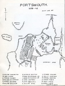
Some places in Portsmouth have changed names over the years, but Common Fence Point was the name used in 1638 and it is the name used today.  A Borden family genealogy gives us the root cause for the name: “To the northeast of the spring a neck of land extends about two miles, which was nearly separated by creeks, marshes and the town pond from the rest of the island.  This strip of land, called by the natives Pocasset Neck, was set off by the settlers as a common by running a fence from the south end of the pond to a cove on the east side of the island. This common was called the fence common, to distinguish it from the lands outside to the south and west of it, which were all common; and the north point then received the name of common fence point. “(1)

The original settlement of Portsmouth took a pattern that was familiar to the English – homes were in a central village location and their animals grazed on common land around the homesteads.  Recording how each family branded their animals was very important with their stock intermingled in the commons.   While this may have been a good pattern the first year when they needed to be close together for safety, this land use soon gave way to larger scattered farm lots which included their homes.

Edward West’s land grant maps show William Brenton as being the owner of much of Common Fence Point. Common Fence Point shifted to the Durfee Family a short while later.  Thomas Durfee Junior was a Portsmouth Deputy to the colonial Assembly and records show he got an Act passed in 1717 to benefit himself.   “On June 18, 1717, Thomas and his wife Ann petitioned the Assembly … for a good and sufficient highway to be laid out to his farm at Common Fence Point, he having already applied to the committee of the town of Portsmouth, but did not obtain it.  The Assembly ordered the committee to lay out, within one month’s time a good lawful and passable highway fit for horses and carts to pass and repass … “(2)

In 1728 Thomas Durfee Junior deeded 60 acres of Common Fence Point Farm to his son Gideon, but he was to pass it down to his brother Job when he was old enough.  What was farming Common Fence Point like?  Thomas Durfee Jr.’s death inventory gives us some insights.  Among his belongings were spectacles, books, money scales, tailor shears, iron heaters, steelyards, and spinning wheels.  His animals included geese, cattle, horses, sheep and swine.  Among his possessions was a slave.  His home included an “outward room, bedroom, kitchen, bedchamber, “outward room chamber,”  garret and cellar.”  (3)

The 1849 Hammett Map shows Abner Chace holding Common Fence Point and the Chace (or Chase) family seemed to own pieces of the Point for many years.  In 1865  a charter was granted to several men to build and operate the Rhode Island Oil and Guano Company on Common Fence Point.

Pogy boats

By 1900 part of Common Fence Point held the largest fish factory in the country.  The Tiverton based Church Brothers – Daniel, Nathaniel, Joe, Jim, Isaac, Fisher and George went into business together in 1870.  They commissioned the Herreshoff boatyard in Bristol to build the first fishing steamer – the Seven Brothers.  At first they were fishing for food, but they realized that fish oil and fertilizer from the pogy fish (menhaden)  had potential for profit.  They brought a menhaden processing factory in Maine, dismantled it and rebuilt it on Common Fence Point. The complex cookhouse was 35 ft square and there were two large dinning rooms to feed three hundred workers.  A large building held sleeping quarters and a net mending area.  A cooper made barrels for transporting the oil and there were boat shops.  The Church Brothers Fisheries barn burned in 1928 and that was the last of the Church facilities on Common Fence Point.

Common Fence Point gradually developed into a community.  At first many of the houses served as summer homes, but they gradually became occupied year round.  The Common Fence Point Improvement Association has been active in the community since he 1950s and continues to serve the residents of Common Fence Point with music programs, classes, activities for children and as an Arts Center.

(1) Historical and Genealogical Record of the Descendants as Far as Known of Richard and Joan Borden, who Settled in Portsmouth, Rhode Island, May, 1638: With Historical and Biographical Sketches of Some of Their Descendants H.B. Weld, 1899

(2) The Descendants of Thomas Durfee of Portsmouth RI-Vol. 1, by Wm. Reed.  1902.

(3) Genealogical Records of the Descendants of Thomas Brownell compiled by George Brownell, New York, 1910.

Portsmouth Grove, Bradford, Melville — What’s in a Name?

3 Comments

We know the area as Melville today, but if you look at some of the maps from before the Civil War it was called “Portsmouth Grove.”  It was the site of a recreational park with games (ten pin bowling) and rides (like a merry go round). There was a dock for the steam ships to bring customers for a day of fun and recreation. During the Civil War it was the location of Lovell Hospital.  After the war all signs of the hospital vanished after an auction was held to move buildings and equipment off the ground.  Many old homes in the Portsmouth area have additions or woodwork from the old hospital.  The land became private again.

Bradford Coaling Station

In 1901 the Bradford Coaling Station was constructed in the area in order to supply coal to steamers and military transports navigating Narragansett Bay.   Coal was stored until it was loaded onto ships.  Bradford was named for Rear Admiral Royal Bird Bradford whose job was to supply coal to American warships throughout the world.  Vintage postcards from “Bradford, Rhode Island” show images of the coaling station and a coaling towers the background. By 1910 the Post Office became known by the name “Bradford.”

By 1914 the Post Office began to be called “Melville.”  At that time the

Admiral Melville

coaling station was converted to the Melville Oil Depot.  It was named for Admiral George Wallace Melville.  He had been in the Navy during the Civil War and made heroic Arctic expeditions.  He administered the Bureau of Steam Engineering, but he did pioneering work that opened the way for the Navy to power its ships with oil.

The Melville area played a vital role in the war effort during World War II. The Patrol Torpedo Boat training base at Melville was commissioned in the spring of 1942.  In November of 1945 the PT base at Melville was de-commissioned, but by then it had trained approximately 2,500 officers and 20,000 men for duty on PT boats. The base was known as the Motor Torpedo Boat Squadron Training Center at Melville. The small but fast PT boats saw duty in the Pacific against the Japanese and were used in the Atlantic and Mediterranean as well.

Approximately 45 different squadrons of PT boats were trained at Melville which was the only training facility for these boats. Captain William C. Speech was the commanding officer of Melville. The training period consisted of a three month course with one of those months onboard a PT Boat.  John F. Kennedy was one of those trained at Melville.  On September 27, 1942, Kennedy entered the Training Center. He was promoted to lieutenant (junior grade) during the training.  He completed his training there on December 2 and he took over command of a torpedo boat in early 1943. He ended up in the Pacific and the story of the sinking of PT 109 and Kennedy’s rescue of a crew member became famous when Kennedy ran for President.  The PT crews received a number of commendations for heroism and the small but swift PT boat was recognized for its value in the war effort.

Today Melville is known as a recreational and boating area.

Portsmouth Place Names: Turnpike Avenue

Leave a comment

1855 Map showing Toll House

Today Turnpike Avenue is a town road, but it didn’t start out that way. As its name implies, it once was a toll road. In 1804 the “Rhode Island Turnpike Company,” – with business partners Artemus Fish, Abraham Barker, Peleg Fish, Isaac Fish and others, petitioned the State Assembly to make a shortcut to Bristol Ferry and charge people to use the road.  The Assembly granted this request a year later, but added some rules.  The company had two years to create the road or the charter would be void and they could not make the road on any land they had not paid for already.  The capital stock was set at sixty shares at $50 for each share.

According to the charter, the route was “beginning at the fork of the east and west roads near Mr. Job Durfey’s and from thence on a southwesterly course, until it shall meet with the east road near the corner of the orchard late belonging to Mrs. Bathsheba Fish.”  A “turnpike” (a pike or pole on a swivel that was turned to let the travelers through after they paid their toll) was set up in a toll house by the Methodist meeting house near Dexter Street.  The Turnpike ran a mile and three quarters.  By 1853 there was a suit filed against the turnpike company, but it existed until 1864 when the owner, Gardner Thomas, donated the turnpike road to the town.

Portsmouth Place Names: Island Park

Leave a comment

1848 map

What we call “Island Park” today had other names in the past.  In early days it was called Ferry Neck and the main street was called “Ferry Neck Road.”  It was the first highway to an important ferry between Tiverton and Portsmouth.  The land around it was mainly grazing ground for cattle.  In 1848 the Hammett map calls it “Road to the Stone Bridge.”  Later it was called Greene’s Farm for the family that owned the land.  The main street was called Buffum’s Lane.

The name evolved to “Island Park” because electric cars came to the area in June of 1897.   “Island Park”  first appears in town records when the town council allowed a shooting gallery to be erected in Island Park on “Green’s Estate” by Joseph Lunan and Sons on August 12, 1901.

The trolley car companies developed a place at the end of their lines for people from the Fall River area and Aquidneck Island to go during weekends for the beach and some fun.  The Barker family purchased the park and set up first merry-go-round in Island Park in 1898. A variety of amusements and concessions began to bring in the crowds and the area became residential as well. Families built summer cottages there to be close to the activity. In 1924, Park Avenue was made wider and had a layer of tar and stone on the surface.

Glider swings, rental row-boats, and a dancehall were all added through the years. There was even a horse diving attraction.   By early 1920’s tea rooms, fortune tellers, speak-easies were there as well.  The amusement park  had the 2nd largest rollercoaster in New England.   Built in 1926, it was called the Bullet.

The park changed hands through the years.  Hyman Swartz of Swartz Lumber in Fall River owned it and later it was sold to the Cashman Family in 1925. The park operated up to Hurricane of 1938.  Hurricane Carol hit the area hard as well. The “summer homes” have become more full time residences and Island Park is a community on its own.

“The Bullet” at Island Park

We remember the days of the amusement park as we call it “Island Park” today.

Portsmouth Place Names: Linden Lane

Leave a comment

Linden Lane

One of the most beautiful drives in Portsmouth is up Linden Lane toward the Leonard Brown House and then the Polo Field.   It is named “Linden Lane” for the stately old linden trees that line the drive.

Older Portsmouth maps do not show a driveway or path there.  When the property was owned by Cook Wilcox his house was close to East Main Road.  The property was passed down to Sarah Wilcox Brown after she married Leonard Brown.  They tore down the Wilcox home and built their home further up – the restored home we know as the Leonard Brown House.  The diary of a local carpenter, George Manchester, dates the building of the house to around 1850.  When Leonard Brown died the property was sold to H.A.C. Taylor and added to Glen Farm.  It was Taylor that added the linden trees.  A 1904 gardening journal reports:

“The walls have been curved at the entrance to give the driveway a better effect, and on both sides of the drive, from the road to the Taylor mansion, young linden trees have been put out to make the way ornamental as well as shady. V.A. Vanicek, of the Rhode Island nurseries, furnished the trees and also six car loads of hardy rhododendrons for Mr. Vanderbilt’s Oakland Farm.”

Hurricanes have damaged the trees and there are gaps in the stately rows of lindens, but Linden Lane is still beautiful to behold.