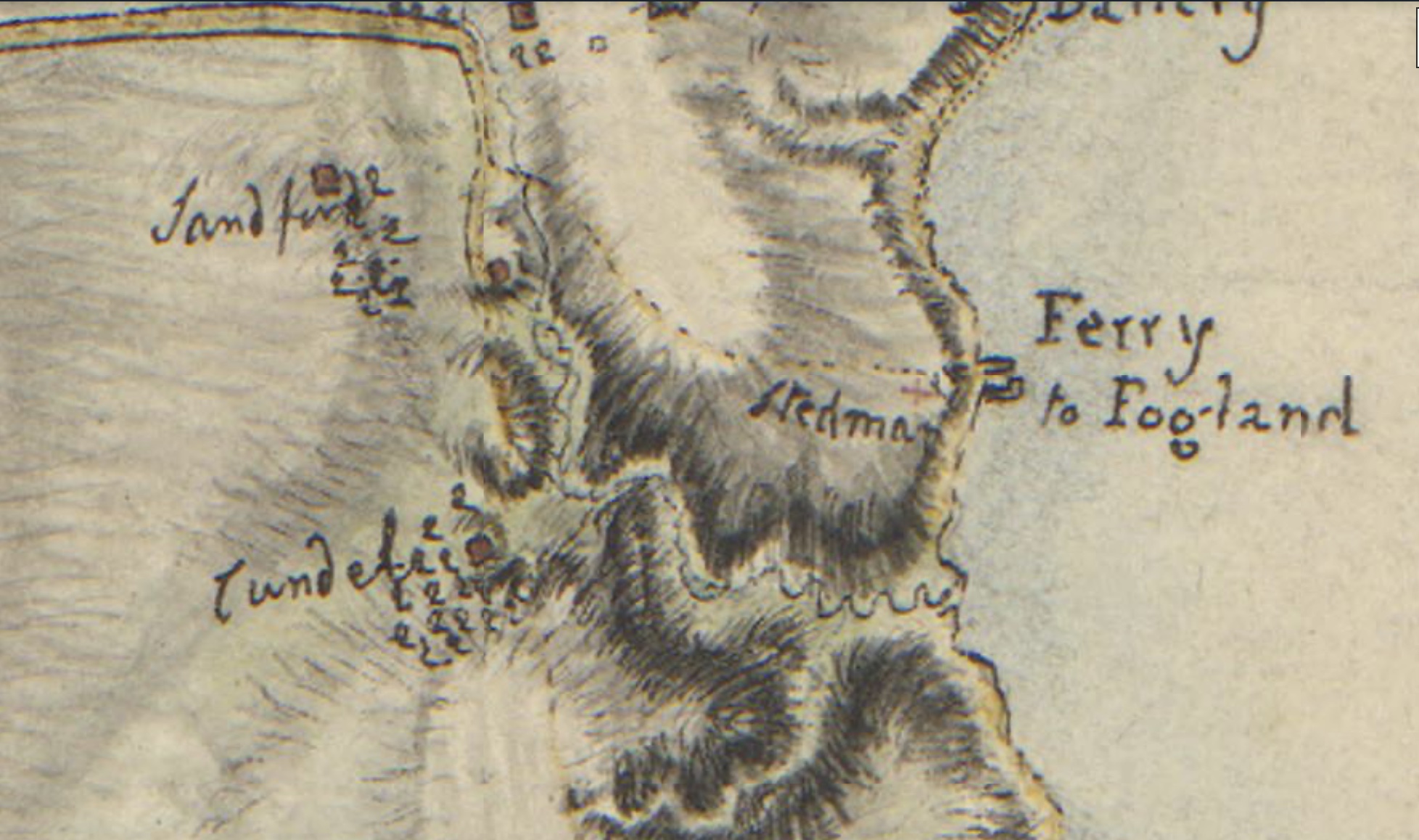
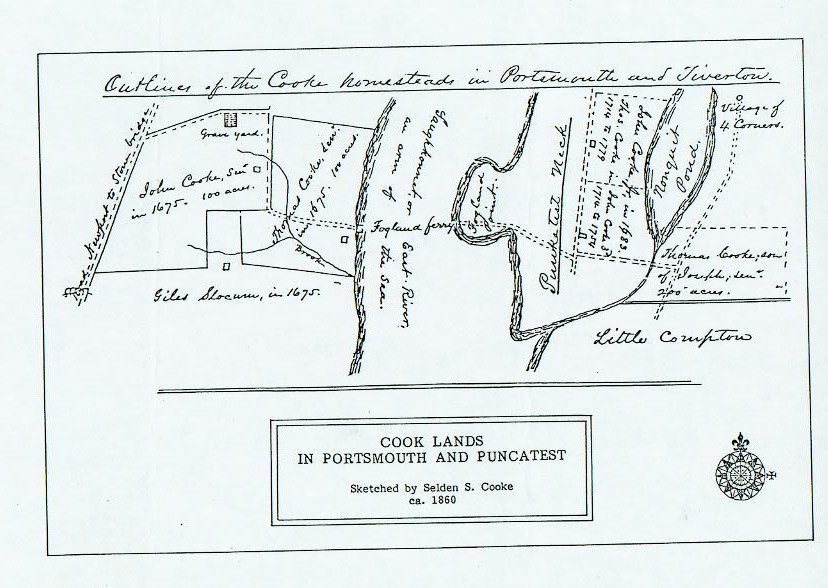
The Glen area was a strategic area for both the British and American forces during Campaign on Rhode Island 1778. State Senator and historian Erich A. O’D. Taylor wrote about Fogland ferry fortifications in his article on the Rhode Island Campaign. Octobert 22, 1777, there were rumors of an impending American landing near the Fogland ferry. American General Spencer did not try that, but English General Pigott strengthened the works at Butts Hill, Fogland Ferry and Lawton’s Valley.
Taylor wrote: “The commander at Fogland Ferry had no small task before him to safeguard the nearby farms. It is interesting to learn therefore that this important position was usually assigned to Hessian regiments and was so well defended and its duties so well executed that the inhabitants complimented the commanders when they were relieve and returned to town. Among those who returned thanks to Captain Baron de Malsburg of the regiment Ansbach-Bayreuth on his leaving this post are to be found – Mr. Bowler, Restcome Sanford, Elisha Coggeshall, George Martin, Jonathan Davenport, John Lawton, Giles Slocum, George Taber, Giles Lawton and John Sanford…The farmers thoroughly understood the Hessian soldiers who came of a range of agriculturalists like themselves. During the quiet summers of 77 and 79 when no “assault was intended on the city,” many of these Hessians hired themselves out to farmers, working for the small wage of (about 51 cents ) a day.’
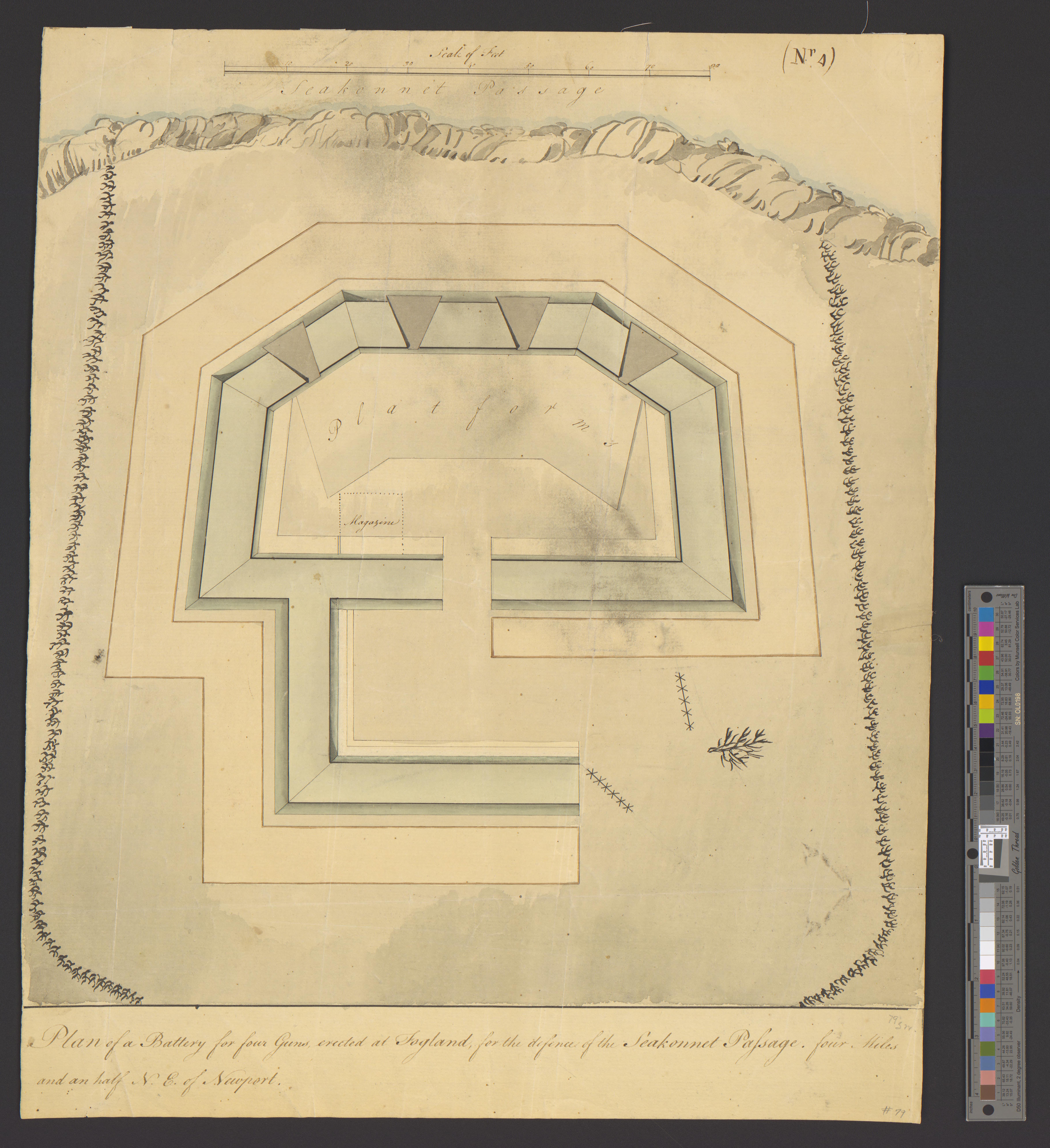
Fogland Battery – From Univ. of Michagan Collection
I recognized the names of a number of those listed on the 1730 census. Some of them I have already researched, so I can give some information about them. So many of these families are inter-related.
John Butts
A son, John, was born to Zaccheus and Sarah in Little Compton in 1691. The family history is complicated, but John would have had his grandfather (Thomas Cornell, Jr.) hung for murder and his great grandmother (Alice Lake) hung for witchcraft. He moved to Portsmouth and is recorded to have had two wives. One of his wives was from the Wordell family and the other, Abigail, was from the Briggs Family. This Briggs connection is interesting because what we call Butts Hill was once called Briggs Hill. On January 15, 1725 John bought from Caleb Bennett a windmill and about one rood (about a quarter of an acre) of land on Windmill Hill (now called Butts Hill). He erected a house by the windmill. He must have owned other land in Portsmouth since he had been considered a freeman for some time. A 1726 map of the Newtown area of Portsmouth shows him having a small parcel of land on what would be the East Path (East Main Road today). John is recorded as being a tavern keeper. He was accused in 1747 of allowing card playing at his tavern and his future son-in-law Thomas Cook was called as a witness against him. John’s daughter Sarah married Cook in 1763. When John died in 1768 he left his daughter, Sarah Butts Cook, “my dwelling house and land, bounded southerly on land from my father-in-law Enoch Briggs, next to David Lake.” This is as far as I can trace the Butts presence on this Windmill Hill (Butts Hill). Some of Butts land was passed down through the Cook family. One Butts family genealogist wrote that the War for Independence had ruined the family fortunes. They lost their land and their business interests.
Joseph Cundall
In 1706 Joseph Cundall had left his native England to become an indentured servant in America. Becoming an indentured servant was a way a young person could learn a trade and get an education in exchange for working for seven years or more. Cundall seems to have learned his trade well and was in a good position to buy land as an adult. James Sisson sold his grist mill and 46 acres around the brook to Joseph Cundall. What we call “the Glen” becames commonly known as Cundall’s Mills. Water from the stream powered the carding and fulling mills to wash and pull woolen fibers. Joseph Cundall added almost a hundred more acres to his land around the Glen before he died in 1760.
A note: Joseph Cundall married Elizabeth Butts
“Plan of Rhode-Island / Surveyed and drawn by Edw: Fage, captn. Royal Artillery, in the years 1777, 78 & 79.”. https://quod.lib.umich.edu/w/wcl1ic/x-828/wcl000922. In the digital collection William L. Clements Library Image Bank. William L. Clements Library, University of Michigan Library Digital Collections. March 10, 2025.
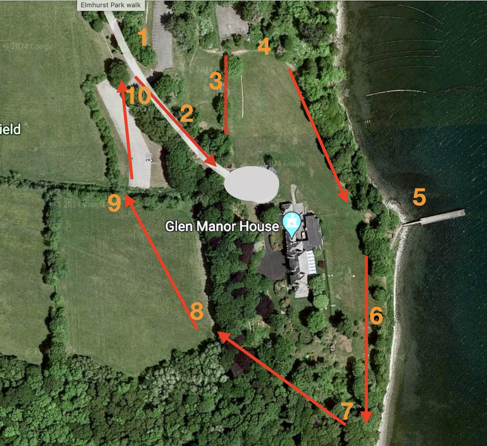
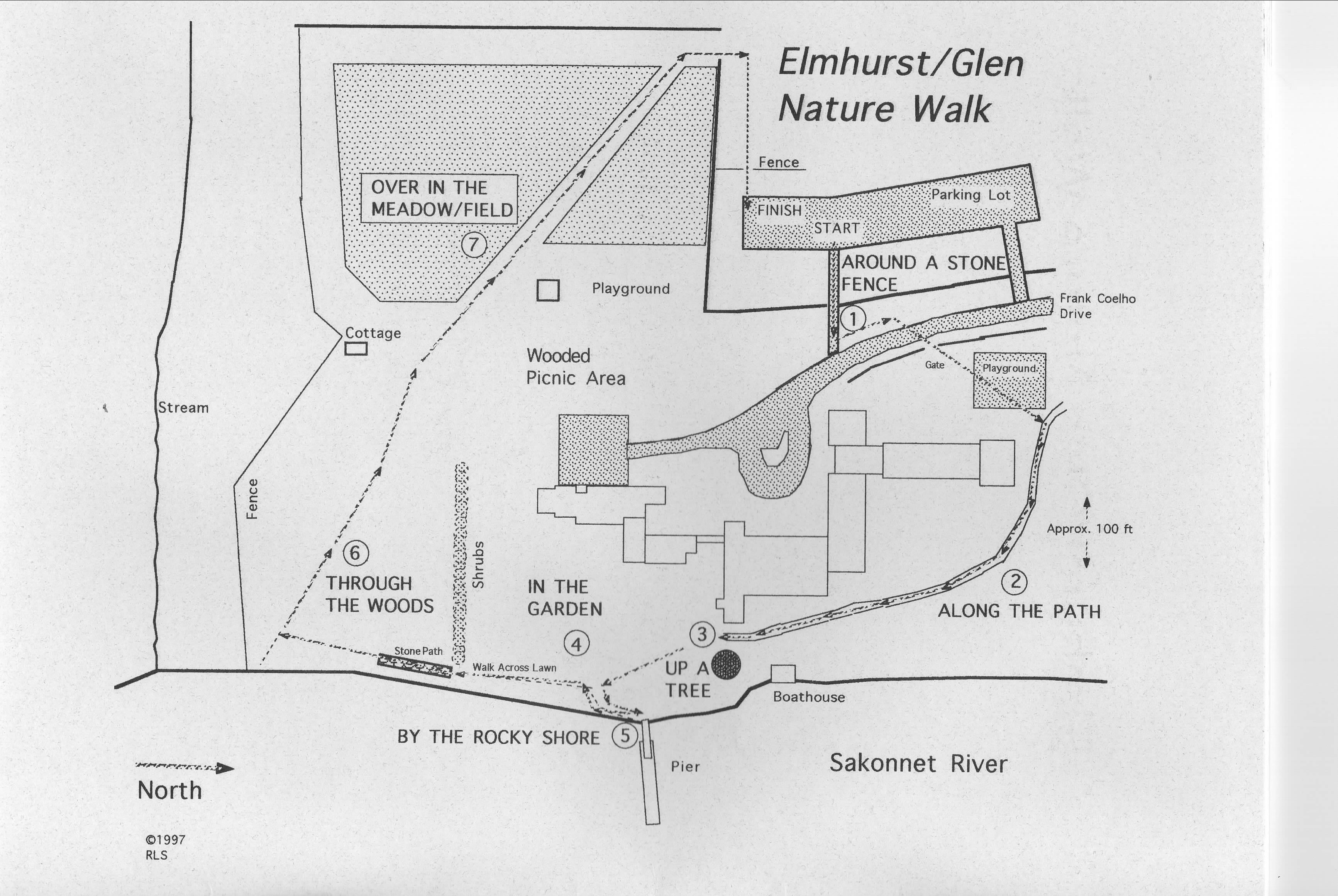
As librarian at Elmhurst School, I liked to teach research skills by having my students work on a local project. Elmhurst is gone now, but the setting of our school offered spectacular subjects for study. In 1996 through 1997 my students worked on an Elmhurst/Glen Nature Walk. Today my husband and I revisited that walk and found that we can still enjoy the variety of habitats along the way.
The walk is about 3/4 of a mile long and is easy going most of the way. The path is not quite the same as it was over 20 years ago.
Starting Point: This is the new parking lot for “Elmhurst Park.”
Follow Frank Coelho Drive towards the Manor House.
As you approach the old Elmhurst Circle, take the old Elmhurst Playground walkway toward the left.
At the end of the walkway turn right. There are remains of a carriage path that was the way to the old Fogland Ferry. This was the “Along the Path” section of our booklet.
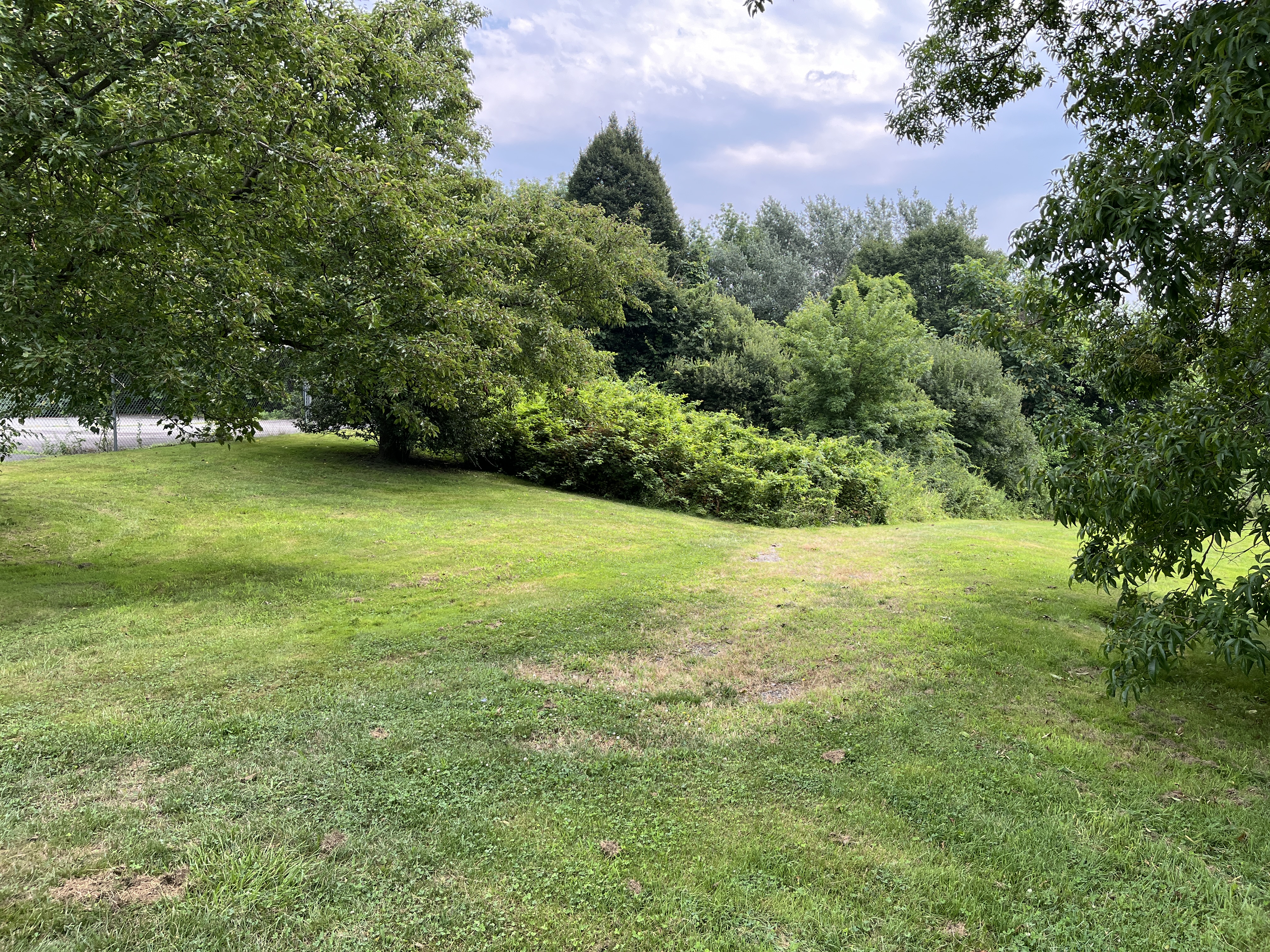
Most of this is grass now, but throughout the warmer months it is a nice place to see some wildflowers. My students used to take pictures of them so we could identify them with field guides. Now you can identify them through a google information setting.
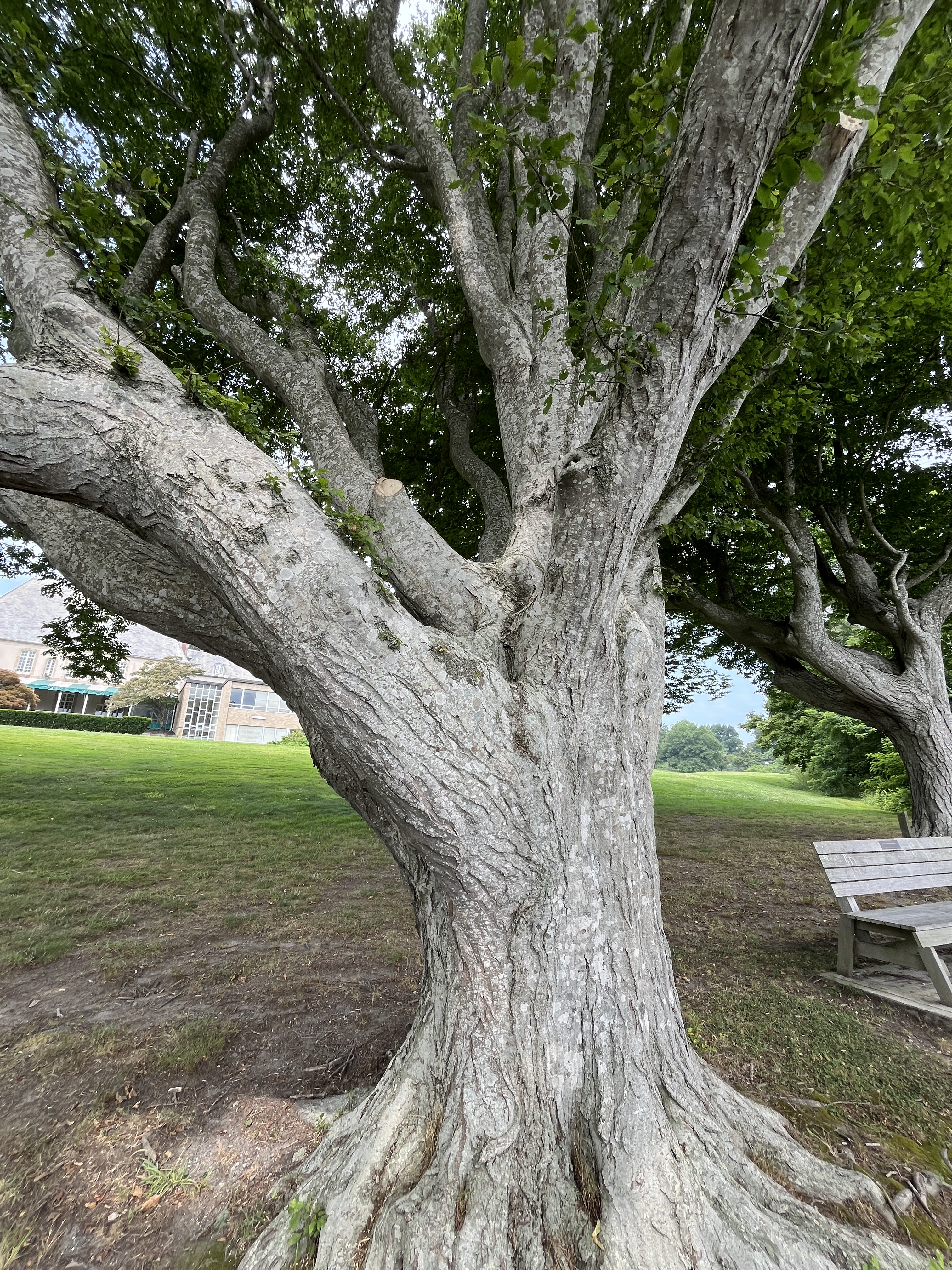
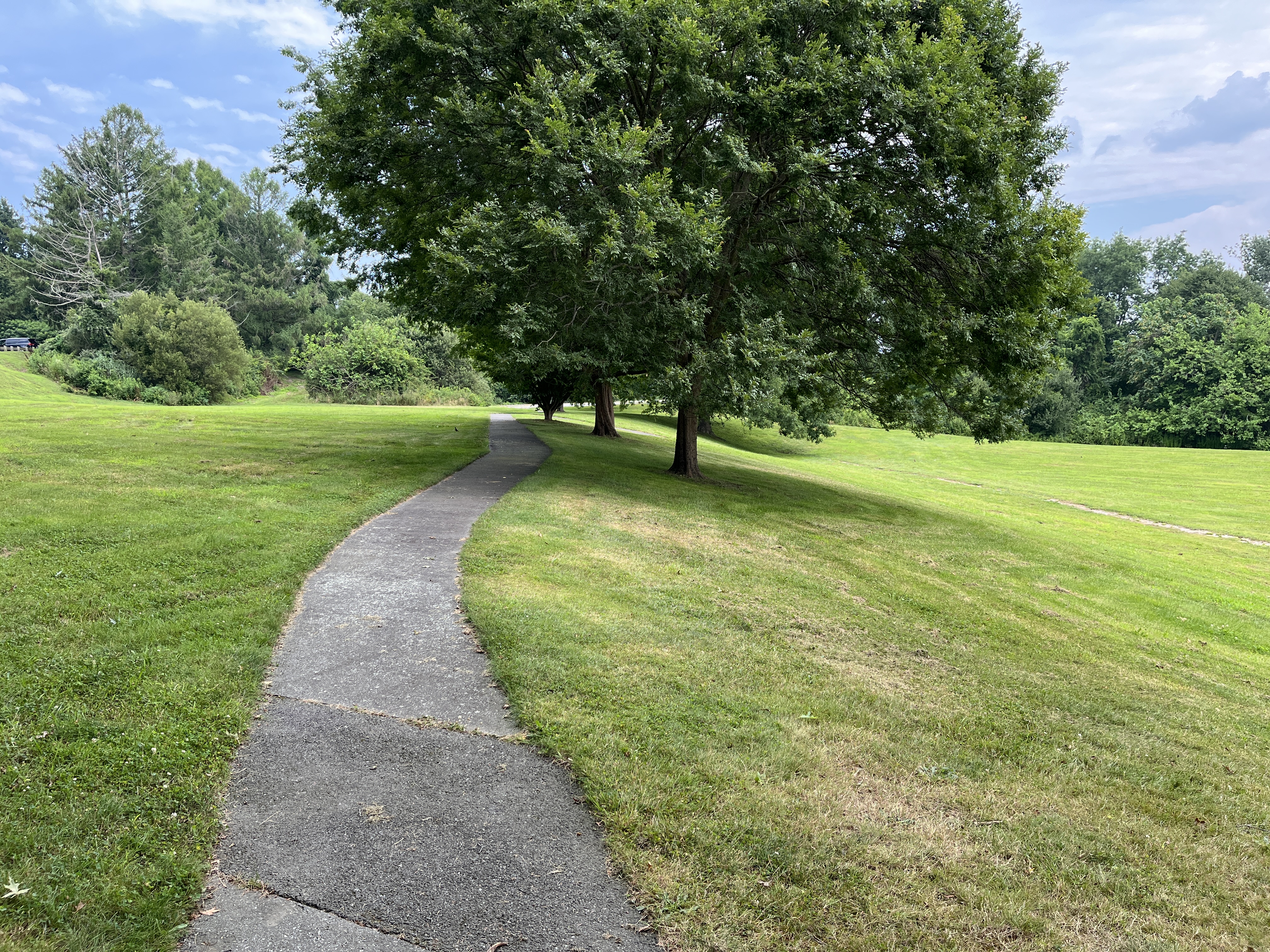
Toward the water there are still some of the old trees from the days when the Taylor family lived at the Manor House. Mrs. Taylor was very particular about where each of these trees were planted in the 1920s. Our students studied the old trees as habitats in themselves. We called this “Up a Tree” in our guide.
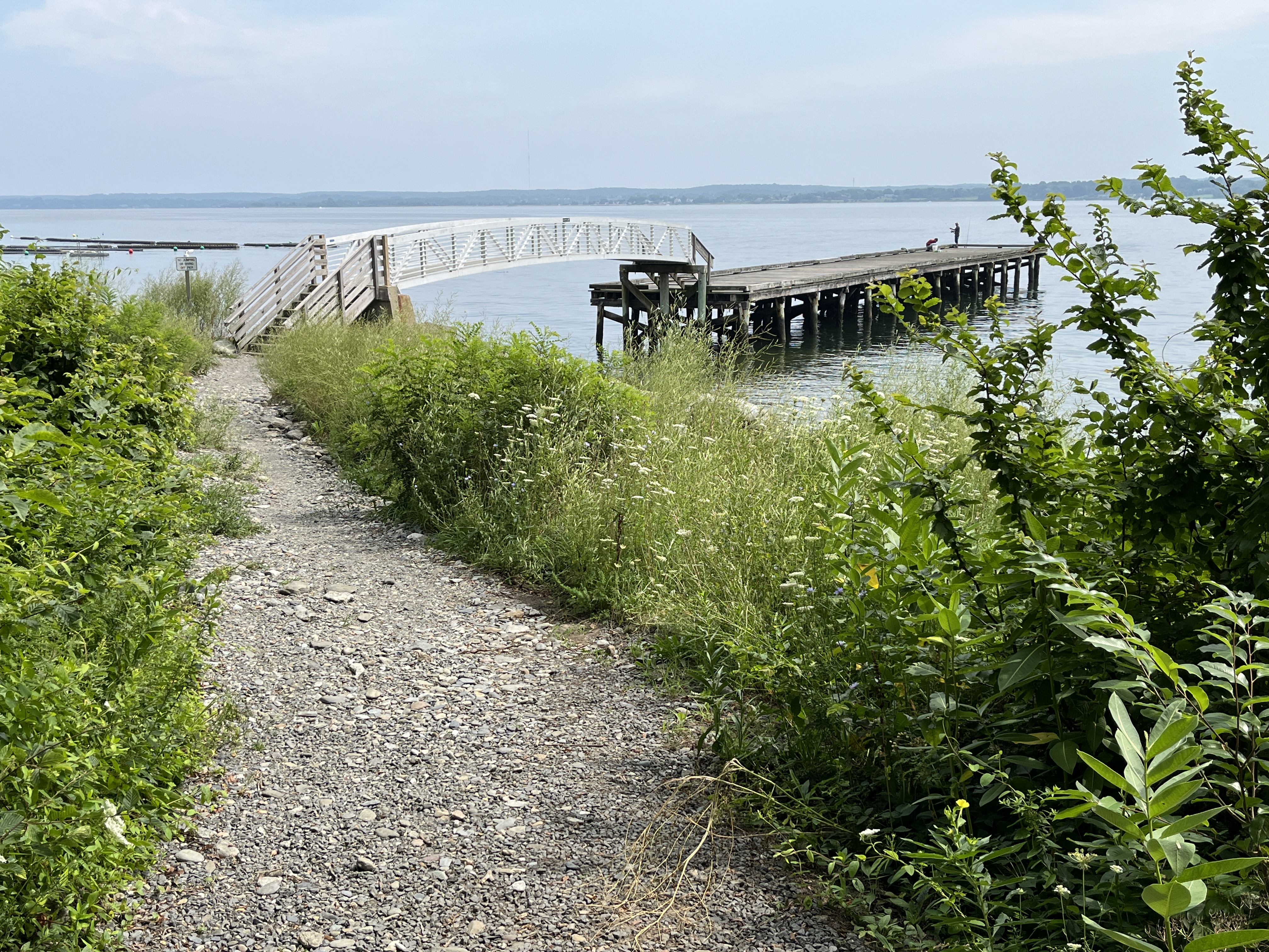
“By the Rocky Shore” explored the dock and rocky shoreline. We can see Sandy Point Beach in the distance to the right. Our town beach was a gift of the Taylor family. To the left is an oyster farm. Life along this shoreline depends on the constant cycle of the tides. The current dock is a replacement for the original “L” shaped dock that the Taylors used. You may see fishermen on this dock and it is a good place to watch for marine birds.
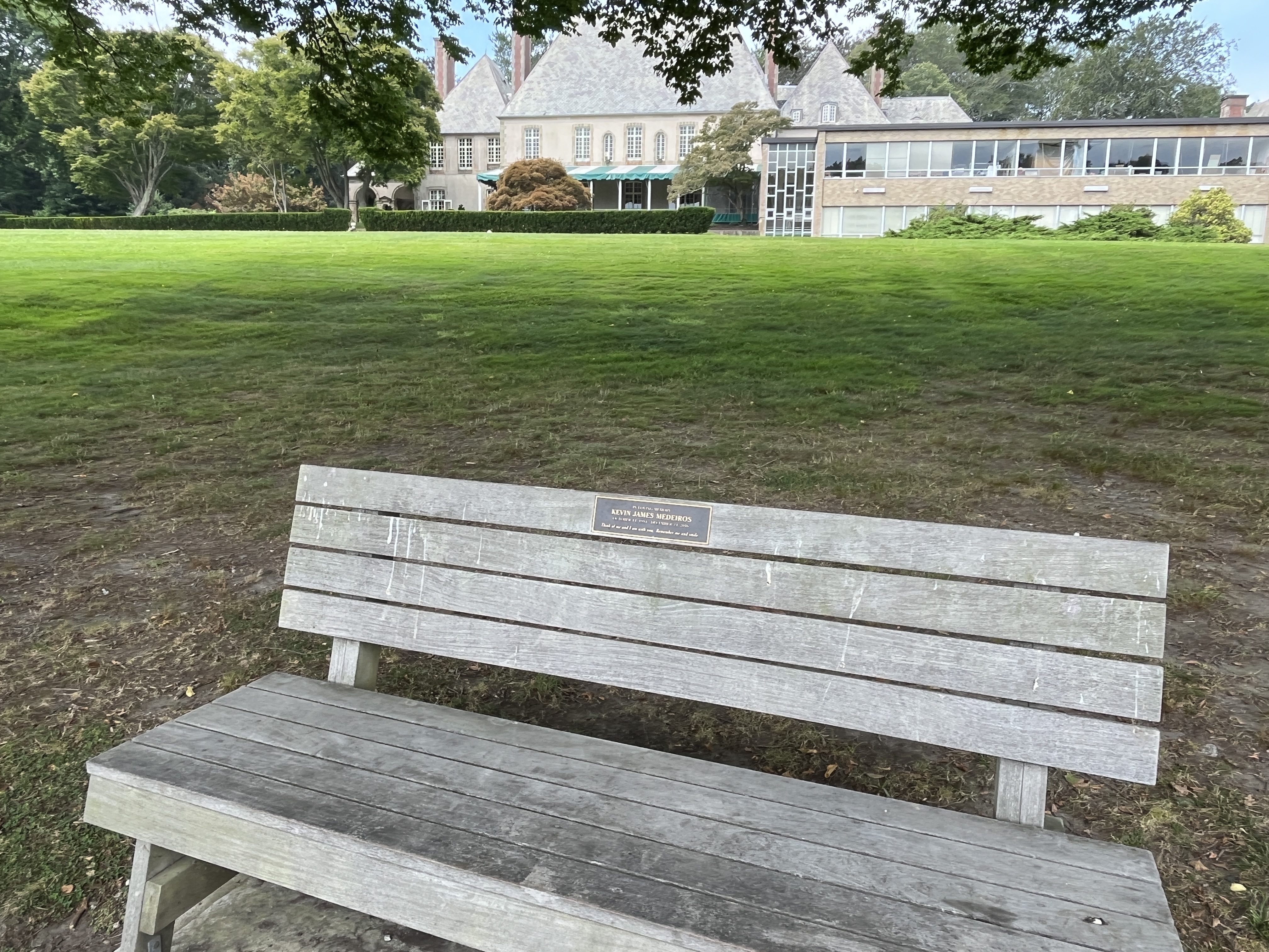
Heading back to the trail we see the Glen Manor House and its gardens. Landscaped gardens are a different kind of habitat. The Olmsted Brothers did the original landscape architecture. Mrs. Taylor loved fresh flowers and varieties were selected that would bloom while the Taylors were in residence during July and August. The “In the Garden” section suggested that as you look at the gardens from a distance, you can look for geometric shapes in landscape designs.
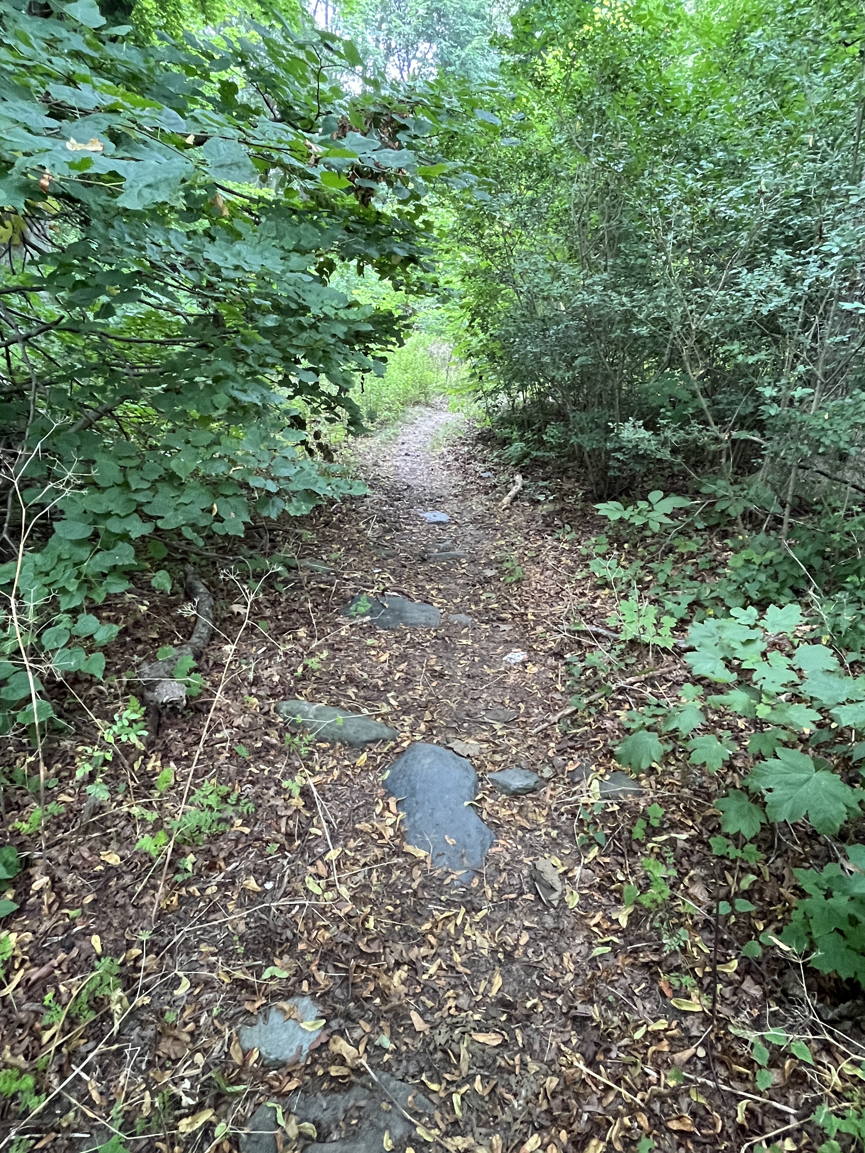
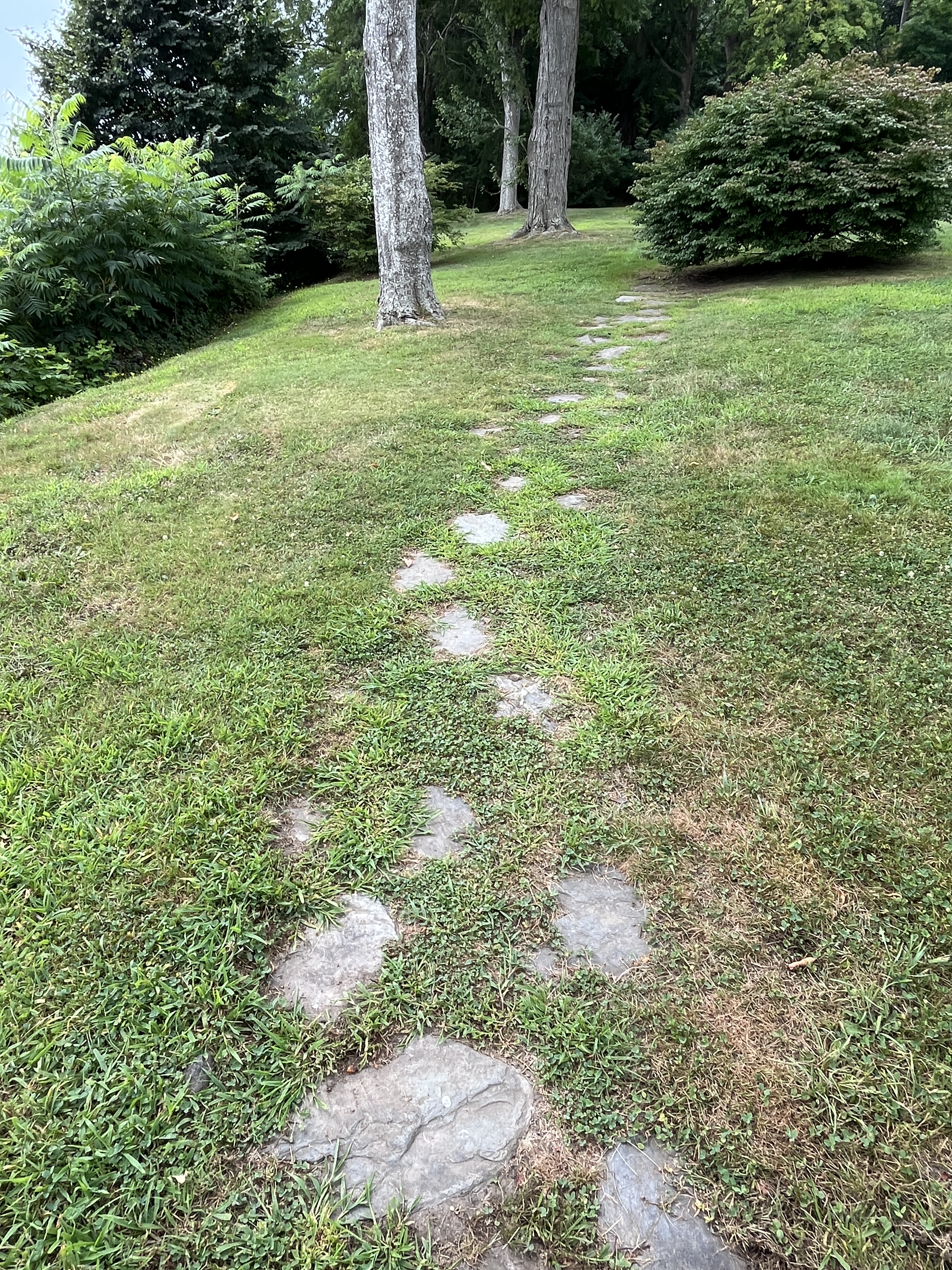
A walkway of stones leads you “Through the Woods.” Where there are stones in the paths is easy walking, but as the path heads up the trail it is narrower.
You have to watch for tree roots, but the woods habitat is full of interesting things. My students suggested a scavenger hunt for types of fungi, bark beetle tunnels, woodpecker holes, green moss, and tree holes that were homes for animals.
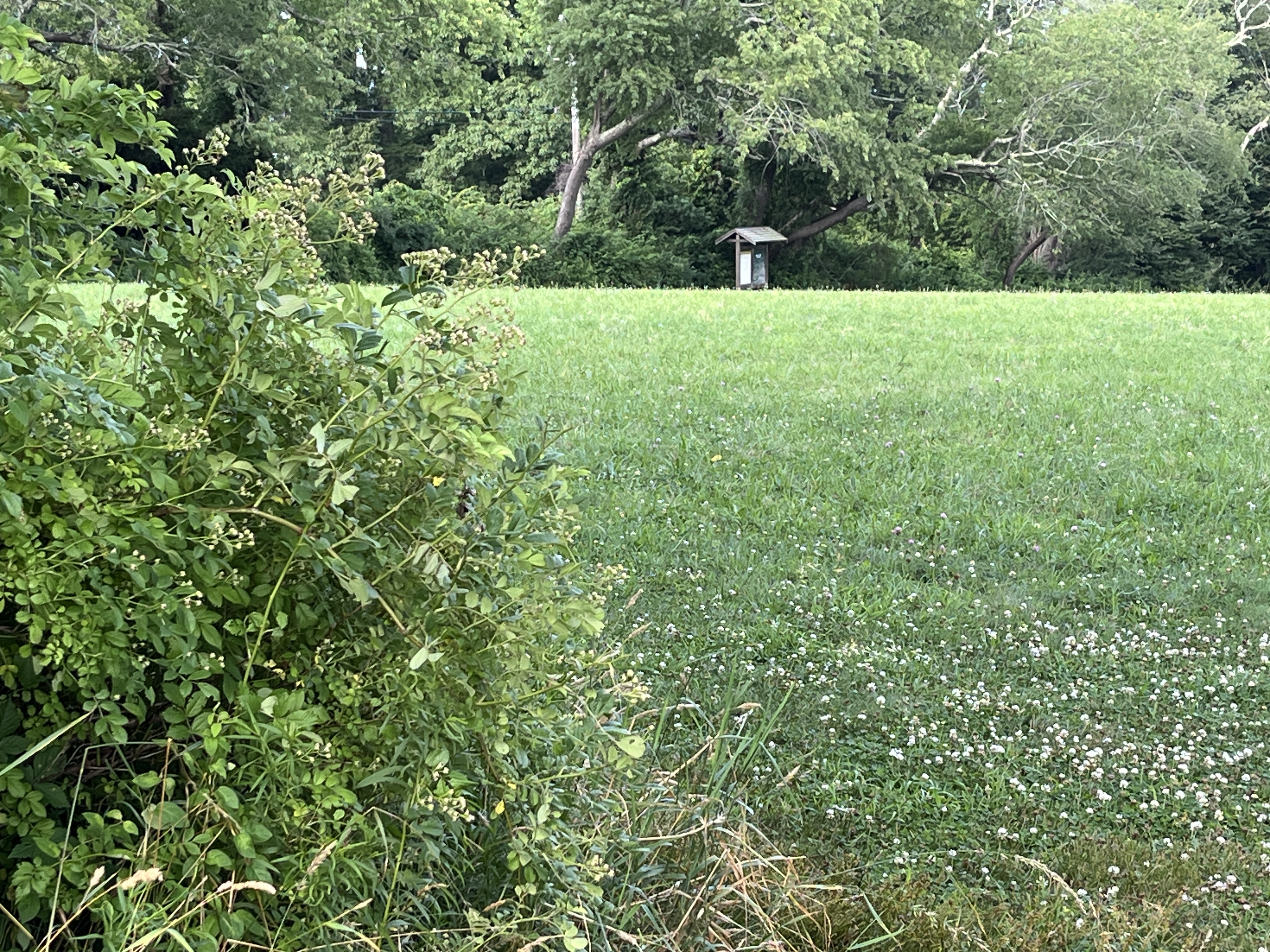
You come out of the woods to “Over in the Meadow/Field.” When we did our habitat study the fields were allowed to grow tall so we could find flowers and seeds and look for signs of animals. Today it is mostly mowed. This field is a reminder that it used to grow crops to feed the 25 families who lived and worked on the farm.
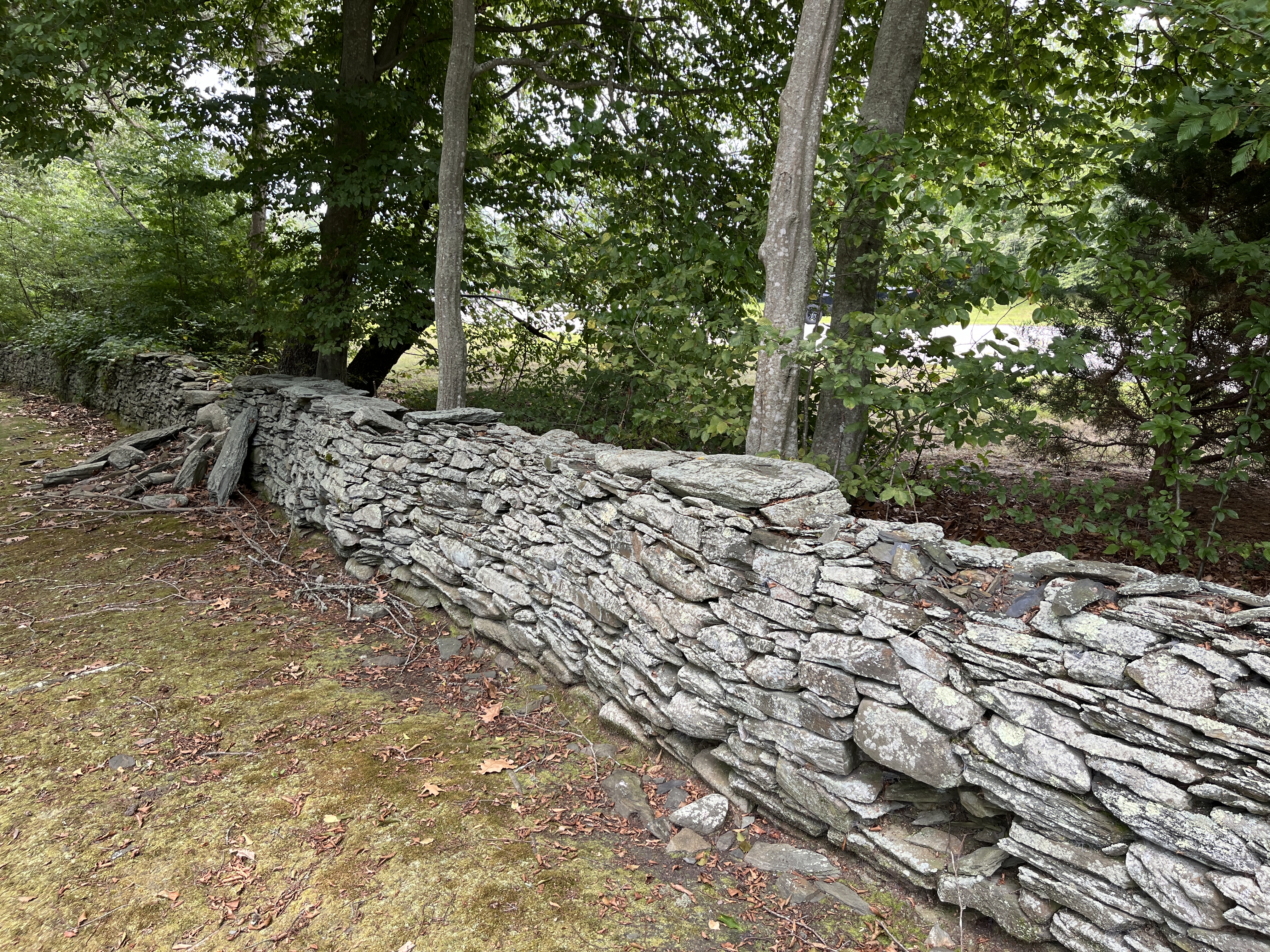
Cross the Meadow/Field towards the Trail sign that marks a longer Brown House/Glen Farm Trail. That trail is over 2.5 miles and is a good one for a longer hike. To the left of the sign is a rocky cut in the stonewall that leads you to the old Elmhurst parking lot. Cross the lot to the North entrance.
Outside the parking lot entrance, notice the stonewalls. “Around a Stone Fence” was our last natural neighborhood. The rock walls and fences are a reminder of the way this land was used in the past. They are a sign of cleared land and they were used as boundaries between pasture and cropland. The Glen area was used for farming from the 1640s (Thomas Cook) through the 1950s (Taylor family).
Stonewalls are man-made, but nature takes them over. Look for lichen (a crusty fungus growth over the rocks), and evidence of spots were animals might hide.
You are back at the parking lot.
Up a treeAlong the PathIn the GardenAround a Stone FenceOver in the Meadow/FieldThrough the WoodsElmhurst WalkwayStone walk leading to WoodsBy the Rocky Shore
The Cook family began to ferry their animals to Fogland to graze during the day.
Fogland Ferry (or Cooks Ferry) began when Thomas Cook bought grazing rights to Fogland across the river in what is now Tiverton. Cook lands were located in the Glen area. Thomas Cook’s home was where the Glen Manor House is today. Later on the family seems to have established a public ferry. In 1762 Joseph Cook sold 31 acres of land with wharves, buildings and ferry rights to Christopher Cadman. When he died in 1787, the Cadman Ferry was left to Gideon Cadman, Christopher’s son.