Home

Common Fence Point: A History

Leave a comment

Some places in Portsmouth have changed names over the years, but Common Fence Point was the name used in 1638 and it is the name used today.  A Borden family genealogy gives us the root cause for the name: “To the northeast of the spring a neck of land extends about two miles, which was nearly separated by creeks, marshes and the town pond from the rest of the island.  This strip of land, called by the natives Pocasset Neck, was set off by the settlers as a common by running a fence from the south end of the pond to a cove on the east side of the island. This common was called the fence common, to distinguish it from the lands outside to the south and west of it, which were all common; and the north point then received the name of common fence point. “(1)

The original settlement of Portsmouth took a pattern that was familiar to the English – homes were in a central village location and their animals grazed on common land around the homesteads.  Recording how each family branded their animals was very important with their stock intermingled in the commons. While this may have been a good pattern the first year when they needed to be close together for safety, this land use soon gave way to larger scattered farm lots which included their homes.

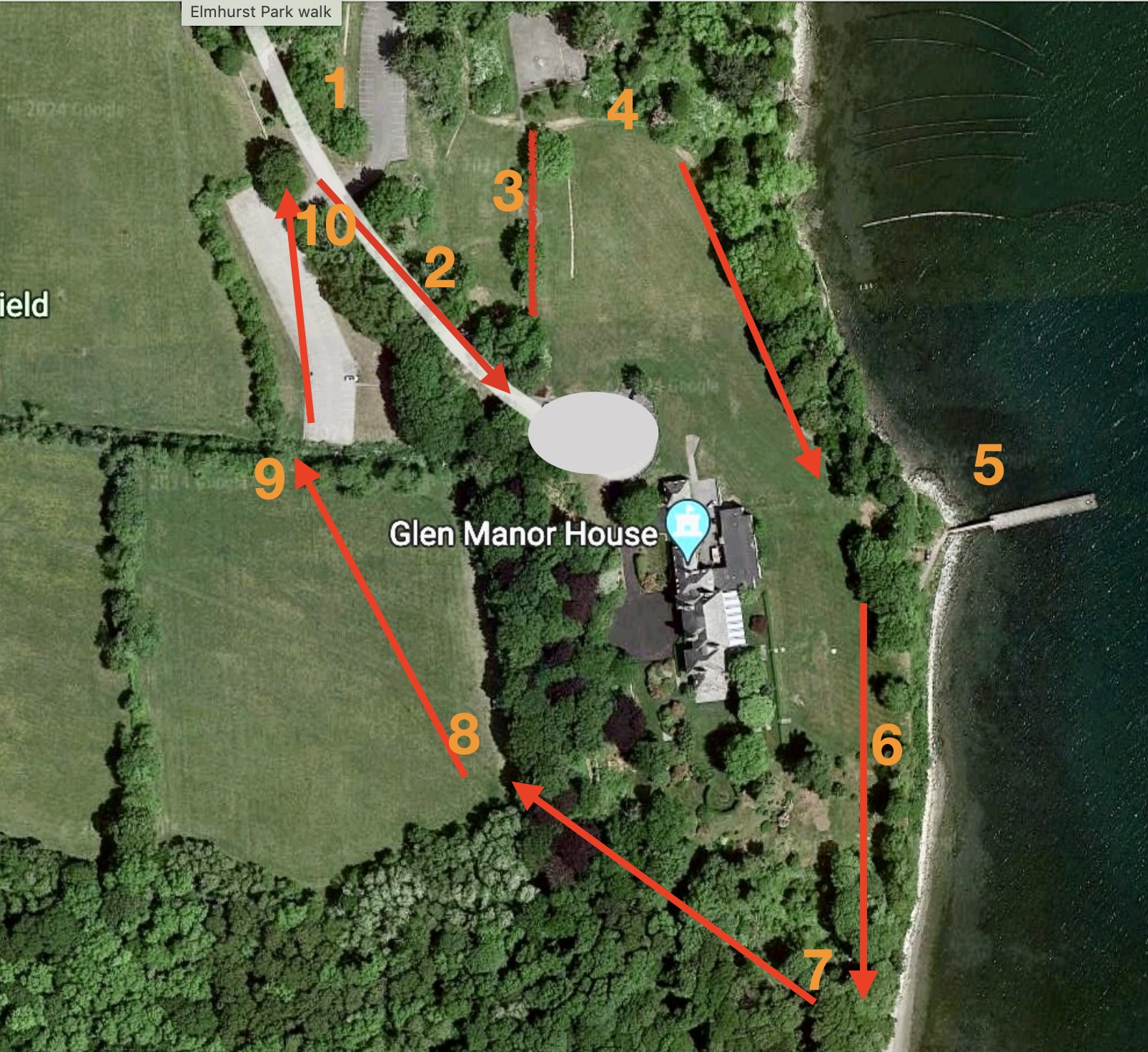
The 1849 Hammett Map shows Abner Chace holding Common Fence Point and the Chace (or Chase) family seemed to own pieces of the Point for many years.  In 1865  a charter was granted to several men to build and operate the Rhode Island Oil and Guano Company on Common Fence Point.
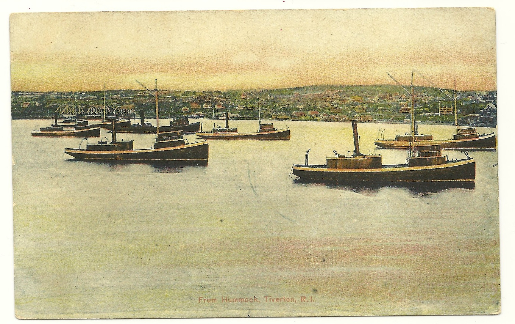
Edward West map of original settlers.

Pogy boats
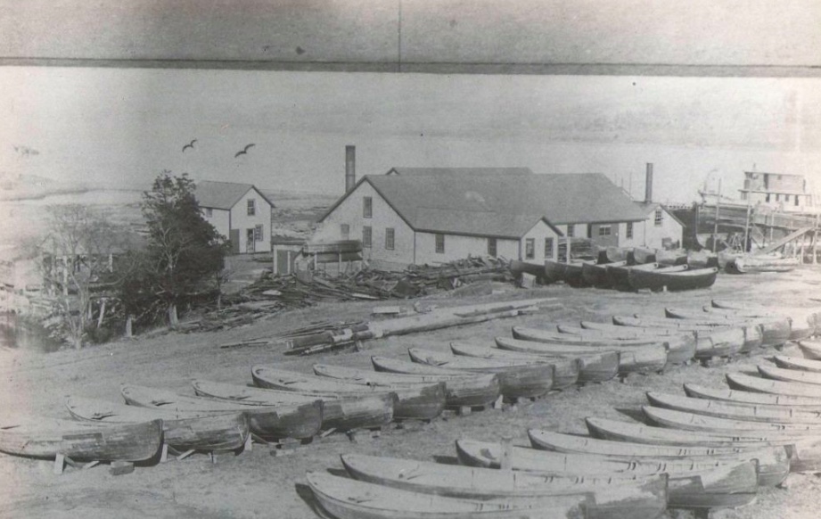
By 1900 part of Common Fence Point held the largest fish factory in the country.  The Tiverton based Church Brothers – Daniel, Nathaniel, Joe, Jim, Isaac, Fisher and George went into business together in 1870.  They commissioned the Herreshoff boatyard in Bristol to build the first fishing steamer – the Seven Brothers.  At first they were fishing for food, but they realized that fish oil and fertilizer from the pogy fish (menhaden)  had potential for profit.  They brought a menhaden processing factory in Maine, dismantled it and rebuilt it on Common Fence Point. The complex cookhouse was 35 ft square and there were two large dinning rooms to feed three hundred workers.  A large building held sleeping quarters and a net mending area.  A cooper made barrels for transporting the oil and there were boat shops.  The Church Brothers Fisheries barn burned in 1928 and that was the last of the Church facilities on Common Fence Point.

Common Fence Point gradually developed into a community.  At first many of the houses served as summer homes, but they gradually became occupied year round.  The Common Fence Point Improvement Association has been active in the community since he 1950s and continues to serve the residents of Common Fence Point with music programs, classes, activities for children and as an Arts Center.

(1) Historical and Genealogical Record of the Descendants as Far as Known of Richard and Joan Borden, who Settled in Portsmouth, Rhode Island, May, 1638: With Historical and Biographical Sketches of Some of Their Descendants H.B. Weld, 1899

(2) The Descendants of Thomas Durfee of Portsmouth RI-Vol. 1, by Wm. Reed.  1902.

(3) Genealogical Records of the Descendants of Thomas Brownell compiled by George Brownell, New York, 1910.

Revisiting the Elmhurst/Glen Nature Walk

Leave a comment

As librarian at Elmhurst School, I liked to teach research skills by having my students work on a local project. Elmhurst is gone now, but the setting of our school offered spectacular subjects for study. In 1996 through 1997 my students worked on an Elmhurst/Glen Nature Walk. Today my husband and I revisited that walk and found that we can still enjoy the variety of habitats along the way.

The walk is about 3/4 of a mile long and is easy going most of the way. The path is not quite the same as it was over 20 years ago.

  1. Starting Point: This is the new parking lot for “Elmhurst Park.”
  2. Follow Frank Coelho Drive towards the Manor House.
  3. As you approach the old Elmhurst Circle, take the old Elmhurst Playground walkway toward the left.
  4. At the end of the walkway turn right. There are remains of a carriage path that was the way to the old Fogland Ferry. This was the “Along the Path” section of our booklet.
    • Most of this is grass now, but throughout the warmer months it is a nice place to see some wildflowers. My students used to take pictures of them so we could identify them with field guides. Now you can identify them through a google information setting.
    • Toward the water there are still some of the old trees from the days when the Taylor family lived at the Manor House. Mrs. Taylor was very particular about where each of these trees were planted in the 1920s. Our students studied the old trees as habitats in themselves. We called this “Up a Tree” in our guide.
  5. “By the Rocky Shore” explored the dock and rocky shoreline. We can see Sandy Point Beach in the distance to the right. Our town beach was a gift of the Taylor family. To the left is an oyster farm. Life along this shoreline depends on the constant cycle of the tides. The current dock is a replacement for the original “L” shaped dock that the Taylors used. You may see fishermen on this dock and it is a good place to watch for marine birds.
  6. Heading back to the trail we see the Glen Manor House and its gardens. Landscaped gardens are a different kind of habitat. The Olmsted Brothers did the original landscape architecture. Mrs. Taylor loved fresh flowers and varieties were selected that would bloom while the Taylors were in residence during July and August. The “In the Garden” section suggested that as you look at the gardens from a distance, you can look for geometric shapes in landscape designs.
  7. A walkway of stones leads you “Through the Woods.” Where there are stones in the paths is easy walking, but as the path heads up the trail it is narrower.
    • You have to watch for tree roots, but the woods habitat is full of interesting things. My students suggested a scavenger hunt for types of fungi, bark beetle tunnels, woodpecker holes, green moss, and tree holes that were homes for animals.
  8. You come out of the woods to “Over in the Meadow/Field.” When we did our habitat study the fields were allowed to grow tall so we could find flowers and seeds and look for signs of animals. Today it is mostly mowed. This field is a reminder that it used to grow crops to feed the 25 families who lived and worked on the farm.
  9. Cross the Meadow/Field towards the Trail sign that marks a longer Brown House/Glen Farm Trail. That trail is over 2.5 miles and is a good one for a longer hike. To the left of the sign is a rocky cut in the stonewall that leads you to the old Elmhurst parking lot. Cross the lot to the North entrance.
  10. Outside the parking lot entrance, notice the stonewalls. “Around a Stone Fence” was our last natural neighborhood. The rock walls and fences are a reminder of the way this land was used in the past. They are a sign of cleared land and they were used as boundaries between pasture and cropland. The Glen area was used for farming from the 1640s (Thomas Cook) through the 1950s (Taylor family).
    • Stonewalls are man-made, but nature takes them over. Look for lichen (a crusty fungus growth over the rocks), and evidence of spots were animals might hide.

You are back at the parking lot.