
Glen area map 1885
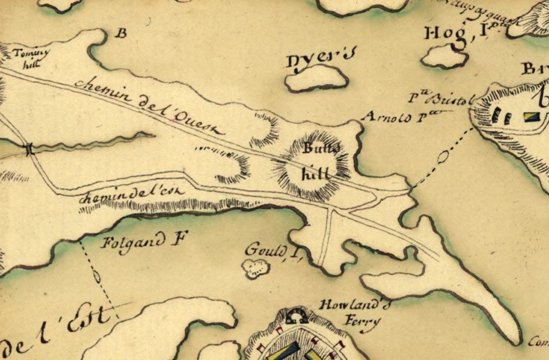
French revolutionary war map
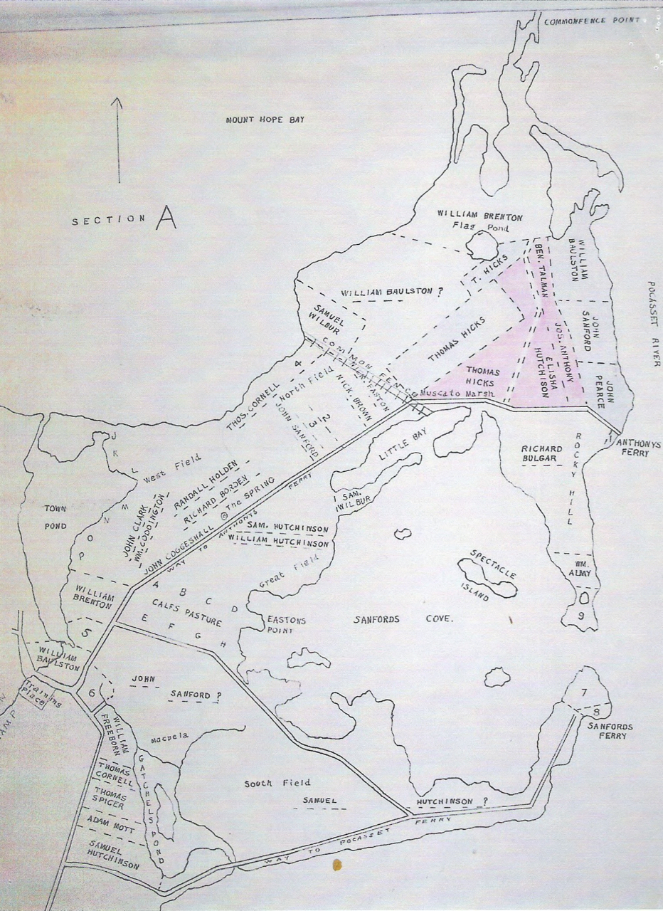
Land Grant Map Section A Map
Many wonderful historical maps of the Portsmouth area are available online. This is a guide to how to location some of them.
One of the most valuable sets of maps for researching early Portsmouth are the West Land Grant maps. Most maps are considered “primary” or first hand sources, but this one is a little different. In 1932 historian Edward H. West tried to match the land deeds from 1638 to 1781 with where in Portsmouth that land would be. The West maps are an invaluable resource for families are trying to figure out where their ancestors lived in Portsmouth. The maps are Edward West’s attempt, but some family genealogists have found fault with the work. I still consider this a very valuable source. The original maps were color coded to when the land grants were given, but the colors have faded and it is difficult to see the coloring.
Land Grant Maps are being archived in the high resolution Portsmouth History Center Archives (http://www.portsmouthhistorycenterarchive.org). On the home page, put “maps” in the search box and it should bring you to a page with maps from the Portsmouth Free Public Library collection.
From Rhode Island Gen Web
There are some wonderful maps on the Rhode Island Gen Web site.
1893 Map of the Island of Rhode Island
http://www.rootsweb.ancestry.com/~rinewpor/maps/Newport1893a.html
Beers map 1870

I would recommend a visit to the Library of Congress site and search for “Rhode Island maps.”
Here I found some great maps dating from the Revolutionary War.
A German map from 1777: https://www.loc.gov/resource/g3772r.ar101400/
A French Rev. War 1778: https://www.loc.gov/resource/g3772r.ar101600/
Attacks upon rhode island August1778 https://www.loc.gov/item/gm71000685/
19th century maps of Portsmouth from the Library of Congress
Aquidneck Island Road Map 1849 Hammett- https://www.loc.gov/item/2012593354/
Aquidneck Island land owners map 1870 Ward- https://www.loc.gov/item/2012593354/ 1870 Dripps – https://www.loc.gov/item/2013593287/
1850 Walling – https://www.loc.gov/item/2013591358/
Brown University has Sanborn Insurance maps online. These maps show buildings and out buildings.
Island park Sanborn map: https://repository.library.brown.edu/studio/item/bdr:212703/
Sanborn Portsmouth map 1921 https://repository.library.brown.edu/studio/item/bdr:
384480/

Leave a comment