Home

Portsmouth Neighborhoods: Bristol Ferry/Commons – Colonial Days

Leave a comment

As the Portsmouth founders moved away from the settlements around the Town Pond, Common Fence and Founder’s Brook, the Bristol Ferry community to the northwest began to develop. In the 1930s, Portsmouth historian Edward West did some remarkable work with land evidence. Among his works are the Land Grant Maps that tell us where the early settlers were given land. How he worked through all the locations with rods as measurements, we will never know. West tells us that upon founding the town “they immediately made laws governing the size and location of the house lots.” They began recording property in a book. There were times when land transferred without records, so the accuracy of the land evidence may be questionable in some cases. West illustrates the grants and town plan with his maps. Some of the first grants given were in the Bristol Ferry area.  As the town was laid out, Sprague Street was the southernmost border.  Land grants were given out in 1657, 1693 and the last lands were given out in 1713.  By 1713 the commons were laid out, highways were straightened and the town was considered finished as laid out from Sprague Street northward. As the Portsmouth population spread to the north and west of Town Pond, the town fathers and surveyors thought they had finished laying out the town.

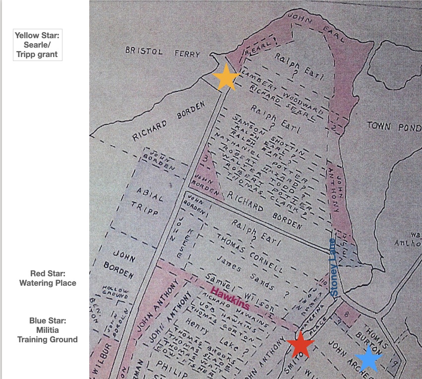
The first street to the right was “Stoney Lane.”  It was a short “driftway” (a path used to drive cattle or sheep) between Richard Borden’s property and that of Mistress Harts.  South of that was a lane that led to a “watering place” now called Founder’s Brook. On the map it is called Hawkins Lane for Richard Hawkins and his wife Jane who was a friend of Anne Hutchinson. This “watering place” was laid out in 1713 as a public place for the washing of sheep and general water uses.  Also in 1713 Thomas Burton received a piece of land that was known as the “Training Place” before that.  That ground may be where the militia had trained.

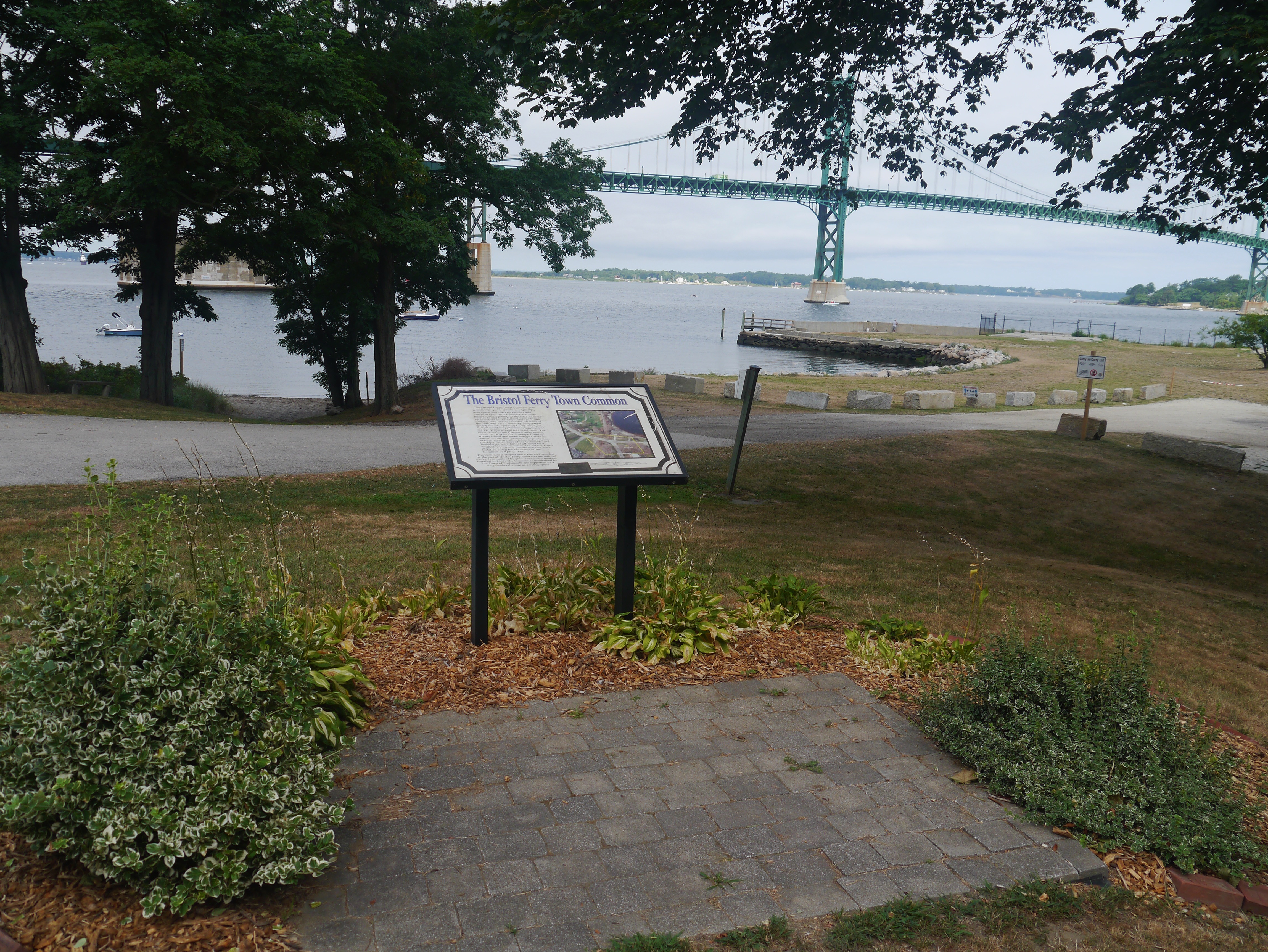
Waiting for the Ferry

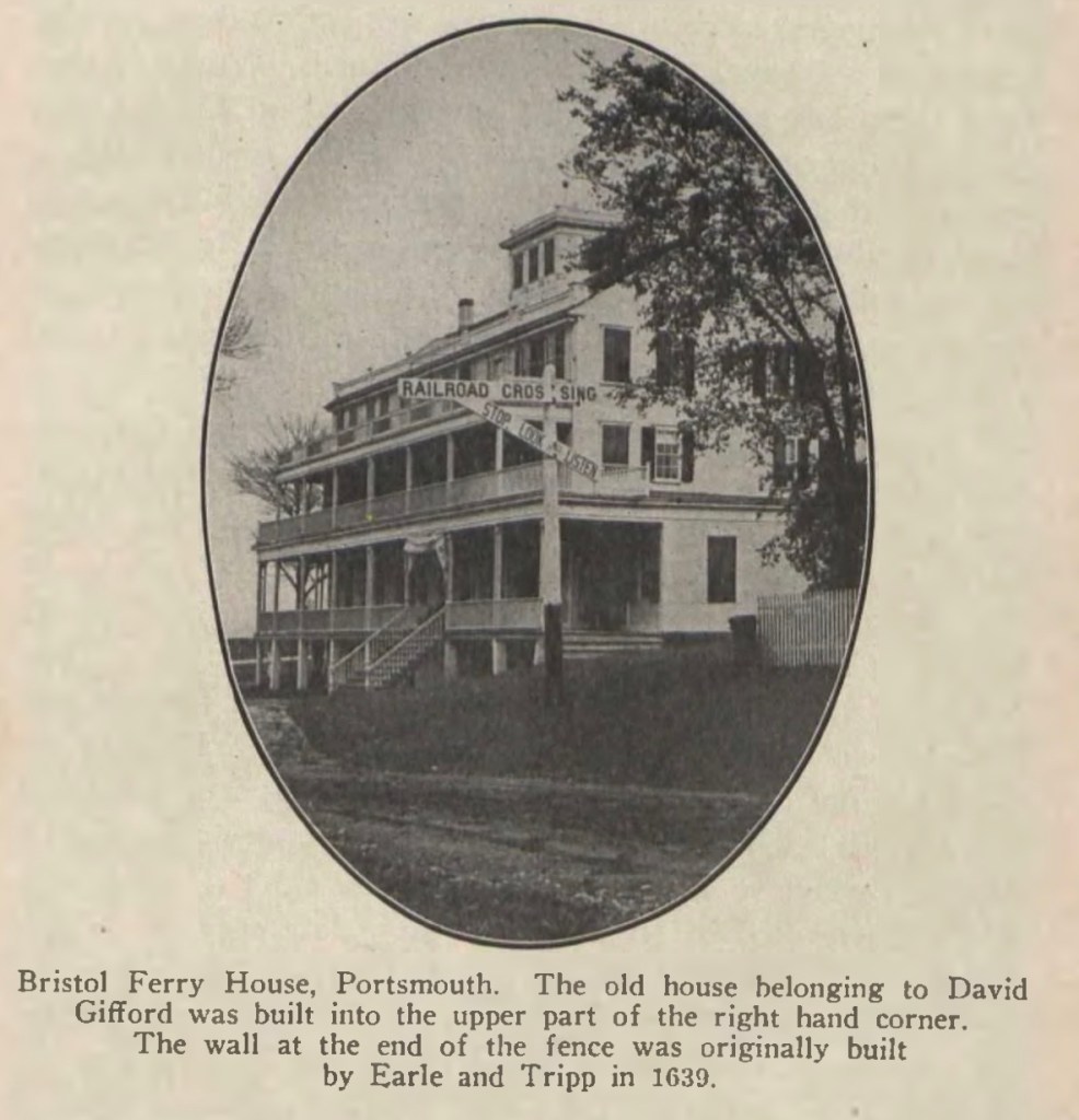
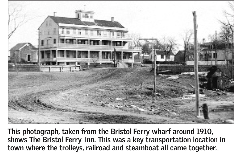
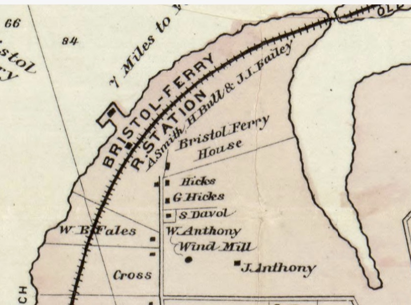
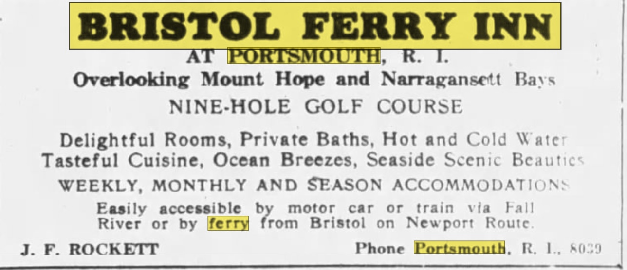
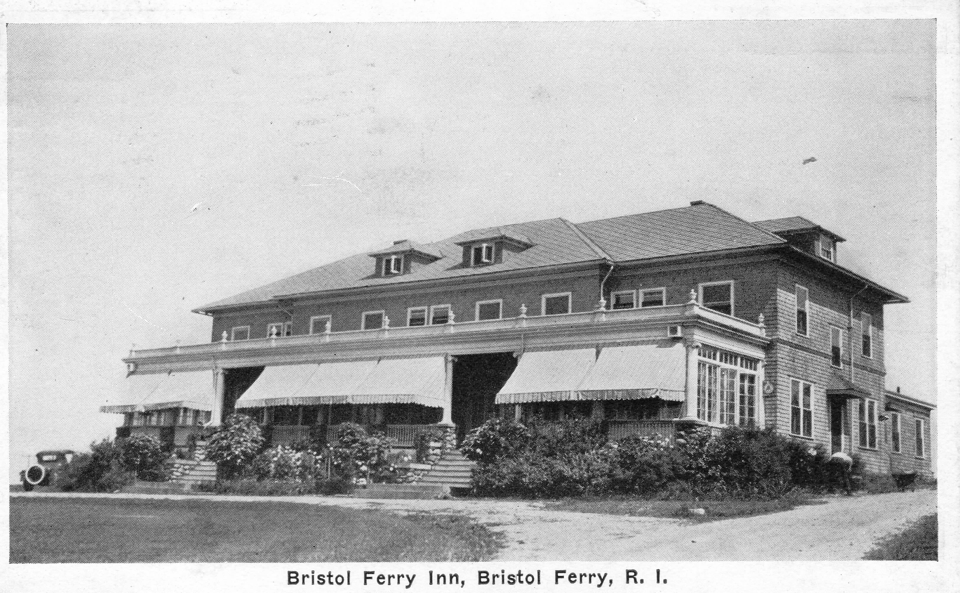
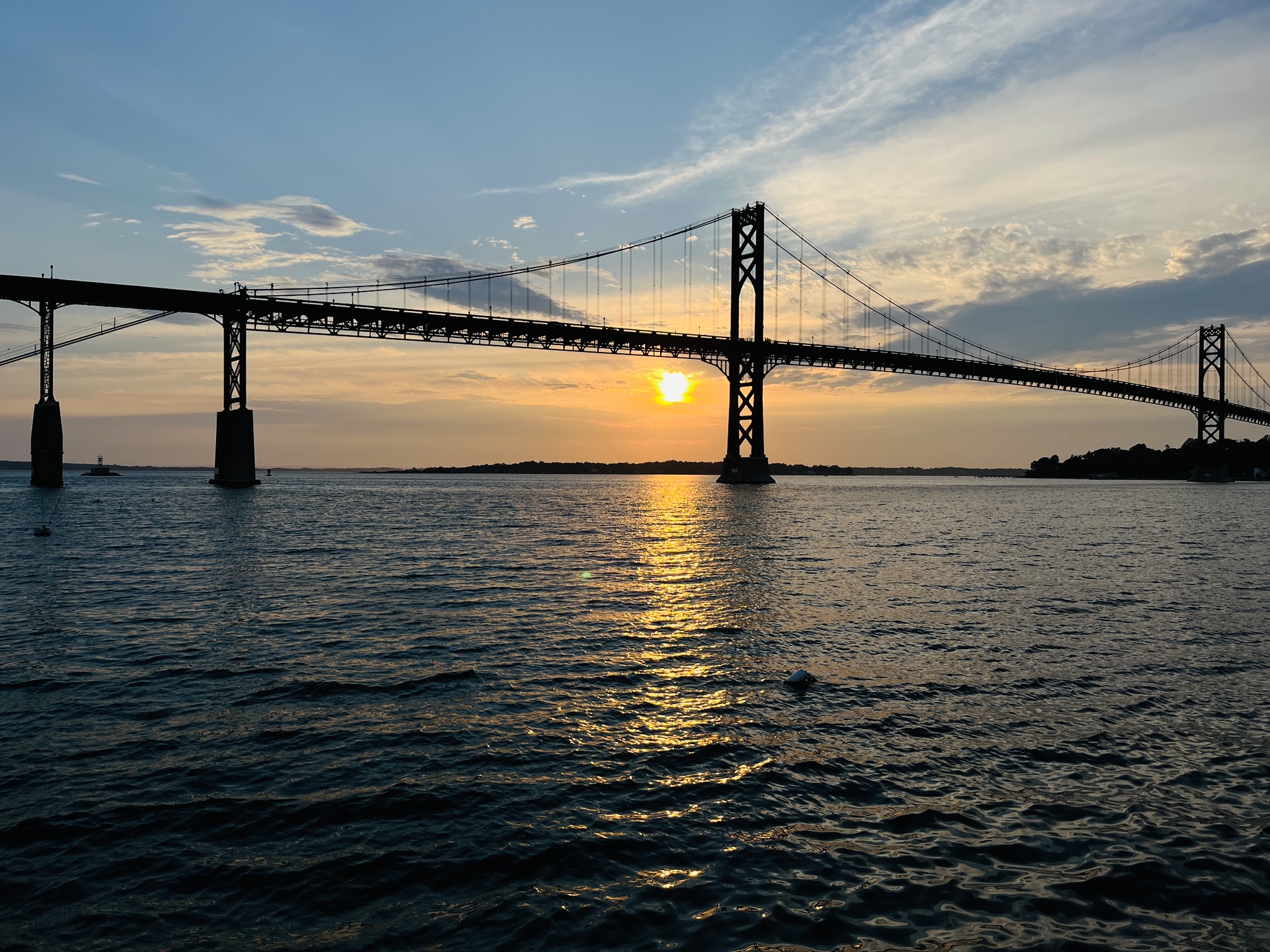
The tip of the Bristol Ferry area developed commercial businesses like taverns and shops that catered to those using the ferry. Ferries were more informal at the beginning. Those with boats provided a service to passengers and goods that needed to be transported to the mainline at Bristol. This is the site of a town common dating back to 1714. Ferry service started here in 1640. This 1.5 acre space was originally used by farmers and others to keep their livestock and other goods while waiting for the ferry to Bristol. The Bristol Ferry area had a British fort during the occupation. This area was the transportation hub for Aquidneck Island (Rhode Island) and there are records of George Washington passing through here after visiting with General Rochambeau in 1781. The French and Americans would make the start of their long journey to victory at Yorktown through Bristol Ferry.

A Bristol Ferry story

Just above the Bristol Ferry is the 3 acre lot that Richard Searle sold to Mary Paine.  Mary was a bar-maid at Baulston’s public house.  Searl exchanged his lot for a pint of wine.  He didn’t give Mary a deed, but the town council ratified the sale on the testimony of a witness in 1666.  Mary later married John Tripp and that piece of land became the site of his ferry house.

Recommended Reading

 West, Edward. Rhode Island Historical Society Journal in July of 1932 (The Lands of Portsmouth, R. I., and a Glimpse of Its People).

Portsmouth Neighborhoods

Leave a comment

What’s the story of Portsmouth’s various neighborhoods? Over the winter I will be gradually exploring our communities. What history happened here? Who are people of note who lived here? What can you see of the past and what recreations can you enjoy today?

Portsmouth has never had a central “downtown” area like most communities. The original settlers tried to create a traditional town with residences clustered together and farm lots further away, but that is not what the settlers wanted.

Original settlements centered around Common Fence and Town Pond. They opted to live spread out on their farmlands. So Portsmouth developed neighborhoods instead of a central town.

Some of those neighborhoods centered around the ferry landings – Bristol Ferry Road and Glen Street heading to the Fogland Ferry.

The Glen area of Portsmouth featured the grand Taylor family Glen Farm.

South Portsmouth featured large “Gentlemen’s Farms.”

Quaker Hill and Middle Road took on importance as a central spot with Town Hall and the Quaker Meeting House.

The Melville area took on importance when the military claimed most of the Westside of town.

Lawton’s Valley – Wading River was the home of Julia Ward Howe and the site of the mysterious death of Rebecca Cornell.

Newtown was a planned central downtown, but it never seemed to reach its promise. The location along East Main Road, however, made it somewhat a commercial and social area with churches, the library and businesses.

Island Park was created as a summer resort and Park Avenue – on the way to the Stone Bridge and Ferry, was as close to a “downtown” as Portsmouth ever would experience.

Lost Portsmouth: Bristol Ferry Inn

Leave a comment

One of the attendees at our Bristol Ferry Commons/Mt Hope Park evening asked me about the Bristol Ferry Inn and what had happened to it. I have some of the pieces of that story, but there is still more to uncover.

The earliest information I have traces an original Inn to a tavern owned by David Gifford. At the time of the Revolutionary War, Gifford was the leader of the militia and ferryman for Portsmouth. The caption on this photo mentions “The old house belonging to David Gifford was built into the upper part..” of the Inn.

An article by the Historical Preservation and Heritage Commission booklet on Portsmouth stated: “About 1850, a large hotel with accommodations for up to 50 people, was built, and, for the next three-quarters of a century or so, Bristol Ferry was a thriving place, with the hotel, a wharf, a store, summer cottages, a railroad station on the Old Colony line between Fall River and Newport, a telegraph office and post office.”

The Bristol Ferry Inn advertised in New York papers like the Brooklyn Eagle in 1926. A Nine-Hole golf course is advertised at this time.

One travel guide has a description of the hotel’s charms.

“The one hotel here is a big, white, airy structure, tempered with green blinds surrounded by broad piazzas, even up to the third story. In its setting of great poplar trees, with neatly white-washed trunks, it looked somehow like pictures of old-fashioned ” young ladies’ seminaries.” Its proprietor is Alfred Sisson, and the house looks large enough to accommodate twice its stated limit–fifty. However, the ground floor is taken up mainly with large parlors, and a long dining hall; about are in the house now, all the proprietor cares to entertain. Row boats are let by the hotel, and sail but three-fourths of a mile to main land at Bristol Ferry..”

Something must have happened to the three story inn because the Fall River Evening News for July 10, 1923 reports on the opening of a two story smaller hotel. The hotel was described this way.

“The hotel occupies the site of the old Bristol Ferry House at Bristol Ferry, R.I., the main building occupying somewhat higher ground than the older one did, giving a better view. ……
A small hotel more pleasing in effect it would be hard to find. It is a natural wind grewy rising aaboutve field stone supports of a piazza that extends along the full front. …. The main building has two full stories…There are 11 suites of bedroom and bath.”


In its later days the Inn was known as “Hylander Inn” and was burned down in 1945. Coincidentally, the owner, Louis Carreiro, had his Pocasset Country Club building burned down in 1956.

Sunset Photos at Mt. Hope Park

Leave a comment

Mt. Hope Park is a beautiful place to take photos. This Friday – weather permitting – we will encourage people to come down to the park and Bristol Ferry Commons from 5:30-6:30 to learn about the history of the area and take photos of the sunset. We will have a “best” photo contest for small prizes. Those who come to the event will get a card with an email address for submission. Photos of sunsets at Mt. Hope Park could have been taken earlier, but those entering will have until Oct 19 th to make a submission.

I have tried sunset photos, but it is not easy. Below is a recommendation of someone from the Portsmouth Art Guild. I am going to practice with these settings.

Using Your iPhone
iPhone Settings:
In “Settings”, go to the Camera listing
Toggle on “Grid”
Tap on “Preserve Settings” and toggle on “Exposure Adjustments”
Camera Settings
Go to your camera and look for the Exposure Adjustment option
Adjust it to -0.7 to capture more sunset details
Turn on the Flash
Tap on an object in the foreground or in the sky to focus
There is no hard and fast rule on how to frame your photos, but it’s recommended to have an object in the foreground. If that object is s person, using the rule of thirds, try positioning the person on the left grid line while looking 45 degrees toward the horizon.
Practice the above recommendations to feel comfortable while outside taking sunset photos.

Using a DSLR Camera:
How to choose the right camera settings for sunset photography.
Shooting great sunset photos is all about your camera settings. Learn how to set your gear up right with these helpful tips.
Sunsets are one of nature’s greatest spectacles, and they make for absolutely stunning photographs — when you pick the right camera settings. Luckily, sunset photography is easy once you know the basics.
These tips will help you set up your camera correctly and capture the full beauty of a blazing sundown.

  1. Set your ISO to low.
    Naturally, the sun is bright — even when it’s setting. Keep the ISO as low as possible so your photo won’t come out grainy. That said, you should increase the ISO as the sun creeps closer to the horizon.
  2. Use a quick shutter speed.
    Opt for a quick shutter speed to minimize exposure time — otherwise the setting sun might burn out your photograph. Take a few test shots to find the sweet spot. If your camera has an exposure bracketing feature, this is the time to use it.
  3. Shoot with a wide aperture.
    You’ll want maximum depth of field to capture the whole sunset scene. Set your aperture to a very narrow setting, such as f/11 or even higher. You can’t really go too narrow.
  4. Focus your shot manually.
    Some cameras struggle to focus on a sunset, since it doesn’t provide a clear focal point. If your photos are coming out blurry, focus your camera manually.
  5. Experiment with the white balance.
    Most modern cameras have great automatic white balance settings, but you should definitely try out a few different options. The best setting depends completely on the particular sunset, though, so snap a picture with each manual setting.

Recommendations from member of Portsmouth Art Guild