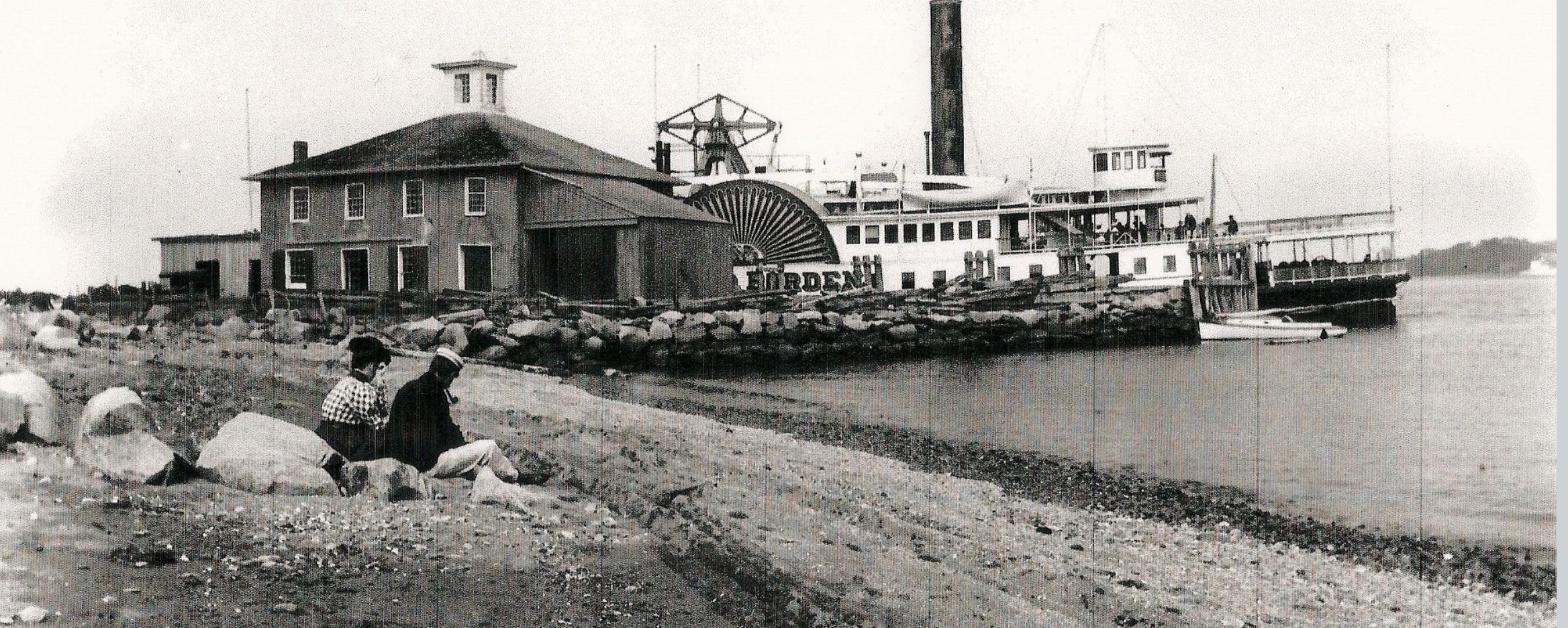
The Bristol Ferry grew in importance after the Revolutionary War and a whole transportation network developed around it. Railroad service, steamers (even the famous Fall River line in the 1860s), and trolleys had stops at this hub. A summer colony grew up around the ferry landing and that drew wealthy people from Providence. Around 1850 a large hotel that could accommodate 50 guests was in service and continued for the next 75 years. Bristol Ferry Landing became a thriving center with the hotel, a wharf, stores, a railroad station, post office, telegraph office and summer cottages.
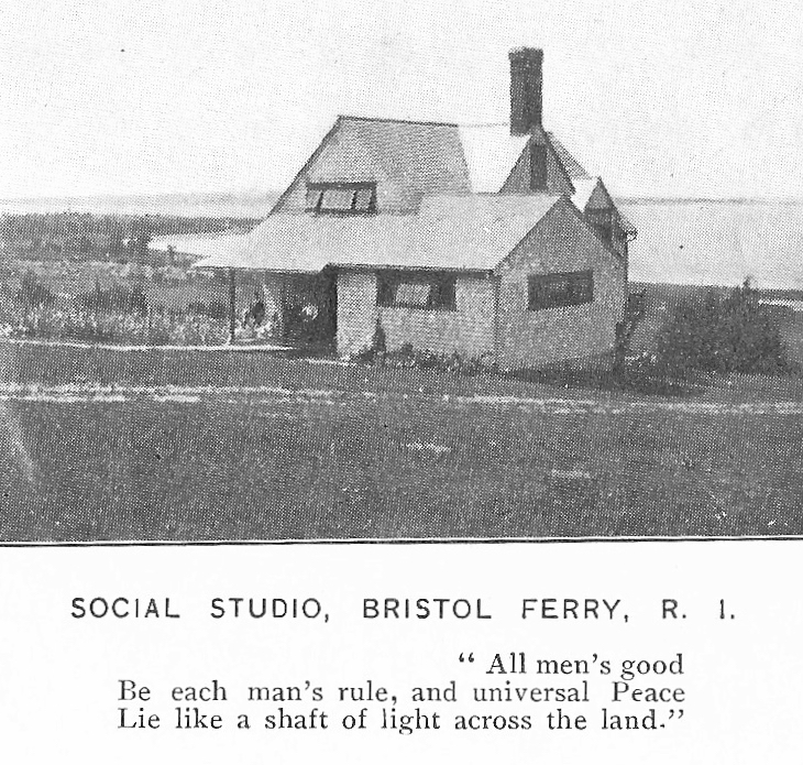
Landing as transportation hubTurn of the century image by Sarah Eddy
Artists
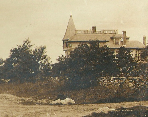
In the late 19th and early 20th centuries the Bristol Ferry neighborhood was known as an artist colony. Along Bristol Ferry Road large homes were built as summer residences. Noted artist, sculptor and photographer Sarah Eddy brought art students to Bristol Ferry to enjoy the special light in the area. Sarah started a “Social Studio” to teach crafts and kindness to the local youth. Internationally known artist Oscar Miller made Bristol Ferry his home when he married into local Mitchell family.
Sarah Eddy House
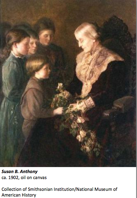
Suffragists
Sarah Eddy had connections with national leaders in the abolition and woman’s suffrage movement. Susan B. Anthony even came to Eddy’s house in Portsmouth to have her portrait painted. The women who lived in the Bristol Ferry area became the hub of the Aquidneck Island and Rhode Island suffrage movement.
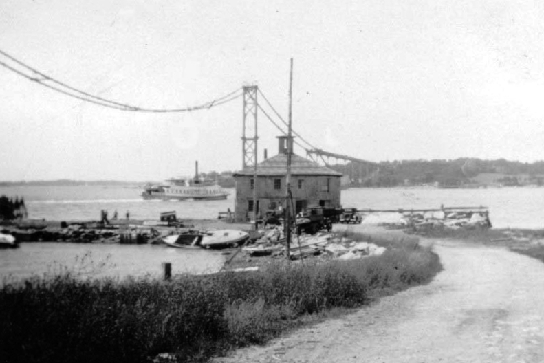
The Bridge changes everything
The Mount Hope Bridge, designed in 1927 by a private company and opened for travel in 1929 is a prize-winning suspension bridge over Narragansett Bay between Providence and Newport. With the bridge, the use of the Bristol Ferry Landing diminished. Today that high transportation area is the beautiful Mt. Hope Park, a quiet spot to enjoy a sunset.
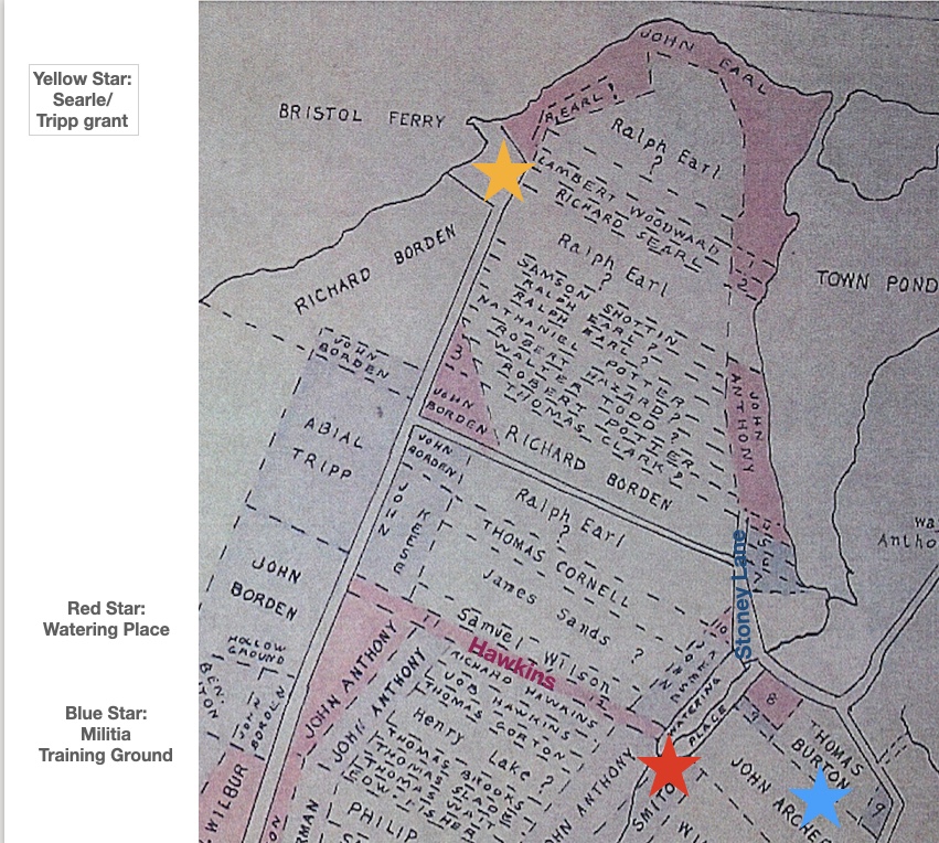
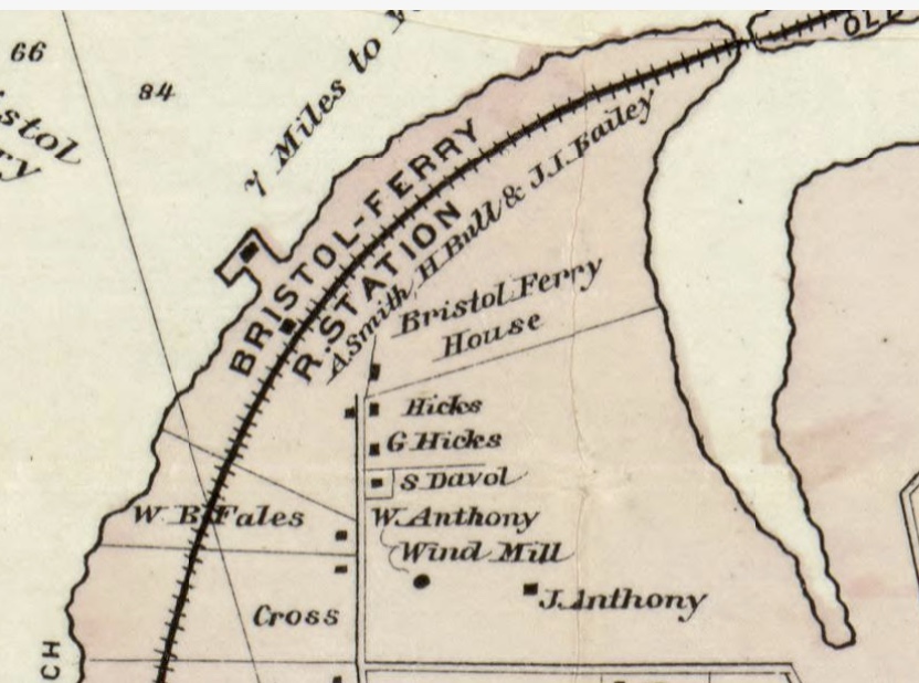
As the Portsmouth founders moved away from the settlements around the Town Pond, Common Fence and Founder’s Brook, the Bristol Ferry community to the northwest began to develop. In the 1930s, Portsmouth historian Edward West did some remarkable work with land evidence. Among his works are the Land Grant Maps that tell us where the early settlers were given land. How he worked through all the locations with rods as measurements, we will never know. West tells us that upon founding the town “they immediately made laws governing the size and location of the house lots.” They began recording property in a book. There were times when land transferred without records, so the accuracy of the land evidence may be questionable in some cases. West illustrates the grants and town plan with his maps. Some of the first grants given were in the Bristol Ferry area. As the town was laid out, Sprague Street was the southernmost border. Land grants were given out in 1657, 1693 and the last lands were given out in 1713. By 1713 the commons were laid out, highways were straightened and the town was considered finished as laid out from Sprague Street northward. As the Portsmouth population spread to the north and west of Town Pond, the town fathers and surveyors thought they had finished laying out the town.
The first street to the right was “Stoney Lane.” It was a short “driftway” (a path used to drive cattle or sheep) between Richard Borden’s property and that of Mistress Harts. South of that was a lane that led to a “watering place” now called Founder’s Brook. On the map it is called Hawkins Lane for Richard Hawkins and his wife Jane who was a friend of Anne Hutchinson. This “watering place” was laid out in 1713 as a public place for the washing of sheep and general water uses. Also in 1713 Thomas Burton received a piece of land that was known as the “Training Place” before that. That ground may be where the militia had trained.
Waiting for the Ferry
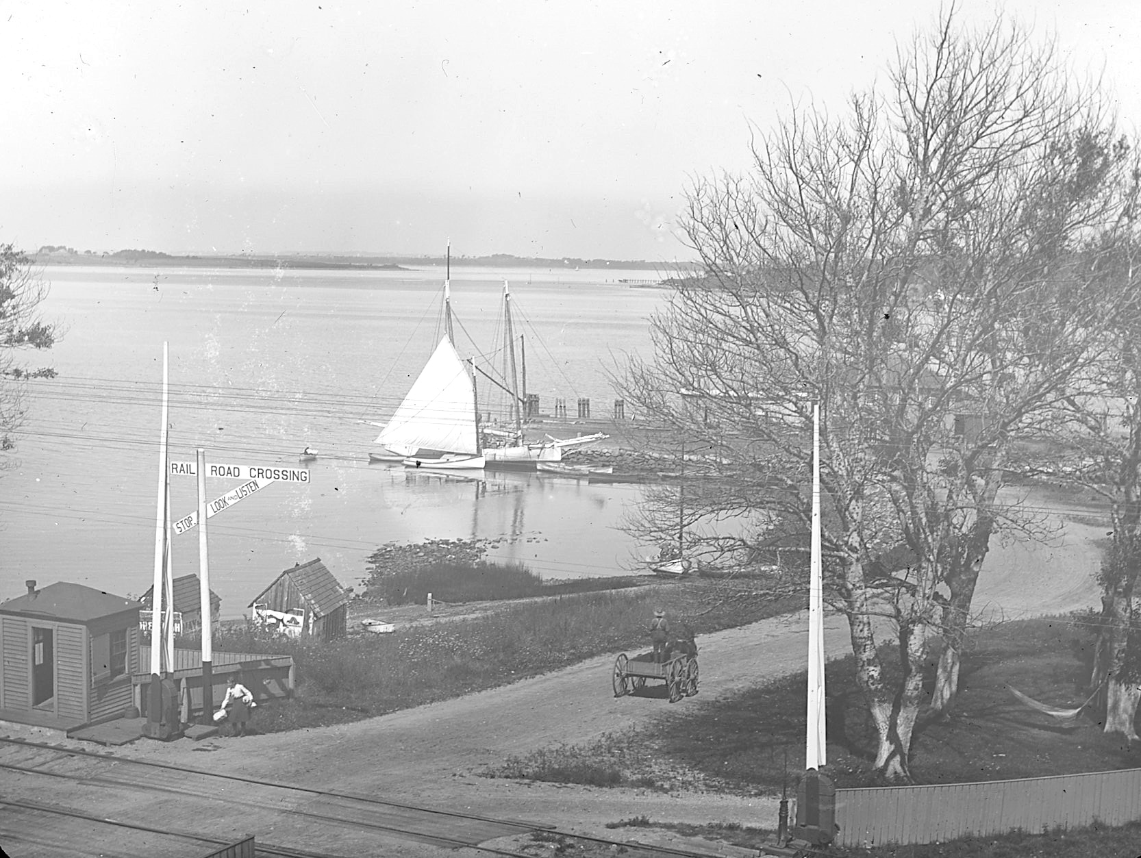
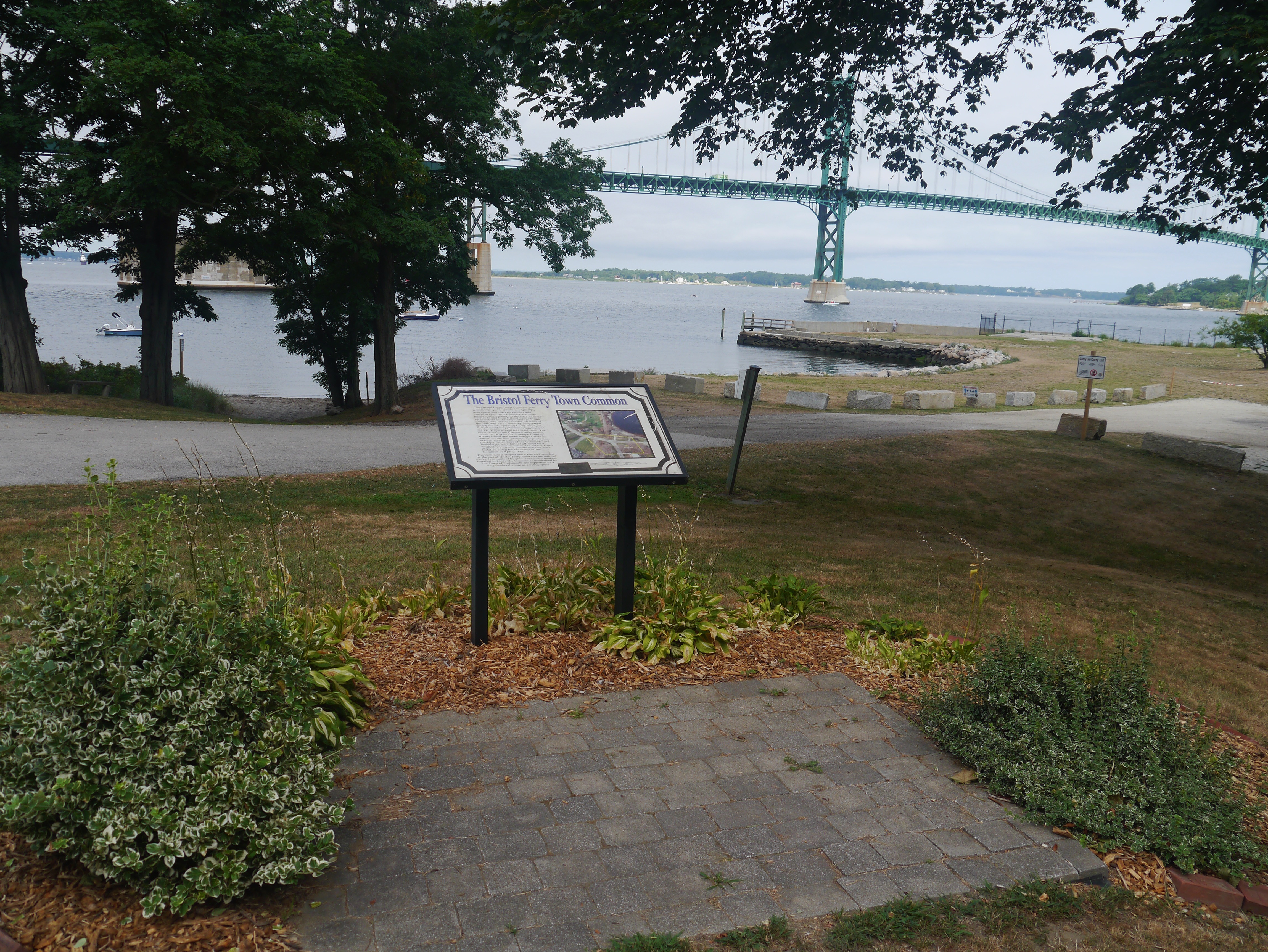
The tip of the Bristol Ferry area developed commercial businesses like taverns and shops that catered to those using the ferry. Ferries were more informal at the beginning. Those with boats provided a service to passengers and goods that needed to be transported to the mainline at Bristol. This is the site of a town common dating back to 1714. Ferry service started here in 1640. This 1.5 acre space was originally used by farmers and others to keep their livestock and other goods while waiting for the ferry to Bristol. The Bristol Ferry area had a British fort during the occupation. This area was the transportation hub for Aquidneck Island (Rhode Island) and there are records of George Washington passing through here after visiting with General Rochambeau in 1781. The French and Americans would make the start of their long journey to victory at Yorktown through Bristol Ferry.
A Bristol Ferry story
Just above the Bristol Ferry is the 3 acre lot that Richard Searle sold to Mary Paine. Mary was a bar-maid at Baulston’s public house. Searl exchanged his lot for a pint of wine. He didn’t give Mary a deed, but the town council ratified the sale on the testimony of a witness in 1666. Mary later married John Tripp and that piece of land became the site of his ferry house.
Bristol Ferry Common today
Recommended Reading
West, Edward. Rhode Island Historical Society Journal in July of 1932 (The Lands of Portsmouth, R. I., and a Glimpse of Its People).
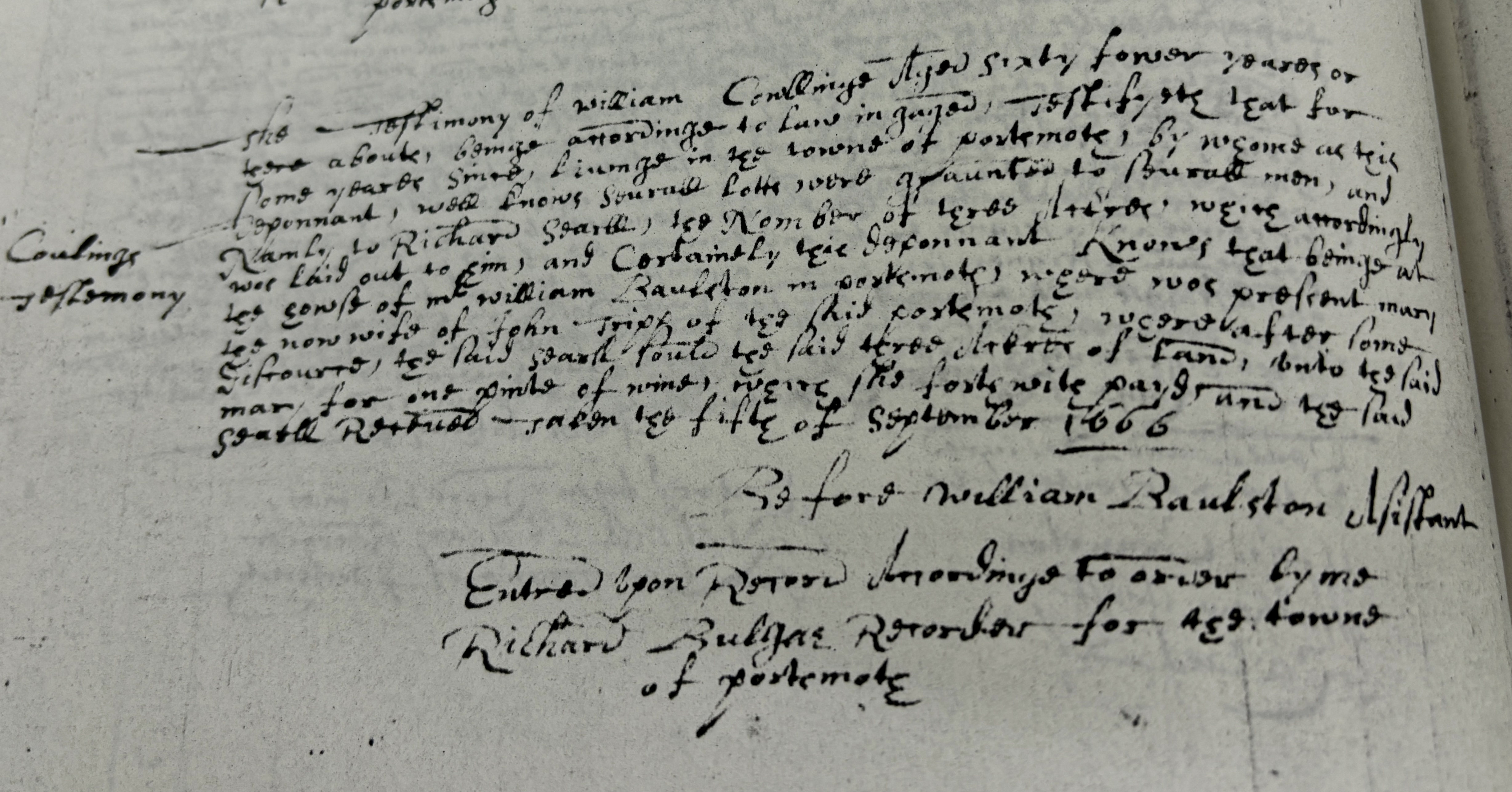
I recently shared the story of Mary Payne (Tripp) trading a 3 acre land grant for a pint of wine. One of the audience members questioned me about whether this was a just a story or really true. The story came from Portsmouth historian Edward West and I trusted his scholarship. He spent lots of time working with town records. I like to see the primary sources, so I began to look for confirmations. Tripp family genealogies gave me some clues of where to find the answers. One of these family histories said that the court of Commissions, on 8 Dec 1666, confirmed the sale. I wasn’t sure what the court of commissions was. Another family history stated that someone named Collings had testified in Mary’s behalf. A former Portsmouth Historical Society curator remembered seeing a transcription of Collings’ testimony in the society collection. The society’s collection has been re-organized and I wasn’t able to find it, but I knew it had to be somewhere. I went to the office of the Town Clerk to ask where I could find “Court of Commissions” records. A very helpful worker suggested that if a deed was involved, we could look for it in Land Evidence. We had a date and the name of who was granted a deed, so it was easy to find both the granting of the deed and the testimony of the witness.
I took images of the deed and now I needed to transcribe it. These Land Evidence books are photocopies, so legibility was difficult to begin with. Ancient forms of spellings and grammar make for difficult reading as well. While I had transcribed documents before, this seemed like quite a chore. I have seen a commercial touting artificial intelligence’s usefulness in transcribing old recipes. Well if AI can work on handwriting, maybe it could help me with transcription. I found an online transcription service and tried it. It wasn’t perfect, but I was helpful. Between what I can transcribe on my own and the suggestions of AI, I was able to get a general sense of the testimony.
There is confirmation of the story. Mary did get a deed for the property even though Searl left town without giving her the deed. Listening to the testimony of someone who was at the Tavern, the town gave the deed to Mary and her husband John Tripp more than twenty years later.
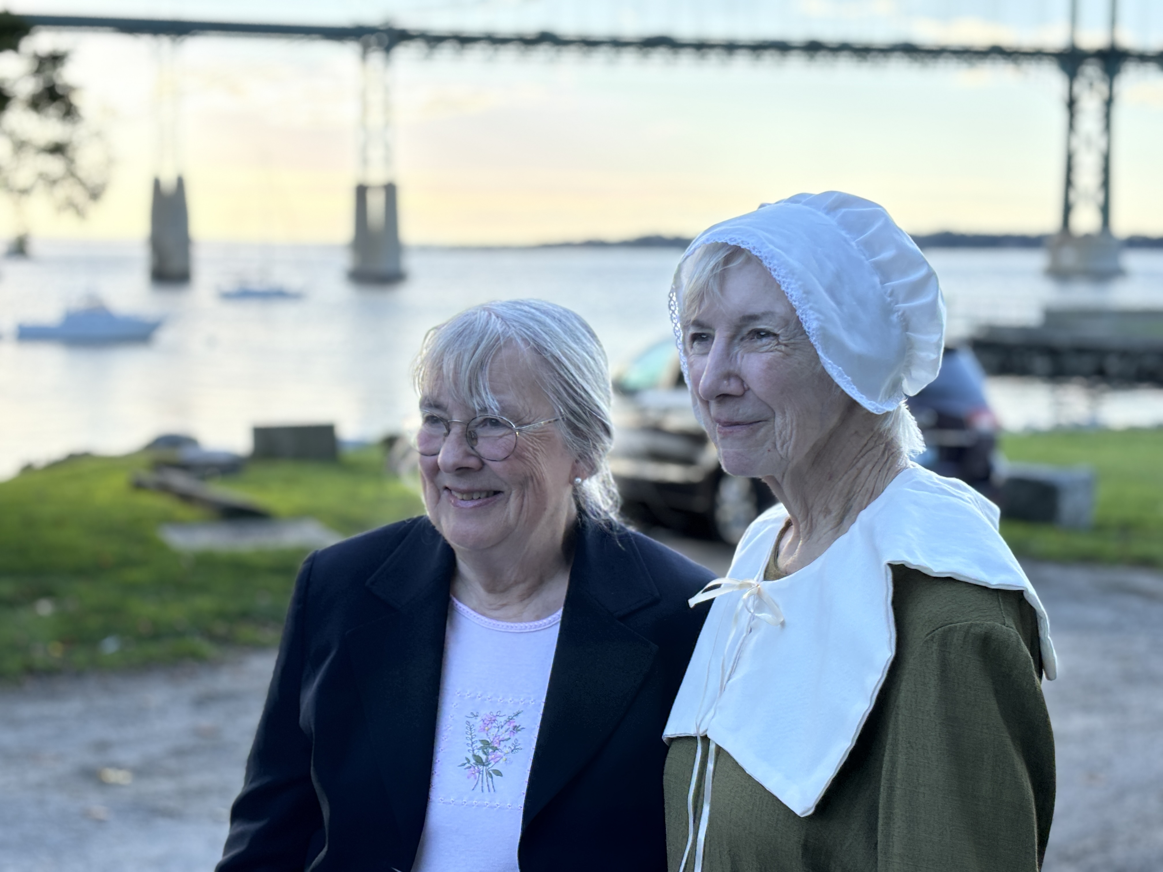
Left: 7th great granddaughter of Mary with Cindy Killavey who portrayed Mary.
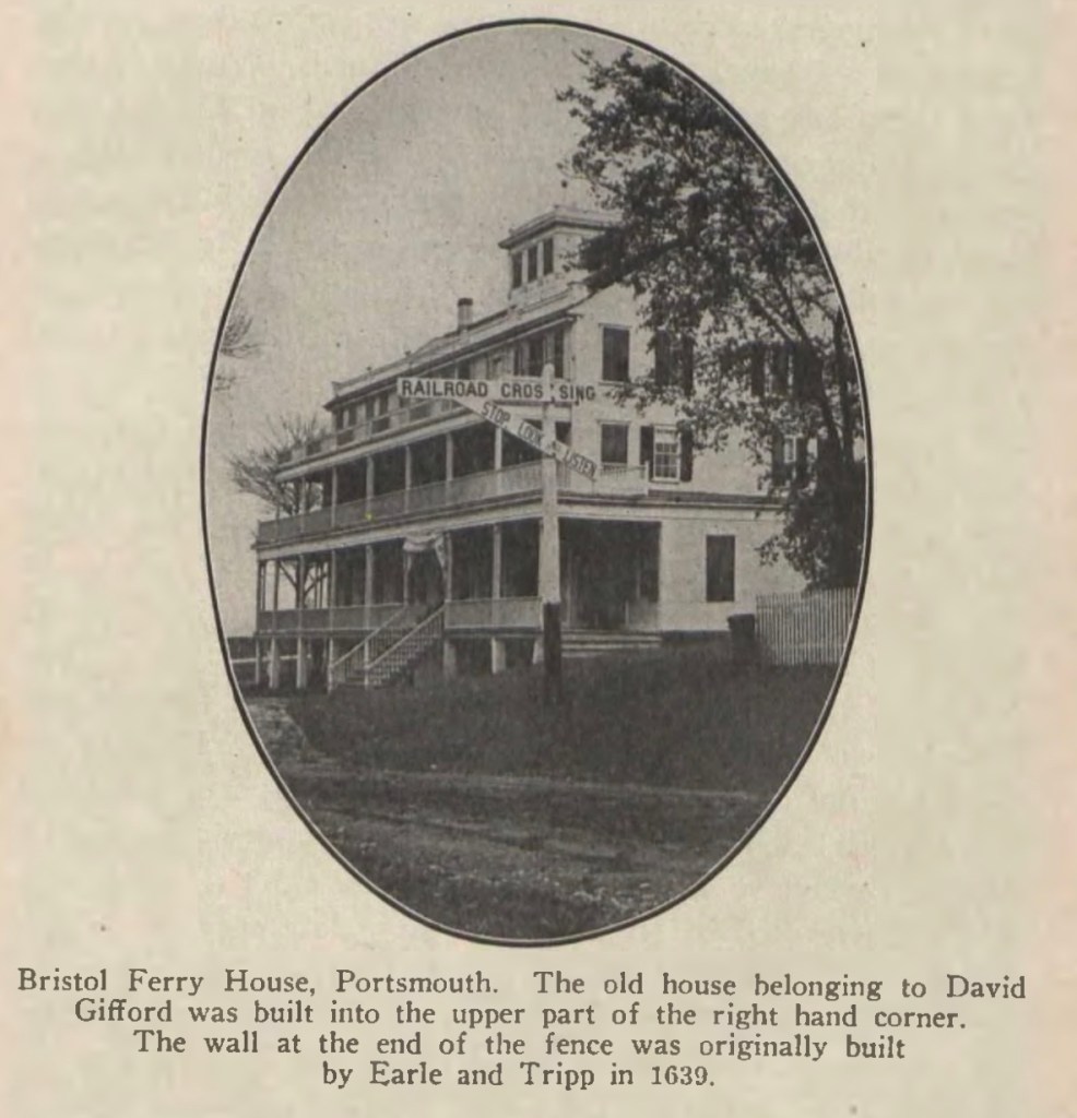
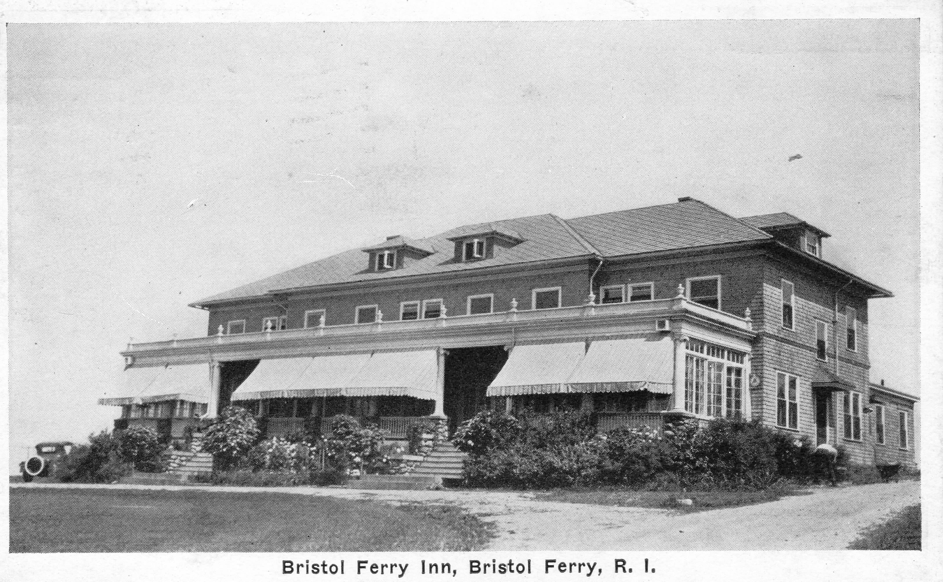
One of the attendees at our Bristol Ferry Commons/Mt Hope Park evening asked me about the Bristol Ferry Inn and what had happened to it. I have some of the pieces of that story, but there is still more to uncover.
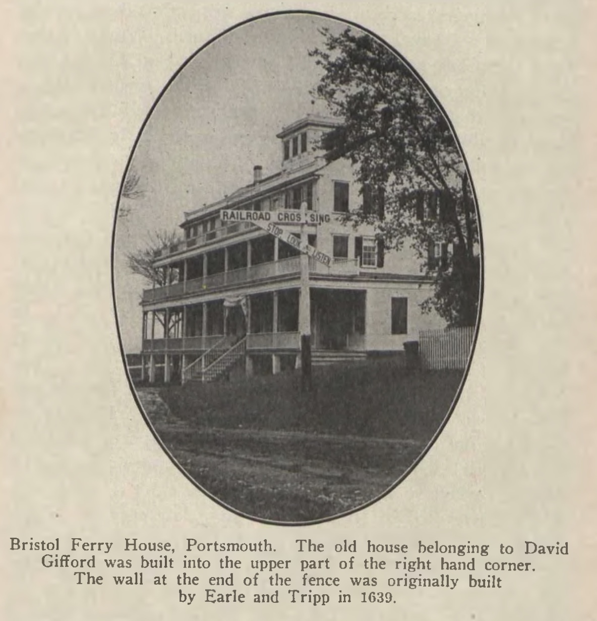
The earliest information I have traces an original Inn to a tavern owned by David Gifford. At the time of the Revolutionary War, Gifford was the leader of the militia and ferryman for Portsmouth. The caption on this photo mentions “The old house belonging to David Gifford was built into the upper part..” of the Inn.
An article by the Historical Preservation and Heritage Commission booklet on Portsmouth stated: “About 1850, a large hotel with accommodations for up to 50 people, was built, and, for the next three-quarters of a century or so, Bristol Ferry was a thriving place, with the hotel, a wharf, a store, summer cottages, a railroad station on the Old Colony line between Fall River and Newport, a telegraph office and post office.”
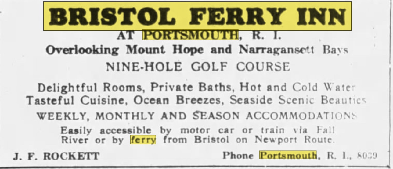
The Bristol Ferry Inn advertised in New York papers like the Brooklyn Eagle in 1926. A Nine-Hole golf course is advertised at this time.
1870 Ward mapAd in Brooklyn Paper
One travel guide has a description of the hotel’s charms.
“The one hotel here is a big, white, airy structure, tempered with green blinds surrounded by broad piazzas, even up to the third story. In its setting of great poplar trees, with neatly white-washed trunks, it looked somehow like pictures of old-fashioned ” young ladies’ seminaries.” Its proprietor is Alfred Sisson, and the house looks large enough to accommodate twice its stated limit–fifty. However, the ground floor is taken up mainly with large parlors, and a long dining hall; about are in the house now, all the proprietor cares to entertain. Row boats are let by the hotel, and sail but three-fourths of a mile to main land at Bristol Ferry..”
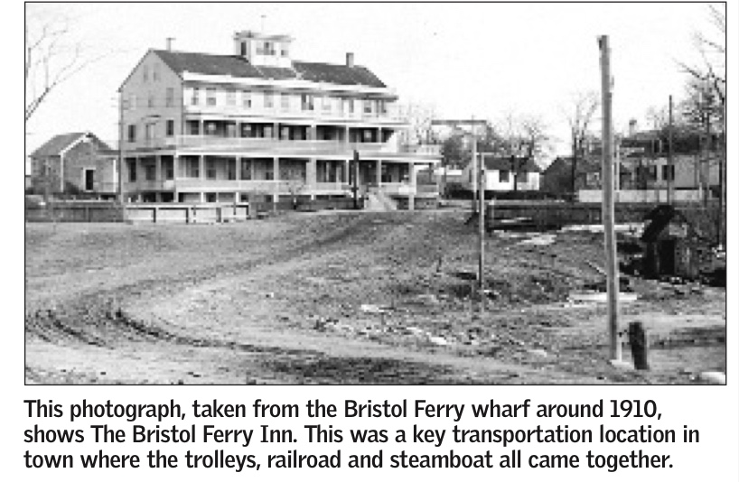
Something must have happened to the three story inn because the Fall River Evening News for July 10, 1923 reports on the opening of a two story smaller hotel. The hotel was described this way.
“The hotel occupies the site of the old Bristol Ferry House at Bristol Ferry, R.I., the main building occupying somewhat higher ground than the older one did, giving a better view. …… A small hotel more pleasing in effect it would be hard to find. It is a natural wind grewy rising aaboutve field stone supports of a piazza that extends along the full front. …. The main building has two full stories…There are 11 suites of bedroom and bath.”
In its later days the Inn was known as “Hylander Inn” and was burned down in 1945. Coincidentally, the owner, Louis Carreiro, had his Pocasset Country Club building burned down in 1956.
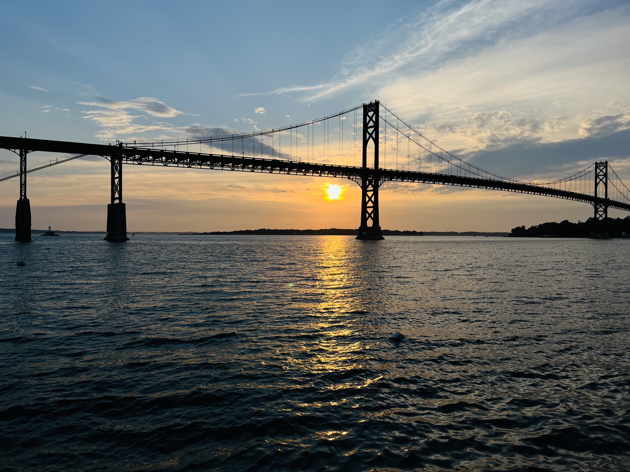
The old Bristol Ferry landing (now known as Mt. Hope Park) was once the transportation center for Portsmouth. Ferry boat service to Bristol and back began as early as the 1650s. The Old Colony Railway had a train station there and steamboats docked at that spot for travelers on the Fall River and Providence steam boat line. In the early 20th century, the electric street railway came to Bristol Ferry from Newport. Passengers could proceed to a ferry to cross to downtown Bristol were they could take a train to Providence. When the Mt. Hope Bridge opened in 1929 and the ferries stopped running, the area lost much of its importance as a transportation center.
Through the years the area became the site of Mount Hope Marina, a restaurant. When it closed the land was vacant and cut off from the public with fencing. In January 2016, the Aquidneck Island Land Trust and the Town of Portsmouth formed a partnership to purchase the waterfront property. The Town of Portsmouth owns the property subject to a conservation easement with the the Land Trust. Mount Hope Park opened for public use on August 30, 2019.
Mt. Hope Park is considered a public access to the shoreline. The beautiful view is open to all because of a guaranteed right to access the shoreline that dates back to the Royal Charter granted to the colony of Rhode Island by King Charles II in 1663. Mount Hope Park is just one of the state’s more than 220 designated coastal rights-of-way, including more than 65 on Aquidneck Island.
It is a beautiful spot to enjoy the sun setting behind Mt. Hope Bridge. It is also recreational with access for kayaks and fishing available
For a number of years I have been gathering stories of Portsmouth women. Their stories can be forgotten when history is generally written about the men. In presentations I tell the story of Mary Paine Tripp, but John and Mary Tripp’s combined story gives us a glimpse of what was happening in the early days of Portsmouth. It also helps us to focus on what was happening in the Bristol Ferry neighborhood of our town. It was one of the first neighborhoods to be developed.
A story about Mary:
I came across an interesting story from Edward West’s 1932 article in the journal of the Rhode Island Historical Society on the “The Lands of Portsmouth, Rhode Island”. How much would you give for a glass of wine? Back in 1666 Richard Searl sold a three acre lot just above the Bristol Ferry to Mary Paine. Mary was the barmaid at Baulston’s Tavern and the land was exchanged for a “pint of wine.” Mary later married John Tripp who used the land for a ferry house. Although this deed wasn’t registered, the Town Council accepted the deposition of William Collinge as to how the land was transferred. Mary officially owned the land.
Note Searl Property on Land Grant Map. Marked with star.
John Tripp, early settler
An article by Tripp Family genealogist Janet Tripp Andrews provides us with information about John Tripp, 1611 – 1678, as well as the conditions in Portsmouth for the first settlers. John started life here as an indentured servant – perhaps to a ship’s carpenter. He was admitted as an “inhabitant” at Portsmouth’s founding. That allowed a settler to own land but not to vote or hold office. He must have paid off the indenture because a year later he was admitted as a freeman.
Early Records of the Town of Portsmouth show that the community developed quickly. The first house lots were assigned and an inn, brewery and general store were established with William Baulston in charge. Like all men between the ages of sixteen and fifty, John would have trained with the militia. To keep order a pair of stocks with a whipping post was ordered. To enable easier home construction a water mill was proposed. Meanwhile, that first summer settlers lived in caves or dugouts covered in branches. As wood was processed for construction more permanent one and two room structures with lofts and thatched roofs were considered permanent housing. Regardless of what their occupation had been in Massachusetts, the people of Portsmouth became farmers tending to hogs, goats, sheep and cattle. John Tripp, like the other Portsmouth settlers, would have been fencing property, digging wells, and planting orchards.
Although disagreements led to many residents leaving Portsmouth to establish Newport in 1639, John Tripp was among the thirty who signed the second Portsmouth Compact. He signed his own name. This was about the time that John Tripp married Mary Paine.
John Tripp would later become associated with boats and ferries, but Thomas Gorton was appointed ferryman to the Howland Ferry to Tiverton when it was established in 1640. Cattle were ferried across to graze in the Tiverton grasses. Early records show that in 1650 John had the approved weights to measure as the standard for the town. John took on other positions in town. In 1656 he was appointed to inspect cattle moving on and off the island. Tripp must have been able to read and write to do this job.
Meanwhile the Tripp family was growing. In 1640 their first son (John Jr.) was born. By 1650 their thrid daughter was born. Altogether Mary and John had ten or eleven children.
The process of becoming a “ferryman” was gradual for John. The shoreline around Bristol Ferry was owned by the town, but John Tripp, Ralph Earle and John Borden owned land that could add a pier. In 1658 the town treasurer was ordered to pay “Goodman” Tripp “for going into the Bay.” This could mean that Tripp was using his boat to deliver people and/or items like documents or goods.
In 1670 John Tripp had the honor of serving on the Governor’s Council. In 1673 John served as Town Moderator. With this service to the town and colony, Tripp was also serving as a ferryman. Captain Church’s writings have the first mention of “Tripp’ s Ferry” in 1676. After King Philip’s War Tripp’s son Abiel, William Earl, John Borden, and Joseph Anthony were given permission to build or finish wharfs on public land in 1682. Belore the Revolutionary War, the ferries were known by their owners – (Tripp’s Ferry, Borden’s Ferry). After the war it became know as the “Bristol Ferry” and was one of the most important ferries because it was a direct route from Newport to Providence. Washington, Lafayette, Rochambeau and other notables crossed to Bristol by way of this ferry.
Mary’s story continues
Mary Paine Tripp inherited John’s boats at his death in 1678. At a town meeting April 23, 1679 Widow Tripp was granted a license to sell food and drink to travelers. Perhaps she turned her house into a tavern. That would be full circle to her days at Baulton’s Tavern were she exchanged wine for a land grant.
Sources used:
Andrews, Janet Tripp. John Tripp, 1611-1678, A Glimpse into our Founder’s Life, Nov. 2016. In the collection of the Portsmouth Historical Society.
Bristol Ferry Town Commons and Mount Hope Park (old ferry landing) End of Bristol Ferry Road at Bayview
This is the site of a town common dating back to 1714. Ferry service started here in 1640. This 1.5 acre space was originally used by farmers and others to keep their livestock and other goods while waiting for the ferry to Bristol. The Bristol Ferry area had a British fort during the occupation. This area was the transportation hub for Aquidneck Island (Rhode Island) and there are records of George Washington passing through here after visiting with General Rochambeau in 1781. The French and Americans would make the start of their long journey to victory at Yorktown through Bristol Ferry.
This year the Portsmouth Free Public Library is celebrating one hundred and twenty-five years of service to the Portsmouth community. Portsmouth women have been vital to the success of the library. In a history of the library, Ernest Denomme remarks that Sarah Eddy of Bristol Ferry Road was “one of the best educated and well traveled women in Portsmouth….she made her presence felt throughout the community.” She contributed to the success of the Portsmouth Free Public library from the beginning of the organization, but you won’t find her name among the board of directors. She was a private person who worked effectively behind the scenes. Many of the original library organizers were in her circle of friends. One of her best friends, Emeline Eldrege, served on the library board for years.
Sarah was a world class artist, writer, and sculptor. The Bristol Ferry area where she lived became a center for artists such as Oscar Miller. She is famous for her portrait of Frederick Douglass and she brought Susan B. Anthony to Portsmouth to sit for her portrait. That portrait is in the Smithsonian in Washington today. She made a number of donations of artwork to the library, some of which are on view now. Sarah never sold her work, she always gave it away.
By the 1920s the original library needed to be expanded. The West Wing was constructed chiefly through Sarah’s funding to be used as an Art Room. It was common for libraries in that period to also serve as places to display art and bring culture to the community. In 1921 a Newport Mercury article shows Sarah as part of the Art Committee of the library. As she grew older her interest in the library waned, but the traces of her influence remain. In the 1950s the Art Room was re-purposed into a Children’s Room. It serves as the book shop today.
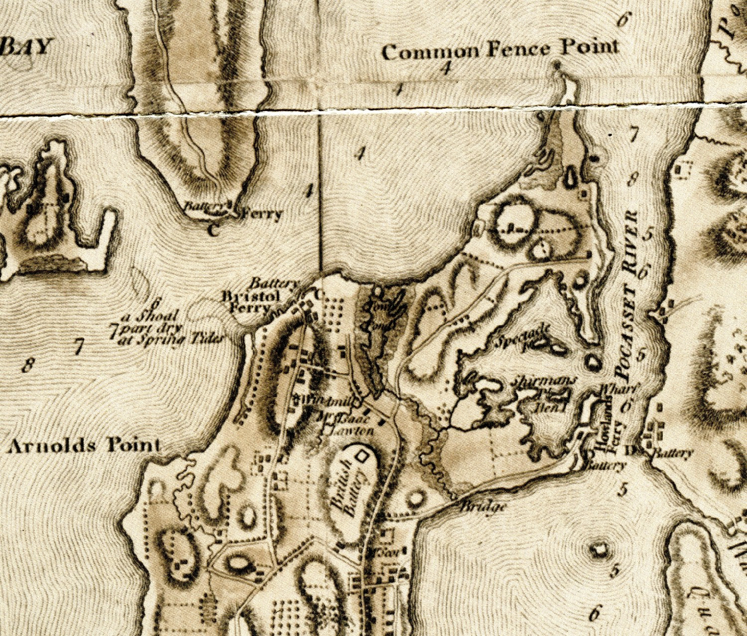
Sarah’s sculpture in Children’s RoomSarah used local models for her work.
In reading a map for information, it helps to view the map in smaller sections to pull out the information. I am focusing on the Northern portion of the town – basically Sprague Street and north. As I view the map I try to put elements into categories. I encourage my readers to view the map and let me know what they see that I have missed.
Transportation -Roads
Looking at today’s map as well as the Blaskowitz Map, these are the roads I see. Blaskowitz does not label the roads, so I will use today’s labels
Park Avenue which would head toward the Howland Ferry
Bristol Ferry Road which would head toward the Bristol Ferry
Part of Boyd’s Lane
Sprague Street
Child Street
Anthony Road
East Main Road
West Main Road
Water Street
Transportation: Ferries
Bristol Ferry which was the main route to Bristol and the North
Howland Ferry which was the main route to Tiverton and Massachusetts to the East
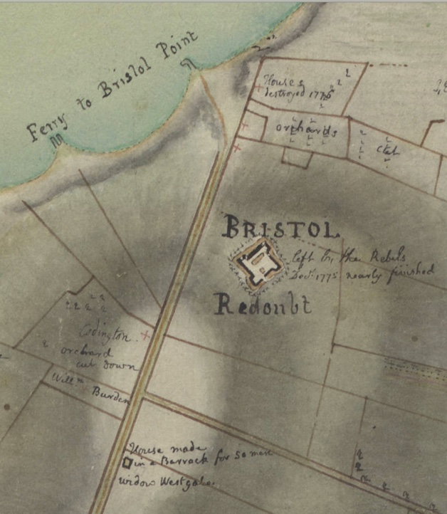
Military Sites: Batteries
Blaskowitz noted where Americans had placed defenses before the Occupation, but he also includes British battery along East Main Road to the north of Sprague Street.
Howland Ferry Battery: This is an important place for the Americans who used this narrow area as a point to move their troops onto the island and when the battle was done to escape off the Island to Tiverton and the safety of Fort Barton.
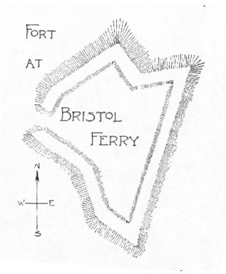
Bristol Ferry Battery: Edward Field’s paper on Revolutionary Defenses a diagram of the Fort at Bristol Ferry. See Reference below.
Farmers and Farms
Mr. Scott’s farm was located between Child Street and Park Avenue. I could not find information on Mr. Scott, but he may have been a Newport merchant and or Captain who had a country farm in Portsmouth. He was not included in the 1778 tax roll.
Isaac Lawton’s farm was located around East Main Road heading toward Boyd’s Lane. Isaac is active in the Quaker church. After the War for Independence many Quakers began to give up their slaves and Isaac’s widow, Mary Fish Lawton, was among those who freed her slave.
Geographic Features
To the East: Common Fence Point, Spectacle Island, Sherman’s Point, Hen Island, Town Pond, Pocasset River
To the West: Arnold’s Point, Shoal by Bristol Ferry that is part dry at Spring Tides
Man-Made Features
To the East: Bridge by Park Avenue, Wharf by Howland Ferry
To the West: Windmill by Bristol Ferry Road
Distribution of Homes
Where did Portsmouth residents live? In this section of the map there are two basic communities. The largest collection of homes was in the Bristol Ferry Road neighborhood. This was one of the earliest areas established when the original land grants were given out. This would have been a high volume transportation route, so there were accommodations for travelers, taverns and other commercial properties here. The second community seems to be in what is called the Newtown area around Child Street and between East Main Road and Water Street. This was an area established when the Town Pond became silted up in 1728 and the original settlement around Anthony Road were abandoned.
Resources Used:
REVOLUTIONARY DEFENCES IN RHODE ISLAND AN HISTORICAL ACCOUNT OF THE FORTIFICATIONS AND BEACONS ERECTED DURING THE AMERICAN REVOLUTION, WITH MUSTER ROLLS OF THE COMPANIES STATIONED ALONG THE SHORES OF NARRAGANSETT BAY BY EDWARD FIELD PAST PRESIDENT OF THE RHODE ISLAND SOCIETY OF THE SONS OF THE AMERICAN REVOLUTION WITH MAPS, PLANS, AND ILLUSTRATIONS PROVIDENCE, R.I. PRESTON AND ROUNDS 1896
The plans of the Musselbed Shoal Light show the quarters for the lighthouse keeper. The keeper led an isolated life. Most keepers held the post for only a short time. A few of them lasted as long as ten years.