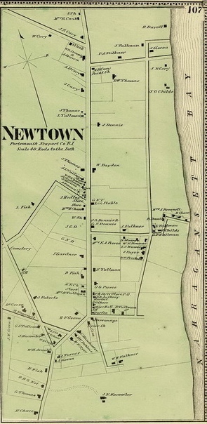
Map of Newtown 1870
How do you describe the town center for Portsmouth? You might think of the “Cozy Corners” area where Clements Market, the bank and the library are located. The original village around Founder’s Brook was to be abandoned because the Town Pond was beginning to silt up. Town fathers in 1728 proposed the town village called Newtown. Streets were officially laid out in 1740 and there were only a few homes built. It was an area east of East Main Road between Church Lane and Child Street. There was a middle highway through it now known as Water Street. A number of streets cut through from East Main Road to the water’s edge. Most of the roads remained abandoned and only Church Lane, Power Street, Child Street and Water street remained active. Town planners hoped this area would rival Newport. It was considered a good site with land sloping down from Butts Hill to a good harbor with deeper water than the original settlement. The community only began to grow with the coming of the trolley car and the automobile. Power Street took its name from a power house at the foot of the road that supplied electricity for the electric cars. Today the area imagined as Newtown is as close to a town center as we have. Portsmouth has always been a town with a variety of villages – Bristol Ferry, Melville, Island Park, the Glen, South Portsmouth, etc.

Leave a comment