In Newport County we are fortunate to have “history we can see.” Fort Barton and Butts Hill Fort are locations where we can imagine events during the War for Independence. As I research Butts Hill Fort and the Battle of Rhode Island, I always find references to what we call Fort Barton today. The Tiverton redoubt (called Tiverton Heights Fort at the time) was the gathering place for the troops who would go to Aquidneck Island in hopes of ending the British Occupation. They traveled across the Howland Ferry area to get to Portsmouth. They returned to this same area in Tiverton during the retreat after the Battle of Rhode Island.
After the British occupied Aquidneck Island in 1776, Tiverton became a base of operations for Colonial forces. Both Rhode Island and Massachusetts cooperated in building the fortification. British officer Frederick Mackenzie’s journal describes the construction in a entry in his diary on June 11, 1777:
“The Rebels have been busily employed in making a work on the hill above Howland’s ferry where their guns have been placed all the Winter. It appears to be very extensive, and must cost them a great deal of labour, as there is little or no soil on the hill.” On June 28th 1777, Mackenzie observed the fort as “irregular in its figure, but very extensive. From the situation, it must be strong.”
In July of 1777 William Barton began his journey from this fort to capture British General Richard Prescott at the Overing House on the Portsmouth/Middletown border. Barton’s raid gave the Americans hope during a very discouraging time and so this fort was named in his honor.
On August 9th of 1778, 11,000 Continental troops and militia under the command of General Sullivan ferried across the short passage between Tiverton and Portsmouth known as Howland Ferry. General Sullivan used Butts Hill Fort as his headquarters. American plans were dashed when a storm damaged the French fleet which was to have helped in the battle for Aquidneck. The Continental troops later moved south toward Newport, and they engaged the British forces in what has been called “The Battle of Rhode Island.” The American effort to regain Newport was crushed and Sullivan made plans for a quick and orderly retreat to save his men. Patriot forces retreated from the island overnight on August 30, 1778. They navigated the same Howland ferry passage under the protection of the guns at Fort Barton. From this location the Americans dispersed to other locations within Rhode Island.
We have these historic landscapes today because of the generosity of Dr. Roderick Terry of the Newport Historical Society. To preserve both Butts Hill Fort and Fort Barton, Dr. Terry bought the lands and donated them to the Newport Historical Society. The Newport Historical Society turned Fort Barton over to the town of Tiverton in the 1960s.
Hopefully there will be a park around the Butts Hill earthworks, but today you can hike the trails in the woods behind Fort Barton. The trails are difficult for the beginning hiker, but the landscape is beautiful to see. A tower provides excellent views of North Portsmouth.
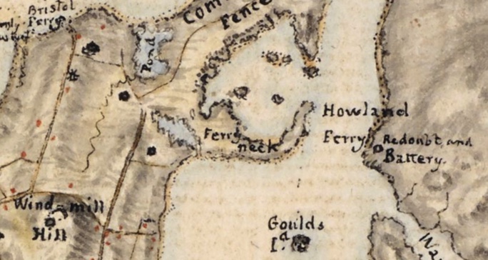
FAGE map 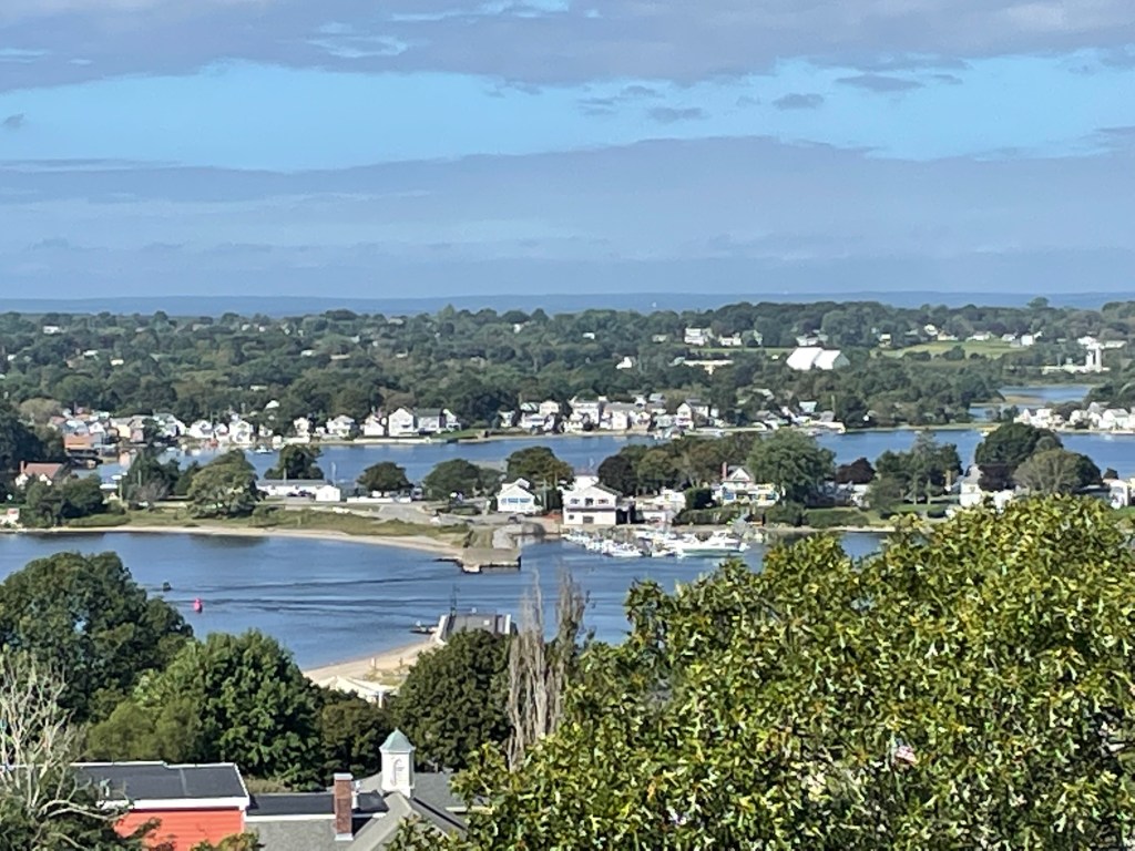
View from Fort Barton

References:
D. K. Abbass, Ph.D., “Fort Barton, Tiverton,” Rhode Tour, accessed September 21, 2021, https://rhodetour.org/items/show/52.
PLAN of RHODE ISLAND, the HARBOUR, the Adjacent ISLANDS, and COAST
Cartographer:Fage, Edward
https://collections.leventhalmap.org/search/commonwealth:hx11z3134
Diary of Frederick Mackenzie, giving a daily narrative of his military service as an officer of the regiment of Royal Welch Fusiliers during the years 1775-1781 in Massachusetts, Rhode Island and New York. 1

Leave a comment