
Information from the Huntington Library map gives us a picture of the fortifications at Butts Hill and other locations in Portsmouth during the British Occupation. The map’s purpose to show “the British posts of defence as compleated during the possession of Rhode Island, from the 8th of Dec. 1776 to the 25th of Oct. 1778.” It covers only the Northern portion of “the Township of Portsmouth”.
The map adds to our understanding of the structure of Windmill Hill (Butts Hill) Fort at the time of the Battle of Rhode Island. On the map you can see the abatis around the Windmill Hill Barrack and the Redoubt and Battery. The fortification is dated from 1776, and that confirms that it was begun by the Americans.
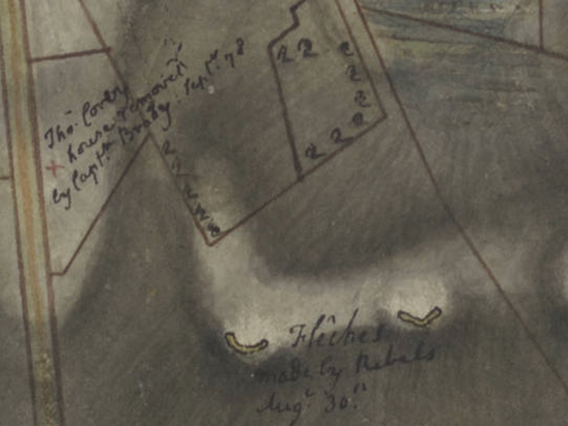
The map even provides information on Rebel constructed fortifications that the British destroyed. To the left of the depiction of the Windmill Hill is a handwritten note: “All the works in colored yellow were made by the Rebels August 30, 1778 but immediately after their retreat were filled in by us.” Another part of the map shows “fleches” made by the Americans on August 30, 1778. This was a new term for me. It derives from the old French word for arrow. “An earthwork consisting of two berms forming an angle with an open gorge.”
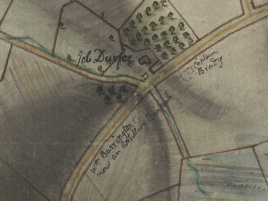
On West Main Road, southwest of Butts Hill Fort, there is an artillery redoubt listed as made in September of 1776. This also must have originated with the Americans. Looking at a Fage map, this redoubt might be labeled as “Burrington Hill.” Durfee’s Hill and Lehigh Hill are other names for it.


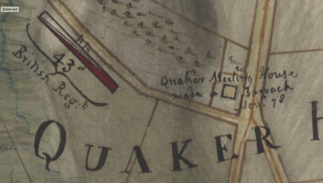
There are handwritten notes that add information like what structures in Portsmouth became barracks, whose orchards were cut down, and the location of local homes by owner’s names.

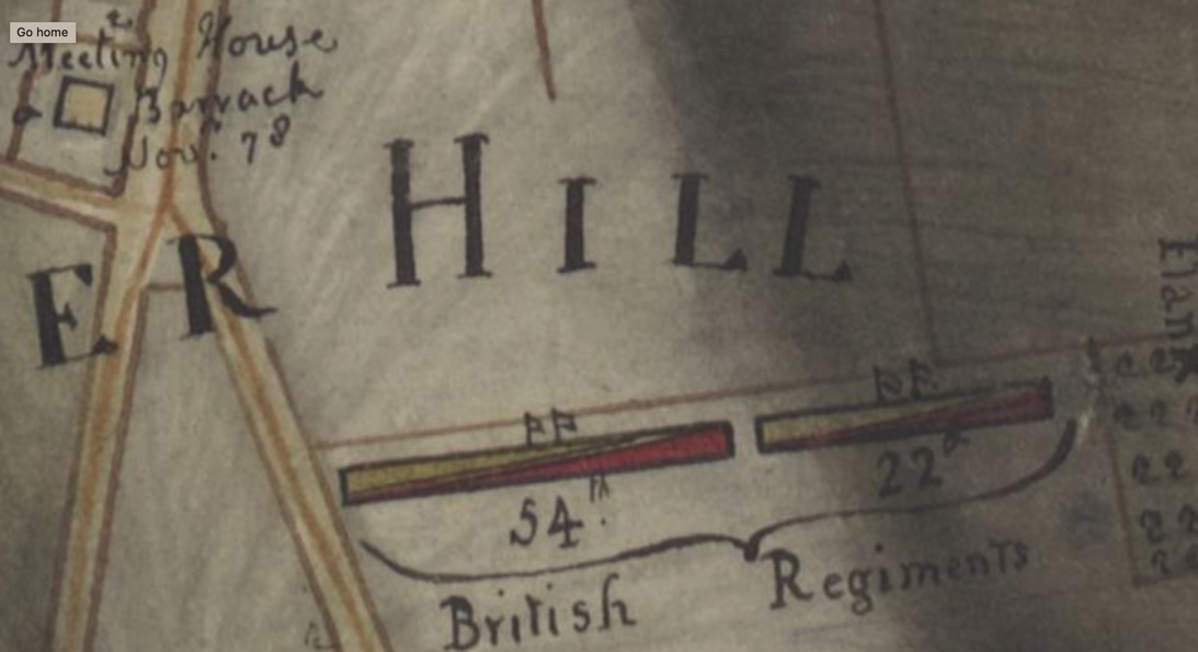
The British positions for the Battle of Rhode Island are quite prominently labeled.


The Huntington Map can be found online: https://hdl.huntington.org/digital/collection/p15150coll4/id/16295/rec/3

Leave a comment