Home

Resolves Against the Duties on Tea: Block Islanders in Union

Leave a comment

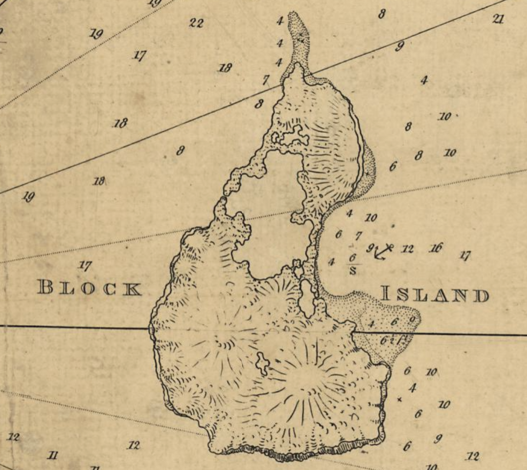
Although Block Island remained neutral in the Revolutionary War, they expressed their unity with other Rhode Island communities in a Town Meeting at New Shoreham, March 2, 1774. According to Livermore’s “History of Block Island,” Newport had sent a copy of resolves on the tea duties and Block Island was asked to unite with the other towns in the Colony. The resolves voted by the Town Meeting give us a glimpse of the grievances of the Americans.

What were the tea duties?

Cartoon from American Battlefield Trust

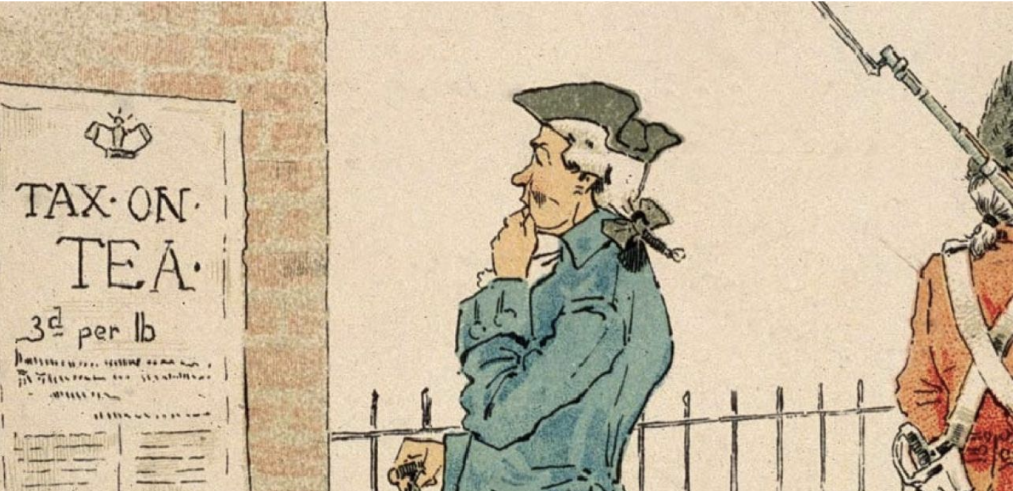
Americans were consuming smuggled tea and that hurt the profits of the East India Company. This company was a private business, but it was important to Britain’s economy. The British Parliament passed the Tea Act in 1773 to give the East India Company the right to ship its tea leaves directly to America. Only the East India Company could sell tea in the colonies. This lowered the price of East India Company’s tea in America. This forced the colonists to pay a tax of 3 pennies on every pound of tea. The Tea Act thus retained the three pence Townshend duty on tea imported to the colonies. The money was to go to the support of the British Army in the colonies.

What were the Block Island Resolves?

I am listing the resolves, bolding what struck me, and commenting briefly on the concern of the Block Islanders with parentheses.

  1. Therefore we the inhabitants of this town, being legally convened in town meeting, do firmly resolve, as the opinion of said town,
    • 1. That the Americans have as good a right to be as free a people as any upon the earth; and to enjoy at all times an uninterrupted possession of their rights and properties, (Americans were concerned about maintaining their rights and properties)
  2. That the act of the British Parliament, claiming the right to make laws binding upon the Colonies, in all cases whatsoever, is inconsistent with the natural, constitutional, and charter rights and privileges of the inhabitants of this Colony. (Acts like the Tea duties go against the colonial rights given in colonial charters).
  3. That the express purpose for which the tax is levied on the Americans, namely, for the support of government, administration of justice, and defense of His Majesty’s dominions in America, has a direct tendency to render Assemblies useless, and to introduce arbitrary government and slavery. (The duty is suppose to go toward the support of British forces in America. This overrides the authority of the Colonial Assemblies.)
  4. That a tax on the inhabitants of America, without their consent, is a measure absolutely destructive of their freedom, tending to enslave and impoverish all who tamely submit to it. (The phrase “no taxation without representation” is evident here. The Americans have not voted for this.)
  5. That the act allowing the East India Company to export tea to America, subject to a duty payable here, and the actual sending tea into the Colonies, by said Company, is an open attempt to enforce the ministerial plan, and a violent attack upon the liberties of America. (As East India Company is the only sanctioned tea importer, this violates the right to choices in America.)

The other parts of the Block Island resolutions give us an idea of the sympathies of the islanders.

  1. That it is the duty of every American to oppose this attempt. (This is a strong statement of duty to oppose.)
  2. That whosoever shall, directly, or indirectly, countenance this attempt, or in anywise aid or assist in running, receiving, or unloading any such tea, or in piloting any vessel, having any such tea on board, while it remains subject to the payment of a duty here, is an enemy to his country. (Even stronger language calling those who assist in this are enemies.)
  3. That we will heartily unite with our American brethren, in supporting the inhabitants of this Continent in all their just rights and privileges. (This is a call to unity with the colonists).
  4. That Joshua Sands, Caleb Littlefield, and John Sands, Esqs., and Messrs. Walter Rathbone, and Edward Sands, Jr., or the major part of them, be appointed a committee for this town, to correspond with all other committees appointed by any town in this Colony; and said committee is requested to give the closest attention to everything which concerns the liberties of America; and if any tea, subject to a duty here, should be landed in this town, the committee is directed and empowered to call a town meeting, forthwith, that such measures maybe taken as the public safety may require.
  5. And we return our hearty thanks to the town of Newport for their patriotic resolutions to maintain the liberties of their country ; and the prudent measures they have taken to induce the other towns in this Colony to come into the same generous resolutions.
    WALTER RATHBONE,
    Town Clerk:’

Perhaps the sympathies of the Block Islanders were with the other towns in Rhode Island – even if later they technically remained neutral.

Reference: Livermore, ST. A History of Block Island. Block Island Historical Society – 14th printing 2024 (original 1877).

Block Island Revolutionary Connections – Patriots

Leave a comment

Block Island in the Revolution is on my mind as I prepare to visit a friend on Block Island. This is a collection of information on Revolutionary Block Island. My understanding is that the island remained uncommitted during the war, but Block Island people were involved in the fight for independence.

Caty Littlefield

A while back I researched women in the Revolution and I learned the story of Catherine Littlefield Greene Miller. Her family called her Caty and she was born on Block Island in 1755. Her mother descended from Block Island founders and her father, John Littlefield, was a member of the Rhode Island legislature. Her Block Island childhood ended with her mother’s death when she was only 10 years old, and Caty went to live with and aunt and uncle. At that time her uncle, William Greene, was a Supreme Court justice, but he went on to being Governor of Rhode Island. Under the guidance of her aunt and uncle, Caty learned how to read and write and how to manage a household. Caty would meet and marry General Nathanael Greene and she took a prominent role in his efforts. She opened her home in Coventry as a hospital when the Rhode Island troops were inoculated for small pox. Caty followed her husband to just about every assignment including Valley Forge.

William Littlefield

William Littlefield was Caty’s younger brother. We learn a little bit about his service in a letter he wrote to Washington to secure a federal position.

“I served my Country upwards of five years in the Continental line of the Army part of which time was in General Greenes family.”

The notes below the transcript of the letter inform us that he didn’t get the job, but he had been active in the war.

William Littlefield (1753–1822), a native of Block Island, R.I., was the younger brother of Catharine Greene, widow of Maj. Gen. Nathanael Greene. Littlefield had served with Varnum’s Rhode Island brigade during the early years of the Revolution and in 1779 had become an aide to his brother-in-law. He resigned on 20 June 1780 and returned to Block Island where he fell under suspicion of trading with the enemy although he was later exonerated (Bartlett, R.I. Records, 10:45). In 1785 and 1792 he represented Block Island in the Rhode Island legislature. Littlefield received no post in the civil service and later in the 1790s apparently moved to Tennessee. https://founders.archives.gov/documents/Washington/05-04-02-0052

Before the war started he is listed as being an ensign in Block Island’s militia.

Captain Samuel Dunn

Another Block Island figure was involved in the Gaspee attack. The Gaspee Committeed issued this statement:
“We conclude that it was Captain Samuel Dunn, 1710-c1790 of New Shoreham (Block Island), RI that took part in the attack on the HMS Gaspee, and later went on to service in the Revolutionary War. The Gaspee Days Committee therefore recognizes Captain Dunn as a true American patriot.”

I am confused about which Samuel Dunn was part of the Gaspee action. This Samuel has a son Samuel Dunn, Jr. who was born in 1743. The elder Samuel Dunn would have been over sixty when the Gaspee incident occured.

The next blog will be on the “Battle of Block Island” that featured Esek Hopkins.

Birds-Eye View of Butts Hill – May 2025 – Max McVay video

Leave a comment

Did the British Chop Down All the Trees During Occupation ? – Or did Oakland Forest Survive

Leave a comment

I attended a lecture on the beech trees of Newport and the director of the Aquidneck Land Trust commented that some the trees of this forest are 300 years old. I have researched the British Occupation of 1776-1779 and I usually make a point of saying that the British and Hessians (Germans) chopped down most all of our trees except those in the Glen. If the Oakland trees are 300 years old they were there during the Occupation.

A number of years ago I was privileged to take a tour of the Glen with arborist Matt Largess. He commented that the Glen itself was one of the few areas on the island with old growth trees because the British were not able to easily cut down the trees during the occupation of the Island. That explained why in the 1850s the Glen would be an attraction because its natural beauty had been preserved.

Online the Aquidneck Land Trust says: Aquidneck Land Trust’s Oakland Forest includes a regionally ecologically unique old-growth American beech forest, with trees estimated to be between 200 and 300 years old based on tree coring done in 2000.”

Reading through British soldier Mackenzie’s diary it is clear why so much wood was needed by the Royal forces. Mackenzie writes on December 6th, 1778:

“Every step is being taken to supply fuel: All the timber trees on the island are cutting down and the old wharves will be broken up.”

Vacant houses were taken apart and the wood was used for fuel. Rail fences were taken apart and burned. On December 13th his diary entry reads:

“All the carriages that can be collected on the Island are employed in bringing in the wood which is cut by the party out on the island.”

“Turf” was cut on Brenton’s Neck and used for fuel. When the island was exhausted, they sent fleets out to collect wood on Conanicut, Block Island and Long Island.

Looking at Revolutionary era maps, I do see areas still shown as forested.

I am not sure about the accuracy of the core samples, however I don’t dismiss them. From now on I need to express the probability that some of the trees at Oakland Forest were spared by the British.

The Story Behind the Rhode Island Campaign: Occupation

Leave a comment

On December 8th, 1776 British General Prescott landed his troops on Aquidneck Island. They landed on the Western shore near the border of Middletown and Portsmouth at Weaver’s Cove. This was the beginning of the Occupation of Rhode Island (Aquidneck Island). The American militiamen were unable to mount a defense and they escaped by using the ferries to Bristol and Tiverton.

The British had ample reason to invade and occupy Aquidneck Island (called Rhode Island at that time). Newport had a fine harbor from which the British fleet could raid up and down the coast. It would enable them to blockade ships carrying supplies from abroad that were needed by the Americans.

The British Occupation of Rhode Island would last until October of 1779. Life for the residents deteriorated throughout that time. There were different experiences for those who lived in Newport and those who lived in the farmlands of Middletown and Portsmouth. Newport had more British sympathizers and life for them was good at first. The “well to do” Newporters and British enjoyed concerts, dances, card parties, and Christmas concerts after the British first arrived in 1776. In 1777 daily routines continued. The occupiers took over houses, shops, wharves, and farms. The British and Hessians (German) came with wives and children and all needed food, supplies, housing and heat. The residents competed with the British for scarce items. The British took hay and confiscated cattle and livestock. Residents could hunt birds, catch fish and collect shellfish. The British collected boats and guns. The longer the Occupation lasted, the harder it was on those in the maritime trades such as coopers, sailors, rope makers, etc. Wharves were pulled up for fire wood. Merchants had no supplies coming in so they had little to sell.

Local citizens couldn’t count on growing food for their families. Gardens were raided, fruit was plucked from trees and potatoes were dug up by British soldiers. There was no freedom of movement. Women could travel a little more freely at first, but later they needed passes to leave town. The border of Newport and the rest of the island was gated and locked There was no free press or local government. Births, deaths, marriages were not recorded and Newport lost its property records when the British shipped them to New York and they were ruined by water.

Destruction was even more disastrous when the French fleet was arriving in August of 1778. In creating defensive works. the British demolished homes, chopped down orchards and trees for abatis (a defensive obstacle formed by felled trees with sharpened branches facing the enemy.). Conditions worsened after the Battle of Rhode Island and through to October of 1779 when the British left the island.

The Rhode Island Campaign was a plan by the Americans and their new allies the French to rid the island of the occupying forces.

Who Went to Southermost School?

Leave a comment

“Do you know if the school taught girls alongside boys, and if so, when that co-ed started? Also, any indication of any Black or Indigenous ever being taught there?” I received these questions from a Portsmouth Historical Society board member and I have been searching through new and old resources to try and answer that question

When my husband portrays James Preston to a school group, the “students” are a mixture of boys and girls. There are few sources on the students at Southermost, but state orders and details drawn from newpaper articles on the school may help us draw some tentative conclusions.

Public or Private?

Newport and Providence had schools that were established in earlier days then Southermost. These were private and religiously based schools. Portsmouth founders had a core belief in religious freedom and they had suffered under the hand of ministers. They may not have been interested in having their children’s education formed by religious leaders. Private schools and religious based schools were available on the island in Newport. Portsmouth residents advocated for a school that was open to all students (boys). The schoolmaster was not a religious leader. The first schoolmaster’s background seemed to be as a mariner judgeing from his books.

Boys and Girls?

Chances are that before 1800 education was for boys only.

State guidelines for education in public schools in 1800 show that at that point the general view was white students only.

“for the instruction of all the white inhabitants of said town, between the ages of six and twenty years, in reading, writing and common arithmetic, who may stand in need of such instruction, and apply therefor.” (1)

A chart in the History of Education book lists Portsmouth as having 4 schoolhouses in 1828. School was held in the winter, but one or two of the schoolhouses stayed open over the summer as well.

In 1832 there were 8 schools and 360 students. There were two male teachers. By 1844 there were 6 male teachers and 4 female teachers. That detail leads me to wonder of there were female students at that time.

By 1876 the laws were clear on girls attending.

Gexeral Provisioxs Relating to Public Schools.
Section 1. No person shall be excluded from any public school in the district to which such person belongs, if the town is divided into districts, or if not so divided, from the nearest public school, on account of race or color, or for being over fifteen years of age… (A history of public education)

In newspaper articles from the time of the Hall family donation of the school, Herb Hall comments that there was grafiti left in the school from before it was moved to the Almy farm. Names included Sarah Coggeshall and Mary Spooner. If the school was moved around 1863, it would be evidence of girls attending the school before that. Herb said the family found a list of punishments at the school. That rules list refers to boys and girls.

List of Rules and Punishment posted at Southernmost School.
Boys and girls playing together – 1 lash
• Fighting at School – 5 lashes
• Quarreling at school – 3 lashes
• Climbing for every foot over 3ft up a tree – 1 lash
• Telling tales out of school – 8 lashes
• Giving each other ill names – 3 lashes
Misbehaving to girls – 10 lashes
• Leaving school without leave of the teacher – 4 lashes
• Wearing long fingernails – 2 lashes
Boys going to the girls’ play place – 3 lashes
• Girls going to the boys’ play place – 2 lashes

• For every word you miss on your heart lessons without a good excuse – 1 lash
• For not saying yes or no sir or yes or no marm – 2 lashes
• Telling lies – 7 lashes
• Swearing at school – 9 lashes.

I haven’t found information on when “all races” could attend public school in Portsmouth. We gather through school photos at the turn of the 20th century that those classes were well integrated. Indigenous attendance is something I cannot determine.

Extra Notes from historian Edward West.

The donor of the land, William Sanford, commended on his reason for the donation: “…for and in consideration of the venerable estreem I have for the Town of my Nativity and also to my very much esteemed friends and neighbors, but more especially for the better encouragement of bringing up and educating children in litteral learning. “

Sources:

  1. Stockwell, Thomas B., Ed, Thomas Wentworth Higginson, Edwin Martin Stone, and Rhode Island. Board Of Education. A history of public education in Rhode Island, fromto 1876
    . Providence, Providence press company, printers to the city and state, 1876.
  2. Portsmouth Historical Society has images from one-room schools.
  3. Newspaper articles. Daily News August 29, 1968 –
  4. Edward West, Early Schoolhouses and Schoolmasters of Portsmouth, Rhode Island.

Southermost Travels

Leave a comment

Travels of the Southermost School are pictured on this map.

  1. The original location was around 102 Union Street. One of the founders of the Portsmouth Historical Socity – J. Fred Sherman – lived at that location and he commented that in the first half of the 20th century remnants of the cellar were still visible there.
  2. Around 1800 the Southermost School was moved to a location on the north side of Union Street nearer to West Main Road. That lot is used for a utility building for the town. At that time the entryway was added to the building and a wood stove was added because it no longer had a cellar and fireplace. At this time the Schoolhouse was still functioning as a school.
  3. Around 1863 Southermost was no longer needed and the Almy family purchased the building at auction and moved it to Lakeside Farm at 559 Union Street. The remaining lot was used to build the Gibbs School. At Lakeside Farm the building was used as a tack or harness outbuilding. Members of the Hall family remembered that the the building wad moved to the farm by eight teams of oxen.
  4. In 1952 the Hall family – the owners of Lakeside Farm – donated the school building to the Portsmouth Historical Society. With the building came the original lift part of schoolmaster’s desk and one of the original pupil desks. Through fundraising and grants through the years, the Portsmouth Historical Society has kept the one-room school in good condition.

The First Schoolmaster: James Preston

Leave a comment

What books would you think Portsmouth’s first schoolmaster had in his collection? You might guess an arithmetic book and a dictionary. Schoolmaster James Preston had those, but would you think of books for seamen and navigators? We happen to know what books he had because there is a record of the town selling eight books that comprised the library of the ” James Preston, school master, late deceased.”

Southermost School on the grounds of the Portsmouth Historical Society.

Preston’s books:

Norwoods Epitomy of Navigation, Cockers Decimal Arithmetic, Mariners Compass Rectified, Seamans Kelender or an Ephemerides, The Art of Measuring, Marriners New Calendar, The Great English and Latin Dictionary and Gumbers Scale.

Preston’s book titles lead me to believe that Preston was trained as a navigator, not a teacher. Attracting a well trained teacher would have been difficult in the small town of Portsmouth. Town records show that in 1724 it was voted that “that the schoolhouse erected and built in said town be improved by the freemen of said town and will hire and settle a schoolmaster in each house for the benefit of all children as shall be sent to be instructed therein.” The Southermost School would serve the children in the south end of the town and the Northermost School would be built to serve the students in the more settled area of the north part of town. By the next year at least the Southermost School was open.

Historian Edward West was able to go through town records to write an article about Portsmouth’s early schools and schoolmasters. He found that our first school teachers were mostly poor, had large families and with the little salary they received they had a hard time providing for their families. West believed that Southermost School was built to house the families of the schoolmasters because it was constructed with an oven in the cellar. West found a mention in the town records that “James Preston (school master) present at this meeting Engaged upon his word that he would Remove himself and his family out of the School House by the first day of September next except the Freemen of the Town should see cause to Improve him to keep school there after the Expiration of said Term.”

Although Preston and his family had lived in the cellar of Southermost School, it was clear from the records that they also boarded with parents of students. West found records that it was the town’s responsibility to keep the schools in repair, but that the parents of the children who attended the school paid for the expenses of the school.

The town had responsibility for the poor and there were few public buildings to house someone who was down on his luck. In December of 1727 the Town Council heard that James Preston was sick and helpless. Two men were appointed to “take care for his relief,” to find a place of residence for him and his family and to provide a nurse for his wife (who was pregnant?). All that James Preston had, including his books and his cow, were sold to contribute to his upkeep. When James Strange refused to house Preston any longer, it was ordered the the family be relocated to Southermost School in the cellar. By 1729 the Town Council ordered ” that James Preston and his family be removed out of the School house wherein they now live…” His wife was ordered to “bind out” her oldest children so they would no longer be a burden on the town.

Richard Schmidt portrays James Preston at a Portsmouth Historical family day.

Credit to the work of Edward H. West: Early Schoolhouses and Schoolmasters of Portsmouth, Rhode Island. In the files of the Portsmouth Historical Society

This blog is a reprise of an earlier blog.

Southermost’s Journey on Union Street – Part 2

Leave a comment

The original location of Southermost School may have been on Union Street near Middle Road. Edward West’s land grant maps are interesting, but may not be precise. A newspaper article quotes past Historical Society President Herb Hall as 102 Union Street as the location. That is slightly different from the land grant maps, but it still puts the building close to the action of the second skirmish of the Battle of Rhode Island. It would have been directly across from the stone walls where Wade’s men were hiding.

Another Revolutionary map (Fage 1779) shows a building that might be the school. The building on the corner of Union and East Main may have been the home of the Strange family. West’s maps show that was a small land grant to that family.

Fage Map – 1779

Based on Google Maps


Portsmouth followed the example of Newport and Providence in wanting education for their children. Once Sanford had donated the necessary land, the town freemen “having considered how excellent an ornament learning is to mankind,” made in 1716 an appropriation for building a school-house. The experiment was successful, and six years later two others were built— one of them sixteen feet square, the other thirty by twenty-five.

Southermost School becomes a home.

Upstairs in the school room there was a hearth that provided warmth for the classroom. The town was to support the building and the students’ families provided room and board for the schoolmaster and his family. Schoolmaster James Preston and his family stayed close by at the home of the Strange family. As one of the few public buildings here in town it is also used for many purposes such as town meetings, church services and sheltering needy families. When the schoolmaster Preston became ill and later died, the Strange family refused to board Preston’s family. Schoolmaster James Preston was reported as being sick and helpless in 1727. In the early days it was the families of the school children that were responsible for the room and board of the schoolmaster and his family. In an article on “Relief Problems of Old New England,” West reports on Portsmouth Town Council decisions. “James Strange (Sarah’s husband) refuses to entertain James Preston and his family any longer in his dwelling house it is agreed by this council that said Preston and his family be settled in the Southermost School house in the town for the present, that is in the cellar part thereof…” The Town Council agreed to pay Preston’s wife money weekly to provide for the family. Now the building at that time was twenty-two feet by fourteen feet – not large at all to house a family and the school children.

In 1730 it was ordered “that James Preston and his family be removed out of the School house wherein they now dwell and that Rebecca his wife pay the charges of their removal and house rent out of the weekly allowance.” Rebecca was forced to “bind out her two eldest children otherwise the said council will put out the said Children in order for the lessening the Towns Charges therein.” Soon afterwards James Preston died and the town paid his funeral charges. There is no further mention of the family in town records.

In a turnabout, the Strange family ended up living at Southermost School. From the lands of Portsmouth – article by Edward West. pg 75

“Continuing along this road we come to the site of the Southern School House, where the widow Sarah Strange took up her residence after the death of her husband; for at a Town Meeting in 1746, she and her family were ordered out, so that the school house might be improved in the use for which it was built.”

Southermost School Travels Up and Down Union Street. Part 1

1 Comment

Would the Southermost School have been witness to the early skirmishes in the Battle of Rhode Island?

Southemost School before restoration

The Southermost School traveled up and down Union Street. Where was it located at times?

With the coming celebration of the 300th Anniversary of the Southermost School, I am revisiting the information I have gathered in the past. Maps, histories, and documents help us to answer those questions.

According to Portsmouth historian Edward West in his History of Portsmouth 1638-1936, in August of 1716 a school won approval at the Town Meetings. It was to be located on public land between Child Street and Church Lane. The other was approved on September 10th. It would be build on land donated by William Sanford. This was a small triangluar shaped parcel granted to him in 1713. West’s land grant maps help us visualize the location.

I have placed an arrow pointing to this piece of land Sanford Donated. It was labeled as 1. It is on the south side of Union Street and just past Middle Road.

The Portsmouth Historical Society today would be in part of the land of John Cook.

It took nine years for the school to actually be built. The Portsmouth Historical Society has a copy of the bill.

This document gives us some interesting details about what the schoolhouse looked like in its original form.

It had an oven made of 200 bricks. It had a stone hearth. Adam Lawton and a “negro” worked for 8 days on the building. It was completed in March 1725. It is listed as 24/25 because of the change over in the calendar. There was a porch. Lots of lime was used in the building. It took 2 days to paint. Some of the boards were as long as 30 feet.

More about Southermost in coming days.