Home

The Role of Butts Hill in the Siege of Newport

Leave a comment

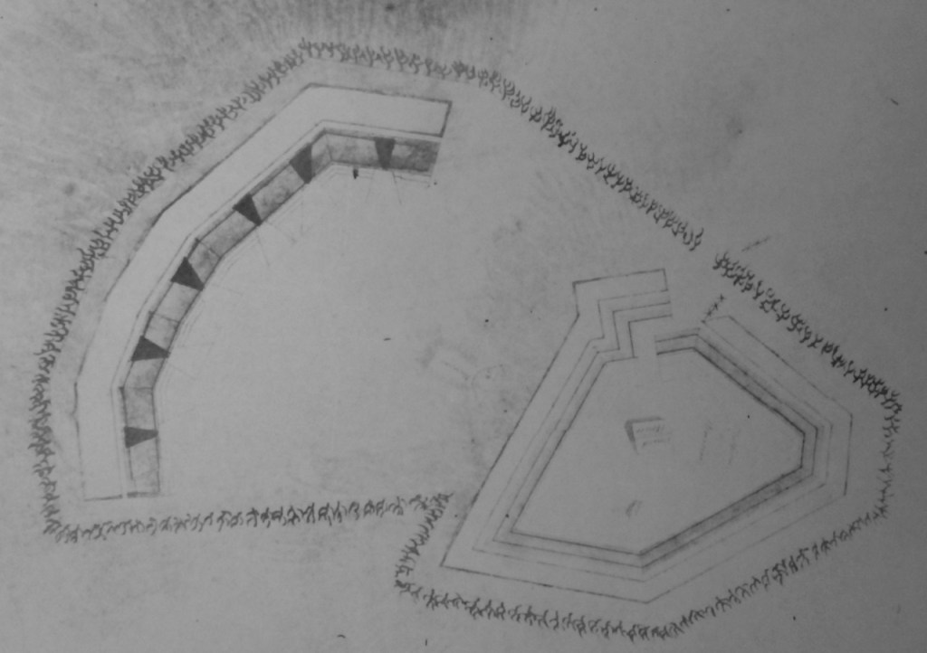
This blog is part three of information that might be provided on a tour of Butts Hill Fort today. We are at the southern fortifications.

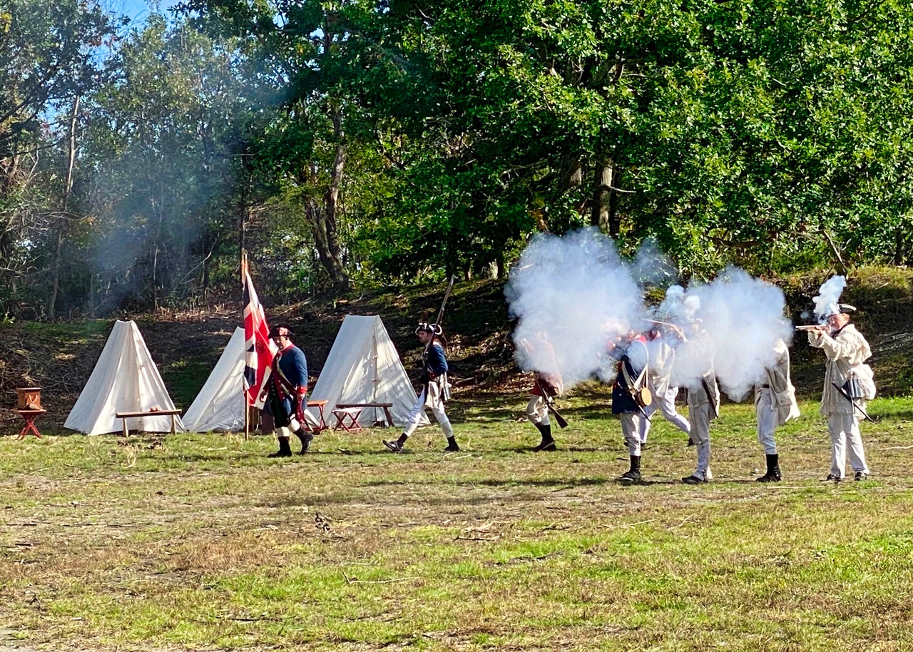
The narrative of our tour of Butts Hill Fort has taken us through the British improvements to the fortifications. This part of the story takes us to the three weeks in August of 1778 when the Americans held this high position during the Siege of Newport.

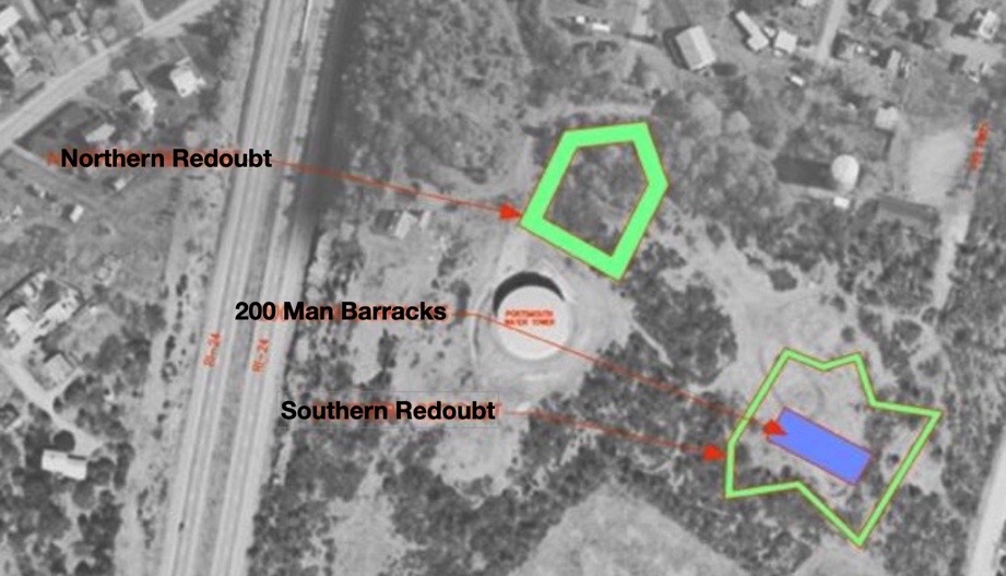
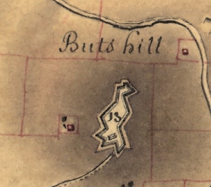
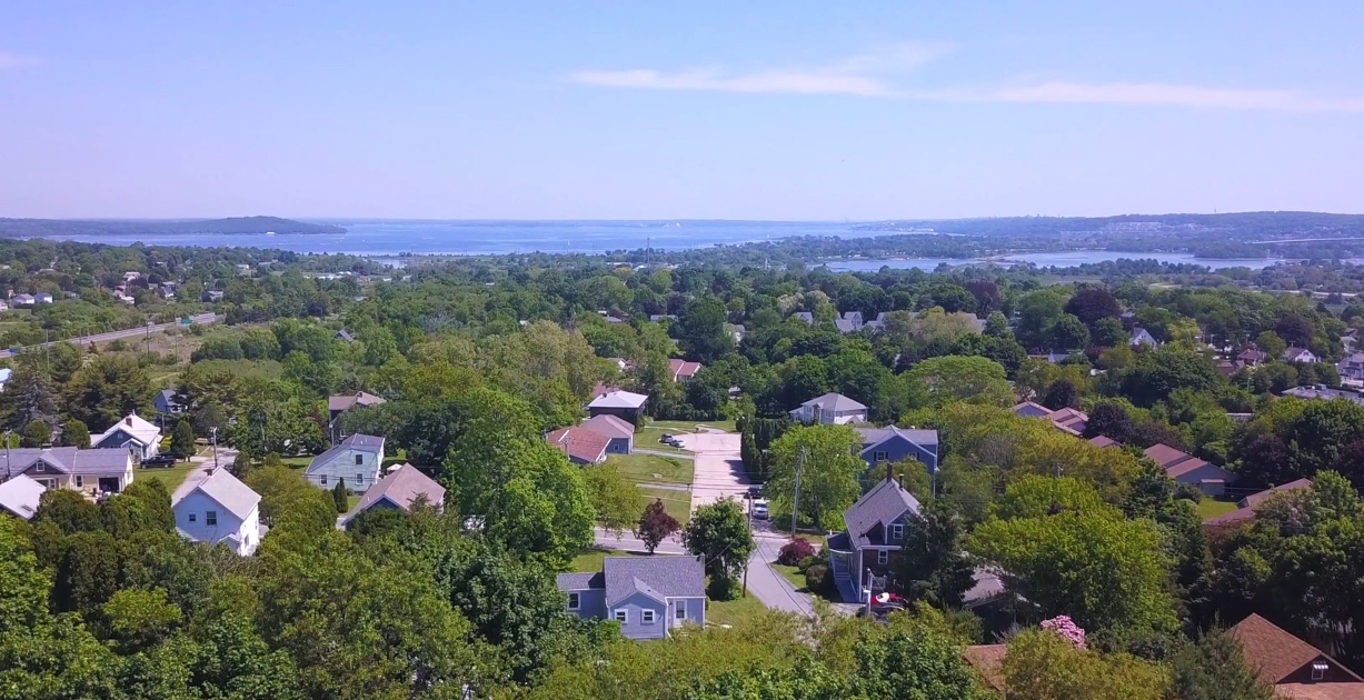
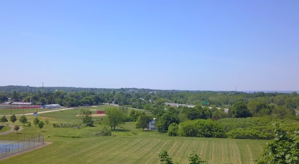
Drone images from Butts Hill illustrate what a commanding view was possible from this location. The British were concerned with the view of possible American invasions from the North from Bristol and Tiverton. For the Americans, however, the view south was essential.

With the French sailing to Newport to help the American forces, Butts Hill became a strategic site.

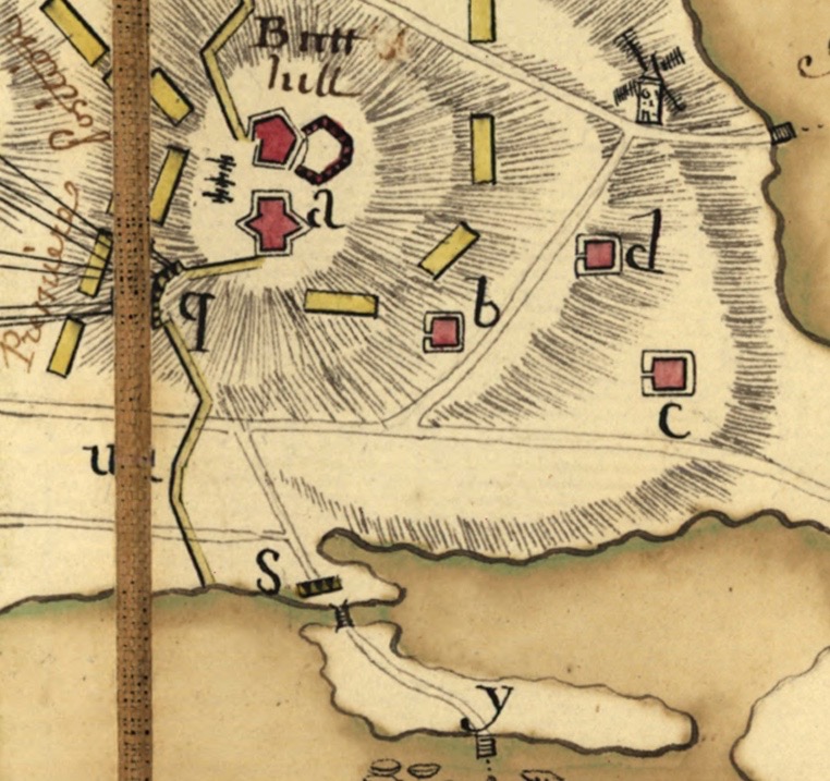
July 29th: d’Estaing met with American Commanders when he arrived at Point Judith. Plans called for Sullivan’s American forces to cross from Tiverton to Aquidneck Island and advance to the British fortifications at Butts Hill. The French would land on Conanicut Island (Jamestown) before arriving in Newport to cut off the British forces.

August 9th: Fearing an attack, British forces abandoned Butts Hill and General Pigot withdrew his forces to Newport as the French were landing on Conanicut. Sullivan discovered that the British had abandoned Butts Hill, so he crossed over to Aquidneck and occupied the high fortifications. He called for the heavy cannon at Fox Point to be moved to Portsmouth. Sullivan was supposed to wait until August 10.

August 11: Most of the American troops were camped about Butts Hill. The diary of Rev. Manasseh Cutler who served as chaplain for American General Titcomb’s Brigade, provides a few glimpses of what was going on around Butts Hill. He wrote on August 11th that at 4 o’clock the whole army paraded and passed in review by the general officers. “The right wing of the army was commanded by General Greene and the left by the Marquis de Lafayette.”

August 12-13: A hurricane hit that destroyed men, horses, camps and supplies on both the British and American sides. Rhode Island’s governor (William Greene) replaced the ruined powder on the American side.

August 16: As the Americans built earthworks and dug trenches toward Newport, American reserves and the sick who were healthy enough to do garrison work remained at Butts Hill which served as Sullivan’s headquarters.

August 17: Sullivan calls a council of War. All officers recommend holding positions until they could be reinforced.

August 26: Americans now know that the British fleet is coming and that it would be at least three weeks before French would arrive. They begin to send their heavy cannon back to northern locations like Butts Hill. The Council of War again determines to hold American positions until they could be reinforced. General Sullivan began to prepare for a retreat. He knew that enemy reinforcements were coming and his best course was to retreat. Cutler’s entry on Monday, August 24th “As much of the heavy baggage moved off last night as possible. A body of men retreated to strengthen the works at Butts’ Hill. At the lines – heavy fire – army preparing to retreat.” Cutler’s story ends on August 26th when he, like many in the militias, escaped to Tiverton and away from battle.

This was not a hasty retreat. Sullivan ordered increased defenses in the North (especially Butts Hill and fortifications guarding the Bristol Ferry and the ferry to Tiverton). He wanted to get all his weaponry out so it would not fall into enemy hands to use against them another day. In his letter to Congress after the retreat, he makes it clear that this was an “unanimous” decision to first retreat to Portsmouth and hope that the French would return.

Initial positions of Americans

Resources

Providence Gazette on September 26, 1778. “Letter from the Hon. Major General Sullivan to the President of Congress dated headquarters Tiverton, August 31, 1778″.

Cutler’s Diary is found in Edwin Stone’s “Our French Allies.” This is an old book (1884, Providence) but it was a great help. It is available online through Google Books. https://www.google.com/books/edition/Our_French_Allies/YY8LAAAAIAAJ?hl=en&gbpv=1

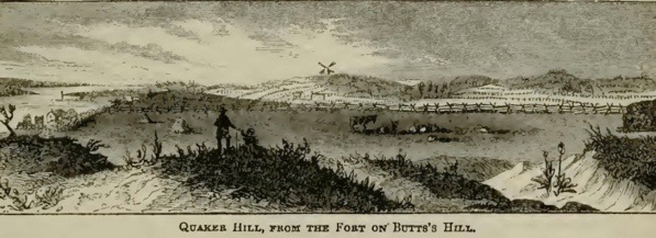
Image of Quaker Hill: Benson John Lossing, ed. Harper’s Encyclopedia of United States History (vol. 7) (New York, NY: Harper and Brothers, 1912)

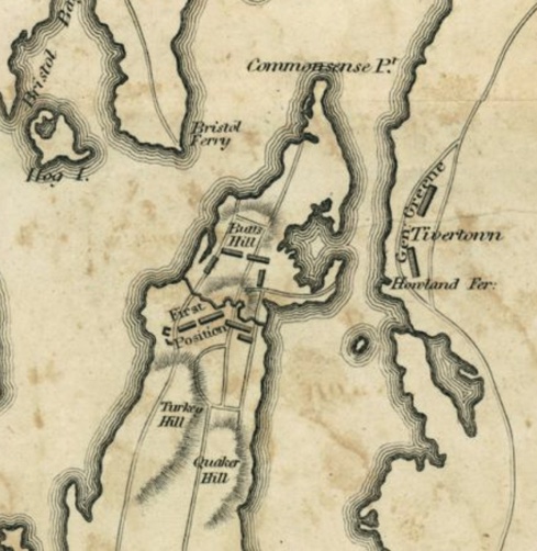
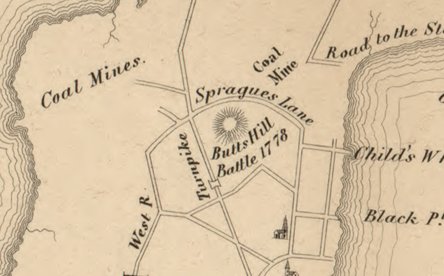
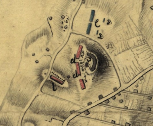
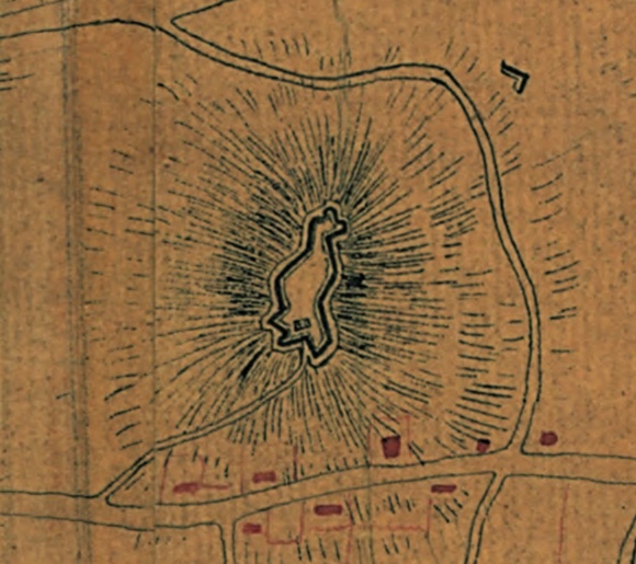
A map of part of Rhode Island shewing the positions of the American and British armies at the Siege of Newport, and the subsequent action on the 29th of August 1778. [1807]. Original in Boston Public Library Leventhal Map Center.

When Did “Butts Hill” Become a Fort?

Leave a comment

As I try to imagine giving a tour of the Butts Hill Fort, I am coming across military terms that I need to understand. Thankfully, there are others in the Butts Hill Fort Restoration Committee that are willing to share their knowledge with me. I find that I have been using the term “fort” rather loosely.

Stephen Luce reminded me: “The fortifications there were called ‘works’ from 1775/6 to 1780. There was never a ‘Windmill Hill Fort’ because the Fort did not exist until the French combined the separate works in 1780/81 and by that time the hill was called Butts Hill.”

Going back to the revolutionary terminology guides (American Battlefield Trust Glossary) clarified things for me.

Fort: A fully enclosed earthwork; a fortified building, enclosure, or strategic position.
Fortification: Something that makes a defensive position stronger, like high mounds of earth to protect cannon or spiky breastworks to slow an enemy charge. Fortifications may be man-made structures or a part of the natural terrain.  Man-made fortifications could be permanent (mortar or stone) or temporary (wood and soil).  Natural fortifications could include waterways, forests, hills and mountains, swamps and marshes.

The British works at “Windmill Hill” were fortifications. When they arrived on the island they took over an American militia made natural (hill top) defensive position that was a temporary construction of wood and soil. The British sought to make it a more permanent fortification with the building of barracks and a guard house.

Plan of a barrack for 300 men, and officers, erected at Windmill Hill with an abbatis, December 1777 :

Note there is an “Abbatis” around the barracks. Abatis: A line of trees, chopped down and placed with their branches facing the enemy, used to strengthen fortifications.

As we look at the military maps of the time, it is clear that the British fortification at Windmill Hill was not enclosed as a fort would be. It was a more permanent fortification because they had built structures such as a guard house and a barracks. It was carefully planned and as Frederick Mackenzie’s diary proves, it was worked on over time to improve the position. The Edward Fage map shows a second redoubt – the Southern Redoubt – was added to the fortifications. This was the condition of the fortifications when the Americans returned to Aquidneck Island in August of 1778.

Resources:

“Plan of a barrack for 300 men, and officers, erected at Windmill Hill with an abbatis, December 1777 : Plan nr 18..” https://quod.lib.umich.edu/w/wcl1ic/x-6053/wcl006127. University of Michigan Library Digital Collections. Accessed: December 19, 2021.

Planning, Preservation and Management Plan for Butts Hill Fort, Portsmouth, RI. A Project of the Rhode Island Marine Archaeology Project.

American Battlefield Trust website.

Fage, Edward, 1777-1779: Manuscript chart of Aquidneck Island and environs. Original in the Clinton Collection, Clements Library, University of Michigan at Ann Arbor. Plan of the adjacent coast to the northern part of Rhode Island, to express the route of a body of troops under the command of Lieut Colonel Campbell of the 22d: Regiment to destroy the enemies batteaux, vessels, galley &c &c &c which was accomplished May 25th 1778 / laid down and drawn by Edwd Fage, lieutt. of artillery.

Butts Hill Fort: Making Sense of What You See

Leave a comment

It is difficult to understand what you can see today at Butts Hill Fort. The landscape doesn’t quite make sense, but if you are fortunate to have a knowledgeable guide with you, you can imagine the fort as it used to be. Fortunately for me, the first time I saw the fort I was guided by Dr. Kathy Abbass and she understood the fort. At that time (2008 or 2009) Dr. Abbass was advocating for a restoration of the fort and I was the board member of the Portsmouth Historical Society assigned to see how we could work with her. I was overwhelmed with the moats and sloping hills (glacis), and it seemed incredible that the fort could be in Portsmouth and I hadn’t known about it. I did some research on the Battle of Rhode Island, but Abbass’ proposal seemed to go nowhere. I picked up my research again as the Butts Hill Fort Restoration Committee developed last year.

One goal I have is to help Portsmouth residents (and others) to understand what they see when they come to the fort. There is nothing better than a “field trip” – actually being at an historic site. The Butts Hill Fort Restoration Committee is working towards a time when there are marked trails, observation posts, signage and QR codes. Right now those things are admirable goals (that take planning and money). What I am trying to work out is how I could give a knowledgeable tour to a group coming in May or June of 2022. These next blogs are part of my brainstorming of materials I would need to write a tour script.

One thing I know from my research is that the Butts Hill Fort (or Windmill Hill Fort) evolved along the way. The outlines we are seeing date from the improvements made by the French (with the help of Americans) in 1780-1781.

Parts of the Fort:

Before I even begin I need to get my terms straight. My knowledge of military terminology is limited, but I am learning. The definitions I am using are adapted from the American Battlefield Trust and other military websites.

Battery: A fortified emplacement for heavy guns or artillery pieces; companies of artillery usually had six to ten guns used together or dispersed based on the situation.

Rampart: A large earthen mound used to shield the inside of a fortified position from artillery fire and infantry assault.

Glacis: A defensive feature which is simply a natural or artificial slope incorporated into the defenses of a fortification. The slopes were initially designed to deter attack on foot with steep man-made slopes

Moat: A depression surrounding the fort. Often the moat was created as a natural result of early methods of fortification by earthworks, for the ditch produced by the removal of earth to form a rampart made a valuable part of the defense system.

Parade Ground: Place where soldiers practice or have parades.

Dr. Abbass’ plan contains some helpful maps that help us understand the fort as we view it now. I tried to simplify a map that is an overlay of the fort outline on current terrain.

North battery ramparts: The oldest portion of the fort. It is intact except for its south wall which opens to the parade.

North Battery


South battery ramparts: The north, south and east faces of this battery’s ramparts are basically intact. The West ramparts were removed during the expansion of the fort when the French and Americans modified it (1780-1781).

Volunteers clearing South Battery Ramparts 9/2021


North and east ditch and glacis: At the base of the ramparts the moat is still recognizable, with the glacis descending to the north.

North and East Ditch and Glacis


Parade ground: In the center of the fort. This parade ground is maintained and mowed on a regular basis, and has been used for events and re-enactments.

Parade.

Battle of Rhode Island Historic District

Leave a comment

Did you know that we have an important battlefield in Portsmouth? Most Rhode Islanders aren’t aware that within Portsmouth is an area of 365 acres that has been designated an historic district on the National Register of Historical Places. We can view this battlefield from Heritage Park off of Hedley Street and from a site on the top of Lehigh Hill that has signage to help you understand the action of the battle. The monument to the Black Regiment between West Main Road and Route 24 and Butts Hill Fort are part of this battlefield as well. There are new efforts to preserve and restore Butts Hill Fort which would give us the view of the battlefield from the position of Patriot headquarters.

Battle of Rhode Island Historic Landmark District.

What is the National Register and what special significance is this area of Portsmouth?

According to their website: “The National Register of Historic Places is the official list of the Nation’s historic places worthy of preservation. Authorized by the National Historic Preservation Act of 1966, the National Park Service’s National Register of Historic Places is part of a national program to coordinate and support public and private efforts to identify, evaluate, and protect America’s historic and archeological resources.”

What is special about this 365 acres of our town? This parcel of land is an important Revolutionary War battlefield. The Battle of Rhode Island was fought in Portsmouth in a valley between three hills. Lehigh Hill is to the North and Turkey and Almy Hills are to the south. This battlefield area along with the 34 acres of Butts Hill Fort are included in this historic district. The outline of the battlefield is approximately:

Western boundary: Parallel to West Main Road. Southern boundary: Cory Lane, West Main Road and a short stretch of Hedley Street. Eastern boundary runs to the east of Turkey Hill and then northward around Barker’s Brook. The boundary crosses Freeborn and Dexter to the southern rise of Lehigh Hill. Butts Hill Fort is to the northeast of the battlefield and is included in the battlefield.

Historians who prepared the application for this designation as an historic district cited a number of reasons why the Battle of Rhode Island was of significance and why the battlefield should be preserved.

  1. The Battle of RI (BRI) was the last major battle fought in the North during the Revolution.
  2. This was the only major battle fought in Rhode Island, so it is important to Rhode Island military history.
  3. The battle was the only occasion in which the Black Regiment served as a segregated unit. They served admirably in repulsing three successive enemy assaults. Due to losses of men in combat and with the repeal of the law allowing blacks to enlist, by 1780 this unit was combined with other units under Christopher Greene.
  4. The battle shows the growing professionalism of the American army.
  5. Although the French were not able to stay and participate in the battle, the overall plan was the first joint effort of the French and American alliance.
  6. The British realized their position in Newport was vulnerable. The Indecisive conclusion of the battle was indirectly responsible for the British evacuation of Newport in October of 1779.

What action occurred on this battlefield during the Battle of Rhode Island? The following descriptions are culled from Christian McBurney’s book, The Rhode Island Campaign by Battle of Rhode Island Committee member Seth Chiaro.

Turkey Hill Engagement: Hessian troops under Captain Von Malburg pursued American Col. Laurens Regiment to Turkey Hill. Laurens men took up a strong defensive position on top of Turkey Hill. Col. Lauren sent a request for reinforcement to General Sullivan. Sullivan responded with orders to ‘fall back to the main line’. General Sullivan sent Webb’s Connecticut Regiment to support Laurens retreat. Ameican and Hessian units engaged on Turkey Hill before the Americans fell back. Laurens Regiments fell back to General Nathanael Green’s position to the right of Butts Hill. By 8:30 am the Hessians had secured Turkey Hill. 

Lehigh Hill Engagement (Durfee’s Hill):  General Nathanael Greene held the right flank of the American Army, along the right-wing stood a small Artillery Redoubt. This was a vital position for both sides. The 1st RI Regiment (Black Regiment)  was under the direct command of Major Samiel Ward who was commanded by Col. Christopher Greene, a distant cousin of Nathanael Greene. Captain Malsburg was ordered to attack the hardened position. The first attack failed. The 1st RI Regiment held its ground. The Hessians tried multiple times to take the position. The Hessians tried to flank the position, this also failed. On the third attempt, the 2nd RI Regiment supported the 1st RI Regiment. As the 2nd RI Reg. approached the redoubt the Hessians were attempting to climb the walls. All together Greene had about 1,600 soldiers fighting on the Lehigh Hill. Units included 1st RI Regiment, 2nd RI Regiment, Livingston’s 1st Canadian, Sherburne’s, and Webbs Regiments. More than 800 Continentals including Laurens advance guard and Jacksons’ Detachment. The American line veered SW at a 45-degree angle from Butts Hill to Durfee’s Hill making the American fire even more effective. Col. Henry Jackson’s men fixed bayonets and charged into the Hessian Line, turning the tide of the battle. The Battle was over at 4 pm. The Hessians retreated to Turkey Hill. Both sides exchanged cannon fire throughout the night. Cannon fire was also exchanged between Turkey Hill and the Butts Hill Fort. 

General Sullivan’s Account of the Battle of Rhode Island – Part 1

Leave a comment

After the Battle of Rhode Island, John Sullivan had to explain his retreat from Aquidneck Island. We have a record of that explanation in a letter published in the Providence Gazette on September 26, 1778. “Letter from the Hon. Major General Sullivan to the President of Congress dated headquarters Tiverton, August 31, 1778″. I was able to find that article and transcribe it. This is quite a lengthy letter, so In the next few blogs I will take you through Sullivan’s explanations in stages. In reading through this letter, we need to remember that Sullivan had been part of retreats before and the Congress had questioned his actions. I am not a military historian and I am only now beginning to study the Battle of Rhode Island, but this is a primary source to be respected as a first hand account of the man in charge of the American troops in the battle.

For some background I searched for some basic information about John Sullivan. He was born in New Hampshire in 1740, the son of Irish immigrants. His original training was as a lawyer.
In 1772 New Hampshire’s Royal governor appointed him as major in the New Hampshire militia. As the break with Britain was unfolding, he began to favor the rebel cause. Sullivan was sent as a delegate to the First Continental Congress in 1774. In 1775 Sullivan was sent to the Second Continental Congress. Congress appointed George Washington Commander in Chief and John Sullivan as brigadier general. Sullivan joined the army at the siege of Boston. Later he took command of a force in Quebec in a failed invasion. Sullivan had to withdraw the survivors. He was captured in defeat at the Battle of Long Island. British General Howe released him on parole to deliver a message to Congress. He was later released in a prisoner exchange for captured British general Prescott. He had some success in battle but had continued difficulties as well. In Early 1778 he was transferred to the post of Rhode Island where he led the continental troops and militia. John Sullivan fought bravely, but his command decisions were questioned on a number of occasions. He had to defend himself, but he was often judged not at fault. Sullivan needs to explain his decisions.

The first part of the letter deals with the prelude of the battle. The French fleet under Count De’Estaing had gone to Boston to make repairs and Sullivan expressed belief that they would come back soon. He decided to carry on with the planned invasion of Aquidneck Island.

“I thought it best to carry on my approaches with as much vigor as possible against Newport, that as time might be lost in making the attack upon the return of the fleet, or any part of it, to cooperate with us. I had sent expresses to the Count to hasten his return which I had no doubt would at least bring part of his fleet to us in a few days.”

Initially he had good success and the enemy abandoned positions. “…on the 27th we found they had removed their cannons on all the outworks except one.” He details the British positions at Newport and described them as two basic lines. He expresses regrets that he had not stormed some of these defenses when the cannons had been withdrawn, but he began to lose manpower. “

He writes he found: ” ..to my great surprise, that the volunteers which completed the great part of my army, had returned [left for home], and reduced my numbers to little more than that of the enemy; between two and three thousand returned in the course of twenty-four hours, and others were______ going off, upon a supposition that nothing could be done before the return of the French fleet.”

Sullivan’s troops were a combination of Continental soldiers and militia. Many militia units came from nearby Massachusetts and in discouragement that the mission could not be accomplished without the French fleet, many units headed home. General Sullivan was in a difficult position.

“Under these circumstances, and the apprehension of the arrival of an English fleet with a reinforcement to relieve the garrison, I sent away all the heavy articles that could be spared from the army to the main; also a large party was detached to get the works in repair on the north end of the island to throw up some additional ones, and put in good repair the batteries at Tiverton and Bristol, to receive a retreat in case of necessity.”

General Sullivan began to prepare for a retreat. He knew that enemy reinforcements were coming and his best course was to retreat. This was not a hasty retreat. He ordered increased defenses in the North (especially Butts Hill Fort and forts guarding the Bristol Ferry and the ferry to Tiverton). He wanted to get all his weaponry out so it would not fall into enemy hands to use against them another day. His letter makes clear that this was an “unanimous” decision to first retreat to Portsmouth and hope that the French would return.

“On the 28th a council was called, in which it was unanimously decided to remove to the north end of the island, fortify our camp, ______ (secure?) our communication with the main, and hold our ground on the island til we could know whether the French fleet would _____ return to our alliance.  On the evening of the 28th we moved with our stores and baggage, which had not been previously sent forward, and about two in the morning encamped on Butts’s Hill, with our right extending to the west road, and left to the east road; the flanking and covering parties ____further towards the west road on the right and left.”

Sullivan details the positions of his forces on the evening of August 28, 1778.

“One regiment was posted in a redoubt advanced to the right of the __ line. Colonel Henry B. Livingston with a light corp, consisting of Colonel Jackson’s detachment, and a detachment from the army was stationed in the east road: Another light corp, under command of Colonel Laurens, Col. Fleury, and Major Talbot, was posted on the west road. These corps were posted near three miles in front; in the rear of these was the picquet of the army, commanded by Col. Wade.”

The stage is set for battle. 

Map: http://library.providence.edu/encompass/rhode-island-in-the-american-revolution/primary-sources/map-of-the-siege-of-newport/

Butts Hill Timeline

Leave a comment

This is a work in progress as I uncover more dates of importance in the land history of the Butts Hill – (Windmill Hill – Briggs Hill) area. Working with the early dates is difficult.

Until 1638: The land on Aquidneck Island was a summer hunting ground for Wampanoags and later the Narragansetts.

1638 – Portsmouth town land.

1665 – Land owned by Caleb Briggs.

1666 – Windmill erected on Briggs Hill or Windmill Hill (from Preservation book).

1668 – Windmill completed by William Earle and William Cory.

1682 (Feb 24, 1682) – William Cory (carpenter and miller) in his will gave windmill to his wife Mary.
Mary traded land back to the town.

1688 William Earle (Wm Cory’s brother in law) built windmill on Briggs Hill (I doubt this date unless this is a second windmill on the spot).

1721 – Caleb Bennett inherits windmill from father Robert Bennett. Robert had married Anne Cory – daughter of William and Mary Earle.

1725 (January) – John Butts bought from Caleb Bennett the windmill and about one rod of land (maybe a quarter of an acre) on Windmill Hill.

Before 1729 : Town gave a land grant to Thomas Durfee. West land-grant map shows windmill already on site. My suspicion is that town had held the larger parcels of land until this time. Windmill area small piece of that whole.

1729 (February): Town records show “a parcel called the Wind Mill Hill land” given to son Gideon Durfee. I suspect that there were several parcels of land on Windmill Hill. The West land-grant maps show that.

1776 – Americans built small battery at Butts Hill.

1776 to 1779 – British occupation of Island and fort.

1778 – July 29 to August 15 – Siege of Newport: British bring troops down to Newport. August 11: American troops at Butts Hill.

1778 – August 29-30 Battle of Rhode Island. Gen. Sullivan uses Butts Hill Fort as headquarters.

1778 – September 1, British return to Ft. Butts (known as Windmill Hill to them).

1779 – December – Butts Hill Fort returned to American control.

1780-1781 Camp Butts Hill housed French and American troops.

1782 Butts Hill Fort was abandoned by the end of the war (1782).
1900 House lots for sale – Benjamin Hall Jr.
1907 – Dyer family farm. Fort and surrounding platted for 200 house lots.
1908 – Benjamin Hall selling house lots

1920s -1930s. – Roderick Terry conveyed to Newport Historical Society, pieces of the land in 1923, 1924, and 1932.
1968 state transfers land to Town of Portsmouth.

Butts Hill Fort on the Map

2 Comments

We are collecting maps and blueprints that give us an image of Butts Hill Fort. If you have one to add to our collection, let me know, we would be happy to have it. Maps and diagrams are such an important primary source and we can learn from them.

1849 Hammett Map
Plan von Rhode Island, und deren dem comando des Herrn General Majors Presgott inf dies-malig befundlichen campements.

Schiffer, J. C. 1777
Created / Published
[1777]
Subject Headings
Rhode Island (R.I. : Island)–Defenses–Maps, Manuscript–Early works to 1800
[Plan de la ville, du port, et de la rade de New-port et Rhode Island. Debarquement en 1780.
Huntington Library Map – British 1778
Map drawn by Frederick Mackenzie, Summer 1778
Lawton Map circa 1907

Good Uses for an Old Fort

Leave a comment

On Sunday, October 17, 2021, old Butts Hill Fort was lively once more. Re-enactors in Revolutionary era uniforms demonstrated the same military drills used in the War for Independence. It was a perfect example of what Dr. Roderick Terry had in mind when he donated the land around Butts Hill Fort to the Newport Historical Society in the 1920s. He envisioned a “place where the public may enter, view and study the battle field on which our soldiers fought, be enlightened in the battles thereon fought, and in American history.” Through the years the land passed into the hands of the Town of Portsmouth, but the town still has Terry’s mandate to use Butts Hill Fort as a public space where citizen can learn about the Battle of Rhode Island and our history. The Living History Day is a perfect example of how we can use the fort in the spirit it was given to us. Another mandate given was that the fort should be maintained. The Butts Hill Fort Restoration Committee (an outgrowth of the Portsmouth Historical Society) has been working towards a goal of clearing the vegetation that threatens the earthen fortifications. The committee has already begun to bring the fort out of the trees and bushes. There is much to do, but their goal is to preserve this historic battlefield, create a park with walking trails around it and prepare it for Revolutionary War celebrations around 2026. Visiting an historic site is certainly a valuable way to learn our history and the committee is doing the research to create informative signage and educational stations. How can we use this historical gem in our community? A gathering spot for community celebrations, for scout activities, staging area for re-enactments, and opportunities for heritage tourism are just some ideas that come to mind.

Are you interested in volunteering for some cleanup or other activities?  Email Seth Chiaro at seth.chiaro@gmail.com.

Utilizing Butts Hill Fort: Playground, Ball Park, Scouting and Re-enactments

1 Comment

Butts Hill Fort has been a presence in Portsmouth and Aquidneck Island since the War for Independence. The other redoubts and fortifications were lost through time as Portsmouth farmers resumed plowing and farming the land. The Butts Hill area was spared because the rocky soil wasn’t useful for agriculture. Butts Hill Fort continues to be depicted on area maps even today. What happened to the fort after it was purchased by Rev. Terry and entrusted to the Newport Historical Society in 1923? According to Terry’s stipulations:

  1. The Newport Historical Society and its successors were to forever “preserve, keep and maintain” the property as a monument to those who fought in the Revolutionary War.
  2. That the property will always keep the name “Butts Hill Fort.”
  3. That the property should never be used for monetary gain.

How has Butts Hill Fort been utilized through the years?

1939: A newspaper article (Newport Mercury, April 31, 1939) announces plans to use Butts Hill Fort as a playground and ball field for the children of Portsmouth. The land would still be held by the Newport Historical Society, but the American Legion would supervise the playground. The field in the center of the fortifications would be used for Boy Scouts, Girl Scouts and American Legion activities. The American Legion pledged to police the area and keep it litter free. The Legion would work to prevent vandalism. According to the article, the fort had been badly damaged by vandals through the years.

1946: Boy Scouts from local troops “gained further knowledge of Rhode Island in the Revolution” when they hiked from Butts Hill Fort along the picket and entrenchment lines where colonial forces met the British during the Battle of Rhode Island. (Newport Mercury, May 24, 1946.)

1947: An article in the Daily News of January 31, 1947 tells us that the Newport Historical Society is still trying to maintain the fort. “Butts Hill was given a general clean up; the grass was mowed, ground cleared and iron fence rails that had fallen were cemented in place. Eleven pipe rails missing from the fence could not be replaced with available funds. The work on Butts Hill cost $194.” There is no mention of the playground or how the fort was used, only the continual effort to maintain the grounds. Maud Howe Elliott was among the committee members trying to raise funds for Butts Hill Fort, Fort Barton and the Sherman Windmill.

1955: “Portsmouth Scouts’ Plans for Bonfire Go Up in Smoke of ‘Book Burn” Tag” reads the headline on a February 12, 1955, Newport Daily News. It seems that the scouts were indeed using Butts Hill Fort for events. The Newport Historical Society and the Portsmouth Fire Department gave permission for the boys of Explorer Post 18 to burn crime and horror type comics as part of a campaign on indecent literature. They had been collecting them from their homes and the homes of neighbors. The New York Post got the idea this was book burning and that generated media attention. In the end the quiet night of bonfire and refreshments at Butts Hill Fort was cancelled.

1975: The Portsmouth Conservation Commission lead a special “colonial” celebration to mark the beginning of a restoration effort at the fort. “Celebration at Butts Hill is Colonial” reads the headline on the Newport Daily News article of September 2, 1975. This restoration effort was begun to prepare the fort for the 200th anniversary of the Battle of Rhode Island. Much like our restoration efforts today, it began with cutting brush, spraying poison ivy and clearing the fort. A new flagpole was raised. Volunteers included Boy Scouts from Portsmouth and surrounding areas. The celebration included fife and drum music, and canon firing by the Newport Artillery Company. Colonial dress was the uniform of the day for the 200 participants.

1976: “1978 showdown looms at Fort Butts” read the headline of a Newport Mercury article on April 16, 1976. The showdown was a fight between Tiverton and Portsmouth as to where the 200th Anniversary of the Battle of Rhode Island would be held. Tiverton held celebrations at Howland Ferry, but Portsmouth Conservation Commission members wanted to bring the festivities back to Butts Hill Fort. By this time the fort had changed hands and now the six acres belonged to the Town of Portsmouth. Steve Boscarino and George Thurston of the Commission told the reporters that although there are no buildings left, the area is ringed by 15 to 20 foot mounds of earth called parapets. These survived because of the rocky soil used to build them. “mostly made of shale, the earth was piled around huge bundles of sticks tied together to make an embankment.” The Public Works Department will cut down all the overgrown shrubs and there will be spraying to rid the area of poison ivy. They completed a small parking lot to the left of the site and there were plans in the works to construct a 15 foot tower so visitors can enjoy the panoramic view from the top of Butts Hill. Vandalism by motorbike riders is a problem.

1980: Butts Hill Fort was the site of an 18th century encampment that was part of the Portsmouth Heritage Celebration. (Daily News, May 1, 1980).

Camp Butts Hill – October 1780: Americans and French Working Together.

Leave a comment

This is a continuation of information in Thayer’s Orderly Book that covers what was going on at Camp Butts Hill. This is not a transcription, but it is notes on the information provided. This book ends at the end of October when the brigade leaves Camp Butts Hill. The orderly book helps us understand the cooperation between the French masons and engineers who are working on Butts Hill Fort and the Americans who are aiding in this building project.

October 2, 1780: The main guard will consist of one captain, one “subb (Subaltern-like a second lieutenant),” two sergeants, four corporals and 48 privates. There was concern that the “property of the inhabitants be secured” and public property be guarded. Captain Devol wants one boat builder and one caulker to assist him in repairing the public boats from this port.

Rocambeau’s Map

October 3, 1780: The drum major and fife major will practice two hours a day with the drummers and fifers.

October 4, 1780: Commanding officers of each brigade should insure that there are enough provisions on hand “that they may be always fit for duty.” At least one day’s provisions is required to be on hand. In letters from Camp Butts Hill we find that hunger was a real concern. The drum major is to start the beat for reveille at first light for the guard and the drummer should sound the beat through the whole camp. Lieutenant Waterman will receive directions for removing the small barracks which stands at Butts Hill Fort.

October 6, 1780: Cartridge boxes in tents will have names of commanding officers and be taken to the magazine in the fort. Kitchens were built in front of the tents and high so smoke doesn’t get to the tents. There will be a regimental court martial for James Stanford of Captain Hodge’s group of Thayer’s regiment. The charge was insulting language to the Captain. Found guilty, 15 lashes on a naked back will be administered and the guilty party must ask pardon of the Captain in the presence of the commanding officers. “It is Col. Commandant Greene’s pleasure that one Field Officer shall inspect the works at Butts Hill Fort. They will attend the works in rotation.”

October 7, 1780: Lt. Col. Hallet will supervise the “works” – the work being done on Butts Hill Fort.

October 8, 1780: Lt. Col. Clap will inspect the works. Henry Hilman is accused of desertion. He “shall be drummed out of the brigade with his Hatt under his arm.” The Bristol Ferry Commanding Officers will make a report to the officer of the day.

October 12, 1780: There were complaints of too many soldiers in Newport. They will now need a pass. “It is requested by General Rochambeau and Commander Jacobs that every officer not on duty will attend upon the works for the purpose of encouraging the soldiers and completing the fort.”

October 16, 1780: “There are four men to be detached from the brigade to attend constantly on the French Masons until the stone pillows of the Fort are completed and two masons detached to assist the French Masons until the works are finished and for their service they shall receive half a pint of rum a day when in the store.” Their provisions are ready for them so that they can complete the Fort works in a timely manner.

October 17, 1780: The commander has been informed that “the inhabitants have had a large number of fowls taken from them” supposedly by the soldiers. Those caught stealing from the inhabitants will be punished. “The wagon masters of the brigade are directed to attend on the works with their wagons at the time the fatigue party goes on the works and fetch one load of stones each for the purpose of building the pillows of the fort.

October 19, 1780: The French are getting wood at Freetown and are in need of the American flat bottom boats.

October 25, 1780: The American wagons are bringing loads of stone to the works at Butts Hill Fort. They are building a “sally port” which is a secure, controlled entry way to an enclosure like a fort. All tools must be returned to the engineer.

October 26, 1780: Jacob’s regiment is leaving and his men are requested to return the tools they have borrowed from the French. They will return them to the engineer. Tents and other equipment are to be returned to the quartermaster.

Map:

Plan de Rhodes-Island, et position de l’armée françoise a Newport.
Created / Published
(1780)

Older Entries Newer Entries