This blog is part of a study of Portsmouth neighborhoods. Some areas have a very rich history and the history of the Glen Farm area and South Portsmouth is an example. There will be a few articles to get us through the centuries. Information about this early land grant period for the Glen/South Portsmouth comes from historian Edward West’s article on the “Lands of Portsmouth” in the Rhode Island Historical Society Journal. West drew these land grant maps by going through the property records and there is some question about accuracy. However they give us a good start in learning about the various neighborhoods in town.
From the Lands of Portsmouth: A Glimpse of Its People. Edward West. Rhode Island Historical Society Journal, July 1932
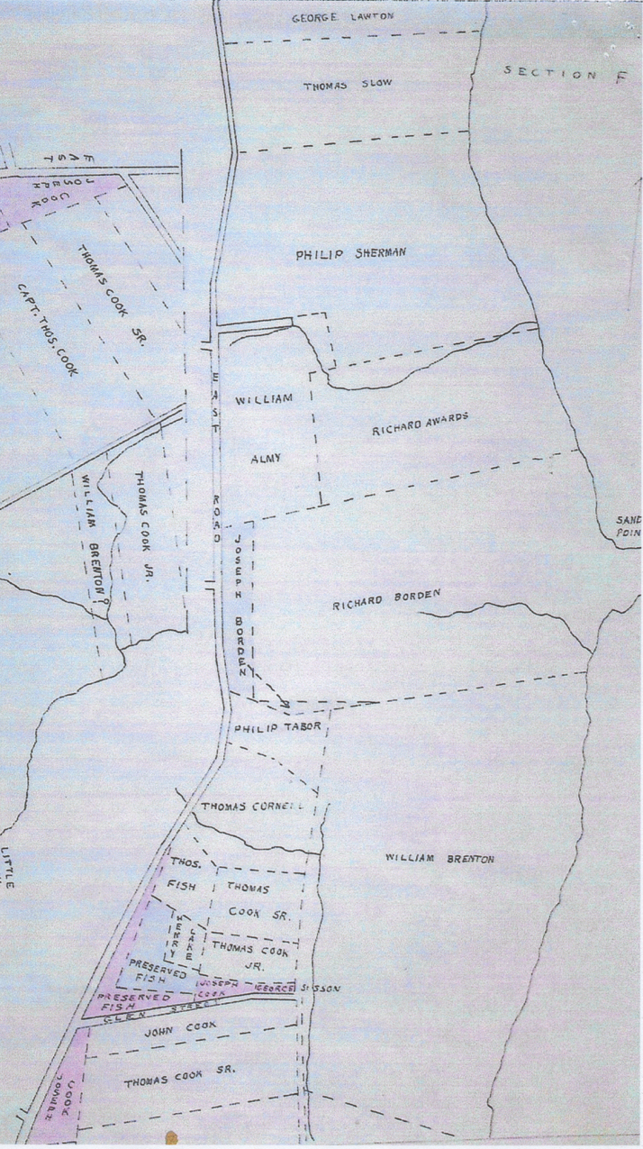
“Let us now turn down the Newport path (East Main Road) until we come
to a road, nearly to the line,(Sandy Point?) which was laid out in 1713. Turning east through this road we come to what has been for many years known as Wapping Road. This road was mentioned in the list of 1661, and ran between many of the large farm grants. In the 1717 list of highways mention is made of the “Great Rock” near the line, a great mass of pudding stone. (Perhaps the great puddingstone at the corner of Wapping Road and Mill Road).
The farms here belonged to Bartholomew West, Samuel Hutchinson, and John Sanford. On the west side of the road was the Long Swamp farm of Thomas Lawton, made
up of several grants which he purchased of the grantees. On the east side was the farm of Thomas Burton, granted in 1640, to run from the middle of the first water south of
the second sandy point to the middle of the fourth water. In 1648, in a grant to Thomas Cook, mention is made of Mr. Burton’s ferry. I have never been able to find any
other mention of this ferry. I suppose it was probably the first ferry to Fogland. Turning east through a former road we come to Sandy Point first granted to William Aspinwall, and after he left, to Edward Hutchinson.
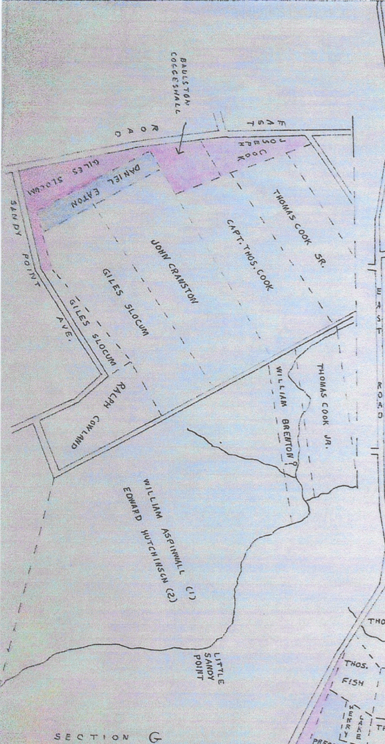
We will now take a cart path to the north, passing the grants, on the right, to Ralph Cowland, Giles Slocum, John Cranston and Thomas Cook. We now come to what
has been called for many years, the Glen. This was granted. to William Brenton but was acquired by Giles Slocum, who built a fulling mill on the bank of the stream.
North of this was the farm of William Brenton, called by him Middleford Farm. There was a broad approach to this farm… Returning to the Newport path we come to a brook, now
called Mint Water Brook, which crosses the road and runs into what was known in 1657 as Briggs Swamp, when Phillip Sherman was granteci 30 acres here. To the north
of this, on the east side of the road, was more of Phillip Sherman’s land, in what was known as Birch Swamp. Here, also, was the land of William Almy, who fenced in the
road to the watering place and was compelled by the court to open it again.
References: This is a link to the Edward West article: https://archive.org/details/rhodeislandhisto11rhod/page/n435/mode/2up