I am continuing to find clues to what Butts Hill Fort looked like in 1781 after the French and Americans had made it into a true fort. In this blog I am gathering images that might help us figure out the shape of the fort.
The first three images are from French made maps. The top two are Rochambeau maps in the Library of Congress. The third map is in the Pierce Collection of the Portsmouth Free Public Library and is also a French map.
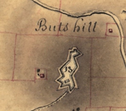
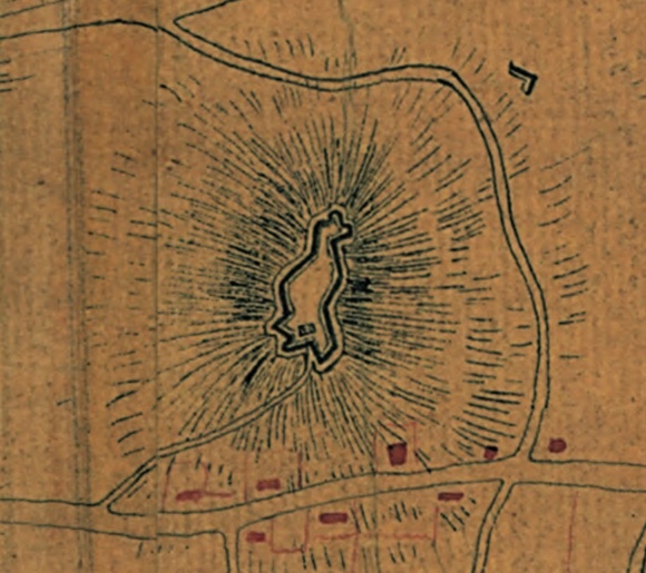

What do we learn from the maps?
- The entrance was on the Southeast.
- There was a road leading from the entrance to East Main Road.
- There was a barracks inside the fort.
- The last map seems to show some defenses to the northeast – outside of the fort.
- The last map shows were Col. Greene’s men were camped while working on the fort with the French.
- The triangular defensive (ravelins) positions are most prominent to the south.
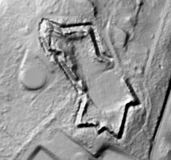
The image below is LIDAR- Light Detection and Ranging. It uses light to measure distances and is also known as laser scanning or 3D scanning. It shows us what is under the vegetation on Butts Hill today. We still have the elementary outlines of the fort under the vegetation today.

Leave a comment