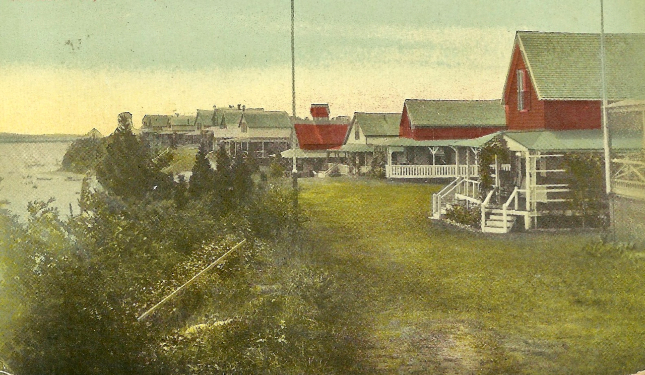
Home

Portsmouth Places: The Hummocks

1 Comment

The Hummocks

The Hummocks is a community of homes perched on a ridge on the northeastern shore of Portsmouth between the Sakonnet River Bridge and the Escape Bridge toward Island Park.  There was a fish factory at the Hummocks that was being used as a government storehouse in 1919.  The community itself began as a summer get-away for families from Fall River and Taunton.  The New-Haven-Hartford Railroad owned most of the land in the late 1800s  The railroad encouraged the growth of the community because it would generate business for their passenger service.  By 1921 there were seventy summer homes there and more were being planned as the Hummocks Beach area was being opened up.  The Hummocks became a popular spot for social gatherings.  Clubs and organizations would meet at the Hummocks for chowder, clam bakes and to play ball.  By 1923 summer residents received a charter as the Hummock Beach Improvement Company.  There aim was to improve living and social conditions in the Hummocks community.

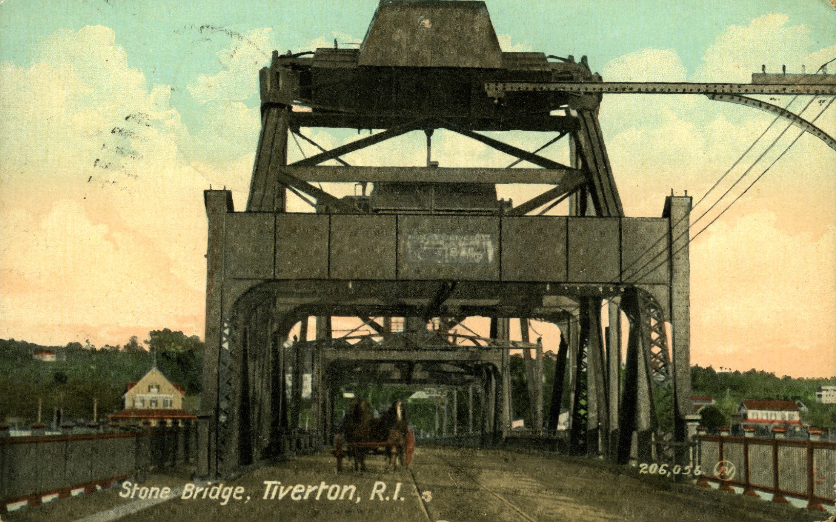
Newspaper accounts from 1899 tell us that the stone to construct the railroad bridge from Tiverton to Portsmouth was taken from the high bluffs of the Hummocks – just as it had for the first railroad bridge there.

Sakonnet River Bridge

Leave a comment

Sakonnet Bridge Under Construction. (PHS collection image)

Sakonnet Bridge (image from G. Schmidt collection)

The Sakonnet River Bridge opened in 1956 as a replacement for the Stone Bridge that was damaged in many storms.  The bridge has not been maintained well and a new bridge is under construction.  Note the railroad bridge to the left.

Railroad Bridge

1 Comment

The Portsmouth Historical Society displays a piece of the railroad bridge. It may be a piece of the swinging mechanism.

The Sakonnet River Rail bridge was built in 1899.  It was a “swing” bridge with part of the bridge staying anchored and the other part swinging back to allow boats to pass through.   The bridge was damaged and closed in 1980 when it was damaged by a heavy train load.  A barge ran into the open bridge in 1988 and it was removed in 2006 to 2007.  The Portsmouth Historical Society has a circular piece of bridge in the Old Town Hall.

The bridge rail bed swings open so ships may pass through.

The Old Howland Ferry

5 Comments

In colonial times the main roads in Portsmouth led to the ferry landings.  What we call East Main Road was known as the Path to Howland’s Ferry.  Its location was close to where the remains of Stone Bridge are today. This location is one of the narrowest points on the Sakonnet River between Tiverton and Portsmouth. The ferry may date back to 1640.  It was also known as Anthony’s Ferry and Pocasset Ferry. Howland’s Ferry played an important part during the Battle of Rhode Island. American forces used the location to pour onto Aquidneck Island to fight the British who occupied the island. When they were forced to retreat, many of the American forces used that route to make their escape. Howland Ferry was less used once the Bristol Ferry was established.

Howland Ferry area

This ferry, the West Side, was used in the Howland Ferry area when the Stone Bridge was not operating. (Image G. Schmidt)

The Old Stone Bridge

Leave a comment

Howland’s Ferry went across the narrowest part of the Sakonnet River, and that is just where the first bridge off Aquidneck Island was constructed.  A toll bridge was constructed by the Rhode Island Bridge Company in 1795.  The bridge was rebuilt and washed away again in 1798 and remained closed until 1808.  The Great September Gale of 1815 destroyed it and it was rebuilt again under the name of the Stone Bridge.  The draw part of the bridge was washed away in 1869, and the owners sold the Stone Bridge to the towns of Tiverton and Portsmouth.  The towns, in turn, gave the bridge to the state to maintain.  The bridge was rebuilt and reopened in 1871 as a free bridge without a toll.  More damage was done by storms and ships that rammed the bridge and it closed after Hurricane Carol. Ferries such as the West Side were used while the bridge was out.   In 1957 it was replaced by the then new Sakonnet River Bridge. What remains of the Stone Bridge is used as a fishing pier today.

Howland Ferry area

The Stone Bridge began as a toll bridge.

Bristol Ferry Town Common

Leave a comment

Blaskewitz Map of Bristol Ferry Area

During Revolutionary times there was an active community around the Bristol Ferry landing. Blaskowitz chart.

The way to Bristol Ferry became a bustling community with taverns and shops. By the old ferry landing is the Town Commons.  On March 12, 1714, the common is listed in a list of “Rhodes, Ways and Lanes in Portsmouth.” This document is available in town archives. Regarding the Bristol Ferry Common, it states that,

“… the piece of  land near Abel Trip house adjoining to the ferry against Bristol, is left for the conveniency (sic) of the Public in importing  and transporting of Cattel (sic), Sheep, Horses, wood, rails, etc. and is bounded on the bank against the salt water 12 rods, and against the land of John Earl & John Earl _____ twelve rods and against the land of  John Pool, John Tripp and Abel Tripp, that is, from the Earl ____ his corner to Thomas Borden’s Northeast corner aforesaid, is twenty rods and from Borden’s down to the lege (sic) of the bank next to the salt water is nineteen rods.”