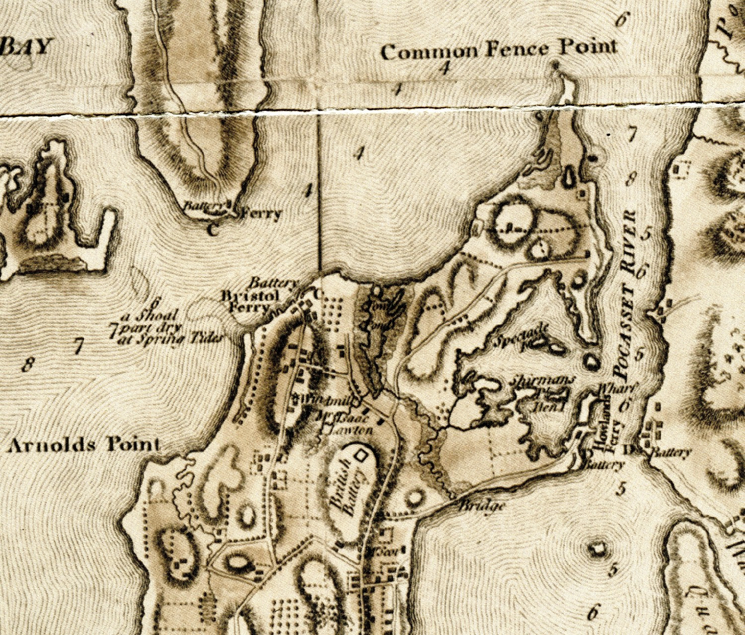
In reading a map for information, it helps to view the map in smaller sections to pull out the information. I am focusing on the Northern portion of the town – basically Sprague Street and north. As I view the map I try to put elements into categories. I encourage my readers to view the map and let me know what they see that I have missed.
Transportation -Roads
Looking at today’s map as well as the Blaskowitz Map, these are the roads I see. Blaskowitz does not label the roads, so I will use today’s labels
Park Avenue which would head toward the Howland Ferry
Bristol Ferry Road which would head toward the Bristol Ferry
Part of Boyd’s Lane
Sprague Street
Child Street
Anthony Road
East Main Road
West Main Road
Water Street
Transportation: Ferries
Bristol Ferry which was the main route to Bristol and the North
Howland Ferry which was the main route to Tiverton and Massachusetts to the East
Military Sites: Batteries
Blaskowitz noted where Americans had placed defenses before the Occupation, but he also includes British battery along East Main Road to the north of Sprague Street.
Howland Ferry Battery: This is an important place for the Americans who used this narrow area as a point to move their troops onto the island and when the battle was done to escape off the Island to Tiverton and the safety of Fort Barton.
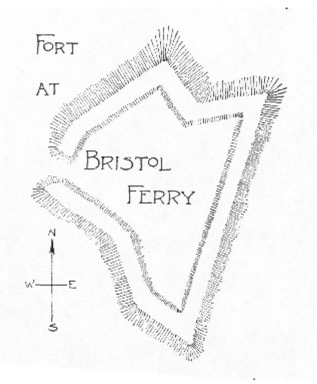
Bristol Ferry Battery: Edward Field’s paper on Revolutionary Defenses a diagram of the Fort at Bristol Ferry. See Reference below.
Farmers and Farms
Mr. Scott’s farm was located between Child Street and Park Avenue. I could not find information on Mr. Scott, but he may have been a Newport merchant and or Captain who had a country farm in Portsmouth. He was not included in the 1778 tax roll.
Isaac Lawton’s farm was located around East Main Road heading toward Boyd’s Lane. Isaac is active in the Quaker church. After the War for Independence many Quakers began to give up their slaves and Isaac’s widow, Mary Fish Lawton, was among those who freed her slave.
Geographic Features
To the East: Common Fence Point, Spectacle Island, Sherman’s Point, Hen Island, Town Pond, Pocasset River
To the West: Arnold’s Point, Shoal by Bristol Ferry that is part dry at Spring Tides
Man-Made Features
To the East: Bridge by Park Avenue, Wharf by Howland Ferry
To the West: Windmill by Bristol Ferry Road
Distribution of Homes
Where did Portsmouth residents live? In this section of the map there are two basic communities. The largest collection of homes was in the Bristol Ferry Road neighborhood. This was one of the earliest areas established when the original land grants were given out. This would have been a high volume transportation route, so there were accommodations for travelers, taverns and other commercial properties here. The second community seems to be in what is called the Newtown area around Child Street and between East Main Road and Water Street. This was an area established when the Town Pond became silted up in 1728 and the original settlement around Anthony Road were abandoned.
Resources Used:
REVOLUTIONARY DEFENCES
IN
RHODE ISLAND
AN HISTORICAL ACCOUNT OF THE FORTIFICATIONS AND BEACONS ERECTED DURING THE AMERICAN REVOLUTION, WITH MUSTER ROLLS OF THE COMPANIES STATIONED ALONG THE
SHORES OF NARRAGANSETT BAY
BY
EDWARD FIELD
PAST PRESIDENT OF THE RHODE ISLAND SOCIETY OF THE SONS OF THE AMERICAN REVOLUTION
WITH MAPS, PLANS, AND ILLUSTRATIONS
PROVIDENCE, R.I. PRESTON AND ROUNDS 1896
