Dr. Robert Selig’s translation of Rochambeau’s Orderly Book gives us an understanding of the French presence at “Camp Butts Hill” in 1780 to 1781. Orderly books contain daily “Morning Reports”, “Garrison orders” and “General Orders”. They don’t give a narration of what happened, but they often give us clues as to who was performing what tasks. We have had access to at least two orderly books from Massachusetts militia units, but Selig’s work brings us a fuller picture from the French side. Selig will be continuing his research and I look forward to adding new information from the engineers who were in charge of the construction at the fort.
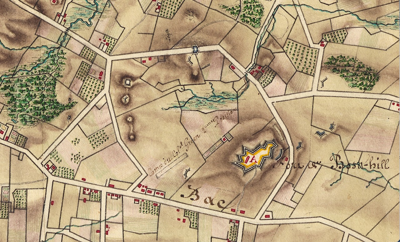
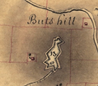
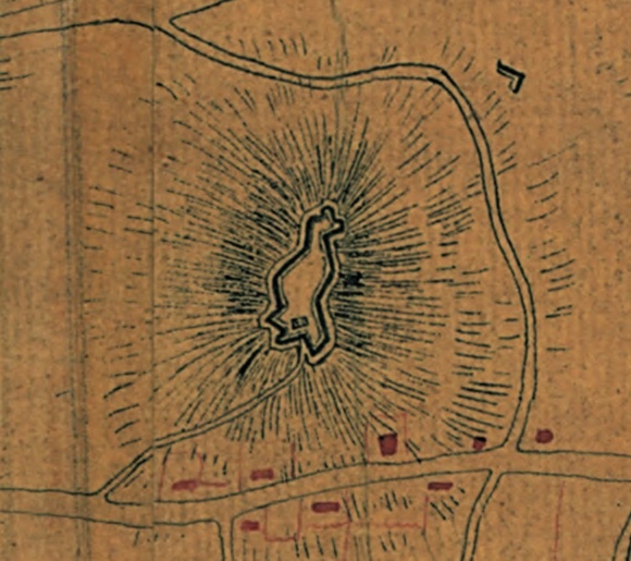
In Selig’s article on the French engineers, he provides background to why the French were interested in building a stronger “Butts Hill Fort.” When the French arrived the fort was in poor shape and there was concern that the British may come back and invade Aquidneck Island again. General Rochambeau, Lafayette and others saw the fort as a key communications point if the British returned.
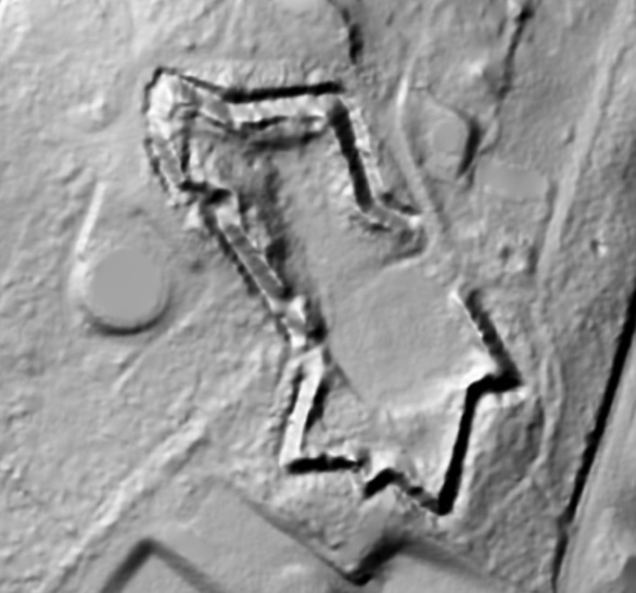
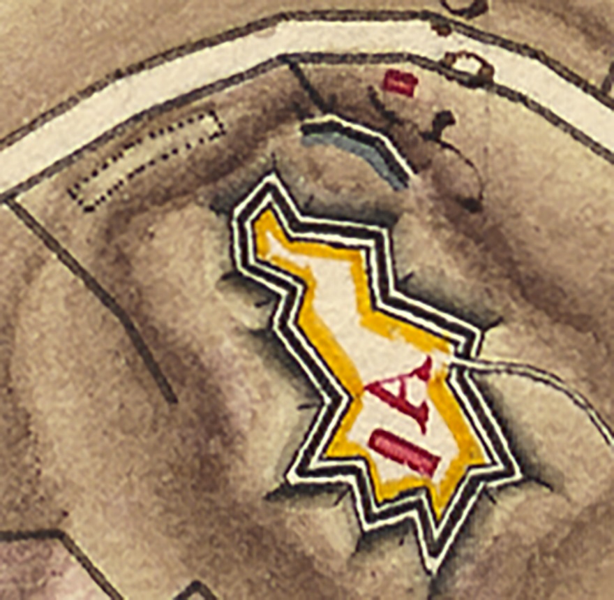
Colonel Jean Nicholas Desandroüins left a description of the fort of December 1780, just as Rochambeau’s engineers began their work. Desandroüin’s observations give us an idea of the condition of the fort when the French began their work.
“It was also necessary to provide the means of being rescued by ensuring communication with the mainland. With this in mind at the far end (northern-most point) […] a fort called Bootshill was built on the height which dominates (overlooking) the space between the two passes or ferry crossings of Bristol and of Howlands. Assistance can assemble under its protection. This good work is of a high elevation, well flanked, preceded by a ditch as wide and deep, dug partly in the rock. It was sufficiently stocked with artillery and could hold 500 men. For its construction, we took advantage of two older, very imperfect, redoubts, whose mutually supporting fronts were shaved off, and which were joined together by two branches with breaks and redans, to make a single piece of good defence and capacity.” (Quoted in Blondet, Jeux de Guerre, p. 239. Blondet dates the letter to 9 December 1780.)
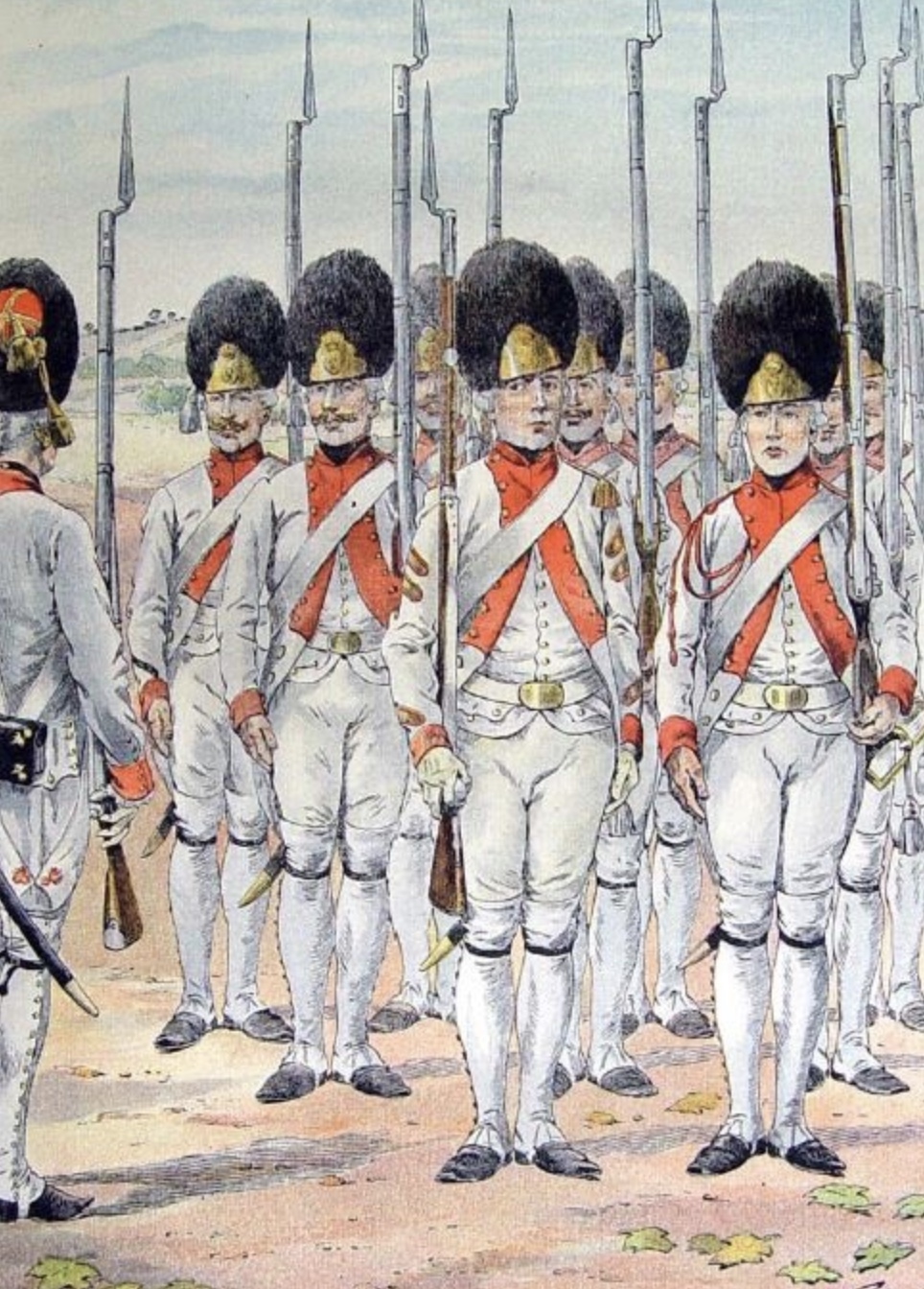
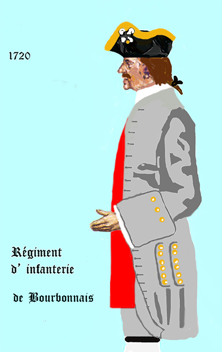
As I read the American Orderly Books from “Camp Butts Hill” (for example Orderly books of Ebenezer Thayer, Jr.) I imagined American militia aiding the French engineers and doing the physical labor at the fort. What I am discovering through Dr. Robert Selig’s work with Rochambeau’s orderly book, is that four French regiments where also present at the construction of the Butts Hill Fort. They included the Soissonnois, Bourbonnois, Royal Deux Ponts, and Santonge Regiments.
Quoting from the Selig’s English version of the orderly books:
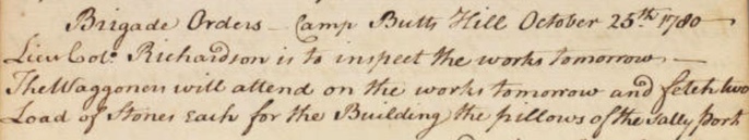
Order of 9 December 1780
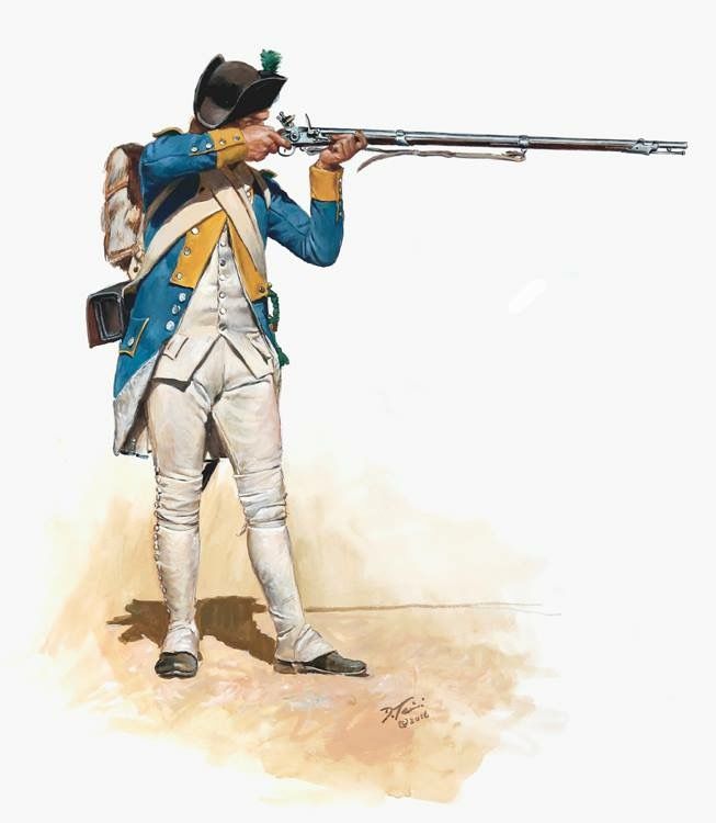
“Each regiment will furnish two squads [at 12 men each] and a sergeant, the brigade of Soissonnois a lieutenant, and that of Bourbonnois a Capitaine en second who will command the whole, they will assemble at 7 o’clock in the morning near the guardhouse on the Parade Ground. This detachment will march with arms and baggage to Butts Hill Fort near Howland’s Ferry to work there as directed to them by the engineer who will be there, they will take with them cooking pots, mess tins, flasks, and provisions for five days, which each regiment will take care to procure today. The captain who will command the detachment ordered to work at Butts Hill Fort, a mile from Howland’s Ferry, will keep his soldiers in good order and discipline, he will order each day only one corporal and four men as guards, and will not allow more than one cook be employed per regiment in order to keep as few men as possible from the work.”
This entry demonstrates that the French soldiers were actively working at fort construction. Five would work as guards and one as cook, but they wanted to “keep as few men as possible from the work.”
In the table below I have outlined the rotation of French Regiments as detailed in Rochambeau’s Orderly Book.
| Date | Unit | Duty | Comment |
| 12/23/1780 | Each regiment | Distribute provisions | |
| 12/28/178 | Soissonnois, Santonge, Royal Deux Ponts – Bourbonnais 23 | 3 regiments return. Take orders from Palisse, Major of the Royal Corps of Engineers | For the security of the post, the police of the guard, and the preservation of the fort’s works. The detachment will also take orders from Monsieur de Palisse, Major of the Royal Corps of Engineers, and from Monsieur Planchard for the work that can be done. |
| Order of 31 December 1780 | Soissonnois | Relieve previous | |
| 1/4/1781 | Saintonge | Relieve previous | |
| 1/9/1781 | Deux Ponts | Relieve previous | All the working soldiers employed in repairing the camp effects will be exempt from roll call and will be allowed to work until 8 o’clock in the evening. |
| 1/14/1781 | Bourbonnais | Relieve previous | |
| 1/16/1781 | Rochambeau grant | Quarter supplement to the ration of bread per day to the workers at the fort of Butts Hill Fort. | |
| 1/19/1781 | Soissonnois | Relieve previous | |
| 1/24/1781 | Saintonge | Relieve previous | |
| 1/29/1781 | Royal Deux Ponts | Relieve previous | |
| 2/2/1781 | Bourbonnais | Relieve previous | |
| 2/7/1781 | Soissonnois | Relieve previous | |
| 2/13/1781 | Saintonge | Relieve previous | |
| 2/18/1781 | Royal Deux Ponts | Relieve previous | |
| 2/23/1781 | Bourbonnais | Relieve previous | |
| 2/28/1781 | Soissonnois | Relieve previous | |
| 3/5/1781 | Saintonge | Relieve previous | Will be relieved by the first American troop that will establish itself in this fort |
| 3/18/1781 | Soissonnois | Send to Butts Hill the soldiers named Armand,Corporal and Foucault, soldiers of the company de lay Boyere, fleur Damour of that company of Anselm and Bourdet of the company of Scanty were they will take the order of M. De Turpin, Captain of the Engineers | Americans relieve |
| 4/1/1781 | Royal Deux Ponts | One sergeant and a squad | |
| 4/11/1781 | Soissonnois | One corporal and six men | |
| 4/16/1781 | Saintonge | One corporal and eight men | |
| 4/21/1781 | Deux Ponts | One sergeant and one corporal and 10 men | |
| 4/25/1781 | Bourbonnais | One sergeant, one corporal and 10 men | |
| 4/29/1781 | Soissonnois | One sergeant and one corporal and 10 men | |
| 5/3/1781 | Saintonge | One sergeant and one corporal and 10 men | |
| 5/8/1781 | Deux Ponts | One Sargent, three corporals and 20 men. | |
| 5/18/1781 | Soissonnois | Three corporals 10 men | |
| 5/23/1781 | Saintonge | One sargeant, three corporals 10 men | |
| 5/28/1781 | Deux Ponts | One sargeant, three corporals 10 men | |
| 6/2/1781 | Bourbonnais | One sergeant, three corporals and ten men. | |
| 6/7/1781 | Soissonnois | Three corporals 10 men |
The presence of, and the work carried out by, French soldiers at Butts Hill Fort from July 1780 and June 1781 is beyond doubt. The Orderly Book clearly established that within a week of their arrival in Newport, French engineers, most notably Major de Palys, were supervising repairs at the fort. At this point the work was carried out by American militia. It was only in December 1780, that French soldiers began working at Butts Hill Fort, which they did until June 1781, when Rochambeau’s forces deployed to New York.

References:Dr. Robert Selig’s research is detailed in a video on Battle of Rhode Island Association website. Rochambeau’s Engineers at Butts Hill.
Illustrations: Par Claude-Antoine Littret de Montigny — Bibliothèque nationale de France, gallica.bnf.fr, Domaine public, https://commons.wikimedia.org/w/index.php?curid=84807137