One of the attendees at our Bristol Ferry Commons/Mt Hope Park evening asked me about the Bristol Ferry Inn and what had happened to it. I have some of the pieces of that story, but there is still more to uncover.
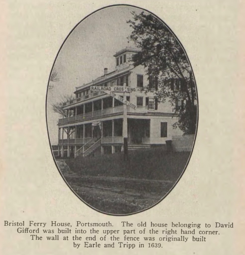
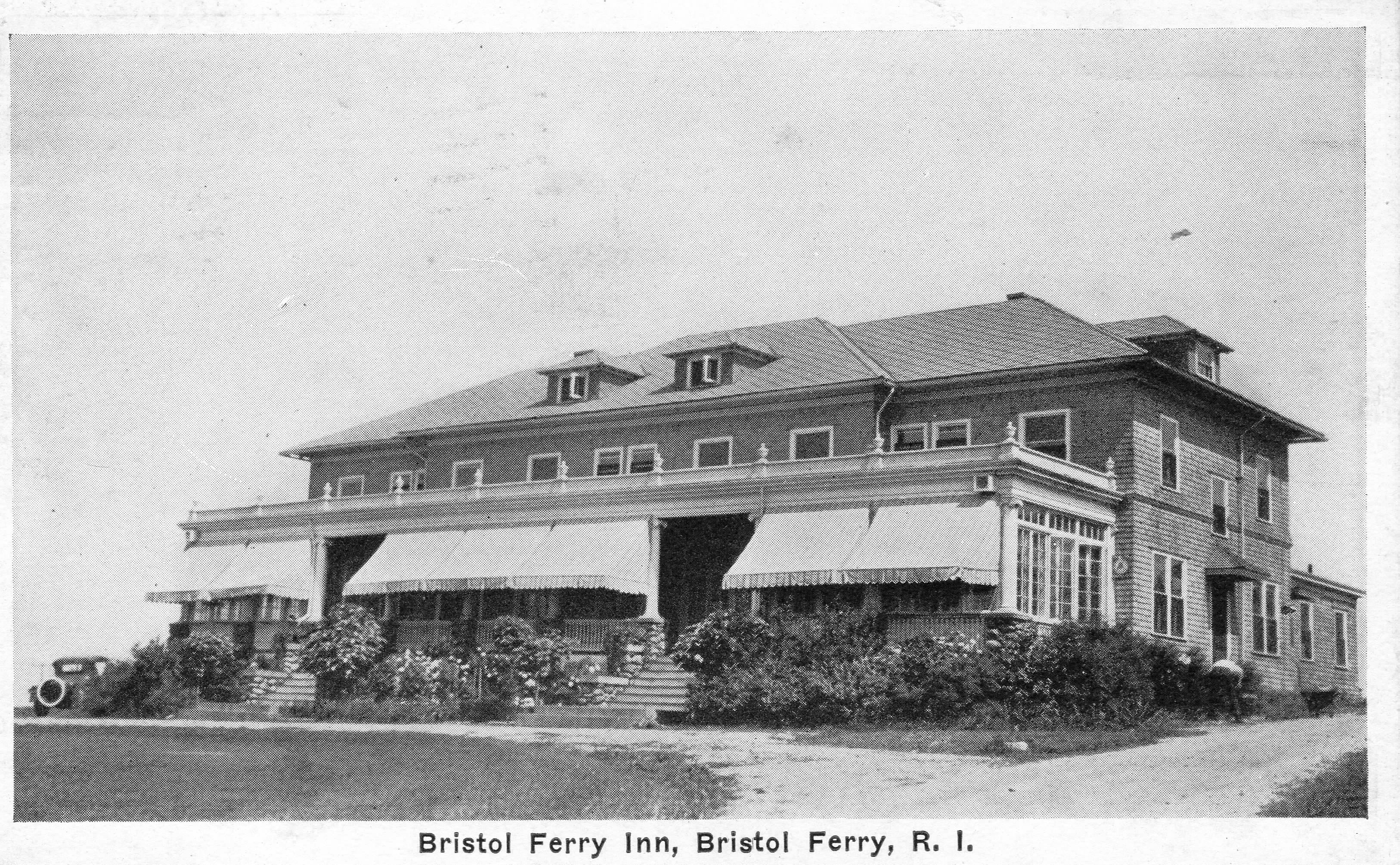
The earliest information I have traces an original Inn to a tavern owned by David Gifford. At the time of the Revolutionary War, Gifford was the leader of the militia and ferryman for Portsmouth. The caption on this photo mentions “The old house belonging to David Gifford was built into the upper part..” of the Inn.
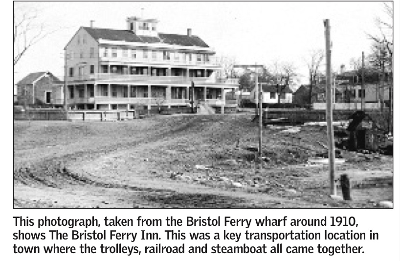
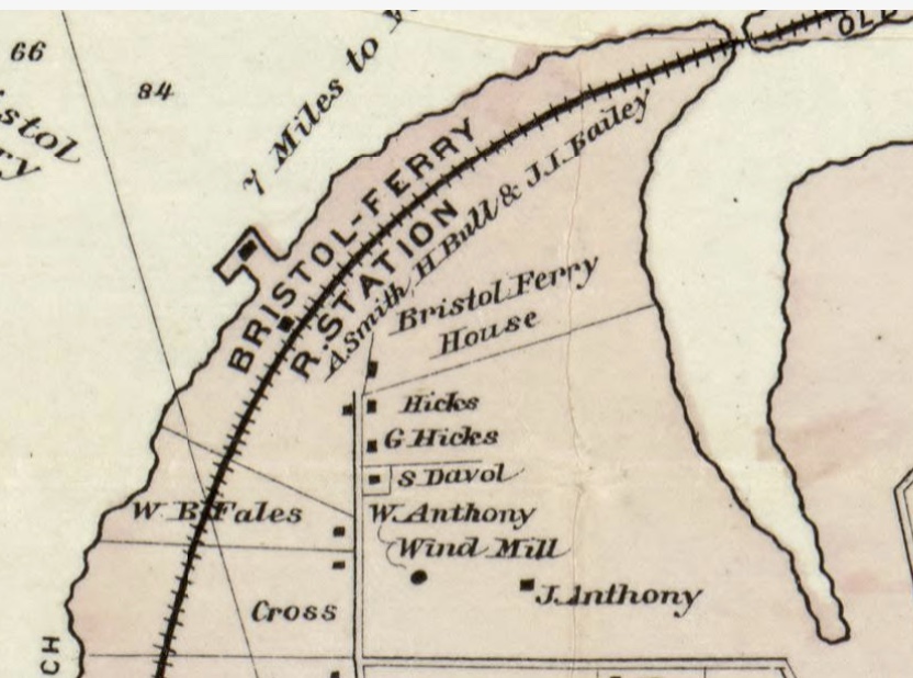
An article by the Historical Preservation and Heritage Commission booklet on Portsmouth stated: “About 1850, a large hotel with accommodations for up to 50 people, was built, and, for the next three-quarters of a century or so, Bristol Ferry was a thriving place, with the hotel, a wharf, a store, summer cottages, a railroad station on the Old Colony line between Fall River and Newport, a telegraph office and post office.”
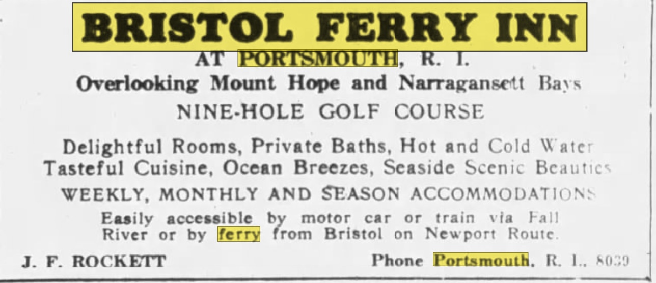
The Bristol Ferry Inn advertised in New York papers like the Brooklyn Eagle in 1926. A Nine-Hole golf course is advertised at this time.
1870 Ward mapAd in Brooklyn Paper
One travel guide has a description of the hotel’s charms.
“The one hotel here is a big, white, airy structure, tempered with green blinds surrounded by broad piazzas, even up to the third story. In its setting of great poplar trees, with neatly white-washed trunks, it looked somehow like pictures of old-fashioned ” young ladies’ seminaries.” Its proprietor is Alfred Sisson, and the house looks large enough to accommodate twice its stated limit–fifty. However, the ground floor is taken up mainly with large parlors, and a long dining hall; about are in the house now, all the proprietor cares to entertain. Row boats are let by the hotel, and sail but three-fourths of a mile to main land at Bristol Ferry..”
Something must have happened to the three story inn because the Fall River Evening News for July 10, 1923 reports on the opening of a two story smaller hotel. The hotel was described this way.
“The hotel occupies the site of the old Bristol Ferry House at Bristol Ferry, R.I., the main building occupying somewhat higher ground than the older one did, giving a better view. …… A small hotel more pleasing in effect it would be hard to find. It is a natural wind grewy rising aaboutve field stone supports of a piazza that extends along the full front. …. The main building has two full stories…There are 11 suites of bedroom and bath.”
In its later days the Inn was known as “Hylander Inn” and was burned down in 1945. Coincidentally, the owner, Louis Carreiro, had his Pocasset Country Club building burned down in 1956.
As I research Portsmouth during Revolutionary times, I frequently come across a mention of the Redwood House. It was a place marker on West Main Road. The first shots fired during the Battle of Rhode Island were close to the Redwood House. What was special about the Redwood House and what happened to it.
The history of the house starts with Abraham Redwood Jr. The Redwood family had a large sugar plantation in Antigua. Abraham Redwood, Jr. was born in 1709 and he was active in the family sugar business from his teenage years. When his father died, the planation – along with the over 200 slaves that worked it – were signed over to Abraham Redwood, Jr. Some sources say he settled on his father’s estate in Portsmouth in 1727. It was known as Redwood Farm. Other sources say that in 1743 he purchased 140 acres of land in Portsmouth that was part of the Coggeshall land grant. It may be that he added to the land he had inherited from his father. He had a great interest in horticulture and he cultivated rare plants, shrubs and trees. He built a greenhouse, hothouse and a serpentine walk through a meadow. From the West Indies he imported orange and fig trees along with guava and pineapple roots. Redwood described a greenhouse 22 feet long, 12 feet wide and 12 feet high so he could raise West Indian fruits.
Redwood House in 1930s.
Samuel Drowne described the gardens in 1767. “Mr. Redwood’s garden. . . is one of the finest gardens I ever saw in my life. In it grows all sorts of West Indian fruits, viz: Oranges, Lemons, Limes, Pineapples, and Tamarinds and other sorts. It has also West Indian flowers—very pretty ones—and a fine summer house. It was told by my father that the man that took care of the garden had above 100 dollars per annum. It had Hot Houses where things that are tender are put for the winter, and hot beds for the West India Fruit. I saw one or two of these gardens in coming from the beach.”
The Redwood Farm estate stayed in the family until 1882. In her book “This Was My Newport,” Maud Howe Elliott (daughter of Julia Ward Howe) describes the garden when she was a child in the 1850s and 60s.
“The garden at “Redwood” was a marvel of taste and neatness. The high bush blackberries that topped the wall were known to every child within a radius of miles. At the corners of the long beds were enormous clumps of peonies. Flowers, fruit and vegetables amicably shared the sunny garden — a pair of acres in size — gooseberry and currant bushes forming the borders, while pear trees were planted at intervals in the center of the beds. There was a little garden-house where Miss Rosalie, the youngest daughter, held a Sunday school for children of the neighboring farmers. I have had cause all my life to bless Miss Rosalie for her gentle ministrations. The seeds of culture and breeding she sowed in the minds of her boys and girls have borne fruit and sweetened the life of generations.”
You can still see the “little garden-house.” It was moved to the grounds of the Redwood Library in 1917. It was originally designed by famed architect Peter Harrison for the Redwoods in 1766.
Through the years the Redwood House was allowed to deteriorate. Newspaper accounts in 1937 say that wealthy Bradford Norman was trying to restore the house, but it was demolished in the 1940s.
Redwood House 1940s. Garman collectionRedwood Garden House at Redwood Library
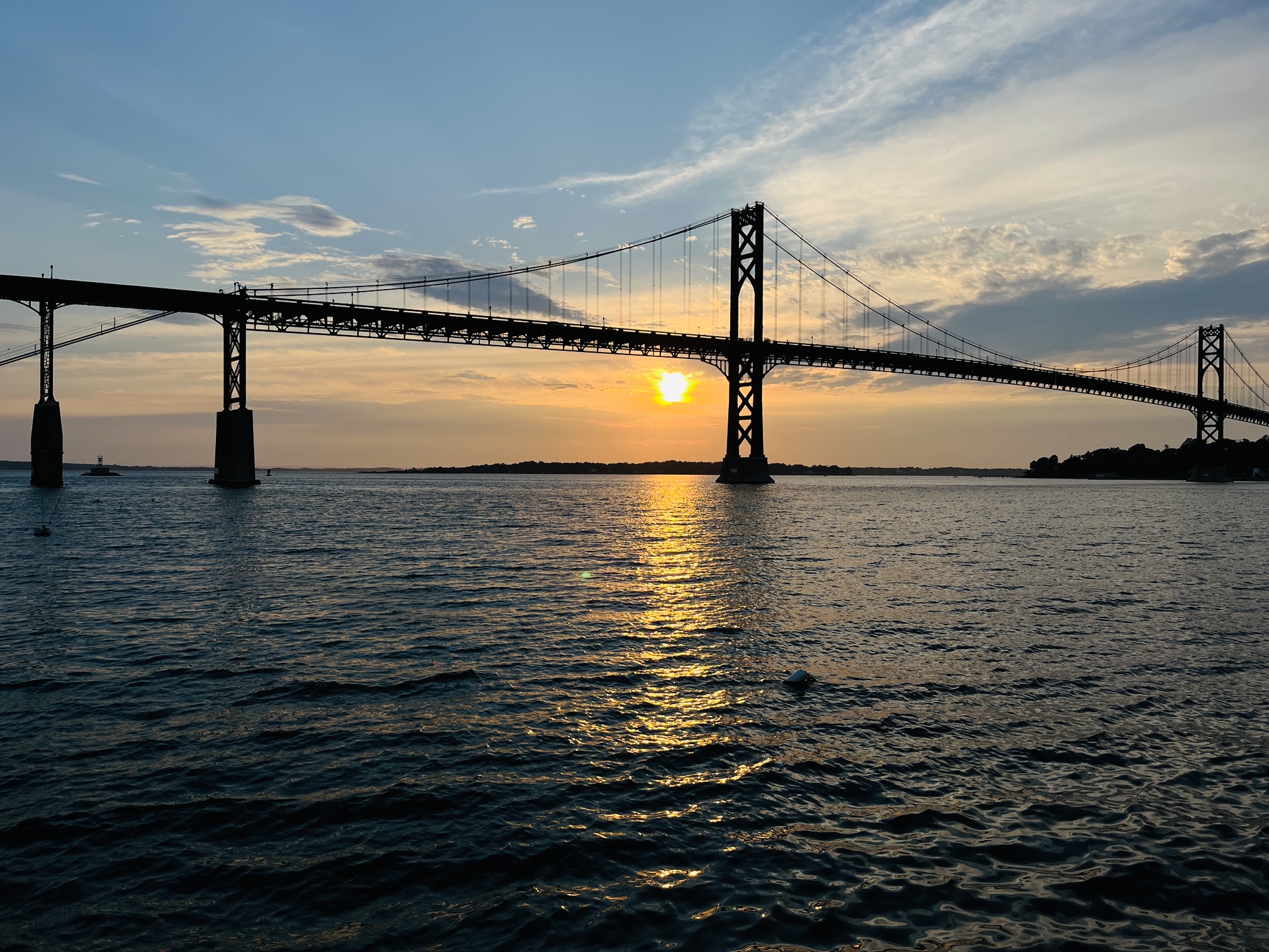
Mt. Hope Park is a beautiful place to take photos. This Friday – weather permitting – we will encourage people to come down to the park and Bristol Ferry Commons from 5:30-6:30 to learn about the history of the area and take photos of the sunset. We will have a “best” photo contest for small prizes. Those who come to the event will get a card with an email address for submission. Photos of sunsets at Mt. Hope Park could have been taken earlier, but those entering will have until Oct 19 th to make a submission.
I have tried sunset photos, but it is not easy. Below is a recommendation of someone from the Portsmouth Art Guild. I am going to practice with these settings.
Using Your iPhone iPhone Settings: In “Settings”, go to the Camera listing Toggle on “Grid” Tap on “Preserve Settings” and toggle on “Exposure Adjustments” Camera Settings Go to your camera and look for the Exposure Adjustment option Adjust it to -0.7 to capture more sunset details Turn on the Flash Tap on an object in the foreground or in the sky to focus There is no hard and fast rule on how to frame your photos, but it’s recommended to have an object in the foreground. If that object is s person, using the rule of thirds, try positioning the person on the left grid line while looking 45 degrees toward the horizon. Practice the above recommendations to feel comfortable while outside taking sunset photos.
Using a DSLR Camera: How to choose the right camera settings for sunset photography. Shooting great sunset photos is all about your camera settings. Learn how to set your gear up right with these helpful tips. Sunsets are one of nature’s greatest spectacles, and they make for absolutely stunning photographs — when you pick the right camera settings. Luckily, sunset photography is easy once you know the basics. These tips will help you set up your camera correctly and capture the full beauty of a blazing sundown.
Set your ISO to low. Naturally, the sun is bright — even when it’s setting. Keep the ISO as low as possible so your photo won’t come out grainy. That said, you should increase the ISO as the sun creeps closer to the horizon.
Use a quick shutter speed. Opt for a quick shutter speed to minimize exposure time — otherwise the setting sun might burn out your photograph. Take a few test shots to find the sweet spot. If your camera has an exposure bracketing feature, this is the time to use it.
Shoot with a wide aperture. You’ll want maximum depth of field to capture the whole sunset scene. Set your aperture to a very narrow setting, such as f/11 or even higher. You can’t really go too narrow.
Focus your shot manually. Some cameras struggle to focus on a sunset, since it doesn’t provide a clear focal point. If your photos are coming out blurry, focus your camera manually.
Experiment with the white balance. Most modern cameras have great automatic white balance settings, but you should definitely try out a few different options. The best setting depends completely on the particular sunset, though, so snap a picture with each manual setting.
Recommendations from member of Portsmouth Art Guild
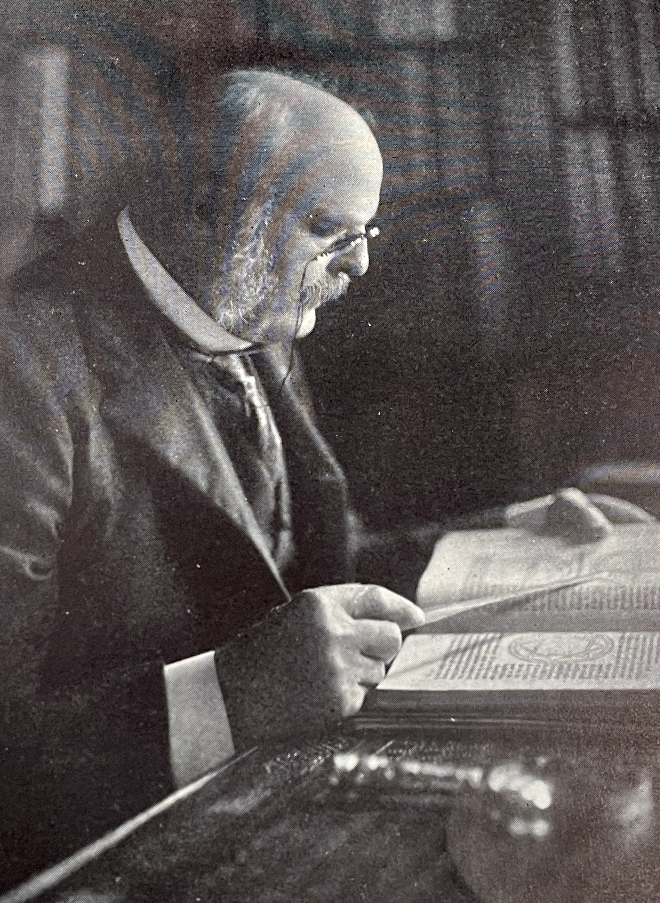
We know that Roderick Terry saved Butts Hill Fort from being divided into 200 house lots. We know he turned over the property to the Newport Historical Society with restrictions. We know that Terry spoke during the dedication ceremonies on August 29, 1923. What did he tell the crowd that day? I am trying to put together a script for an actor who will be portraying Terry during the October 19th tours of the fort. The only record I have to go from is an article in the Newport Historical Society Journal from November of 1929.
Terry spoke towards the end of the ceremonies. He began by remarking “that in the presence of so many who were descendants of those who had fought on this spot 145 years ago”, it may be hardly proper for him to speak. He was not a native of Rhode Island, but was descended from Connecticut stock. His ancestor was a Colonel of the Connecticut forces in the Revolution. He had tried to prove his ancestor fought in the battle, “but unfortunately it was not so.”
Turning his thoughts to the celebration that day, he said it was the realization of the dream of many years. He had not been alone in the dream, “for several times others had attempted to secure possession of this site, but for one reason or another had been unable.” He felt grateful that “he could be the means of preserving for posterity these fortifications, which I hope would serve to all future generations as a reminder of what our ancestors had done to give us our Independence.” He hoped that “those who would visit this historic spot would find their Patriotism aroused, for in spite of what is the opinion of many today, we believe thoroughly in Patriotism, and that there are few nobler qualities to inspire great deeds”
He was happy to welcome the Artillery companies who make the day more enjoyable and instructive. Their uniforms carry our minds back to the day of the battle when their uniforms were not so clean. “But whether in 1778 or 1923, the wearers of these historic uniforms must be thrilled with the thought of what they represented.”
He closed by expressing the “hope that many in the years to come might visit this interesting spot and find here inspiration ever for better living.
These fortifications were not given to the Newport Historical Society as a personal possession of their own so much as a trust, which they held for the community. The purpose and hopes which lay at the bottom of the gift were listed in the deed given.
That the Newport Historical Society and its successors “shall forever preserve, keep and maintain” these premises “as a memorial or monument to the memory of those who fought in the American Revolutionary War – and as a place where the public may view and study the battlefield on which our soldiers fought to be enlightened in the battles fought in American History. The premises shall always retain the name of “Butts Hill Fort.”
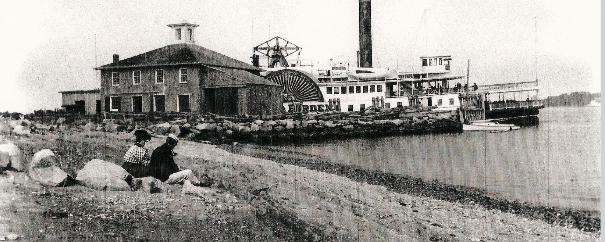
The old Bristol Ferry landing (now known as Mt. Hope Park) was once the transportation center for Portsmouth. Ferry boat service to Bristol and back began as early as the 1650s. The Old Colony Railway had a train station there and steamboats docked at that spot for travelers on the Fall River and Providence steam boat line. In the early 20th century, the electric street railway came to Bristol Ferry from Newport. Passengers could proceed to a ferry to cross to downtown Bristol were they could take a train to Providence. When the Mt. Hope Bridge opened in 1929 and the ferries stopped running, the area lost much of its importance as a transportation center.
Through the years the area became the site of Mount Hope Marina, a restaurant. When it closed the land was vacant and cut off from the public with fencing. In January 2016, the Aquidneck Island Land Trust and the Town of Portsmouth formed a partnership to purchase the waterfront property. The Town of Portsmouth owns the property subject to a conservation easement with the the Land Trust. Mount Hope Park opened for public use on August 30, 2019.
Mt. Hope Park is considered a public access to the shoreline. The beautiful view is open to all because of a guaranteed right to access the shoreline that dates back to the Royal Charter granted to the colony of Rhode Island by King Charles II in 1663. Mount Hope Park is just one of the state’s more than 220 designated coastal rights-of-way, including more than 65 on Aquidneck Island.
It is a beautiful spot to enjoy the sun setting behind Mt. Hope Bridge. It is also recreational with access for kayaks and fishing available
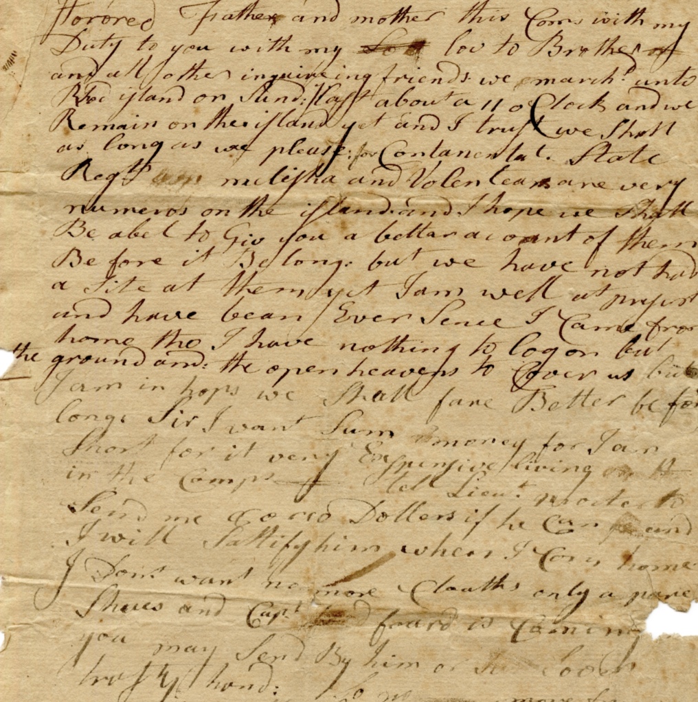
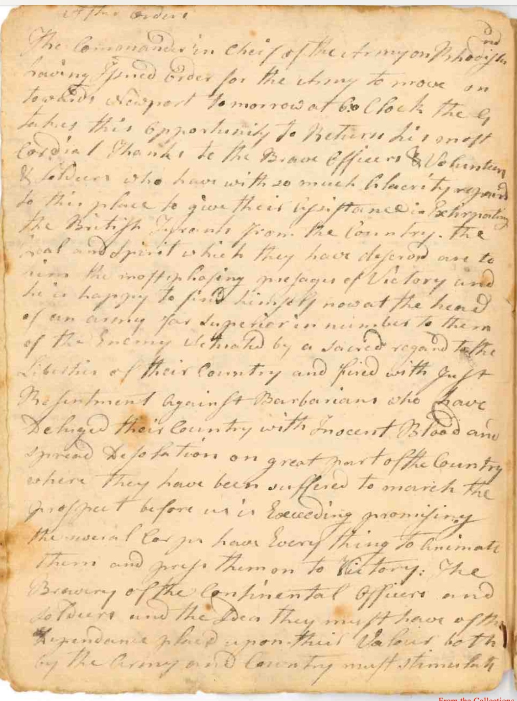
I am always on the look out for primary sources related to the Rhode Island Campaign. I recently came upon two such sources. One is a letter to home from the Portsmouth camp and the other is an orderly book that records orders, events, etc. for a militia regiment from Connecticut. A conversation at a reenactment of the Bristol and Warren raid led me to a letter home from a soldier in the Massachusetts militia. Thankfully the owner of the letter shared both the image and the transcription. The orderly book is in the collection of the Henry Ford Museum, and the museum graciously sent me scans. Historian John Robertson had already transcribed the book so I benefited from his work. The letter was written on a date covered by the orderly book and the two sources together can give us some added details of the early days in the camp before the Siege of Newport.
The auction advertised that the letter was written by John Bettey of Chelmsford, Massachusetts to his father, on August 11, 1778, from the American camp near Portsmouth, Rhode Island.
Bettey wrote: “We march onto Rhode Island on Sunday last about at 11 oClock and we remain on the island yet..” The Sunday would have been August 9th. He is hopeful that they can remain on the island “as long as we please for Continental State Regt. Militia and Volunteers are very numerous on the island.” …”But we have not had a site at them (the enemy) yet.”
Conditions were very poor. Bettey says he is “well at present” although “I have nothing to lay on but the ground and the open heavens to cover us but I am in hope we shall fare better before long.” He complains that it is very expensive at camp and he could like some money. He also wanted his family to send some shoes.
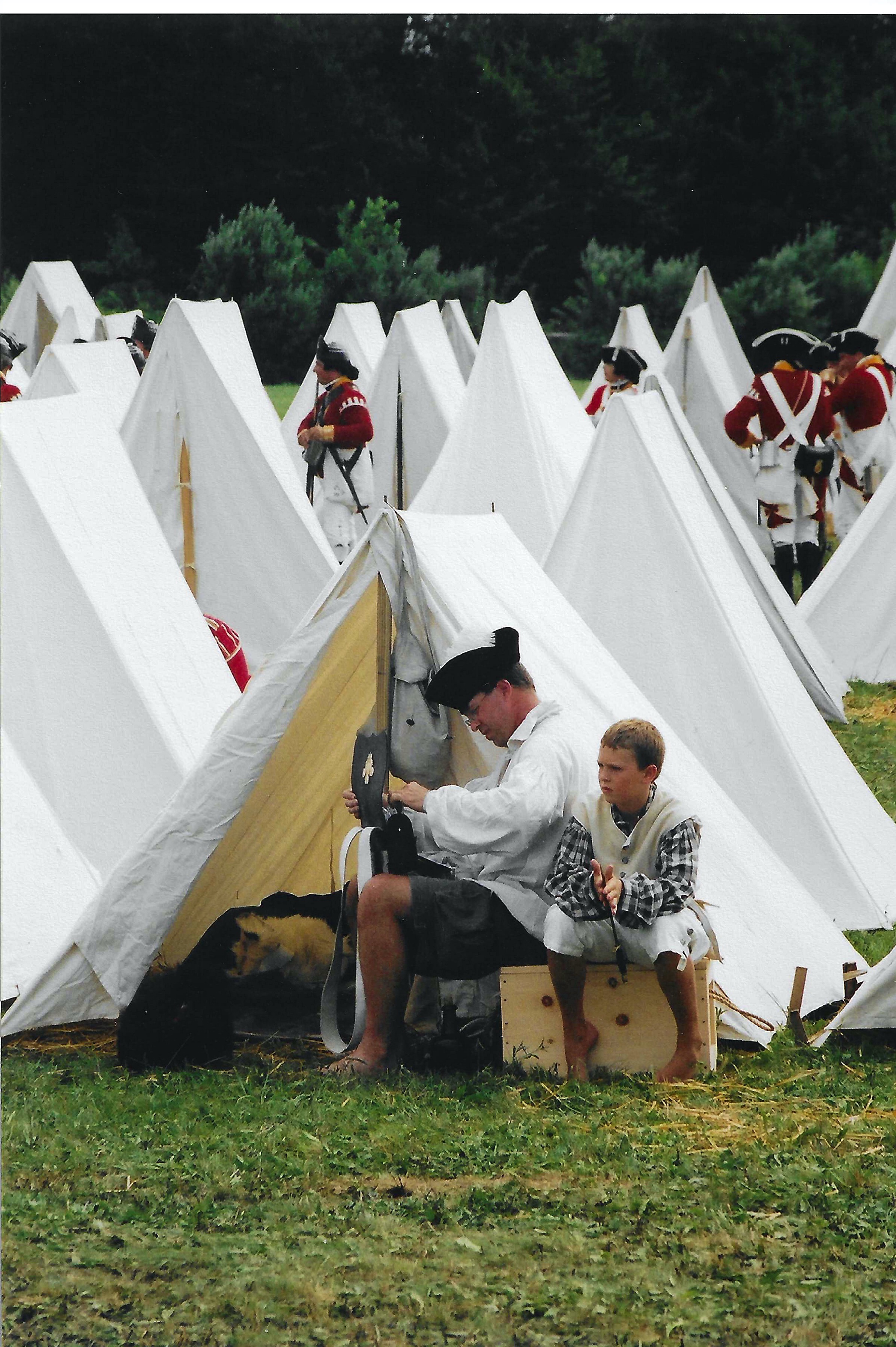
The Orderly Book of Col. Samuel Chapman’s Connecticut Militia Regiment gives us a similar view. From headquarters on August 10th General Sullivan had “Directed to send over all the spare Tents and Destribute them among the Troops that are destitute of Covering also the Volunteers…. Those men that cannot be furnished with Tents are to build Huts and Bush houses …..Comders of Regts and Corps who have Tents on the other side of the River will Immediately send a Detachment from their Companies to bring them over.”
It is hard for me to imagine the soldiers having to build huts and bush houses around Butts Hill just to have shelter. When the storm (hurricane like) hit over the next several days, that lack of shelter would be a major issue.
The letter and the orderly book are small pieces of the puzzle of what happened during the Rhode Island Campaign. However, these small pieces bring the events to life. I will continue to gradually share the events listed in the orderly book as time goes by.
Bettey LetterMissing tentsConnecticut Orderly Book
For a number of years I have been gathering stories of Portsmouth women. Their stories can be forgotten when history is generally written about the men. In presentations I tell the story of Mary Paine Tripp, but John and Mary Tripp’s combined story gives us a glimpse of what was happening in the early days of Portsmouth. It also helps us to focus on what was happening in the Bristol Ferry neighborhood of our town. It was one of the first neighborhoods to be developed.
A story about Mary:
I came across an interesting story from Edward West’s 1932 article in the journal of the Rhode Island Historical Society on the “The Lands of Portsmouth, Rhode Island”. How much would you give for a glass of wine? Back in 1666 Richard Searl sold a three acre lot just above the Bristol Ferry to Mary Paine. Mary was the barmaid at Baulston’s Tavern and the land was exchanged for a “pint of wine.” Mary later married John Tripp who used the land for a ferry house. Although this deed wasn’t registered, the Town Council accepted the deposition of William Collinge as to how the land was transferred. Mary officially owned the land.
Note Searl Property on Land Grant Map. Marked with star.
John Tripp, early settler
An article by Tripp Family genealogist Janet Tripp Andrews provides us with information about John Tripp, 1611 – 1678, as well as the conditions in Portsmouth for the first settlers. John started life here as an indentured servant – perhaps to a ship’s carpenter. He was admitted as an “inhabitant” at Portsmouth’s founding. That allowed a settler to own land but not to vote or hold office. He must have paid off the indenture because a year later he was admitted as a freeman.
Early Records of the Town of Portsmouth show that the community developed quickly. The first house lots were assigned and an inn, brewery and general store were established with William Baulston in charge. Like all men between the ages of sixteen and fifty, John would have trained with the militia. To keep order a pair of stocks with a whipping post was ordered. To enable easier home construction a water mill was proposed. Meanwhile, that first summer settlers lived in caves or dugouts covered in branches. As wood was processed for construction more permanent one and two room structures with lofts and thatched roofs were considered permanent housing. Regardless of what their occupation had been in Massachusetts, the people of Portsmouth became farmers tending to hogs, goats, sheep and cattle. John Tripp, like the other Portsmouth settlers, would have been fencing property, digging wells, and planting orchards.
Although disagreements led to many residents leaving Portsmouth to establish Newport in 1639, John Tripp was among the thirty who signed the second Portsmouth Compact. He signed his own name. This was about the time that John Tripp married Mary Paine.
John Tripp would later become associated with boats and ferries, but Thomas Gorton was appointed ferryman to the Howland Ferry to Tiverton when it was established in 1640. Cattle were ferried across to graze in the Tiverton grasses. Early records show that in 1650 John had the approved weights to measure as the standard for the town. John took on other positions in town. In 1656 he was appointed to inspect cattle moving on and off the island. Tripp must have been able to read and write to do this job.
Meanwhile the Tripp family was growing. In 1640 their first son (John Jr.) was born. By 1650 their thrid daughter was born. Altogether Mary and John had ten or eleven children.
The process of becoming a “ferryman” was gradual for John. The shoreline around Bristol Ferry was owned by the town, but John Tripp, Ralph Earle and John Borden owned land that could add a pier. In 1658 the town treasurer was ordered to pay “Goodman” Tripp “for going into the Bay.” This could mean that Tripp was using his boat to deliver people and/or items like documents or goods.
In 1670 John Tripp had the honor of serving on the Governor’s Council. In 1673 John served as Town Moderator. With this service to the town and colony, Tripp was also serving as a ferryman. Captain Church’s writings have the first mention of “Tripp’ s Ferry” in 1676. After King Philip’s War Tripp’s son Abiel, William Earl, John Borden, and Joseph Anthony were given permission to build or finish wharfs on public land in 1682. Belore the Revolutionary War, the ferries were known by their owners – (Tripp’s Ferry, Borden’s Ferry). After the war it became know as the “Bristol Ferry” and was one of the most important ferries because it was a direct route from Newport to Providence. Washington, Lafayette, Rochambeau and other notables crossed to Bristol by way of this ferry.
Mary’s story continues
Mary Paine Tripp inherited John’s boats at his death in 1678. At a town meeting April 23, 1679 Widow Tripp was granted a license to sell food and drink to travelers. Perhaps she turned her house into a tavern. That would be full circle to her days at Baulton’s Tavern were she exchanged wine for a land grant.
Sources used:
Andrews, Janet Tripp. John Tripp, 1611-1678, A Glimpse into our Founder’s Life, Nov. 2016. In the collection of the Portsmouth Historical Society.
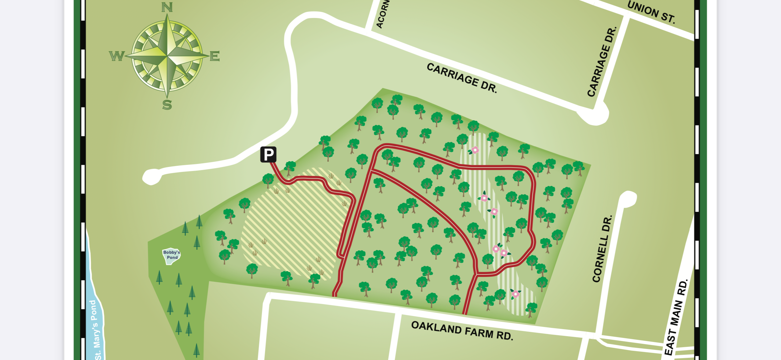
Today we took a gentle mile walk through Oakland Forest. On the walk you see a beautiful meadow and an old growth forest. This 30 acre area was saved for public enjoyment by the Aquidneck Land Trust through the generosity of local people. A developer was buying pieces of the property and building condominiums. Before the last section was sold off, forest scientists realized that the woods had the classic characteristics of old growth. Some of the trees were estimated to be 200-300 years old. The American beeches were 10 feet in circumference and 85 feet tall. There are white oaks in the forest that are 5 to 9 feet around and 70 to 80 feet tall. Considering that during the British Occupation of Aquidneck Island from 1776-1779 just about every tree was chopped down, having an example of “old growth” remaining is a treasure. Walking through the woods gives us an idea of what the land on Aquidneck Island was like when our first settlers arrived. There was a push by local people to preserve this forest instead of cutting it down for more house lots. Aquidneck Land Trust was able to buy this wooded area in 2000 for $1.5 million dollars.
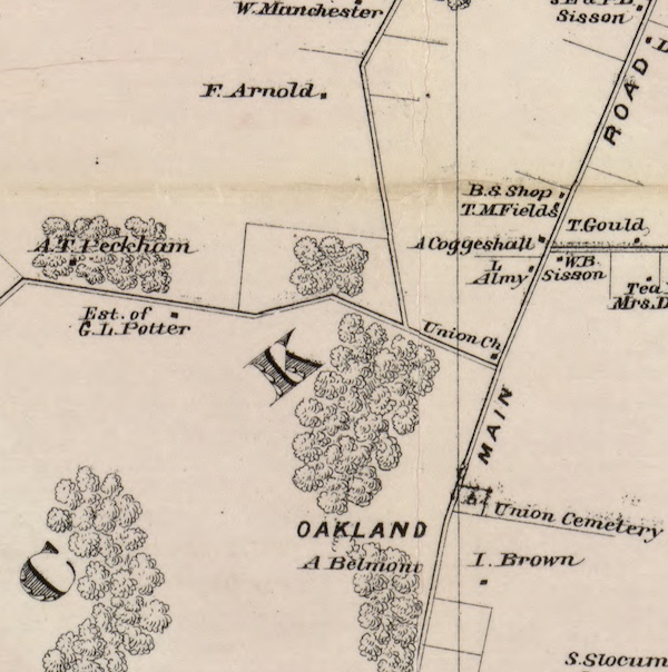
The whole Oakland Farm property has quite a history to it. In the early 1800s Oakland Farm was the summer home of Sarah Gibbs and her sister Ruth Gibbs Channing. Ruth was the wife of William Ellery Channing, a famous Unitarian minister, and Oakland Farm was Channing’s treasured summer retreat. Sarah Gibbs is best known for her founding of St. Mary’s Episcopal Church in Portsmouth. Known as “Aunt Sarah” by her family, she was famous for her hospitality. Sarah never married, but at Oakland Farm she was surrounded by loved ones. Sarah was an integral part of the Channing family and wrote about the Channing girls as “my children.”
Later the property was owned by the Vanderbilts and was a magnificent Gentleman’s Farm with elegant stables and riding rings. Sarah’s home was expanded to suit the Vanderbilt needs.
To access the woods: From the end of Union Street toward East Main Rd, turn onto Carriage Drive. Toward the end of Carriage Drive there is a small parking lot which marks the entrance.
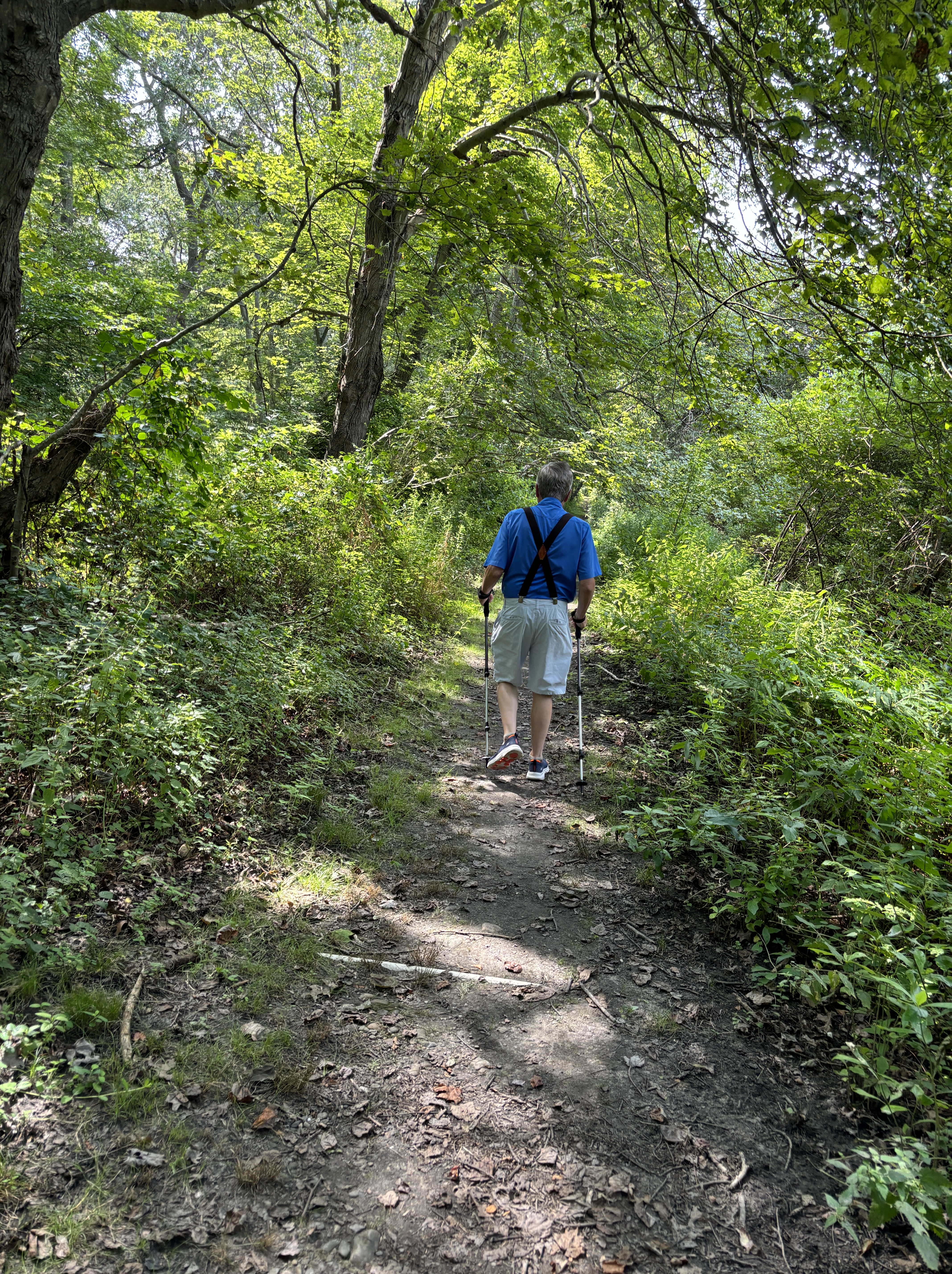
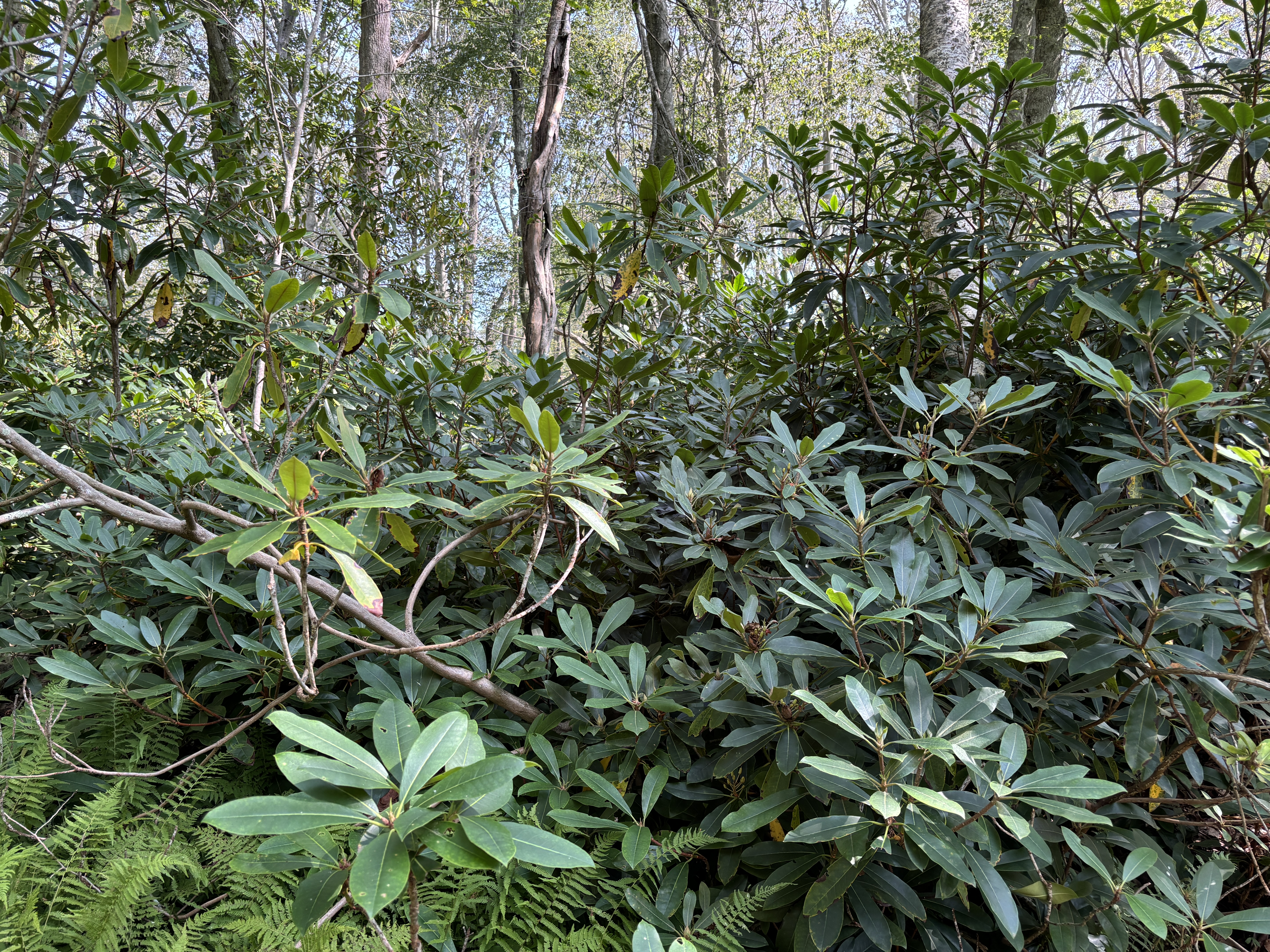
The early part of the trail is through a meadow. The access to the wooded part of the walk will be to your left. Follow the trail around the “Loop” and come back out where you began. In the wooded sections there are many tree roots and I would recommend using hiking poles for safety. Through the trail you will notice that part of the Oakland estate Rhododendron plantings are still there.
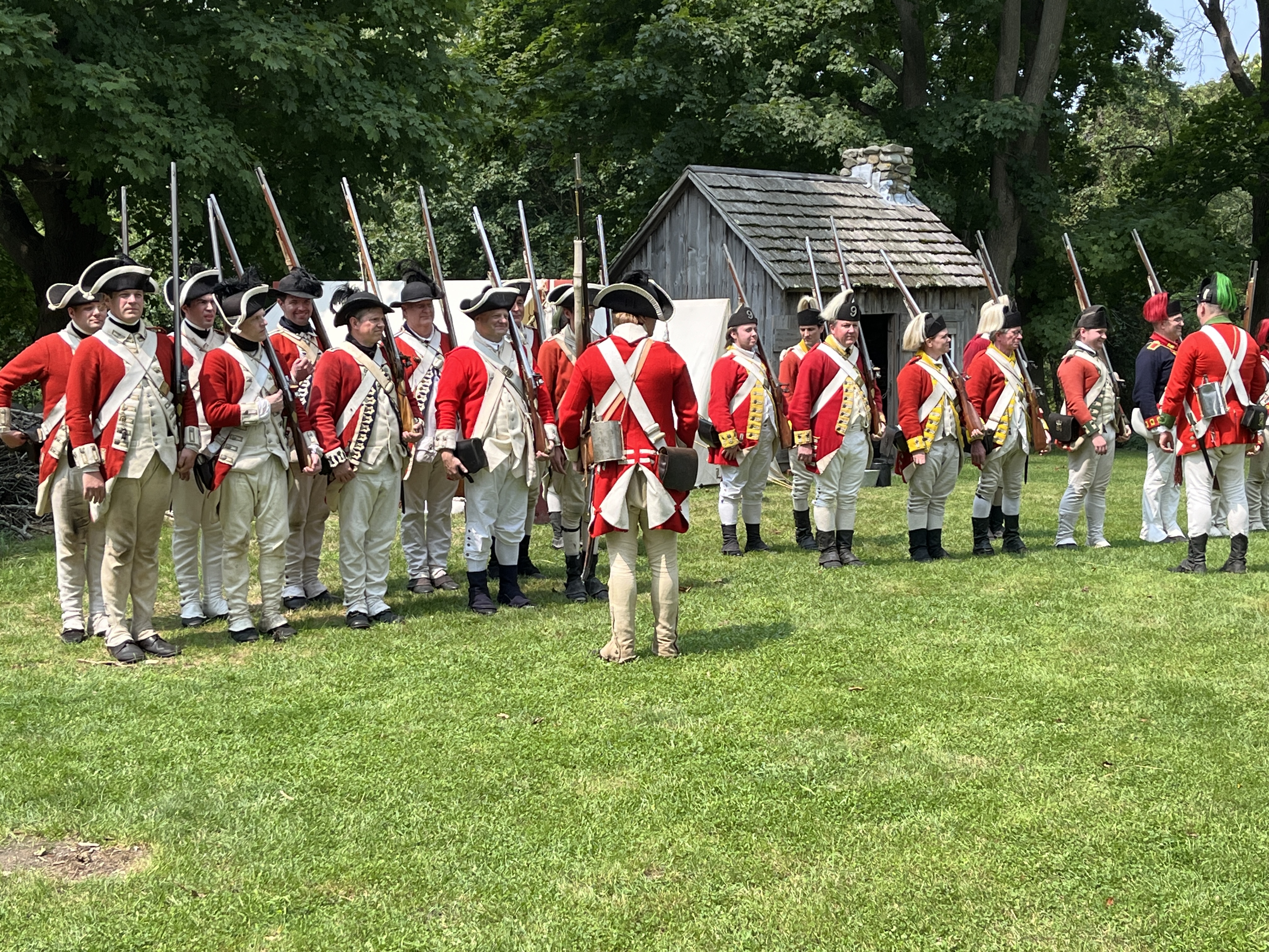
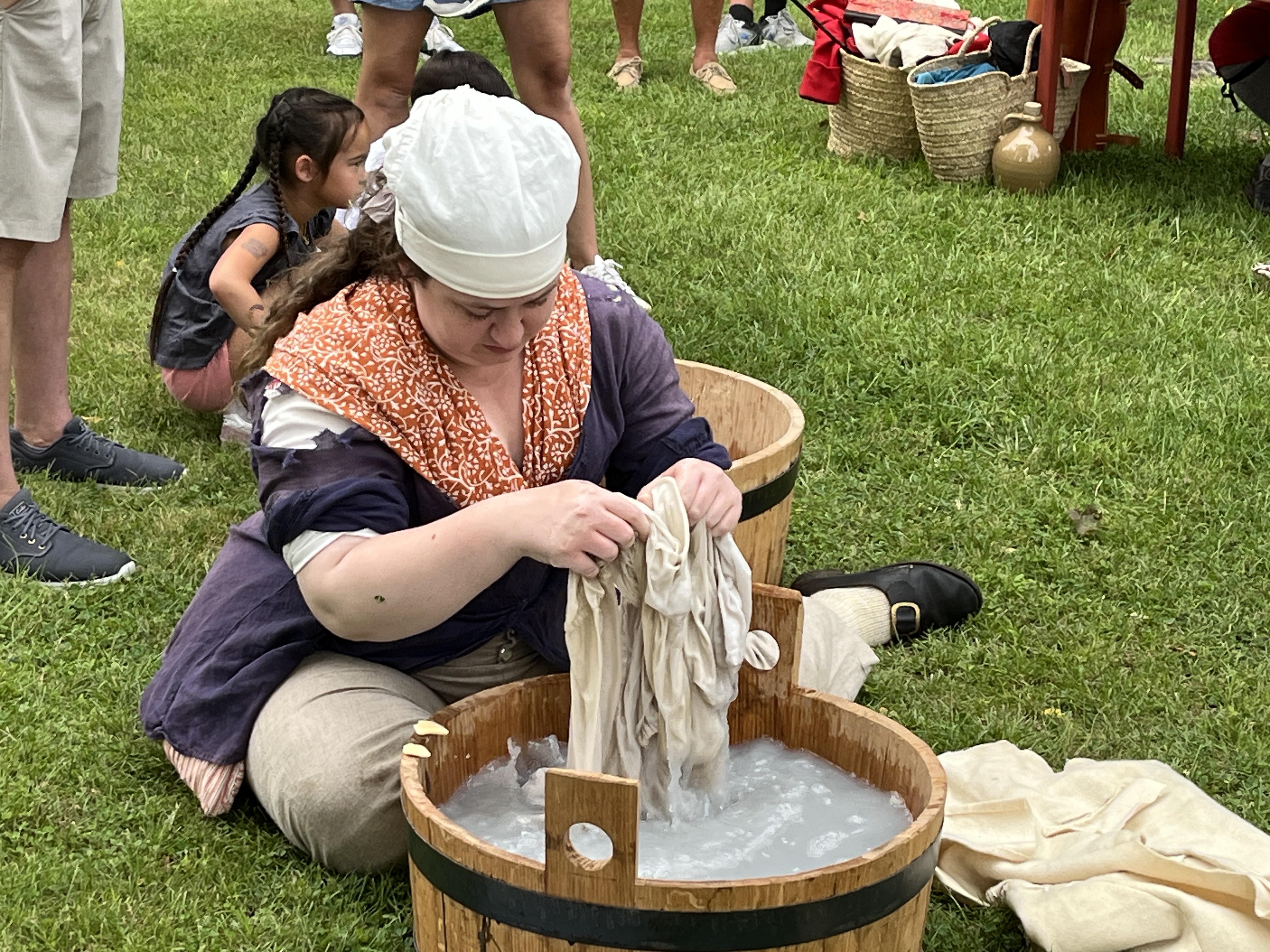
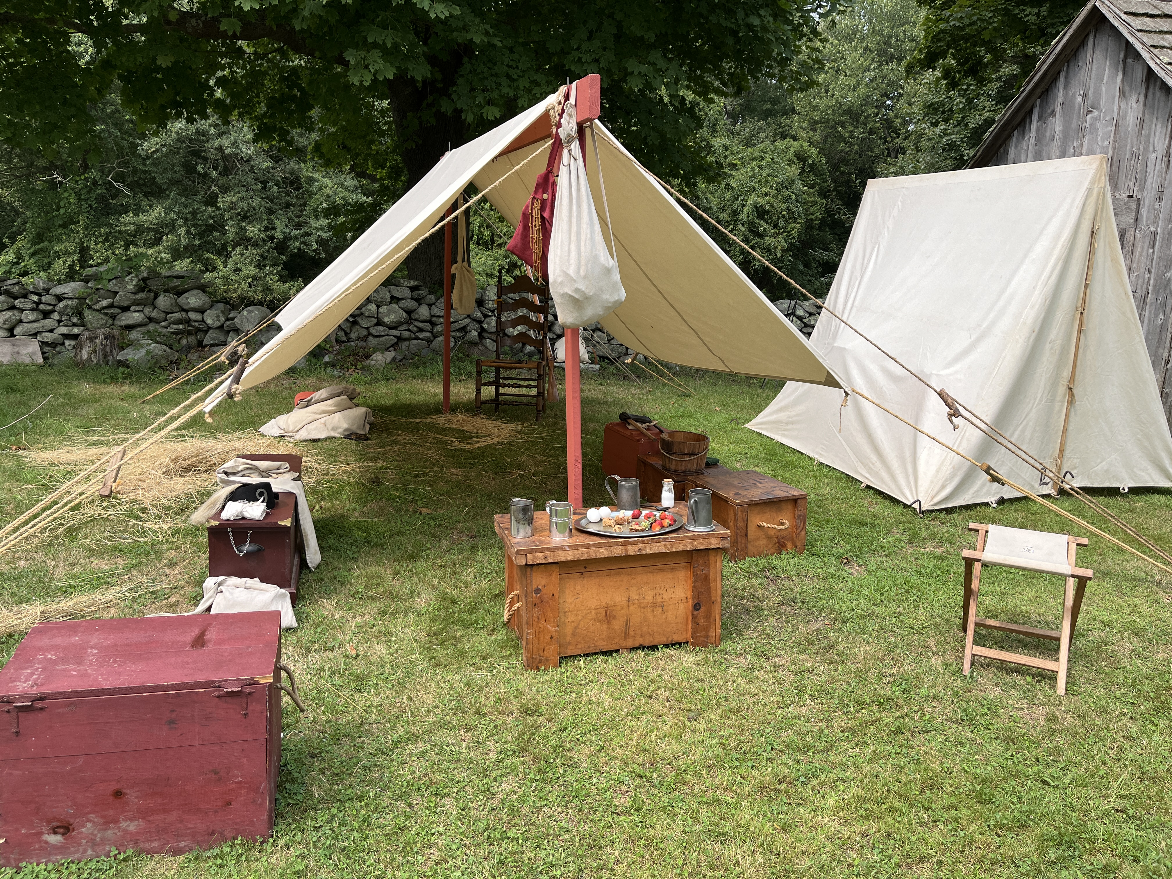
This weekend ( August 18) there is a loosely based re-enactment of Campbell’s Raids on Warren and Bristol. The lectures, demonstrations and battle scenes were interesting and well done.
I’m going through Elmhurst memorabilia as I prepare for a special program at the Portsmouth Historical Society on September 8th – Going to School in Portsmouth. Each year my students worked on a different local research project.
What was it like to go to a one or two room school? In 2005 Elmhurst 3rd graders interviewed Portsmouth residents who had that experience. Here is a sample of some of the questions and answers from those interviews.
Interview of Mr. Douglas Wilkey Quaker Hill School and other schools in the district
What did you wear? They wore knickers that went right under the knee and socks that pulled up and folded at the end.
How many students were in your class? There were from 32 to 36 students in the class.
How many classrooms were in your school? There were three classrooms at Newtown School. There were two rooms at Quaker Hill School. Anthony School had ten rooms. Anne Hutchinson and Coggeshall had four classrooms.
How were kids punished? We were whacked with rulers.
Mrs. Joy Schuur went to Coggeshall School
What were your teachers like? The teachers were single and when they got married they weren’t teachers.
What subjects did you have? We had more music than you do. They didn’t have library or gym. They had math, spelling and language.
What kind of holidays did you have? We had no spring break. There was a long Christmas and Easter break.
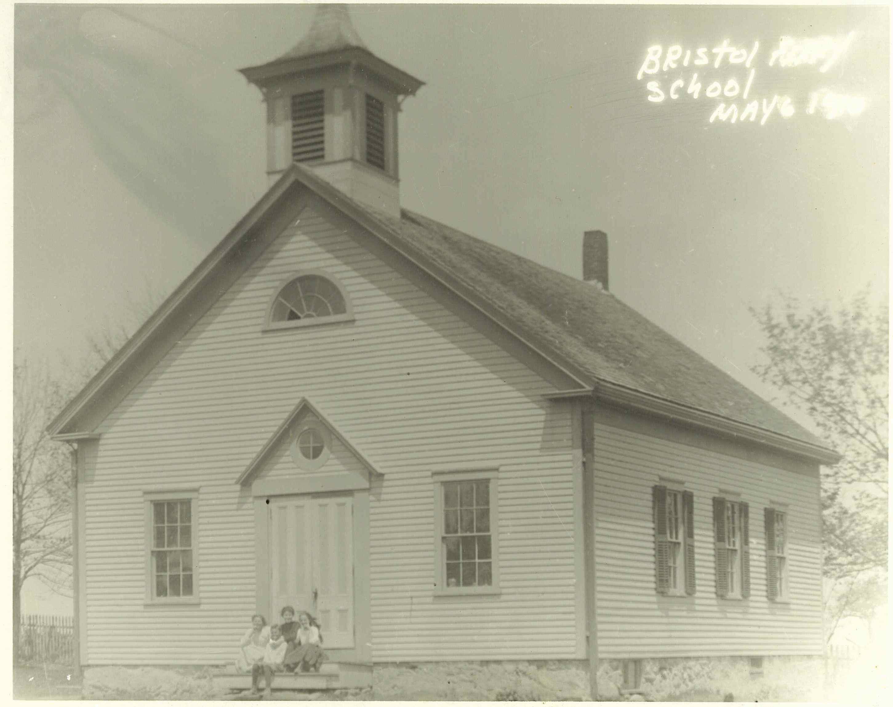
Miss Fay and Mrs. Powers went to Bristol Ferry School
What games did play at recess? We played hopscotch, jump rope and jacks. They had a morning recess which was fifteen minutes and afternoon recess after lunch which was an hour long.
How many grades were in your school? They had grade one to grade eight.
What did you wear to school? Girls wore dresses and cotton stockings. Boys wore pants or knickers.
What was the discipline like? If you got in trouble you would get sent out of the room, sent to the principal’s office or had to sit in the corner. The first thing they would do was have you sit in front.
What were the bathroom’s like? There was one outhouse.
Mrs. Wilkey went to Newtown School Some information the students learned.
Newtown School had three classrooms. The oldest students might have been 16 years old. They had spelling bees and Mrs. Wilkey did well. They had an art teacher and a music teacher, but no library or physical education class. Ten or twelve students might not pass on to the next grade. Girls were not allowed to play team sports. If students were bad, the principal would call the parents and they were in trouble at home.