Home

Portsmouth Neighborhoods: Bristol Ferry/Commons – Colonial Days

Leave a comment

As the Portsmouth founders moved away from the settlements around the Town Pond, Common Fence and Founder’s Brook, the Bristol Ferry community to the northwest began to develop. In the 1930s, Portsmouth historian Edward West did some remarkable work with land evidence. Among his works are the Land Grant Maps that tell us where the early settlers were given land. How he worked through all the locations with rods as measurements, we will never know. West tells us that upon founding the town “they immediately made laws governing the size and location of the house lots.” They began recording property in a book. There were times when land transferred without records, so the accuracy of the land evidence may be questionable in some cases. West illustrates the grants and town plan with his maps. Some of the first grants given were in the Bristol Ferry area.  As the town was laid out, Sprague Street was the southernmost border.  Land grants were given out in 1657, 1693 and the last lands were given out in 1713.  By 1713 the commons were laid out, highways were straightened and the town was considered finished as laid out from Sprague Street northward. As the Portsmouth population spread to the north and west of Town Pond, the town fathers and surveyors thought they had finished laying out the town.
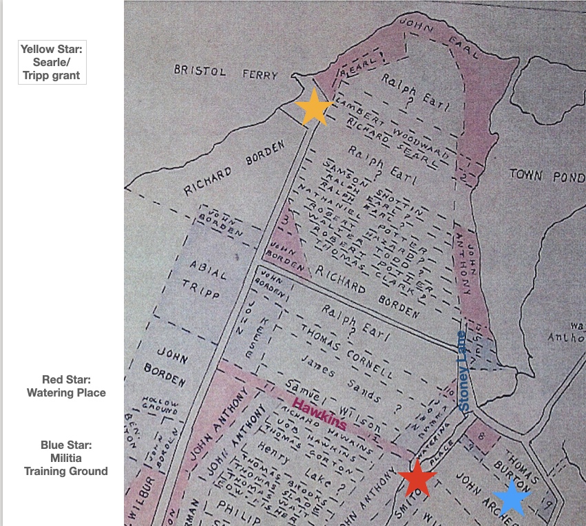
The first street to the right was “Stoney Lane.”  It was a short “driftway” (a path used to drive cattle or sheep) between Richard Borden’s property and that of Mistress Harts.  South of that was a lane that led to a “watering place” now called Founder’s Brook. On the map it is called Hawkins Lane for Richard Hawkins and his wife Jane who was a friend of Anne Hutchinson. This “watering place” was laid out in 1713 as a public place for the washing of sheep and general water uses.  Also in 1713 Thomas Burton received a piece of land that was known as the “Training Place” before that.  That ground may be where the militia had trained.

Waiting for the Ferry

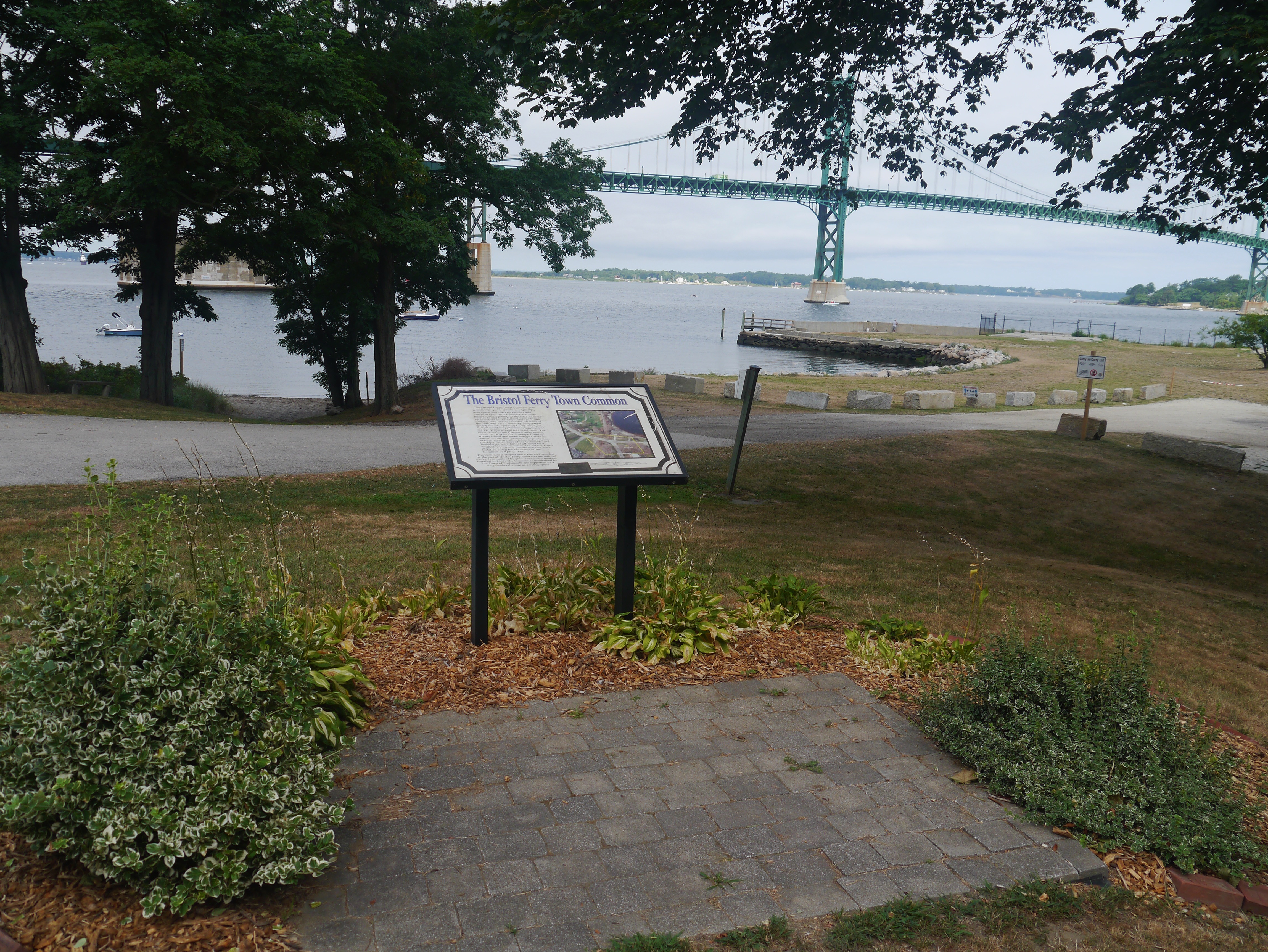
The tip of the Bristol Ferry area developed commercial businesses like taverns and shops that catered to those using the ferry. Ferries were more informal at the beginning. Those with boats provided a service to passengers and goods that needed to be transported to the mainline at Bristol. This is the site of a town common dating back to 1714. Ferry service started here in 1640. This 1.5 acre space was originally used by farmers and others to keep their livestock and other goods while waiting for the ferry to Bristol. The Bristol Ferry area had a British fort during the occupation. This area was the transportation hub for Aquidneck Island (Rhode Island) and there are records of George Washington passing through here after visiting with General Rochambeau in 1781. The French and Americans would make the start of their long journey to victory at Yorktown through Bristol Ferry.

A Bristol Ferry story

Just above the Bristol Ferry is the 3 acre lot that Richard Searle sold to Mary Paine.  Mary was a bar-maid at Baulston’s public house.  Searl exchanged his lot for a pint of wine.  He didn’t give Mary a deed, but the town council ratified the sale on the testimony of a witness in 1666.  Mary later married John Tripp and that piece of land became the site of his ferry house.
Recommended Reading

 West, Edward. Rhode Island Historical Society Journal in July of 1932 (The Lands of Portsmouth, R. I., and a Glimpse of Its People).
Pocasset, the First Neighborhood

1 Comment

Founded on the Compact.

The original settlers of Portsmouth were dissenters with Anne Hutchinson fleeing from Boston’s church rule. Portsmouth’s town seal proclaims “Founded on the Compact 1638.” Through the Compact twenty three men and their families agreed to form a secular government. Will and Edward Hutchinson (Anne’s son) traveled to Providence to Roger Williams who arranged a meeting with Narragansett Sachems Miantonomo and Canonicus. On March 24th they gave the sachems “a gratuity” of forty fathoms of white wampum beads, ten coats, and twenty hoes. The Narragansett removed themselves from the island, but selling land was not a concept in their culture. To the English settlers, this was a sale.

Pocasset Settlement

When they journeyed to Aquidneck Island, the Island was a wilderness and shelter was a big concern. They crawled into caves around the banks of the cove (Town Pond) where they landed. They followed the native’s example by bending birches into house frames, using mud for walls and weaving twigs to make a thatched roof.  When the group of founders began their settlement, they called it “Pocasset.” It is an Algonquian word that refers to the width of the river, but it is also the name of the Pocasset Wampanoag Tribe of the Pokanoket Nation whose land included Tiverton and much of Southeastern Massachusetts..

Re-named Portsmouth

On May 12, 1639 the settlement’s name was changed to Portsmouth. The settlement of Pocasset/Portsmouth included the area around the Montaup Country Club, Town Pond, Founder’s Brook and south to Portsmouth Park. At this time the founders located their houses on small lots around water sources like springs and brooks. They were frightened by the sound of the wolves roaming around the camp.  This was a major threat because livestock was unprotected. They brought with them horses, cows, sheep and hogs. While Anne Hutchinson and the others walked from Boston the animals were brought by ship around Cape Cod.  With the aid of Roger Williams, members of the Narragansett tribe came and laid traps to kill the wolves. The settlers decided to make a Common Fence.  Five rails with no more than three inches between each rail was judged sufficient to keep out predators.  The first fence was built around the common pasture for the whole town and we know that today as Common Fence Point.

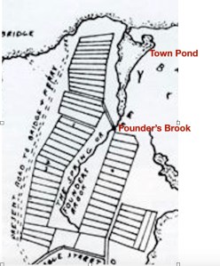
They were given land on the provision that they must built homes within a year. Town Pond was in the middle of activity. There were two springs that provided water – one was to the right of Town Pond near the Common Fence that held their animals. The other was by Founder’s Brook and that provided a central gathering spot and washing area. Baulston’s Tavern was located at the southern tip of the Pond. The Training Ground was across the way by the brook.

It wasn’t long before most of these settlers sold their house lots and moved out to their farm land grants. Town Pond and Founder’s Brook are worthwhile visiting today. The murmur of the brook and the bronze copy of the Compact at Founder’s Brook reminds us of the primitive life of the early settlers and their intention to band together as a political body. Town Pond can be viewed from a half mile hiking trail. The Pond has been restored to a tidal estuary, and you can imagine the scene as the founding families first stepped on Portsmouth ground.

Recommended reading: John Barry’s book on Roger Williams and the Creation of the American Soul.

Roger Williams played a great roll in the founding of Portsmouth.

Common Fence Point: A History

Leave a comment

Some places in Portsmouth have changed names over the years, but Common Fence Point was the name used in 1638 and it is the name used today.  A Borden family genealogy gives us the root cause for the name: “To the northeast of the spring a neck of land extends about two miles, which was nearly separated by creeks, marshes and the town pond from the rest of the island.  This strip of land, called by the natives Pocasset Neck, was set off by the settlers as a common by running a fence from the south end of the pond to a cove on the east side of the island. This common was called the fence common, to distinguish it from the lands outside to the south and west of it, which were all common; and the north point then received the name of common fence point. “(1)

The original settlement of Portsmouth took a pattern that was familiar to the English – homes were in a central village location and their animals grazed on common land around the homesteads.  Recording how each family branded their animals was very important with their stock intermingled in the commons. While this may have been a good pattern the first year when they needed to be close together for safety, this land use soon gave way to larger scattered farm lots which included their homes.

The 1849 Hammett Map shows Abner Chace holding Common Fence Point and the Chace (or Chase) family seemed to own pieces of the Point for many years.  In 1865  a charter was granted to several men to build and operate the Rhode Island Oil and Guano Company on Common Fence Point.

Edward West map of original settlers.

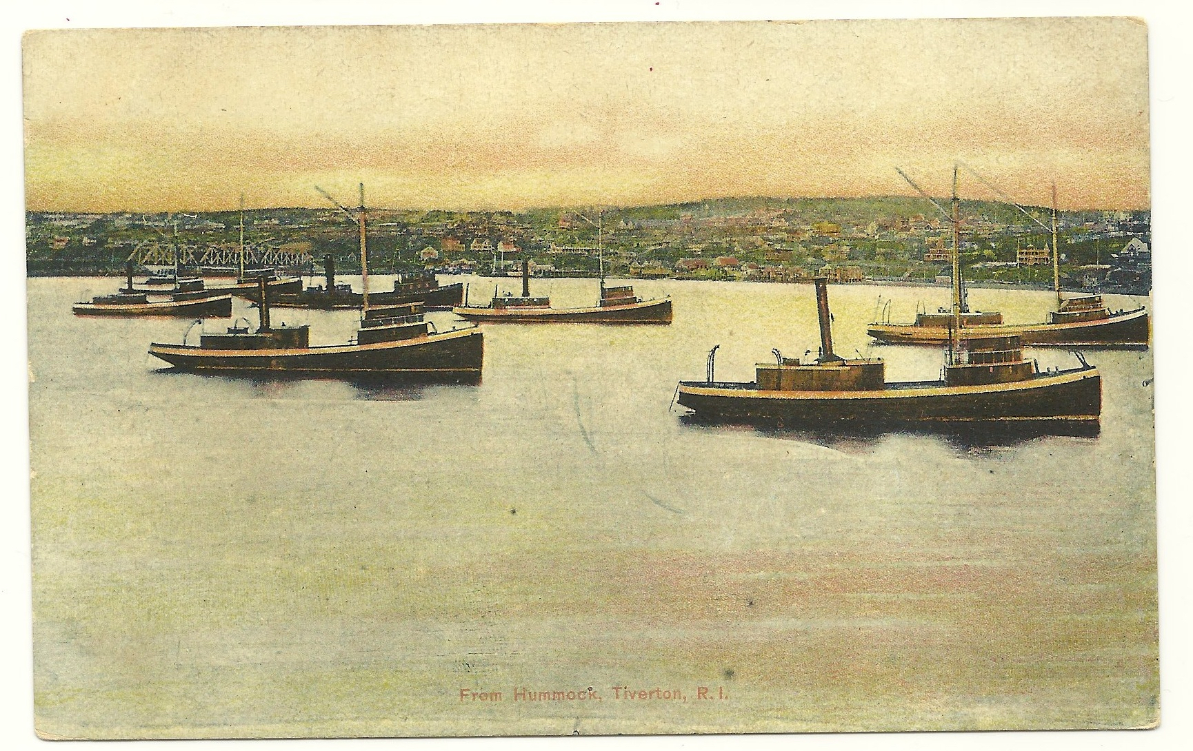
Pogy boats
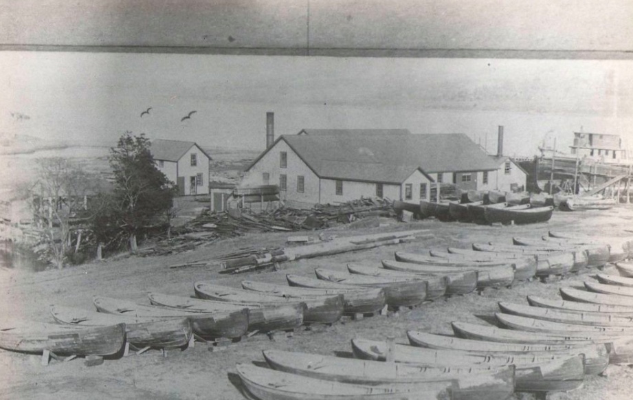
By 1900 part of Common Fence Point held the largest fish factory in the country.  The Tiverton based Church Brothers – Daniel, Nathaniel, Joe, Jim, Isaac, Fisher and George went into business together in 1870.  They commissioned the Herreshoff boatyard in Bristol to build the first fishing steamer – the Seven Brothers.  At first they were fishing for food, but they realized that fish oil and fertilizer from the pogy fish (menhaden)  had potential for profit.  They brought a menhaden processing factory in Maine, dismantled it and rebuilt it on Common Fence Point. The complex cookhouse was 35 ft square and there were two large dinning rooms to feed three hundred workers.  A large building held sleeping quarters and a net mending area.  A cooper made barrels for transporting the oil and there were boat shops.  The Church Brothers Fisheries barn burned in 1928 and that was the last of the Church facilities on Common Fence Point.

Common Fence Point gradually developed into a community.  At first many of the houses served as summer homes, but they gradually became occupied year round.  The Common Fence Point Improvement Association has been active in the community since he 1950s and continues to serve the residents of Common Fence Point with music programs, classes, activities for children and as an Arts Center.

(1) Historical and Genealogical Record of the Descendants as Far as Known of Richard and Joan Borden, who Settled in Portsmouth, Rhode Island, May, 1638: With Historical and Biographical Sketches of Some of Their Descendants H.B. Weld, 1899

(2) The Descendants of Thomas Durfee of Portsmouth RI-Vol. 1, by Wm. Reed.  1902.

(3) Genealogical Records of the Descendants of Thomas Brownell compiled by George Brownell, New York, 1910.

Portsmouth Neighborhoods

Leave a comment

What’s the story of Portsmouth’s various neighborhoods? Over the winter I will be gradually exploring our communities. What history happened here? Who are people of note who lived here? What can you see of the past and what recreations can you enjoy today?

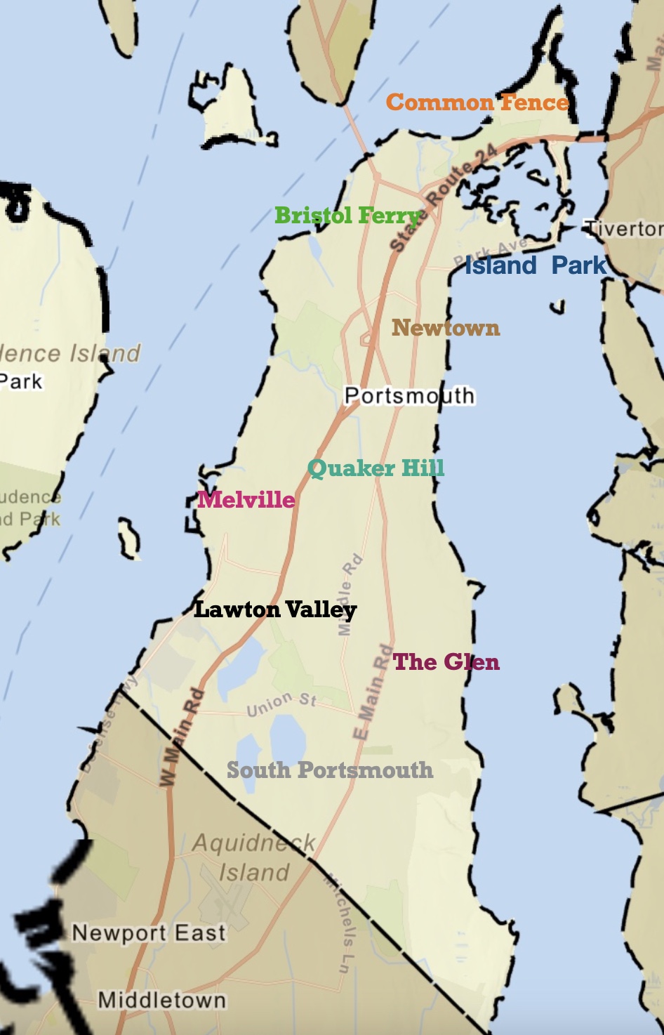
Portsmouth has never had a central “downtown” area like most communities. The original settlers tried to create a traditional town with residences clustered together and farm lots further away, but that is not what the settlers wanted.

Original settlements centered around Common Fence and Town Pond. They opted to live spread out on their farmlands. So Portsmouth developed neighborhoods instead of a central town.

Some of those neighborhoods centered around the ferry landings – Bristol Ferry Road and Glen Street heading to the Fogland Ferry.

The Glen area of Portsmouth featured the grand Taylor family Glen Farm.

South Portsmouth featured large “Gentlemen’s Farms.”

Quaker Hill and Middle Road took on importance as a central spot with Town Hall and the Quaker Meeting House.

The Melville area took on importance when the military claimed most of the Westside of town.

Lawton’s Valley – Wading River was the home of Julia Ward Howe and the site of the mysterious death of Rebecca Cornell.

Newtown was a planned central downtown, but it never seemed to reach its promise. The location along East Main Road, however, made it somewhat a commercial and social area with churches, the library and businesses.

Island Park was created as a summer resort and Park Avenue – on the way to the Stone Bridge and Ferry, was as close to a “downtown” as Portsmouth ever would experience.

“Saving the Blood of a Large Number of Brave Men”: A French description of Joint French and American War Games 1780

Leave a comment

In earlier blogs I wrote about a war game or “sham battle” described in the letter of an American doctor (John Goddard) to a colleague. This battle was on October 2, 1780, but there are also descriptions of later mock battles or skirmishes on October 8th and October 11th of 1780. Louis Bertrand Dupont d’Aubevouede Lauberdiere kept a Journal of his experience in the American Revolutionary War. Through the work of Norman Desmarais, we have an English translation – The French Campaigns in the American Revolution, 1780-1783: The Diary of Count of Lauberdiere, General Rochambeau’s Nephew and Aide-De-Camp.

We know through a brief Providence newspaper account that another “battle” occurred on October 8th. Lauberdiere described the battle as being “on the eighth.” In his diary he mentions yet a third of these war games on October 11th. There are some similarities of the mock battle descriptions in both the American and French accounts.

From Lauberdiere’s diary:

“May our comrades arrive soon and draw us out of the somber tranquility in which we live. The soldiers under canvas (tents) want to see the enemy, want to hear the cannon. In the absence of the British, Mr. De Rochambeau created some and, on the eighth he drilled the army on the point where the real enemy might land. We pretended that a fleet entered our harbor and planned a landing.” ( Road to Yorktown.” page 40-41).

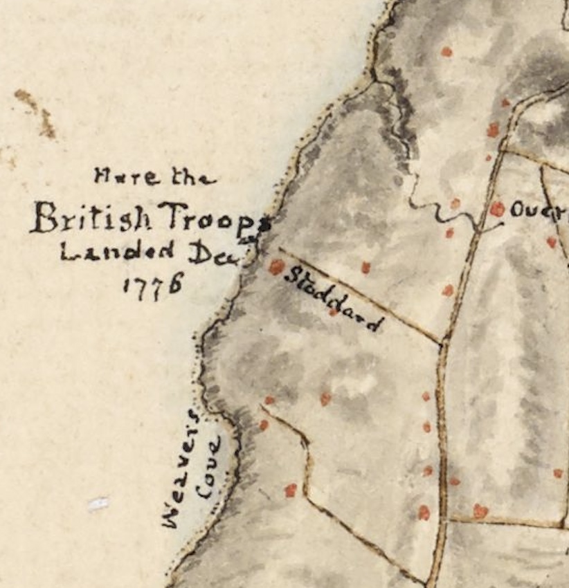
The British ships had been seen near Newport waters and the expectation was that they would invade. Rochambeau picked the location of the British invasion in 1776 as the site for the battle. The diary calls the location “Stauder’s House,” but the actual name was Stoddard. British maps label this location. close to the Middletown – Portsmouth border, as the landing site of the British.

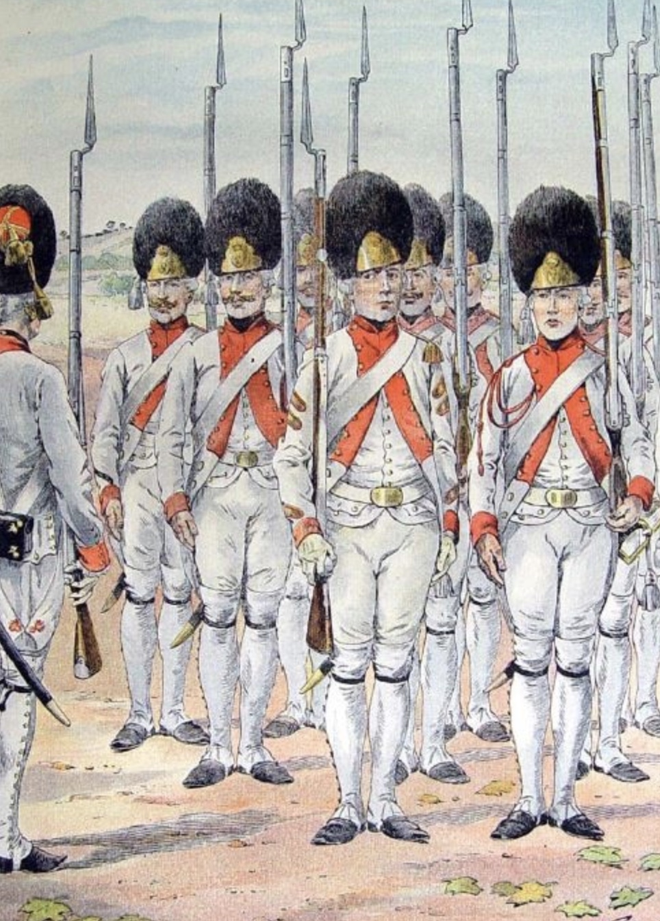
“We put 1500 men under the command of the Viscount de Viomenil who was at Stauder’s house. It was there that our enemies first began to take possession of a few houses along the shore. Mr. De Rochambeau kept the rest of the troops with him for the imminent attack to which he joined the American Rhode Island Regiment commanded by Co. (Christopher) Greene. These troops were divided into two column. Mr. De Rochambeau personally led the left column. The Baron de Viomenil commanded the right. The grenadiers and light infantry battalions formed a separate one.”

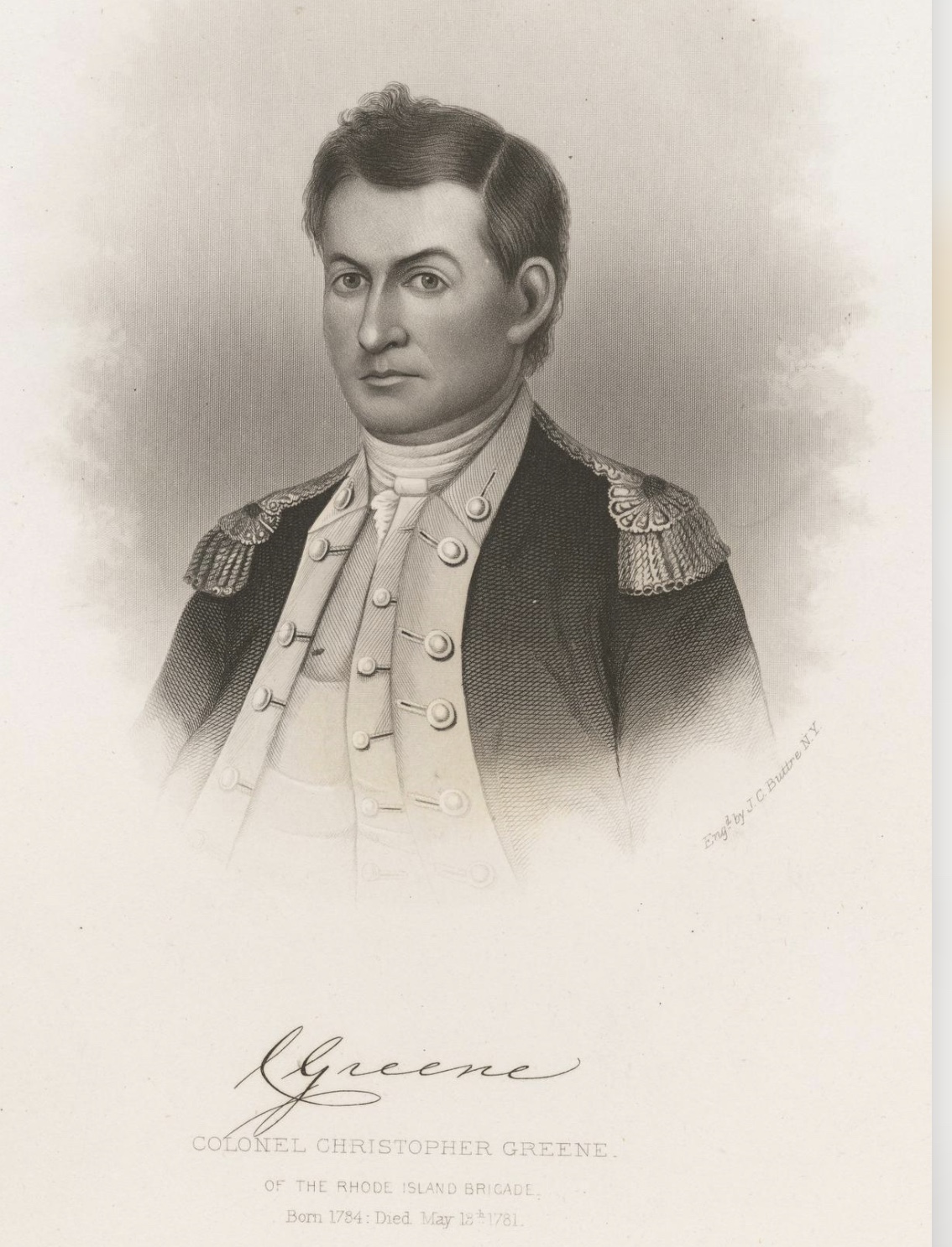
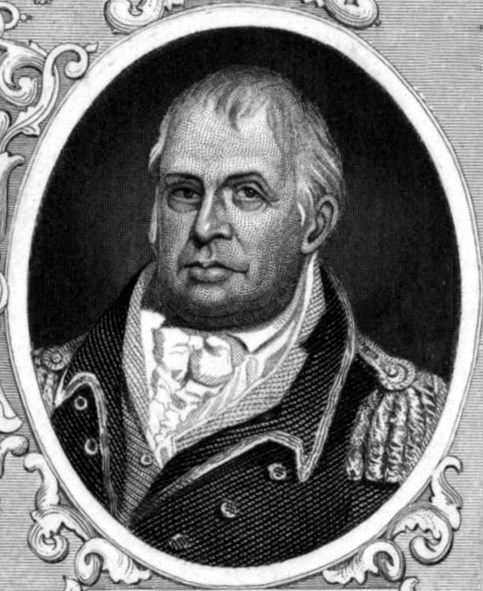
In Goddard’s account of the October 2nd mock battle, the American forces, the Rhode Island First Regiment (the Black Regiment), under Col. Christopher Greene, took part in the drill. The French Army did have drills between their own men and some of those may have been in the Third Beach area of Middletown. This drill on the eighth of October was also a drill of combined forces of the Americans and their French allies.

Col. Christopher Greene

“The attack began with several discharges of cannon, well-executed to create a complete effect of the fictitious enemy leaving their boats and forming quickly. At the same time, the column of grenadiers advanced to dislodge the enemy from the houses as they began to establish themselves there. During this musket fire, the Baron de Viomenil turned their right under the protection of a hill which concealed his movement. When he was ready and the attack was fully engaged, Mr. De Rochambeau had the charge sounded. Everything advanced in good order. The enemy disappeared and reassembled on the seashore.”

An Accident Happens: Lauberdiere’s diary:

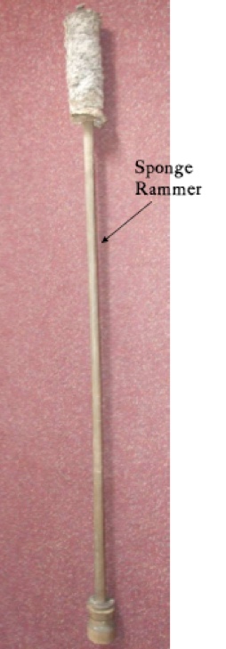
“An accident occurred during this drill. A cannoneer cleaning a piece lost an arm by the sponge. The one who was aiming it had neglected to cover the touchhole with his thumb. An ember remaining from the preceding shot ignited and the charge caught fire.”

During the Revolutionary War a sponge head was used to extinguish embers from the previous firing. The sponge was part of a sponge-rammer tool that pushed the round into the barrel. The sponge head was dipped in water and run down the barrel to quench any embers left over.

Lauberdiere continued:

“Other accidents might have also happened, always caused by the cannon. Many of our navy officers who wanted to witness this drill rented horses. They were usually poor horsemen and wanted to remove all doubt, as three or four were thrown on the ground with each cannon shot.”

It appears there was an audience for the October 8th battle as well as the one described in Goddard’s account of the one on October 2nd.

The diary goes on to describe another drill, this one on the 11th of October:

“Mr. The Count de Rochambeau had the same drill at the point of Stauder’s house on the 11th, just as on the eighth. It was not executed with enough precision or vivacity. It’s on when we are outside the lines and near the one giving orders that we can see the mistakes and know how important it is to have well-informed officers and experienced soldiers. The former understand the orders they receive more easily with experience. In the election, the latter are more prompt, often foresee the objectives and march with greater assurance.”

Lauberdiere’s diary gives an insight into the value of these drills.

“A skirmish is an image of a real battle when it is well conceived and it is also educational. The only real difference, I think, is saving the blood of a large number of brave men. Our general, then, could not make better use of the leisure time which the English gave or to which our small number reduced us, than to accustom his soldiers to the sound of the musket and the cannon to teach them to march without fear especially on the land where they would really fight if the enemy appeared.” (page 46)

Digging in: Information from Robert Selig’s work on the French at Butts Hill

Leave a comment

The Battle of Rhode Island Association has sponsored valuable research on the construction of Butts Hill Fort by Robert Selig and John K. Robertson. I am just now getting around to digesting the reports as I work on a timeline of what happened at the fort during the “Camp Butts Hill” period of 1780 to 1781. This is the first in a series of “Digging In” to the research. Today I am doing a close reading of Robert Selig’s article “Rochambeau’s Engineers at Butts Hill Fort July 1780 to June 1781.” The article appears in the Battle of Rhode Island website – battleofrhodeisland.org.

When the French arrived on Aquidneck Island, they found that work was being done on Butts Hill Fort. Selig writes about a diary entry of Ervoil d’Oyré. Describing the defensive works, he found upon arrival in Newport in July 1780:
“Finally, the works built by the Americans on the north of the island were re-established and repaired to assure communication with the continent.”

Selig writes about the French intentions on Aquidneck Island in their early days on the island.

“Prior to the arrival of Rochambeau’s forces in Rhode Island in mid-July 1780, Butts Hill Fort ‘was the only fort active on the north end of the island.’ As Rochambeau set up defenses against the anticipated and feared British attack, he sought to strengthen Butts Hill Fort to block any access from the north. Earthworks had been set up earlier in the war and repairs and additions were made by Massachusetts State troops, but French engineers almost immediately provided the expertise that the Americans lacked.”

Selig goes on to say that on the 9th of July, 21 British ships were seen near Newport Harbor. .

“The next morning Rochambeau accelerated the construction of defensive works, not only around Newport but at Butts Hill Fort as well. An entry in the journal of Major Marius de Palys’s Journal de Campagne, mentions the redoubts at Howlands Ferry and Butts Hill Fort.

” ‘Eight days had elapsed since the commencement of the work, and no thought had yet been given to fortifying the point of the island which should have 1st thought of. This is the point of Howlands Ferry, and Monsieur de La Fayette decided to occupy it better than it was at the time. There were two bad redoubts, which were connected and formed into a respectable fort, which had not been finished, the fort and another in the shape of a star, which protected the ferry together with a battery on the mainland assured communication with the mainland, which was essential for relief or retreat in case of misfortune.'”

Palys’s Journal continued: “Eight days had elapsed since the commencement of the work.”

That would place the date of the beginning of the work to around 28 or 29 July 1780. Selig tells us that La Fayette spent ten days in Newport from the evening of 24 July to late afternoon 3 August 1780. In a letter to General George Washington, dated “Newport july the 26th at seven o’clock P.M.,” he informed Washington that he “could not help advising him [i.e., Rochambeau] very Strongly and very often to erect works and keep a communication oppenn’d with the Continent By Howland’s Ferry or Bristol Point. That matter will I hope be attended to in the Course of the next day.”

When I started researching Butt Hill Fort, I found several orderly books from Massachusetts militias who were at the fort. I imagined a few French engineers supervising the American workers. Reading through Selig’s translation of a French orderly book gives me a different image. There was a constant French presence at the fort with a five day rotation of men from Soissonnois, Santonge, Royal Deux Ponts, and Bourbonnais. Every five days a new detachment would leave Newport at 7 AM. “This detachment will march with arms and baggage to Butts Hill Fort near Howland’s Ferry to work there as directed to them by the engineer who will be there. They will take with them cooking pots, mess tins, asks, and provisions for five days …The captain who will command the detachment order to work at Butts Hill Fort, a mile from Howland’s Ferry, will keep his soldiers in good order and discipline, he will order each day one corporal and four men as guards, and will not allow more than one cook to be employed per regiment in order to keep as few men as possible from the work.” (Order of 9 December 1780).

The orders of December 28, 1780 provide the duties of the French troops -“for the security of the post, the police of the guard, and the preservation of the fort’s works,” The detachment takes orders from Monseur de Palisse, Major of the Royal Corp of Engineers and from Monsieur Planchard.

The French Orderly book lists orders from December 23, 1780 to June 7, 1781. French forces left Aquidneck Island to travel south in June of 1781. The road to Yorktown began with Aquidneck IsIand. On their way to Bristol Ferry the French army would pass nearby the fort they had been working to build.

Preparing for a Visit of Rochambeau to Butt’s Hill

Leave a comment

Did Rochambeau visit Butts Hill? In a letter dated August 2, 1780 from Newport, Lafayette wrote to American General William Heath about how to prepare for Rochambeau’s visit.

General William Heath

“On my coming into the town, I found that Count de Rochambeau was going to Butts Hill, and you easily guess that I did not like the plan. Our works are so disordered, and his dependence upon them so great, our tools, Boats &c. are in such a situation that I wanted some time to put it in a Better train.”

At this time the French are based on Aquidneck Island. There is an expectation that the British will again try to attack and occupy the island. Butts Hill is seen as a natural location to fortify as a prime spot to communicate with the mainland at Tiverton and Bristol. The French engineers and masons are working to turn fortifications left by the British and Americans into an actual fort. American militia soldiers under General Heath and the Rhode Island First Regiment (the Black Regiment) are aiding in the physical effort to complete the fortifications. The situation at what they call “Camp Butts Hill” is difficult. After three years of British occupation, basic resources like wood for fuel, water and food are lacking.

Lafayette goes on in the letter to encourage Heath and his men.

“From what you told me, my dear friend, I don’t doubt but that the thousand men with thousand tools will be tomorrow morning at work, and think they ought to Begin very early.”

Lafayette suggested ways Heath could prepare for Rochambeau’s visit. The boats should be gathered and men should be working to repair them. Fascines (bundles of sticks for fort construction) and cannons should be ready and guarded.

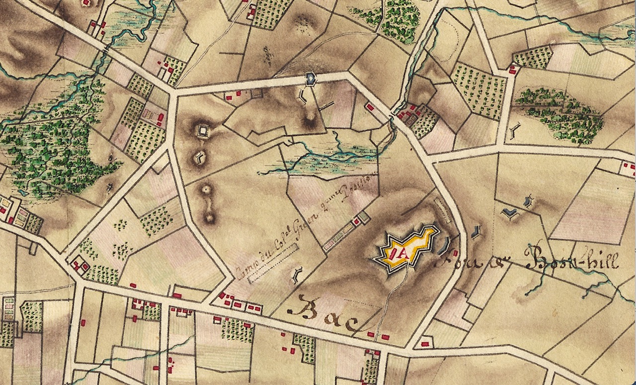
“As to the picquets I think we might have one of the Nigros upon the Road…” Picquets are “a soldier, or small unit of soldiers, placed on a defensive line forward of a friendly position to provide timely warning and screening against an enemy advance.” The “Nigros” Lafayette refers to would be from the Black Regiment (Rhode Island First Regiment) commanded by Col. Christopher Greene. Their camp is pictured next to Butts Hill in the Berthier maps of 1780. Greene’s men were Continentals and had been well trained. The militia, on the other hand, were volunteers that served three to six months and then went back to their homes.

“I believe we ought not to go through the militia Camp, but meet you at the fort with some of their officers to introduce to the count.” The barebones conditions at “Camp Butts Hill” were not something Lafayette wanted Rochambeau to see.

Berthier Map. Note Outline of Butts Hill Fort and location of Col. Greene’s men at Camp Butts Hill.

“Don’t you think, my dear Sir, that we ought to put every thing in a good train as to the tools, workmen &c. against the time the Count will come

The code word for the day would be “Boston.” Lafayette gives us a glimpse of their procedures. “When people are coming from without you know the Centry must say “Who is there,” and upon answering ‘friend’ the centry says ‘advance one’ and the Corporal comes immediately to Reconnoitre.’ Will send Mr Washington, and upon the Corporal’s telling advance, I think we ought to learn our men how to present properly their arms to Count de Rochambeau.”

A footnote explains that “Mr. Washington” is George Augustin Washington, Lafayette’s aide de camp.

The next day Lafayette writes again to Heath. “Count de Rochambeau will be with you between four and five this evening.” (Newport, August 3, 1780 – Lafayette to Heath.). I will look for more letters or orderly reports that will confirm that Rochambeau did visit the fort and what that visit might have been like.

Resources:

Idzerda, Stanley, Editor. Lafayette in the Age of the American Revolution. Selected Letters and Papers 1776-1790. Volume 3.

Lost Portsmouth: Elmhurst Academy of the Sacred Heart

Leave a comment

Lost Portsmouth: Mott House

1 Comment

Adam Mott was one of the first settlers in Portsmouth. In 1639 he was given a land grant of 100 (some sources say 145) acres on West Road, on the south side of Cory’s Lane. Land grants were given on the condition that a house be built on the land within a year. Adam may have built that house in 1640, but that was probably torn down to make way for son Jacob’s larger house between 1650 to 1675. Through the years additions were made to the house, but evidence of the original structure remains. The land and house stayed in the Mott family until 1895 when it was purchased by the Benjamin Hall. In 1973 the property was slated for industrial development and historians, architects and archeologists looked for ways to preserve this unique house. The Mott house was one of the few late 17th century farmhouses with original woodwork and ironwork. The house was dismantled in 1973 with the idea of assembling it somewhere else. Unfortunately, the wood decayed and crumbled while in storage.

The Mott House was so valuable because it had very little in the way of improvements made through the years. If changes were made, what was the old was just covered up and not destroyed. When Benjamin Hall bought the property he had the intention of selling it for industrial purposes. Few improvements were made from the turn of the century through 1973. The Hall family rented the property out to immigrant families who had no resources to modernize the house. The owners didn’t invest in the house upkeep. Investigators trying to do an oral history of the house found that:

“Although the farmstead was still the scene of family life, it had become the site of a rural tenement for Portuguese immigrants. Very soon after they acquired the property in 1895, the new owners leased it to one “broker”family, which in turn rented out space in the house to other Portuguese families. During the crowded years of the twenties, as many as four families resided in the first and second stories of the house, while “greenhorns,” single men who had just arrived in Portsmouth, were boarded in the attic, sometimes as many as a dozen at a time.” The Mott Farm was considered a place to start on a better life for these immigrants.

“The owners demonstrated even less interest in the farmstead, except as a source of a rather small yearly income. This neglect has, in some ways, been a blessing to the archaeologist, as it is the major contributor to the Mott Farm’s time-capsule-like appearance.”

Quotes from Marley Brown, Ethnohistory Journal, Nov. 1, 1974. “The Use of Oral and Documentary Sources in Historical Archaeology: Ethnohistory at the Mott Farm.”

Most of the Mott land is part of Melville Park. One of the trails goes through an area close to the remnants of the cellars, but I could see little on a walk a few days ago. How the Mott property became Portsmouth Town property is still a mystery to me. I do know that as well meaning as the intention to take the house apart and re-assemble, it was a futile attempt to save the house. The disassembly, however led to meticulous notes and images to record the house and all the information of the craftsmanship within the house. The Mott house was as a newspaper account stated “Mott Farm: 300 years of history.” Another headline read: Mott Farm: 4-dimensional textbook. ”

East Bay Window, June 27-28, 1973

For more in depth discussions of what was found in the archaeology, visit the Roger William’s University site: https://docs.rwu.edu/anne_w_baker_collection/

Mary Payne Tripp: Swapping 3 acres for a pint of wine? Artificial Intelligence helps confirm the story.

1 Comment

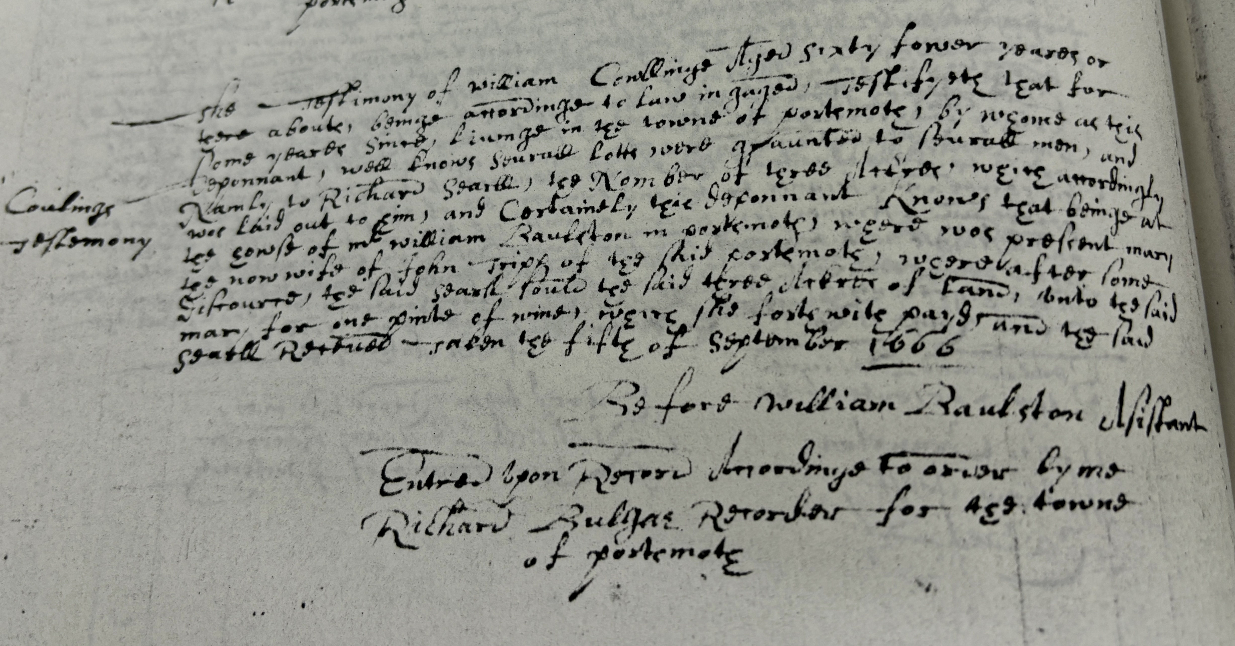
I recently shared the story of Mary Payne (Tripp) trading a 3 acre land grant for a pint of wine. One of the audience members questioned me about whether this was a just a story or really true. The story came from Portsmouth historian Edward West and I trusted his scholarship. He spent lots of time working with town records. I like to see the primary sources, so I began to look for confirmations. Tripp family genealogies gave me some clues of where to find the answers. One of these family histories said that the court of Commissions, on 8 Dec 1666, confirmed the sale. I wasn’t sure what the court of commissions was. Another family history stated that someone named Collings had testified in Mary’s behalf. A former Portsmouth Historical Society curator remembered seeing a transcription of Collings’ testimony in the society collection. The society’s collection has been re-organized and I wasn’t able to find it, but I knew it had to be somewhere. I went to the office of the Town Clerk to ask where I could find “Court of Commissions” records. A very helpful worker suggested that if a deed was involved, we could look for it in Land Evidence. We had a date and the name of who was granted a deed, so it was easy to find both the granting of the deed and the testimony of the witness.

I took images of the deed and now I needed to transcribe it. These Land Evidence books are photocopies, so legibility was difficult to begin with. Ancient forms of spellings and grammar make for difficult reading as well. While I had transcribed documents before, this seemed like quite a chore. I have seen a commercial touting artificial intelligence’s usefulness in transcribing old recipes. Well if AI can work on handwriting, maybe it could help me with transcription. I found an online transcription service and tried it. It wasn’t perfect, but I was helpful. Between what I can transcribe on my own and the suggestions of AI, I was able to get a general sense of the testimony.

There is confirmation of the story. Mary did get a deed for the property even though Searl left town without giving her the deed. Listening to the testimony of someone who was at the Tavern, the town gave the deed to Mary and her husband John Tripp more than twenty years later.

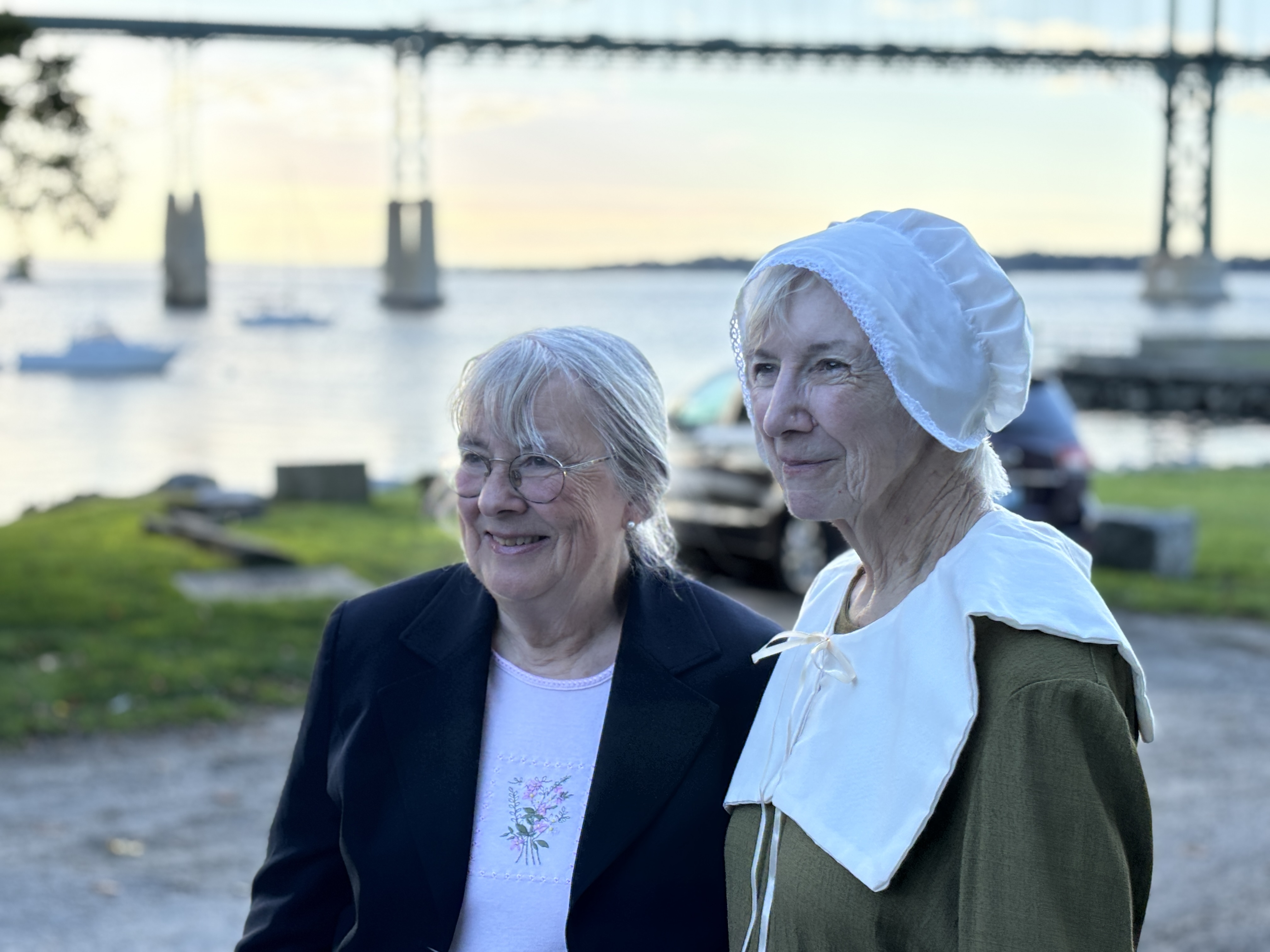
Left: 7th great granddaughter of Mary with Cindy Killavey who portrayed Mary.

Right: Record of William Collings testimony

Older Entries Newer Entries