Home

Lafayette in Rhode Island – First Visit 1778

Leave a comment

Lafayette’s stay in Rhode Island during the Siege of Newport and the Battle of Rhode Island in August of 1778 was just the first time the General came to our state. The second visit was to Newport in 1781 when he came to confer with Rochambeau. In 1784 he came to Rhode Island on a tour after the War for Independence was over. His last visit came during a grand tour of America in 1824. This blog will focus on the first visit.

In the summer of 1778 Lafayette brought a detachment of troops from General Washington to assist General Sullivan in the Rhode Island Campaign, a joint French and American effort to free Rhode Island (Aquidneck Island) from the British Occupation.

A letter Washington wrote from White Plains, New York, on July 22, 1778 contained the orders:

“Sir, You are to have the immediate command of that detachment from this army which consists of Glover’s and Varnum’s brigades and the detachment under the command of Colonel Henry Jackson. You are to march them by the best routes to Providence in the State of Rhode Island. When there, you are to subject yourself to the order of Major General Sullivan, who will have command of the expedition against Newport and the British and other troops on the islands adjacent.”

Lafayette reached Providence with 2,000 men on August 3rd or (August 4th according to other accounts). On their way, Lafayette and his men stayed by “Angell’s Tavern” in Scituate. There his men had a chance to wash and refresh themselves with the spring that became known as Lafayette’s Spring. On August 5th, Lafayette was aboard the French flagship Le Languedoc to meet with French commander d’Estaing. The French fleet was waiting off of Point Judith and d’Estaing provided Lafayette with the ship Provence to bring him back to Providence.

There is some documentation for where Lafayette stayed in Rhode Island at that time, and there are other homes that have “Lafayette Stayed Here” legends that have come down through time.

The American forces gathered in Tiverton, close to the Howland Ferry. By August 6, 1778, Lafayette and his troops had moved to Tiverton where he is said to have stayed at the Abraham Brown House on Main Road close to Lafayette Street. He is said to have occupied the northwest chamber on the second floor. This may have been before the move to Aquidneck Island or it may be that he stayed there after the retreat.

"Lafayette House" in Tiverton
“Lafayette House in Tiverton”

With the arrival of the French fleet, operations were set in motion. The British abandoned Butts Hill Fort and other strategic locations in northern Aquidneck Island. On August 10, 1778 Sullivan began crossing to the island and he moved into Butts Hill Fort and made it his headquarters. The diary of Rev. Manasseh Cutler who served as chaplain for General Titcomb’s Brigade, provides a few glimpses of what Lafayette and others were doing on the island before the Battle of Rhode Island. His entry for Sunday, August 16th, gives us one location of Lafayette’s quarters in Portsmouth.

“Went in the afternoon with a number of officers to view a garden near our quarters, belonging to one Mr. Bowler, – the finest by far I ever saw….” Cutler goes on to describe the garden. The last line in the diary entry reads, “The Marquis de la Fayette took quarters at this house.”
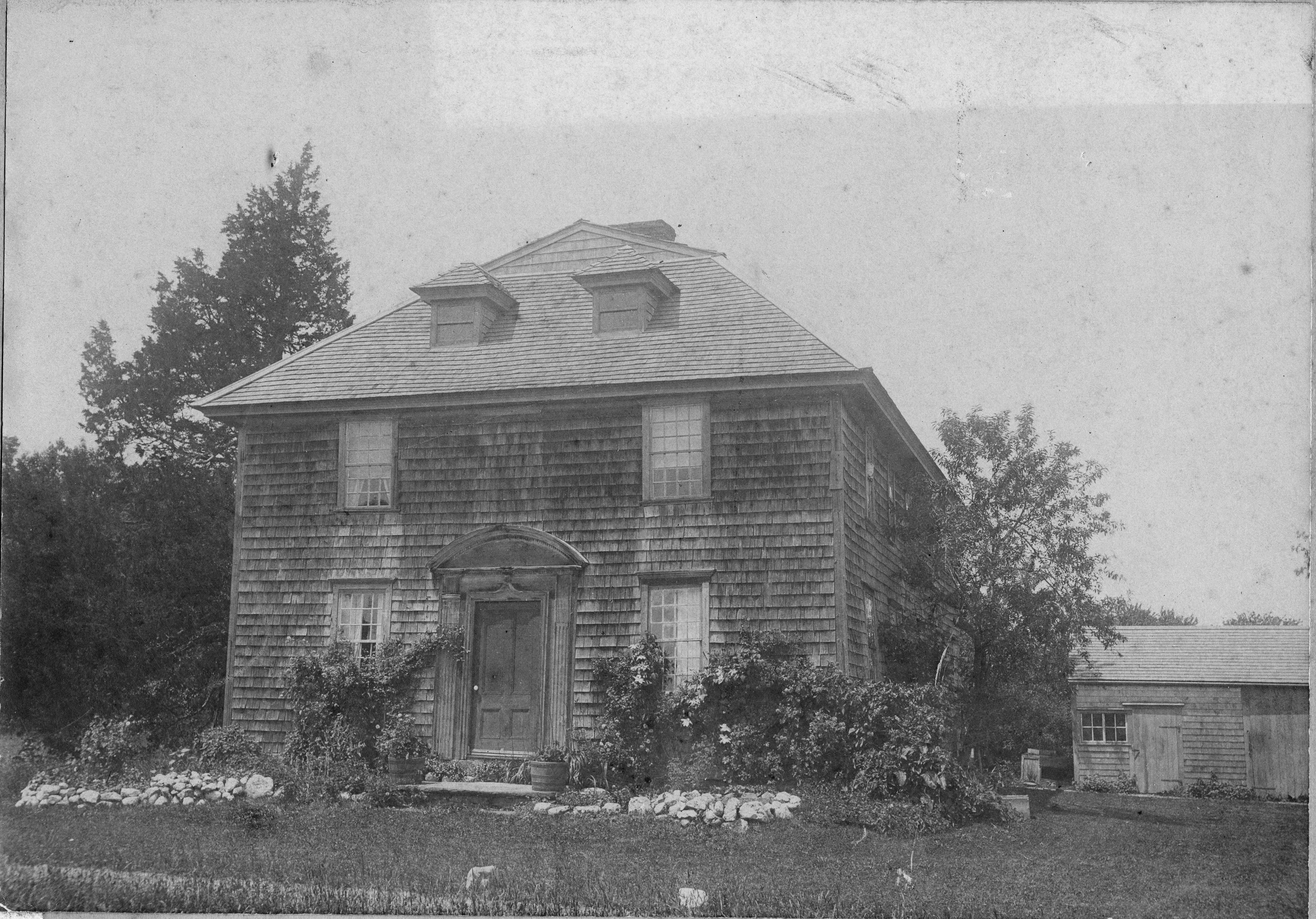
Metcalf Bowler House (now torn down)

Cutler’s entry for Monday the 17th also refers to the Marquis. The British had been firing since early in the morning and Cutler with General Titcomb had been observing the enemy lines from the top of a house. “stood by the Marquis when a cannon ball just passed us. Was pleased with his firmness.”

Metcalf Bowler’s estate has been torn down, but there are two homes in Portsmouth with “Lafayette” legends. One is the Dennis House on East Main Road and not far from Butts Hill Fort. The southeast room on the second floor has traditionally be associated with Lafayette. Lafayette has traditionally been associated with a house on Bristol Ferry Road (Bayles’ History of Newport County: p.665).
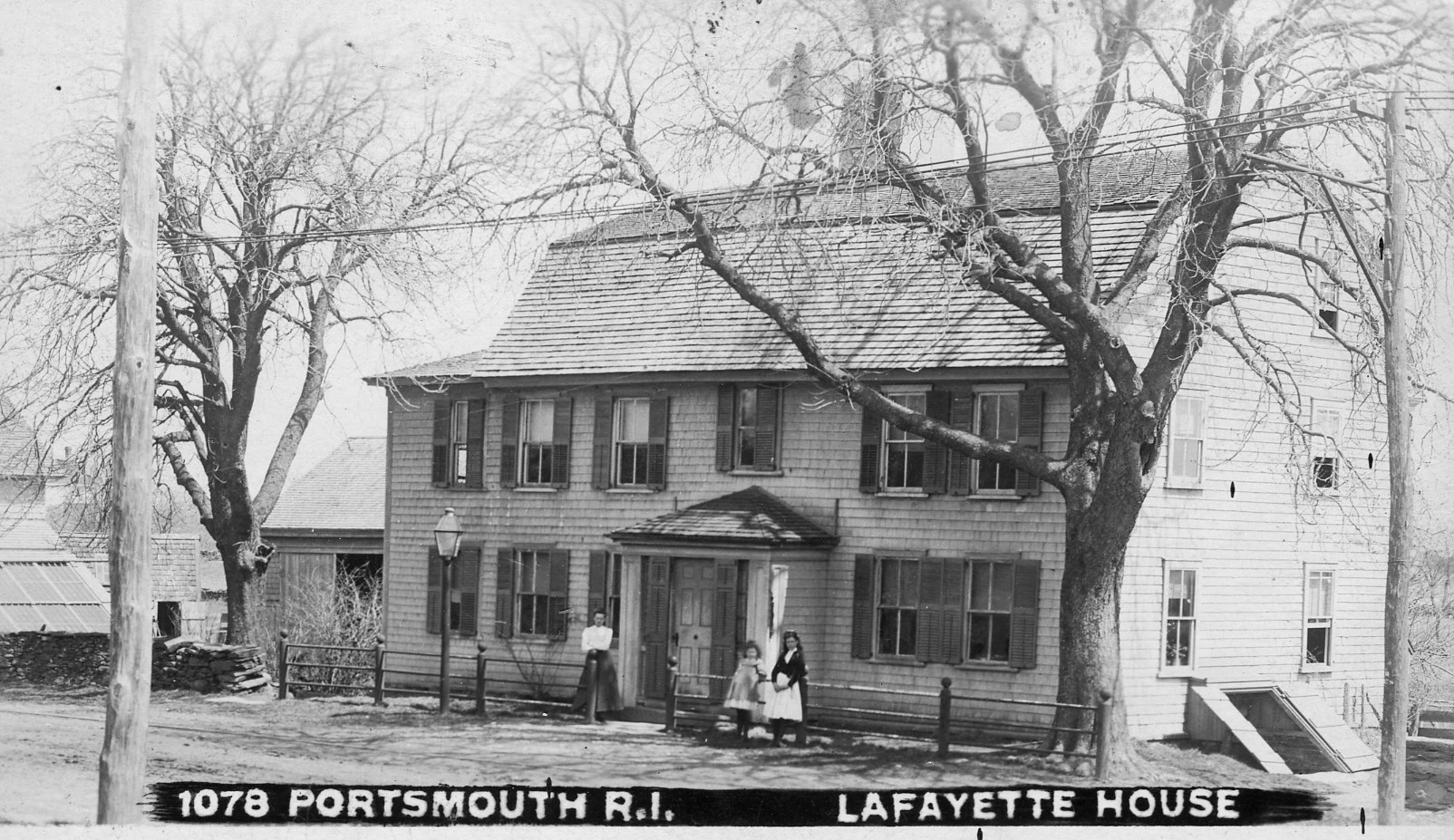
Dennis House, East Main Road, Portsmouth
Dennis House, Portsmouth

Although the American forces had moved onto Rhode Island (Aquidneck), the French forces were unable to move forward with their attack of Newport. Their ships were damaged in a storm and d’Estang decided to head to Boston for repairs on August 21st. The joint French and American plan was about to fail without the French aid. On August 28th, Lafayette made the six and a half hour trip to Boston to talk to d’Estaing. The mission was fruitless and on August 30th Lafayette rode back to Portsmouth in record time. He had missed the battle, but he took command of the rear guard to bring it safely across to Tiverton.

Israel Angell’s Diary notes that on September 1st General Varnum’s brigade in General Lafayette’s detachment passed by boat to Warren. The next day they were in Bristol where Lafayette made the Hope Street home of Joseph Reynolds his headquarters. A plaque on the house reads: This house built about the year 1698 by Joseph Reynolds was occupied by Lafayette as his headquarters September 1778 during the War of American Independence.” Lafayette’s room was the northwest chamber. The southwest room on the first floor was his dining room and office.
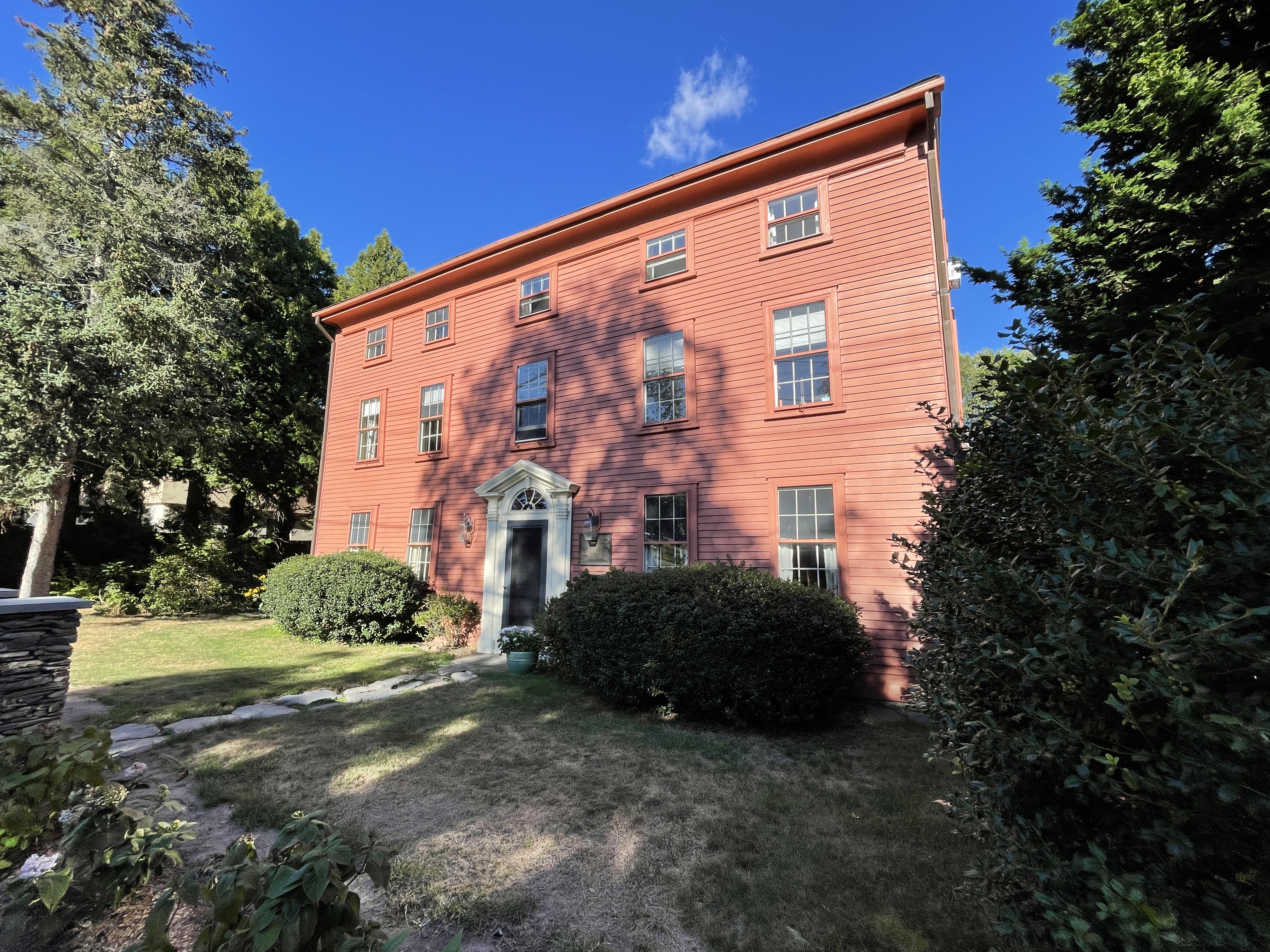
Reynold House today.
Reynolds House today

By September 18th Lafayette had moved on to Warren where the brigade encamped on Windmill Hill. Lafayette’s quarters were at Coles Tavern which has since burned down. On September 28th he was in Boston and on his way to Philadelphia on October 1st.

Lafayette would return to Rhode Island under more peaceful circumstances. More on those visits in our next blog.

References: This article was based on Preston’s 1926 article with added information from other sources.

Preston, Howard. “Lafayette’s Visits to Rhode Island.” Rhode Island Historical Society Collections. January 1, 1926.

Cutler’s Diary is found in Edwin Stone’s “Our French Allies.” This is an old book (1884, Providence) but it was a great help. It is available online through Google Books. https://www.google.com/books/edition/Our_French_Allies/YY8LAAAAIAAJ?hl=en&gbpv=1

Taylor, Erich A. O’D. Campaign on Rhode Island, 1930?

The Diary of Colonel Israel Angell Commanding Officer, 2nd Rhode Island Regiment, Continental Army
by Edward Field.

LaFayette Slept Here: Joseph Reynolds House in Bristol

1 Comment

After the Battle of Rhode Island in September of 1778, this stately home became the headquarters of the

Reynolds House – 956 Hope Street, Bristol, RI

Marquis de Lafayette. General Lafayette was in command of the ports around the Island of Rhode Island (Aquidneck Island). He was responsible for the ports at Warren, Bristol and the Eastern Shore of Narragansett Bay. His troops were stationed in Bristol from September 7 to September 23. Lafayette himself used the Reynold House, especially the north parlor, as central command. There is a legend that on September 7, 1778, Mrs. Reynolds was awaiting her distinguished guest. About an hour before he was expected, a young Frenchman rode to the house, dismounted and tied his horse to a tree in the yard. The gentleman asked Mrs. Reynolds for something to eat. Mrs. Reynolds obliged, but after a while told the guest that she had to prepare for Lafayette’s arrival. The guest replied, “Madam, I am Lafayette.” The general was only 21 at the time and it is reasonable that Mrs. Reynold would not have recognized the Frenchman.

The Reynolds House has been listed on the National Register of Historic Places since 1972. Built circa 1698-1700, the house is three stories high. It stayed in the Reynolds family until the 1920s. It has endured much remodeling

Resources:

Application for inclusion in National Register of Historic Places. https://preservation.ri.gov/sites/g/files/xkgbur406/files/pdfs_zips_downloads/national_pdfs/bristol/bris_hope-street-0956_joseph-reynolds-house.pdf

Early homes of Rhode Island. Architectural Treasures of Early America. Arno Press, Inc. 1977.

Flags of the 1st and 2nd Rhode Island Regiments

Leave a comment

As I was attending the Annual Commemoration Service of the 1st Rhode Island Regiment, I noticed the insignia on buttons some of the guests were wearing. That insignia is also carved in stone on one of the early monuments at Patriots Park. I am gathering materials for a lesson plan on the Black Regiment, and I would like to have students work with the correct flag. I often see two similar flag designs depicted with images of the Black Regiment. It is certainly possible that they would have fought under different flags. In February of 1781 the 1st and 2nd Regiments were combined into the Rhode Island Regiment. The insignia at Patriots Park resembles one of the flags and it is logical that the monument designers would want to reflect the flag used by the 1st Rhode Island Regiment while they were a separate unit.

Emblem at Patriot’s Park

An online search was confusing, but I remembered a 1930 book on Rhode Island flags and symbols by Howard Chapin. There was a depiction of the regimental flag of the 1st Rhode Island Regiment that is kept at the State House. It is described as:

“The field was white, charged with a blue scroll being the inscription “R. Island Regt.” In the upper corner there is a blue canton charged with thirteen white stars.”

The Regimental flag of the 2nd Rhode Island Regiment is pictured as well. This flag is also listed as being at the State House. The description reads:

“The Second Rhode Island Regiment carried a somewhat similar flag, having a white field, charged with a blue foul anchor and the motto, “HOPE,” and having in the corner a blue canton charged with thirteen gold stars…After the passage of the regulation of February 23, 1780, the flag bearing the blue anchor doubtless qualified in a sense partially as a State flag.”

The anchor design is an ancient emblem in Rhode Island. Rhode Island was a seafaring colony. The seal of the colony drawn by William Dyer in 1647 has an anchor. The “foul anchor” described is the robes entwined in the anchor. One description notes that the white is the color of their uniforms and a symbol of the commonwealth. The 13 stars reflect the colonies and may be a reflection of the seals of Portsmouth and Providence.

In May of 1664, the General Assembly “Ordered, That the Seal, with the mottoe Rhod Iland and providence plantations, with the work Hope over the head of the Anker, is the present Seale of the Colony.”

Resources:

Chapin, Howard. Illustrations of the Seals, Arms and Flags of Rhode Island. Providence, RI, Rhode Island Historical Society, 1930.

The View from Butts Hill: Jim Garman’s 1978 images

1 Comment

There has been so much growth in vegetation that it is difficult to imagine the view that General Sullivan would have had from his command post at Butts Hill Fort. Jim Garman has loaned me his notebooks from the 1978 re-enactments of the Battle of Rhode Island. His images clarify things.

Revolutionary Rhode Island: Bristol Ferry Town Common

Leave a comment

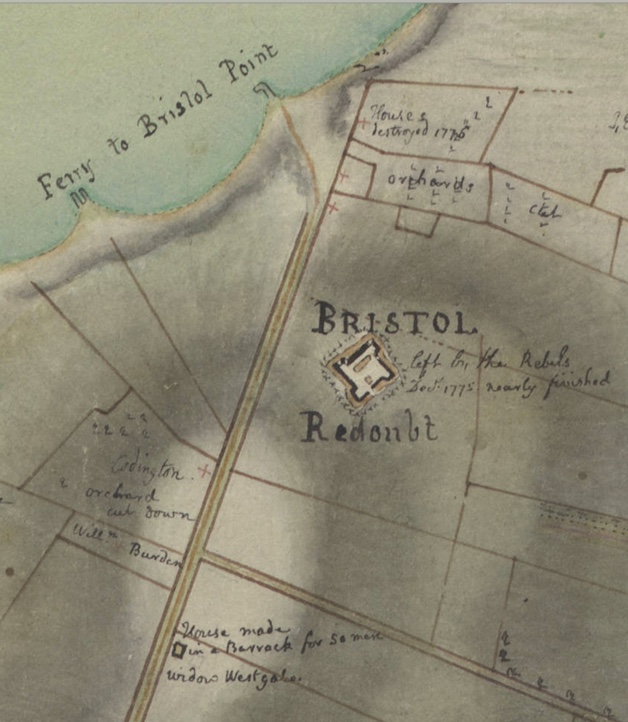
Bristol Ferry Town Commons and Mount Hope Park (old ferry landing)
End of Bristol Ferry Road at Bayview

This is the site of a town common dating back to 1714. Ferry service started here in 1640. This 1.5 acre space was originally used by farmers and others to keep their livestock and other goods while waiting for the ferry to Bristol. The Bristol Ferry area had a British fort during the occupation. This area was the transportation hub for Aquidneck Island (Rhode Island) and there are records of George Washington passing through here after visiting with General Rochambeau in 1781. The French and Americans would make the start of their long journey to victory at Yorktown through Bristol Ferry.

Revolutionary Rhode Island: Miantonomi (Tonomy)

Leave a comment

Miantonomi Park on Hillside Avenue in Newport has a rich history. This hill was the seat of power for Narragansett Sachem Miantonomi. Colonial settlers used this hill for a lookout, for public executions and for a beacon light. By 1667 a beacon was constructed there which when lit signaled beacon lights in the rest of the Bay Area. In 1776 another beacon was erected “to give the country an alarm in case of invasion” and Col. Israel Putnam built fortifications here. When the British occupied Rhode Island (Aquidneck) they strengthened the fortifications with a powder magazine and other defensive works (1776-1779). When the French came (1780-1781) they manned fortifications here as part of their defensive lines for Newport.

Revolutionary Rhode Island: Fort Barton in Tiverton

Leave a comment

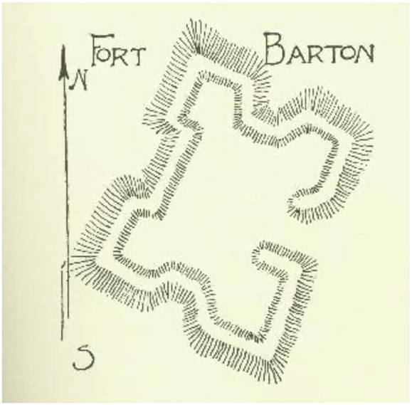
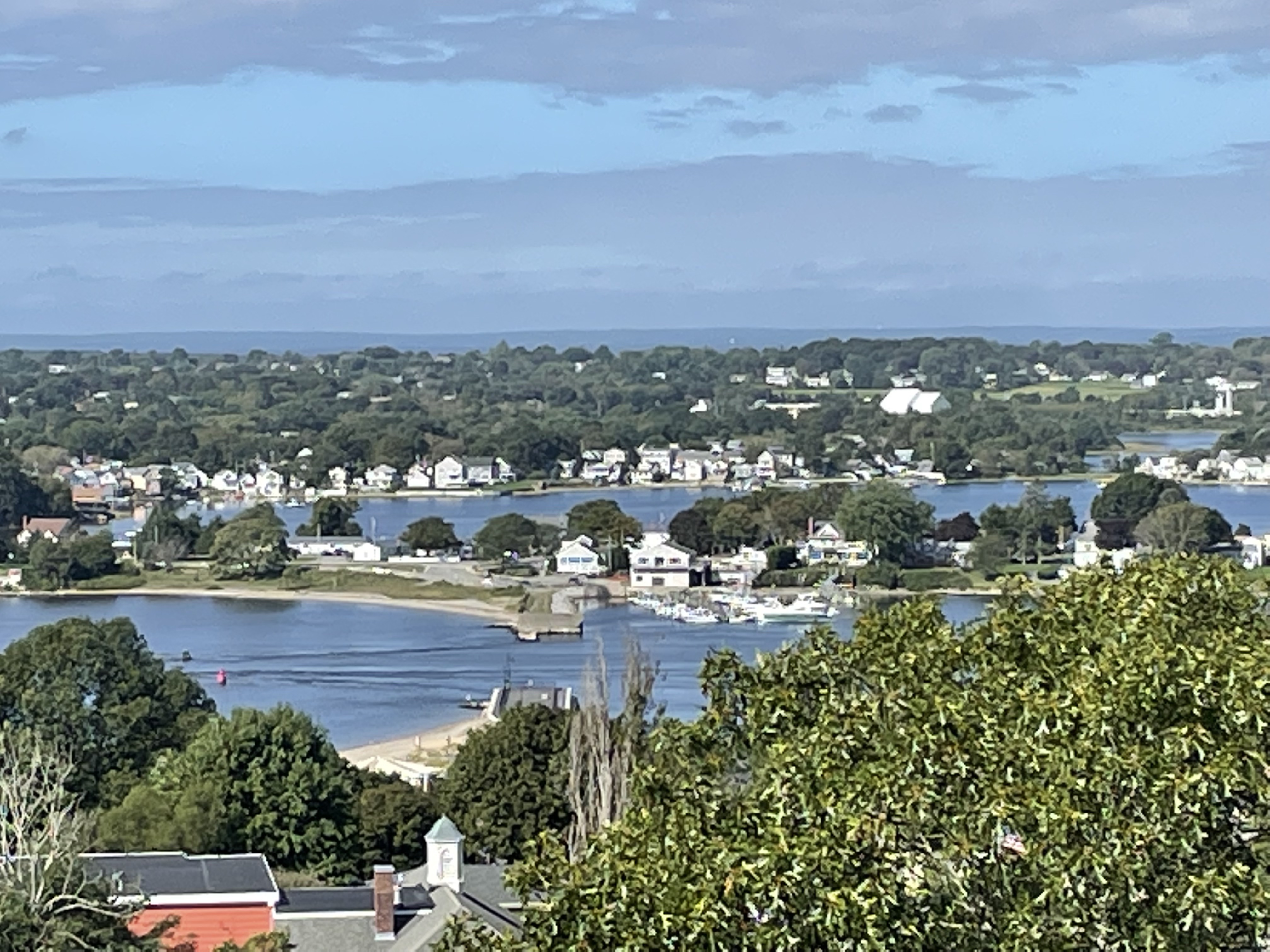
In the 1920s when Dr. Roderick Terry purchased the land to preserve Butts Hill Fort, he also preserved the remains of Fort Barton in Tiverton. You can visit the remains of the Fort at 343 Highland Avenue across from the Tiverton Town Hall. The remains of Fort Barton are located on a rise over 100 feet above sea level so there are commanding views Portsmouth locations like Island Park. Fort overlooked a strategic narrow point of water between the Sakonnet River and Mount Hope Bay. It is the shortest distance between Aquidneck Island and the mainland. This is traditionally known as the Howland Ferry area.

Revolutionary Defences In Rhode Island
Edward Field

After the British occupied Newport and Aquidneck Island in 1776, Tiverton was a gathering point for Americans. The governments of Rhode Island and Massachusetts worked together on the construction of the fort. On June 11, 1777, British officer Frederick Mackenzie described these efforts in his journal: “The Rebels have been busily employed in making a work on the hill above Howland’s ferry where their guns have been placed all the Winter. It appears to be very extensive, and must cost them a great deal of labour, as there is little or no soil on the hill.” On June 28, 1777, the Americans erected a flagstaff at the fort and raised their colors. The following day, Mackenzie described the fort as “irregular in its figure, but very extensive. From the situation, it must be strong.”

A short while later, Lieutenant Colonel William Barton led a daring raid to capture British General Richard Prescott on Aquidneck Island and the fort has been named in Barton’s honor.

In July of 1778, thousands of Colonial troops—including Paul Revere and John Hancock assembled in Tiverton for an invasion of Aquidneck Island. General Sullivan and 11,000 Continental troops and militia ferried across the narrows to participate in the Siege of Newport. When a storm crippled the French fleet that was off of Newport to support the Siege, American troops had to find their way back to Tiverton and Fort Barton. This military action was known as the Battle of Rhode Island and it was a successful retreat on August 30-31, 1778. After this battle, most of the soldiers scattered, leaving only a handful of men to man the fort.

View of Portsmouth from Fort Barton.

Resources: D. K. Abbass, Ph.D., “Fort Barton, Tiverton,” Rhode Tour, accessed August 17, 2022, https://rhodetour.org/items/show/52.

Revolutionary Rhode Island: Rochambeau Statue Newport Harbor

Leave a comment

King’s Park on Newport Harbor is the present location of a statute to General Rochambeau. The statue remains a symbol of the assistance that France rendered to the American colonies during the War for Independence. The statue’s original location in 1934 was Vanderbilt Circle (Equality Park). The statute is the third replica of the Rochambeau Statue. The first statue was created by sculptor Fernand Hamar and was erected in 1900 at Vendome, France – the home town of Rochambeau. (It has been replaced in 1974 with a 4th replica because the Germans melted down the original statue when they occupied the area in World War II. This statue was a gift of the American members of the Society of Cincinnati.) Paris and Washington D.C. also have replicas of the same statue.

Description: Rochambeau is dressed in the uniform of a Marshal of France. He wears the traditional French tricorn hat and cockade (a knot of ribbons) and the medal of the Order of the Saint Esprit on his overcoat. He stands atop in a pose where he holds a battle map of Yorktown in his left hand. Rochambeau’s sword rests at his left hip. The cannons behind him may refer to captured British cannons that the U.S. Congress gave to Rochambeau at the end of the Revolutionary War. A spring of laurel lies at Rochambeau’s feet.

One of the reasons the Newport statue was moved to Newport Harbor in 1940 was that it was the general opinion at the time that the French landed nearby. One of the French maps shows a landing area a few tenths of a mile away. Other maps show other possible landing areas, so the question of exact location is still up for debate.

the Plan de la ville, port, et rade de Newport, avec une partie de Rhode-Island occupée par l’armée française aux ordres de Mr. Le comte de Rochambeau, et de l’escadre française commandée par Mr. le Chr. Destouches [probably done in 1781] (Washington, D.C.: Library of Congress Geography and Map Division, Rochambeau collection, 39, at http://hdl.loc.gov/loc.gmd/g3774n.ar101800)

Near the statue is a cairn or monument of rocks. In 1928, Dr. Roderick Terry of the Newport Historical Society had the cairn designed and built. The cairn’s location is the spot where the Admiral de Ternay Society dedicated a stone in honor of the admiral who commanded the French fleet into Newport Harbor. Restoration work was financed by the Alliance Francaise of Newport in 2019. The stone blocks making up the pyramid shape at the site were crumbling and the entire pyramid was dismantled and rebuilt block by block. The bronze statue of General Rochambeau had also suffered the effects of time and weather and needed restoration.

Revolutionary Rhode Island: Green End Fort

Leave a comment

A stone marker at Green End Fort at the eastern end of Vernon Street in Middletown, RI, reads: “Green End Fort, built 1777 by the English for the Defense of Newport.” This was the popular opinion when the land was put into trust of the Newport Historical Society in 1923. Engineer Kenneth Walsh began to doubt the English origins as he read the diary of British officer Frederick Mackenzie. As he used historical maps as reference points, it became clear that the “Green End Fort” was a French fort, the Saintonge Fort. The British had destroyed their fortifications as they left Aquidneck Island in October of 1779. When Rochambeau arrived in 1780 the French worked on restoration of British fortifications and the creation of new defensive positions. American militiamen under Lafayette aided the French engineers and masons in this work. Six brand new French forts were added in the Bliss Hill area – “new constructions built by the French.” The French maps show an earthenware “Redoute St. Orige” or “Redoute St. Orige” at the location of what we call Green End Fort. The battery served as a way to defend Newport and Middletown against a possible return of the British. The earthenworks was located on a critical spot: on a ridge overlooking the Green End Valley, Easton’s Pond and with views of the Atlantic Ocean and the Sakonnet River. The battery served the French Army until June of 1781 when they departed to prepare for the long march to Yorktown. American militia soldiers took over responsibility for the Aquidneck Island fortifications.

In 1894 three men, William Sherman, Harold Brown and Nicholas Brown purchased the site to preserve it. In 1923 the land was transferred to the Newport Historical Society. The Society of the Sons of the Revolution in the State of Rhode Island and the Newport Historical Society continues to maintain the site today.

# 6 is Green End Fort: Plan de la position de l’armée françoise autour de Newport et du mouillage de l’escadre dans la rade de cette ville.

Revolutionary Rhode Island: The Conanicut Battery

1 Comment

The Conanicut Battery is Revolutionary Rhode Island that we can see and experience. It helps us to understand some of the evolution of Butts Hill Fort. The Rhode Island General Assembly ordered the building of this battery in 1776. A battery was built at Butts Hill by the American militia either in 1776 or before that in 1775 as part of Rhode Island’s preparations for war. The battery was built by hand using shovels and picks. The earth dug from a ditch was used to build up the parapet and its steep walls, the glacis which would have protected soldiers in the battery from attack by infantry. The parapet on the west side would protect against cannon fire from ships in the Bay.

What is a military battery? In the case of Conanicut Battery, it is a parapet or fortification equipped with artillery. So what is a parapet? It is a protective wall or earth defense along the top of a trench or other place of concealment for troops. This definition helps us to understand Conanicut Battery and even Butts Hill Fort.

The original Conanicut Battery was probably a simple, crescent shaped earthwork to protect six to eight cannon and those that operated them. In December of 1776 the British occupied the battery and they held the position until October of 1779. In his diary entry for December 7, 1776, British soldier Frederick Mackenzie writes: “…at 12 made the Light House on the S. point of Connonicut Island at the entrance of Rhode Island harbour….and about 1 o’clock that ship (The Experiment with Capt. Wallace) took the lead, and stood up the Western Channel between Connonicut, and the Main(land)… About 2 miles from the Light House, Rebels had a Battery or Redoubt with 4 Embrazures towards the Channel, But it appeared to be abandoned.”

What you see at the battery today is a shape the British formed. Ditches surround the earthen barricades on all sides and there is a ditch around all sides. When French forces came in July of 1780, they manned the battery until 1781.

Conanicut Battery can be found in Jamestown (Conanicut Island) at the end of Battery Lane which is off of Beavertail Road.

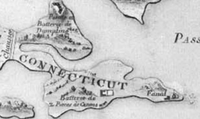
Plan de Rhode-Island Newport en ast la Capitale, 1778. Rhode Island Historical Society Collections RHiX34292

This French map mislabels Conanicut as Connecticut, but it does seem to show the location of the battery.

Older Entries Newer Entries