According to the pension application testimony of Daniel Bowen, Sullivan’s body guard was recognized by Congress as a part of the Continental Army. (War Department Communication dated December 1, 1819). This was a company of volunteers called a “Life Guard” to Major General Sullivan who was appointed commander of the state of Rhode Island. He remembers Aaron Mann, Levi Hoppen, George Potter and John Prescott (may be John Wescott) as officers of the group.
Sullivan sent in his Life Guard to reinforce the American troops at Quaker Hill and there was intense fighting there.
From his testimony
“Our circumstance however, I recollect , —service between Butts and Tominy Hills, the Sullivan guards did not arrive at the commencement of the action and as we neared __ up to meet the British, we could but meet by some carrying off The wounded, who said to us, “that’s right my boys, go and give it to them’ as the were borne off, upon the shoulders of their comrades. And we did go on, until we were overpowered by numbers.”
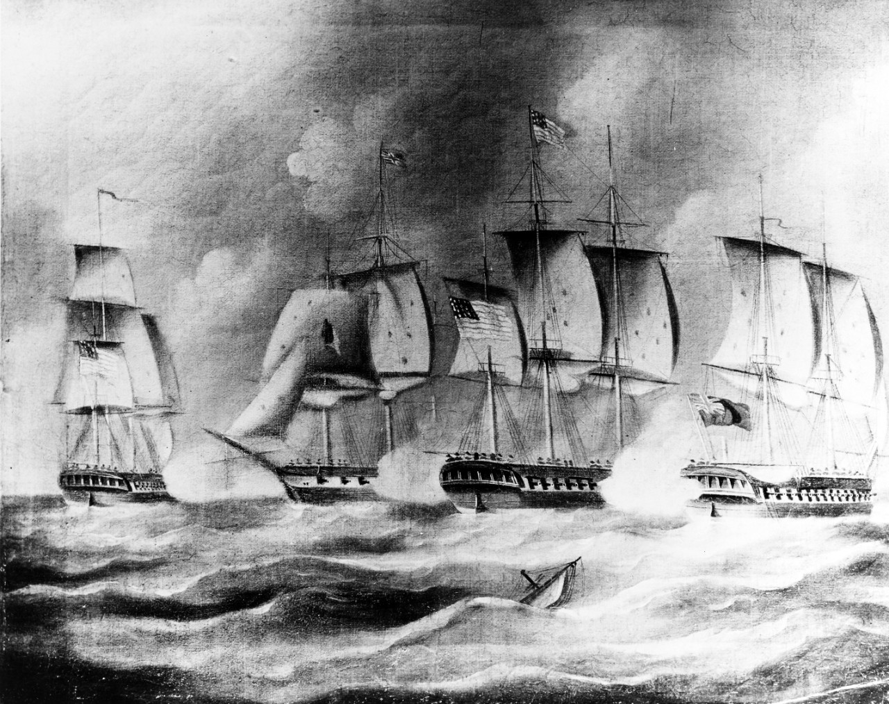
Bowen would go on to serve with Silas Talbot on the Sloop Argo and then aboard the Privateer Washington (a ship of 20 guns) which was also commanded by Talbot. The Americans were taken prisoner and ultimately exchanged for British prisoners.
Bowen called his Revolutionary War experience “days of danger and fatigue and repeated misfortunes.”
Resources: Case Files of Pension and Bounty-Land Warrant Applications Based on Revolutionary War Service, compiled ca. 1800 – ca. 1912, documenting the period ca. 1775 – ca. 1900. I accessed this through Fold3 military records online.
Image: PIGOT and ARGO capture British schooner LIVELY and two privateers, off the coast of Providence. Naval History and Heritage Command.
Aaron Mann of Providence was the commander of Sullivan’s Life Guard and his pension testimony offers us a first hand view of the American retreat on August 30, 1778. Mann had been serving as a soldier when needed beginning in 1775. He served in the Continental Navy in the ill fated Battle of Block Island. Next he was sent to Rhode Island (Aquidneck Island) to protect against British Captain James Wallaces’ raids around Narragansett Bay until the Americans had to flee the Island in December 1776 when the British invaded. He marched to Boston for the Battle of Bunker Hill and he took part in Spencer’s failed expedition in 1777.
From his testimony:
“In May or June 1778, then was got into a company called General Sullivan’s Life Guard – and I entered therein as a commander – Sullivan was quartered in Providence and I with him – I should think about through November 12 of 1778. I went on Sullivan’s expedition.”
He goes on to give a brief recounting of the Rhode Island Campaign. He went onto the island around the 12th of August. He talks about D’Estaing’s arrival and departure, and Lafayette’s efforts to persuade him back from Boston.
The part of his testimony that was most interesting to me was a description of the retreat. A portion of the Life Guard was to guard the retreat of the rear guard.
“Attached a portion of the life guard to guard the retreat of the rear guards and also make fires when lighted up through the camp to deceive the enemy. On this expedition I commanded the life guards – was wounded in my forefingers which were broke. Had Obadiah Brown one of my company killed. Israel Low of Providence wounded in the ankle. Antrum Fenner of Scituate wounded in the stomach and Charles Scot of Cumberland shot in his hip badly and made a cripple for Life.”
Because of his bravery in commanding the Guard during the retreat, Mann was appointed Captain on September 10, 1778. Records show Mann and the Guard at Tiverton through November 10 when the Guard may have been relieved of duty for a while.
In the book Spirit of ’76 Covell, who had listened to countless testimonies for pension applications, records that one of the Guard (Levi Lee) describes Mann in the action. “..while in the act of flourishing his sword, he had one of his fingers shot away, but the only remark he made..was “the d eternal souls shoot pretty close. Don’t mind, my boys, stick to em.” Covell writes that Sullivan’s Life Guards were selected by Lafayette to cover the “rear guard” in the retreat and suffered badly in the action.
Resources
Christian McBurney’s book The Rhode Island Campaign has most of this story on page 181. I was able to see and transcribe Aaron Mann’s testimony through Fold3/Ancestry.com.
Spirit of ’76 in Rhode Island: or, Sketches of the efforts of the government and people in the war of the revolution. Together with the names of those … notices, reminiscences, etc., etc
I have been exploring the stories behind some of the local Revolutionary War flags and this flag has led me to interesting areas of research. The “rattlesnake” emblem on it is very popular these days.
The first time I heard of Sullivan’s Guard was through Christian McBurney’s book on the Rhode Island Campaign. That gave me the name of one of the Guard members to research and his story will come in a later blog. This is a first article about the men of the Life Guard.
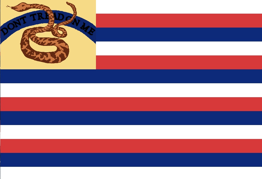
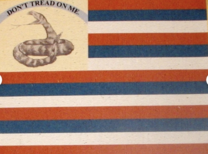
Searching for general information on Sullivan’s guard and the flag was difficult. Reproductions of the flag are available to buy and it is also known as the Tri-Colored Stripes with Rattlesnake Union. One source describes the flag:
“This flag’s field consists of the tri-colored striped flag as designed by Arthur Lee in 1779: thirteen alternating white, red, then blue stripes from top to bottom, ending with a white stripe. But rather than having a canton of stars, this flag has an image of a coiled rattlesnake on a buff colored background for the canton. Behind the rattlesnake is a motto: “Dont Tread On Me” in black lettering on a curved, rainbow-shaped blue band that connects the hoist edge with the third stripe from the top (blue).” https://www.motherbedford.com/Flags27.htm
What was the Life Guard? Who was part of it? What was their service at the Battle of Rhode Island and elsewhere? These are the questions I have been trying to answer.
With the help of Military Historian John Robertson, I was able to get the names of some of the Life Guard soldiers. I have been searching through the Fold3 database for records of the men and some of the pension applications were very helpful in answering some of those questions
“I William Wilkinson of Providence State of Rhode Island on oath do testify that I served in the Rhode Island Brigade of State Troops in the War of the Revolution from July 1777 to March 16, 1780. I stated in a former deposition that I fully recollected that Ford Westcott served during a part of that period in General Sullivan’s Guard, and my impressions are that he was a non-commissioned officer. The Soldiers of the Guard were some of them taken from the Brigade and some were enlisted especially for that service, but were all enrolled in the Brigade. I have no knowledge at what period said Wescott enlisted, but know that the term of enlistment not only of the Brigade but of the guard did all expire on the 16th day of March in the several years of 1770, 1779, 1780. I further testify that for more than forty years I was intimately acquainted with Capt. Man who commanded the Guard and like many other old soldiers have fought our battles over again – and as said Westcott resided in Providence, his name was mentioned by said Man as a good soldier.”
William WILKINSON SEPT 16,1836, Providence (US, Revolutionary War Pensions, 1800-1900)
Let’s look at one question at a time.
What was the Life Guard? “The Soldiers of the Guard were some of them taken from the Brigade and some were enlisted especially for that service, but were all enrolled in the Brigade.” Christian McBurney writes that the guard may have been modeled on George Washington’s Life Guard. In 1776 Washington ordered Commanding officers of each regiment to select four men from each regiment who would form his personal guard. He wanted them good men, sober, five feet eight to five feet 10 and cleanliness was desired. Their job was to protect Washington, the cash and to gather and keep the orders Washington gave..
In researching the names of Sullivan’s guard, I have found they came from at least two of the state militia units – the Pawtuxet Rangers and Crary’s. Some were designated by their commanders and some enlisted themselves.
More information on the Sullivan’s Life Guard will come in future blogs. The flag may not have been at the Battle of Rhode Island. One source says it originated in 1779. Another flag site said it was at the Battle of Rhode Island.
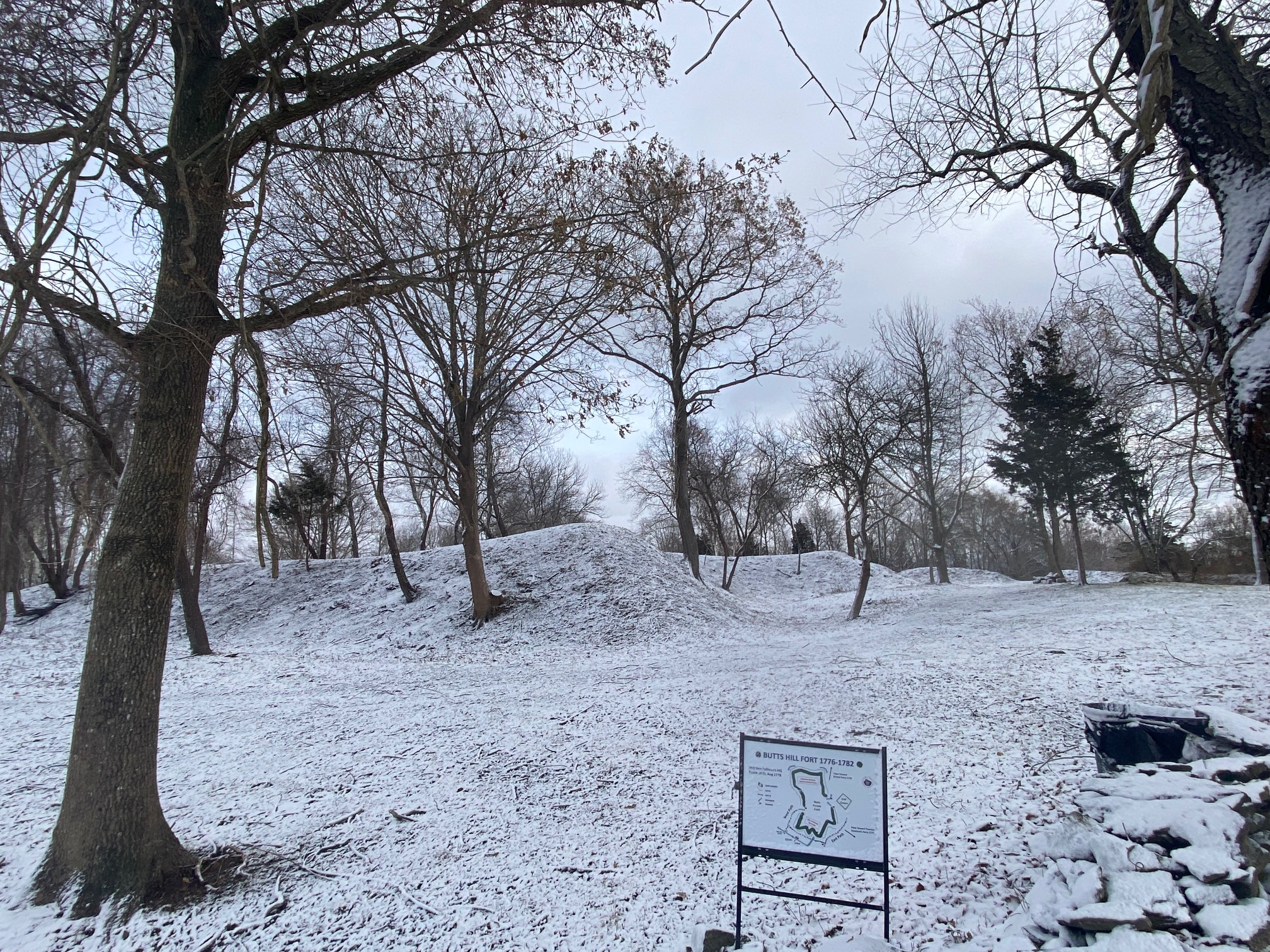
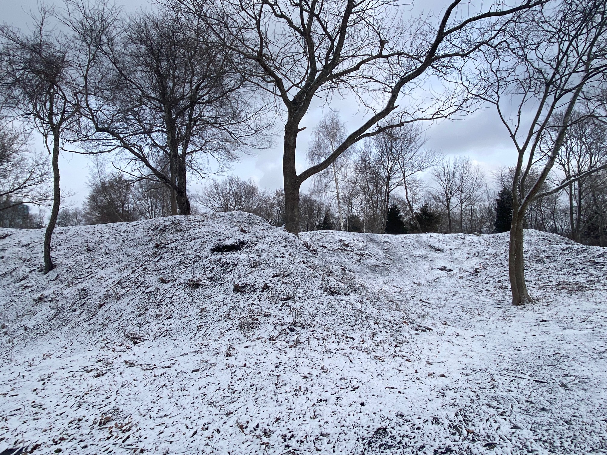
The Butts Hill Fort is emerging through the efforts of the Butts Hill Fort Restoration Committee this year.
Image of Butts Hill Fort – first day in Winter by Paul Murphy.
Butts Hill Fort 2024
“As we close 2024, we can report that the Butts Hill Fort complex has now emerged as a truly open and accessible historic campus. One with fully connected and improved pathways circumnavigating the site, while offering full visibility of the steeply sloping historic earthworks–from the outside looking in–for the first time in many decades. Moreover, the preservation clearing work has also opened up the site to be more understandable as Revolutionary War Era Aquidneck Island’s central defensive feature with improved view corridors to key battle landmarks such as Quaker, Turkey and Durfee hills to the south, and Howland’s Ferry, Tiverton and the Sakonnet to the east. (From: Butts Hill Fort 2024 Southern Earthworks Improvement Project Completion Report)
Butts Hill Fort 1778
The December after the Rhode Island Campaign was a harsh one. The British had systematically gathered all the fuel for fires on Aquidneck Island. At first the British and Hessians (Germans) felled the trees closest to their camps. The Hessians had a camp above Fogland Ferry. They continued to cut further away from their camps until there were no trees to cut and burn. British officer Frederick Mackenzie records that they then turned to cutting down orchards next on Common Fence Point and other locations. After the orchards, all other sources of wood were eyed. Vacant houses, wood carriages, and even wooden farm tools went into the wood supply.
Mackenzie writes on December 6th, 1778: “Every step is being taken to supply fuel: All the timber trees on the island are cutting down and the old wharves will be broken up.” Vacant houses were taken apart and the wood was used for fuel. Rail fences were taken apart and burned. On December 13th Mackenzie’s diary entry reads: “All the carriages that can be collected on the Island are employed in bringing in the wood which is cut by the party out on the island.” Turf” was cut on Brenton’s Neck and used for fuel. When the island’s wood supply was exhausted, they sent fleets to collect wood on Conanicut, Block Island and Long Island.
On Christmas Day of 1778 a blizzard began that lasted until December 28th. Hessian soldier Johann Dohla records in this diary: “26 December: A frightful snow fell here, accompanied by strong winds and a violent snowstorm such that we could hardly remain in our houses because of the snow. Tonight a Hessian sergeant got stuck in the snow near Quaker Hill and froze to death.” In another diary Hessian soldier Stephen Popp records the snow depth to be three or four feet. Mackenzie records drifts of up to 20 feet.
Portsmouth residents were huddled in their homes on Christmas Day of 1778. The mostly Quaker residents would not have had grand celebrations anyway. Christmas was yet another day to do God’s work.
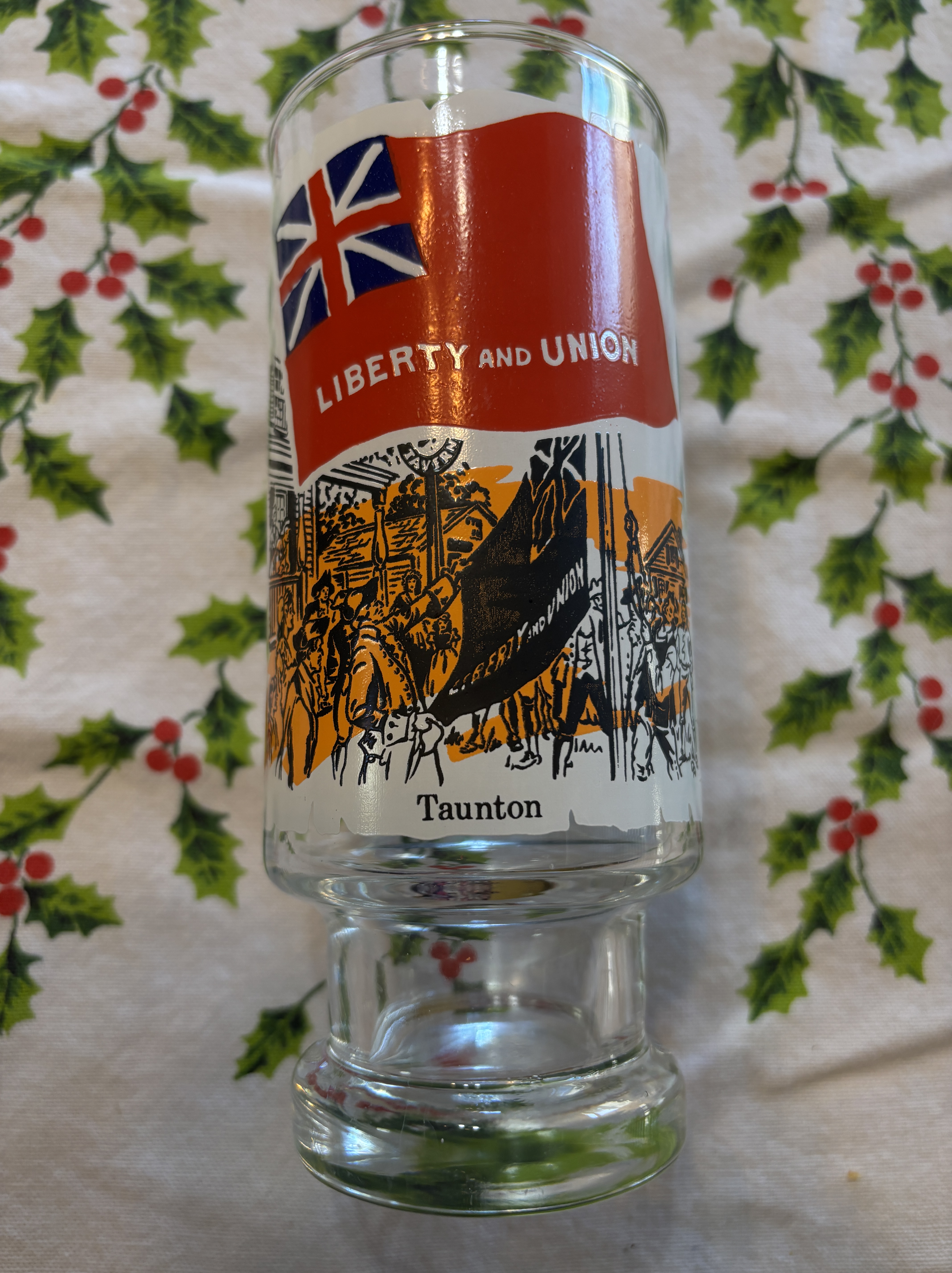
“We have just received the following intelligence from Taunton, ‘that on Friday last a Liberty Pole of 112 Feet long was raised there, on which . . . a Union Flag [was] flying, with the Words LIBERTY and UNION thereon. . . . ‘“ (1). So wrote an unnamed correspondent from Taunton in the pages of the Boston Evening Post’s edition of October 24, 1774.
Sometimes antique shopping can lead to a history lesson. I look for bicentennial items and I was attracted to a glass with an early American flag – the Taunton Flag. According to the text on the back of the glass, Taunton residents took the English Red Ensign and added the words “Liberty and Union.” They raised a flagpole on the Taunton Common and one October 21st, 1774 and they hoisted the flag as a symbol of their dissatisfaction with Britain.
The Old Colony Museum in Taunton has posted good information on the flag. Colonial self-rule was threatened by the passage of laws like the Stamp Act in 1765. British troops were sent to Boston to maintain order when colonists began to protest that their rights as Englishmen were threatened. The “Intolerable Acts” closed Boston Harbor to shipping and the 1692 Massachusetts charter was revoked. Conventions were held in counties to coordinate resistance. The Bristol County convention was held in Taunton. At that time the sovereignty of George II was accepted, but Parliament was blamed. Taunton relied upon the maritime industry and the closure of the port of Boston impacted their economy. Loyalists were blamed and several notable ones were run out of town. The flag was created by the Sons of Liberty, and was the first flag to fly in protest to British rule while still remaining loyal to the crown.
Some sources believe that the Taunton Flag symbolized that at that time local Americans were not looking for independence but were looking to maintain their union with Great Britain. They wanted to keep their liberties and Englishmen.
I am working on a simple timeline for Butts Hill Fort that might go into signage sometime. There are a lot of dates I have firmly determined, but I am stumped on an origin date and credit to which side first began to construct fortifications.
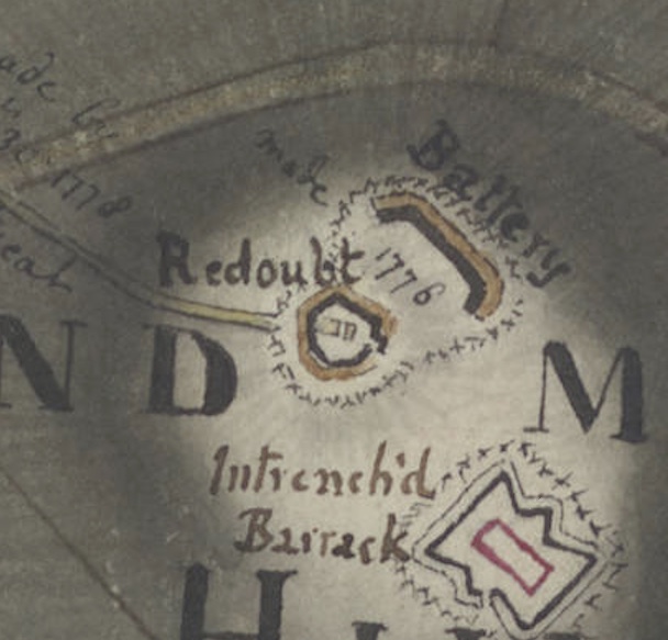
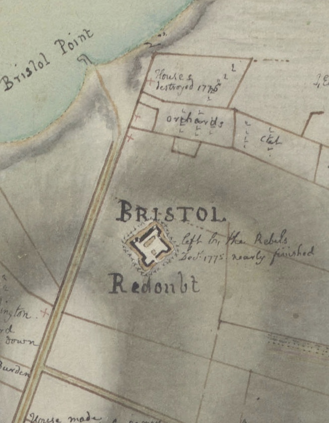
I am not a military historian, but John Robertson is. He credits the British with the first fortification in December of 1776. One reason I have believed that the American militia had to have created some fortifications is notations on the Huntington Library’s map of North Portsmouth. The note reads “made in 1776.” The British did not invade Aquidneck Island until December 8th, 1776. They would have had to work quickly in the cold winter to construct a battery that quickly.
Robertson believes that when the British arrived they found only two American fortifications and they were by the ferries.
Our best resource on British activities in Occupied Portsmouth is the diary of Frederick Mackenzie. Unfortunately Mackenzie was away from the island for the beginning months of 1777, but we have his accounts of December 1776. His account of troop distribution on December 17th doesn’t show any troops stationed at “Windmill Hill” (Americans called it Butts Hill). Those mentioned were “At Bristol ferry house,” (which would have been close to the Commons area today) detached to a house at the point (probably Common Fence Point), Town Pond, at the Neck and at the road to Howland’s Bridge.
Mackenzie diary on December 30 mentions that the British took over a fort that had been constructed by the American up the hill at Bristol Ferry. The notation here specifically mentions that they Rebels built this fortification in 1775. His diaries mention the hard frosts the British encountered so I imagined that digging for battery building would have been hard to accomplish.
After a being away in New York, Mackenzie mentions “Windmill Hill” June 3, 1777.
” A Picquet of one of the Regiments on Windmill, is ordered to reiRnforce the advance posts every evening ’til further orders.” What happened from January until June is missing in the diary.
D.K. Abbass writes that the American Militia had a fortification on the hill. I have tried to find confirmations when I research the Rhode Island Militia. Although Portsmouth did have an active militia, I can’t find mentions of specific use of the hill. I have looked at locations of signal beacons. Butts Hill would be the perfect place to put a beacon. I know there were reports of a beacon in Portsmouth, but I cannot find a specific mention of the Butts Hill site.
Readers – help me write the origin line.
1776 Americans
1776 British
1777 British
I am aware that as we research and find other sources, there might be a change in how we write an origin of the fort. But for now….I have to put something down.
Dr. Robert Selig’s translation of Rochambeau’s Orderly Book gives us an understanding of the French presence at “Camp Butts Hill” in 1780 to 1781. Orderly books contain daily “Morning Reports”, “Garrison orders” and “General Orders”. They don’t give a narration of what happened, but they often give us clues as to who was performing what tasks. We have had access to at least two orderly books from Massachusetts militia units, but Selig’s work brings us a fuller picture from the French side. Selig will be continuing his research and I look forward to adding new information from the engineers who were in charge of the construction at the fort.
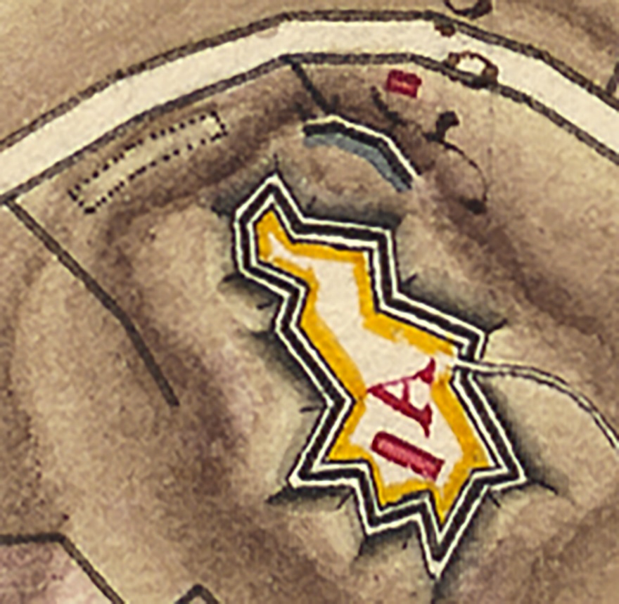
In Selig’s article on the French engineers, he provides background to why the French were interested in building a stronger “Butts Hill Fort.” When the French arrived the fort was in poor shape and there was concern that the British may come back and invade Aquidneck Island again. General Rochambeau, Lafayette and others saw the fort as a key communications point if the British returned.
Colonel Jean Nicholas Desandroüins left a description of the fort of December 1780, just as Rochambeau’s engineers began their work. Desandroüin’s observations give us an idea of the condition of the fort when the French began their work.
“It was also necessary to provide the means of being rescued by ensuring communication with the mainland. With this in mind at the far end (northern-most point) […] a fort called Bootshill was built on the height which dominates (overlooking) the space between the two passes or ferry crossings of Bristol and of Howlands. Assistance can assemble under its protection. This good work is of a high elevation, well flanked, preceded by a ditch as wide and deep, dug partly in the rock. It was sufficiently stocked with artillery and could hold 500 men. For its construction, we took advantage of two older, very imperfect, redoubts, whose mutually supporting fronts were shaved off, and which were joined together by two branches with breaks and redans, to make a single piece of good defence and capacity.” (Quoted in Blondet, Jeux de Guerre, p. 239. Blondet dates the letter to 9 December 1780.)
Butts Hill Fort from the Berthier Brothers Map 1780-81
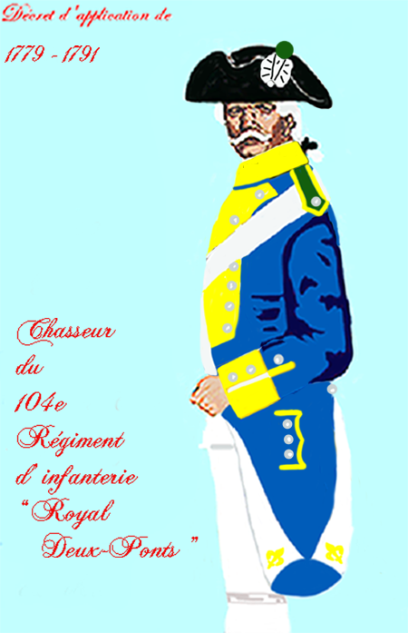
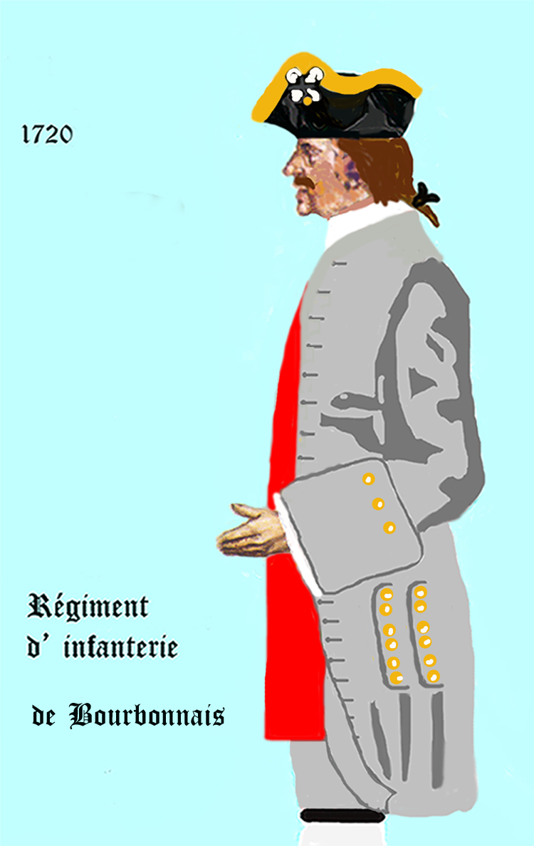
As I read the American Orderly Books from “Camp Butts Hill” (for example Orderly books of Ebenezer Thayer, Jr.) I imagined American militia aiding the French engineers and doing the physical labor at the fort. What I am discovering through Dr. Robert Selig’s work with Rochambeau’s orderly book, is that four French regiments where also present at the construction of the Butts Hill Fort. They included the Soissonnois, Bourbonnois, Royal Deux Ponts, and Santonge Regiments.
Quoting from the Selig’s English version of the orderly books:
Order of 9 December 1780 “Each regiment will furnish two squads [at 12 men each] and a sergeant, the brigade of Soissonnois a lieutenant, and that of Bourbonnois a Capitaine en second who will command the whole, they will assemble at 7 o’clock in the morning near the guardhouse on the Parade Ground. This detachment will march with arms and baggage to Butts Hill Fort near Howland’s Ferry to work there as directed to them by the engineer who will be there, they will take with them cooking pots, mess tins, flasks, and provisions for five days, which each regiment will take care to procure today. The captain who will command the detachment ordered to work at Butts Hill Fort, a mile from Howland’s Ferry, will keep his soldiers in good order and discipline, he will order each day only one corporal and four men as guards, and will not allow more than one cook be employed per regiment in order to keep as few men as possible from the work.”
This entry demonstrates that the French soldiers were actively working at fort construction. Five would work as guards and one as cook, but they wanted to “keep as few men as possible from the work.”
In the table below I have outlined the rotation of French Regiments as detailed in Rochambeau’s Orderly Book.
Date
Unit
Duty
Comment
12/23/1780
Each regiment
Distribute provisions
12/28/178
Soissonnois, Santonge, Royal Deux Ponts – Bourbonnais 23
3 regiments return. Take orders from Palisse, Major of the Royal Corps of Engineers
For the security of the post, the police of the guard, and the preservation of the fort’s works. The detachment will also take orders from Monsieur de Palisse, Major of the Royal Corps of Engineers, and from Monsieur Planchard for the work that can be done.
Order of 31 December 1780
Soissonnois
Relieve previous
1/4/1781
Saintonge
Relieve previous
1/9/1781
Deux Ponts
Relieve previous
All the working soldiers employed in repairing the camp effects will be exempt from roll call and will be allowed to work until 8 o’clock in the evening.
1/14/1781
Bourbonnais
Relieve previous
1/16/1781
Rochambeau grant
Quarter supplement to the ration of bread per day to the workers at the fort of Butts Hill Fort.
1/19/1781
Soissonnois
Relieve previous
1/24/1781
Saintonge
Relieve previous
1/29/1781
Royal Deux Ponts
Relieve previous
2/2/1781
Bourbonnais
Relieve previous
2/7/1781
Soissonnois
Relieve previous
2/13/1781
Saintonge
Relieve previous
2/18/1781
Royal Deux Ponts
Relieve previous
2/23/1781
Bourbonnais
Relieve previous
2/28/1781
Soissonnois
Relieve previous
3/5/1781
Saintonge
Relieve previous
Will be relieved by the first American troop that will establish itself in this fort
3/18/1781
Soissonnois
Send to Butts Hill the soldiers named Armand,Corporal and Foucault, soldiers of the company de lay Boyere, fleur Damour of that company of Anselm and Bourdet of the company of Scanty were they will take the order of M. De Turpin, Captain of the Engineers
Americans relieve
4/1/1781
Royal Deux Ponts
One sergeant and a squad
4/11/1781
Soissonnois
One corporal and six men
4/16/1781
Saintonge
One corporal and eight men
4/21/1781
Deux Ponts
One sergeant and one corporal and 10 men
4/25/1781
Bourbonnais
One sergeant, one corporal and 10 men
4/29/1781
Soissonnois
One sergeant and one corporal and 10 men
5/3/1781
Saintonge
One sergeant and one corporal and 10 men
5/8/1781
Deux Ponts
One Sargent, three corporals and 20 men.
5/18/1781
Soissonnois
Three corporals 10 men
5/23/1781
Saintonge
One sargeant, three corporals 10 men
5/28/1781
Deux Ponts
One sargeant, three corporals 10 men
6/2/1781
Bourbonnais
One sergeant, three corporals and ten men.
6/7/1781
Soissonnois
Three corporals 10 men
The presence of, and the work carried out by, French soldiers at Butts Hill Fort from July 1780 and June 1781 is beyond doubt. The Orderly Book clearly established that within a week of their arrival in Newport, French engineers, most notably Major de Palys, were supervising repairs at the fort. At this point the work was carried out by American militia. It was only in December 1780, that French soldiers began working at Butts Hill Fort, which they did until June 1781, when Rochambeau’s forces deployed to New York.
References:Dr. Robert Selig’s research is detailed in a video on Battle of Rhode Island Association website. Rochambeau’s Engineers at Butts Hill.
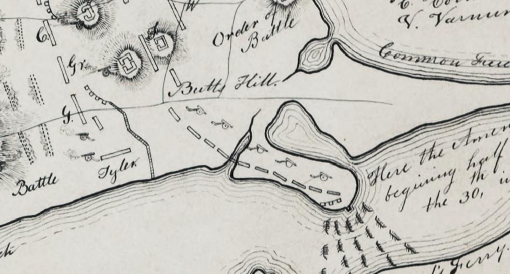
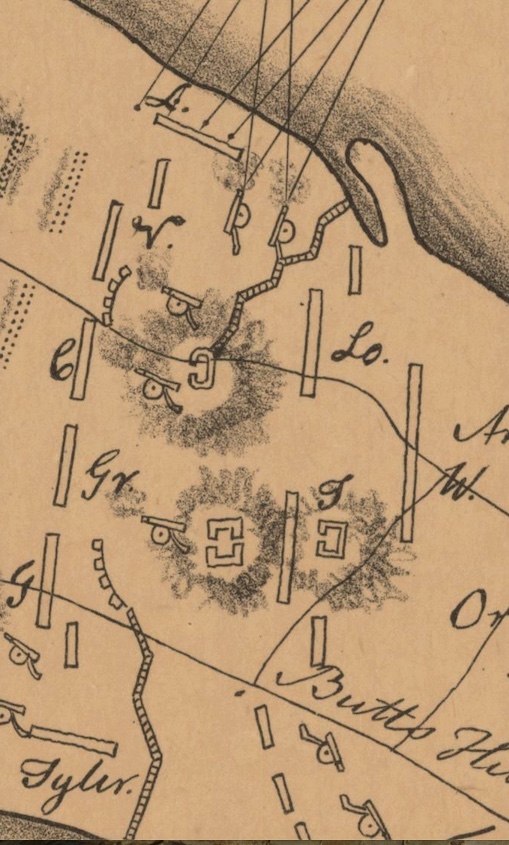
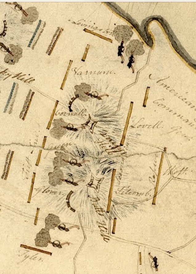
The Denison Map of the Battle of Rhode Island is filled with information. I generally look for specific pieces of information from this gem, but today I am going to methodically go through the information it provides. As I go through this map, I am comparing it to the map from the General Sullivan Collection that is in the state archives. I am noting that the handwriting and comments are very similar.
Looking at the Denison map in general there is a compass on the left hand side. There is a scale for two miles and there is a legend of sorts for the positions of the American commanders. The mapmaker lists himself as J. Denison “Scripsit” which means writer. The map covers the areas and dates involved in the “Rhode Island Campaign” – mainly Aquidneck Island and the surrounding waterways. Notes on the bottom of the map tell us that the original is at the Massachusetts Historical Society and that this version is a copy. A note at the bottom provides a legend for symbols in color in the original.
The legend for the battle positions is given at the bottom.
First Line:
G is for Glover, Gr is for Greene, C is for Cornell, V is for Varnum.
Second Line: T is for Titcomb, L is for Lovell.
Reserve: W is West
Flanking Divisions: L is for Livingston and Tyler
The Archives map has no key, but it does have a compass and scale. The names of the commanders are written out, but the positions are the same as in the Denison map.
Comments comparison:
By Howland Ferry: Denison: Here the American Army landed August 9th 1778 beginning half after 6 o’clock A.M. and retreated the 30th in the evening.
By Howland Ferry: Archives: Here the American Army landed August 9th 1778 beginning half after 6 o’clock A.M. and retreated the 30th in the evening.
The comments close to Union Street about the beginning of the battle were the same. :
The comments between East Main and West Main are the same.
What is different is that the Denison map has notations on the French Fleet. These are absent from the Archives map:
On the Sakonnet: “French ships going out to join the French Fleet going to Boston, August 20, 1778.”
In Newport Harbor”. “French fleet going out in pursuit of the British Fleet August 10th 1778, which were then at anchor Near Point Judith.”
By Hog Island: “British ships firing on the American Troops in time of Battle August 29, 1778.”
There is no Author statement on the Archive’s map, but I believe both maps were drawn by J Denison. The Dennison map is more finished. The Archive map looks to be more a record taken at that time and the basis for the Denison map. Perhaps others were aware that these two maps are basically the same, but this was revelation to me. I am still trying to find out about the mapmaker, j Denison. I would appreciate any information about him. He is credited with many more maps through the years.
I have come across an excellent source that gives us easy access to many of the maps of the Revolutionary Rhode Island era. https://www.argomaps.org/about/ is the link to this great source.
From their website:
“ARGO: American Revolutionary Geographies Online is a new project led by the Leventhal Map and Education Center at the Boston Public Library and the George Washington Presidential Library at Mount Vernon. Leveraging new technology and the recent drive by many museums, libraries, and archives to digitize their collections, the portal collates digitized maps of North America made between 1750 and 1800 into a single user-friendly portal. In addition to providing users from many backgrounds with easy, intuitive access to beautiful high-resolution images, ARGO seeks to give users of all kinds the tools they need to learn and understand through interpretive essays, curated collections, classroom materials, and more. As a platform for scholarship, education, and exploration, the goal of ARGO is to make the rich visual legacy of our Revolutionary past accessible to the public as never before.”
ARGO’s Advice on using maps as a primary source.
Our number one piece of advice? Take time to look. Just as you would read and reread any other primary source document, be sure to examine your selected map. You can look over the map with the following questions in mind:
What does the map focus on? How did the maker get you to focus? Did they use color? Are some things larger than others (scale)? What is at the center of the map? What features are accompanied by text? What is overlooked? What is unlabeled, at the edges, or missing altogether? How is the map intended to be used? To show political boundaries? Navigation? Sharing data? Depicting a particular place for promotion or propaganda?
What i do:
I always look at the cataloguing information. It usually gives me such information as who the mapmaker was, when was it made, size, etc. Who the mapmaker was can tell us something about the intention of the map.
I do look at the whole map, but I also break it down and specifically take note of what is in sections. Usually I look at the map in four sections. That helps me to notice minor details that may be important.
I try to find a map of the same location today. Names change. McCorrie Point is frequently referred to as “Sandy Point” at the time.
I always look for detail like the compass for orientation, scale, and legend. If this map is a rough sketch, these items might not be present.
Here is an example of how I work with a map that is new to me.
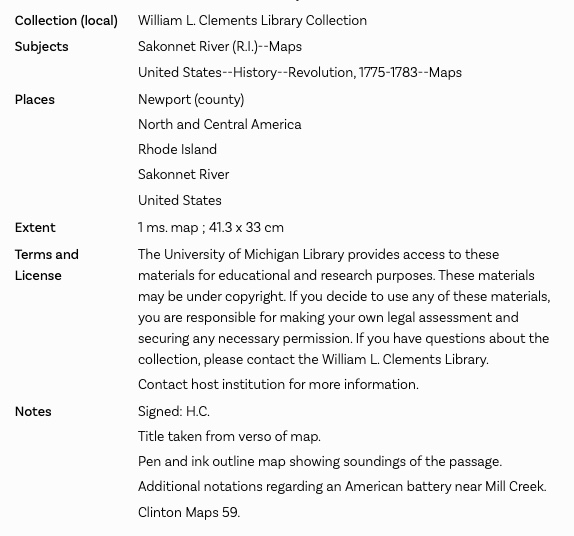
Checking out the bibliographic information.
What information can I cull?
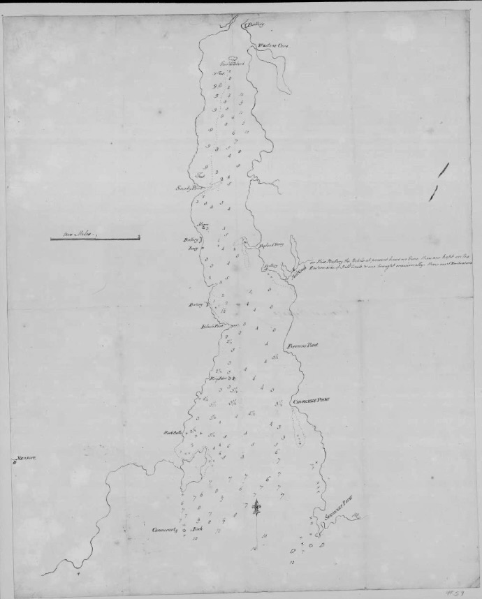
Author: signed H.C. – this is in the Henry Clinton collection
Title: Taken from the back of the map.
Size: about 16 by 13 inches.
Materials: Pen and ink
Notes: Depth soundings are listed. Are they in fathoms? At one location the “Feet” is listed. American and British redoubts are included.
My observations: Although this map has a scale and a compass, it doesn’t have a legend, maker’s name or date. It seems to be a utilitarian map prepared for those defending the East coast of the Sakonnet. The passage depths listed and the scale helps defenders pinpoint locations where the Americans are most likely to cross. There is a special note about the redoubt at the Mill Pond – how it is armed and what weapons they have. As I expected, “Sandy Point” on the map is what we call McCorrie Point. There is even a tracing of what the point is like at low tide. American and British redoubts are listed. It would be good to compare them to other maps to get a sense of the dating of this map. The ferry locations are also listed.
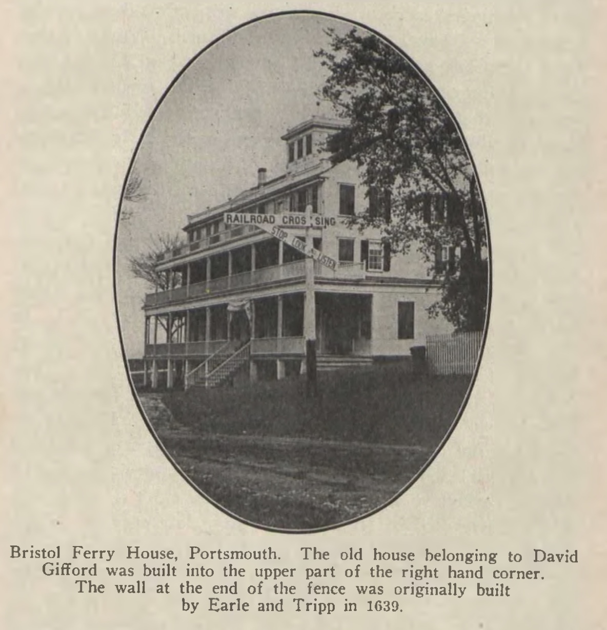
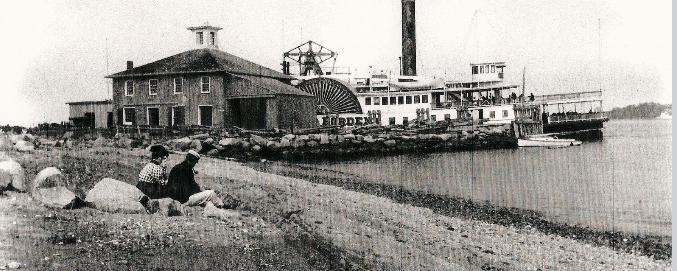
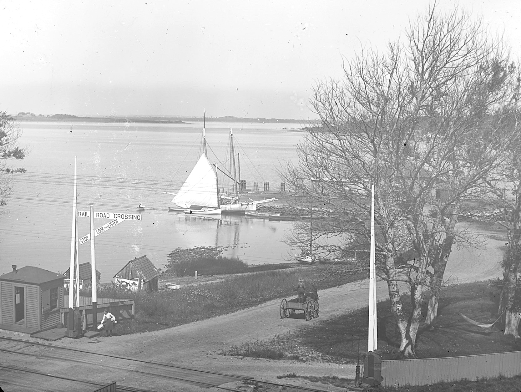
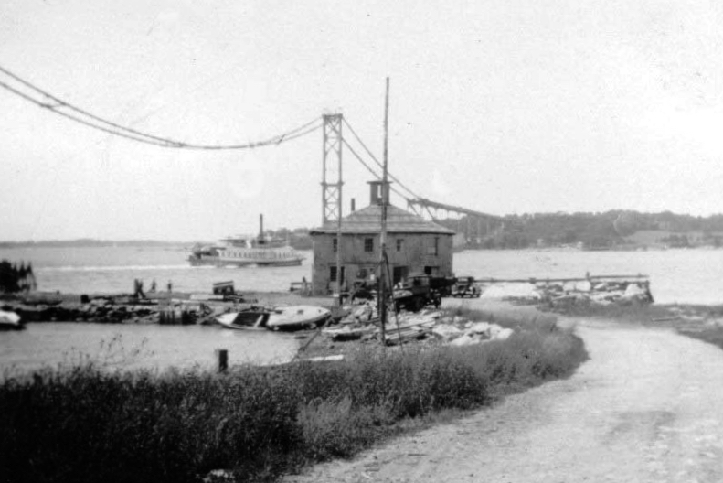
The Bristol Ferry grew in importance after the Revolutionary War and a whole transportation network developed around it. Railroad service, steamers (even the famous Fall River line in the 1860s), and trolleys had stops at this hub. A summer colony grew up around the ferry landing and that drew wealthy people from Providence. Around 1850 a large hotel that could accommodate 50 guests was in service and continued for the next 75 years. Bristol Ferry Landing became a thriving center with the hotel, a wharf, stores, a railroad station, post office, telegraph office and summer cottages.
Landing as transportation hubTurn of the century image by Sarah Eddy
Artists
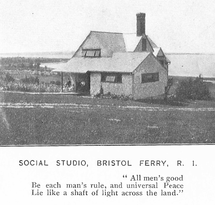
In the late 19th and early 20th centuries the Bristol Ferry neighborhood was known as an artist colony. Along Bristol Ferry Road large homes were built as summer residences. Noted artist, sculptor and photographer Sarah Eddy brought art students to Bristol Ferry to enjoy the special light in the area. Sarah started a “Social Studio” to teach crafts and kindness to the local youth. Internationally known artist Oscar Miller made Bristol Ferry his home when he married into local Mitchell family.
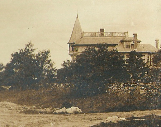
Sarah Eddy House
Suffragists
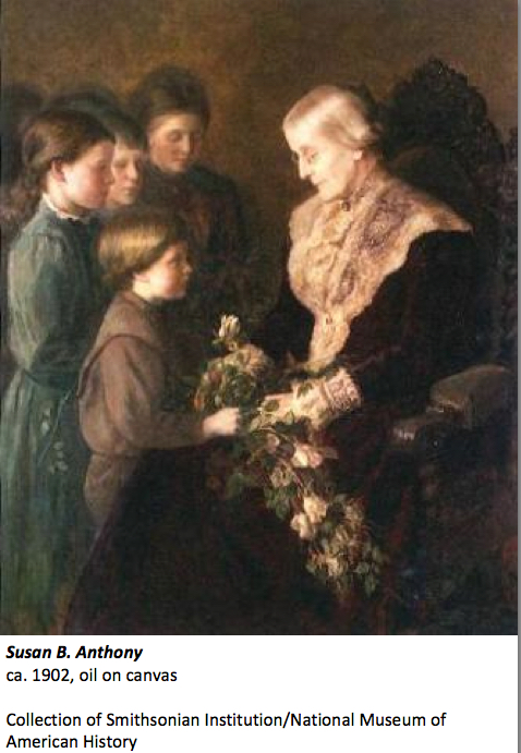
Sarah Eddy had connections with national leaders in the abolition and woman’s suffrage movement. Susan B. Anthony even came to Eddy’s house in Portsmouth to have her portrait painted. The women who lived in the Bristol Ferry area became the hub of the Aquidneck Island and Rhode Island suffrage movement.
The Bridge changes everything
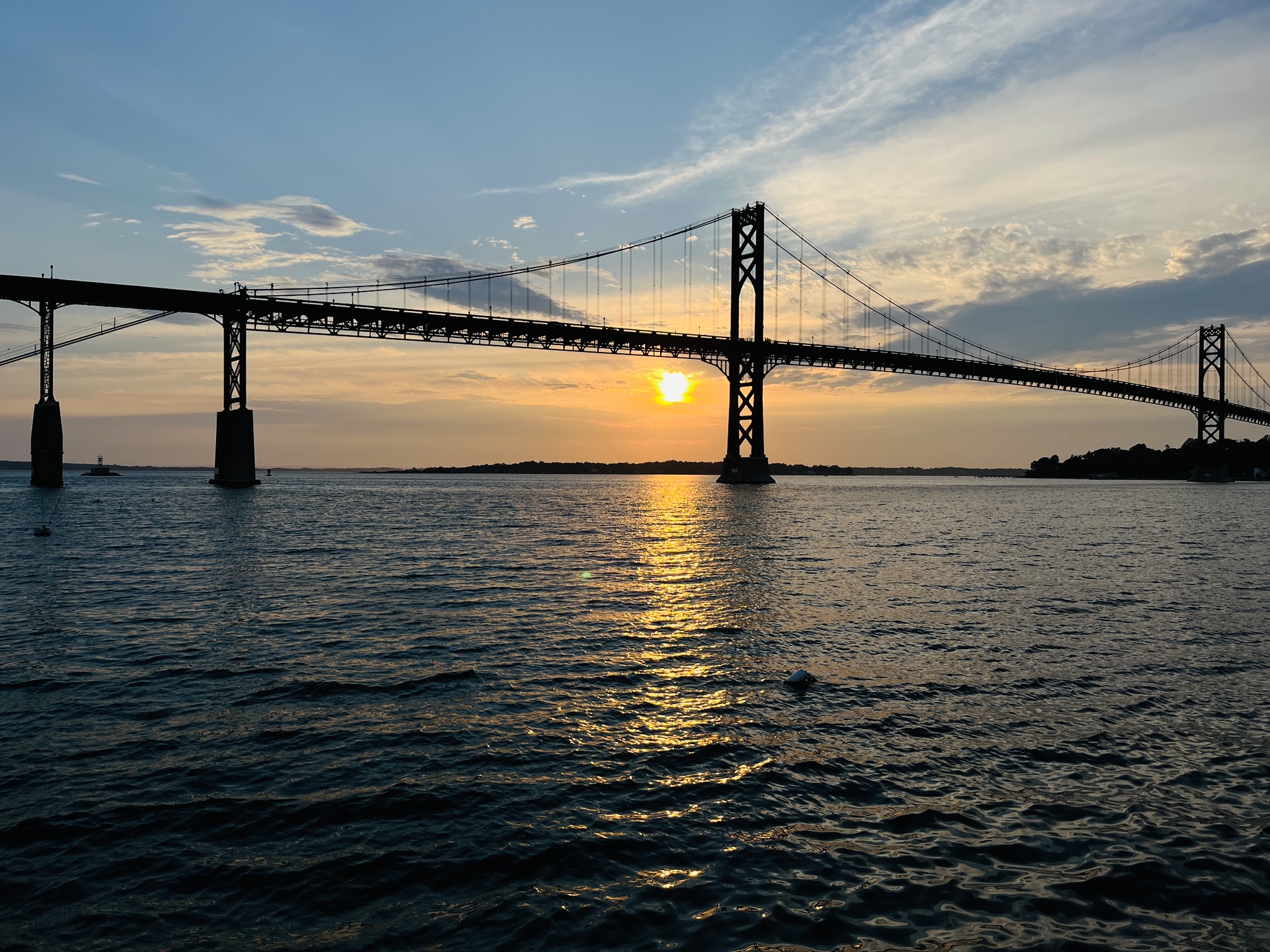
The Mount Hope Bridge, designed in 1927 by a private company and opened for travel in 1929 is a prize-winning suspension bridge over Narragansett Bay between Providence and Newport. With the bridge, the use of the Bristol Ferry Landing diminished. Today that high transportation area is the beautiful Mt. Hope Park, a quiet spot to enjoy a sunset.