Home

The First Schoolmaster: James Preston

Leave a comment

What books would you think Portsmouth’s first schoolmaster had in his collection? You might guess an arithmetic book and a dictionary. Schoolmaster James Preston had those, but would you think of books for seamen and navigators? We happen to know what books he had because there is a record of the town selling eight books that comprised the library of the ” James Preston, school master, late deceased.”

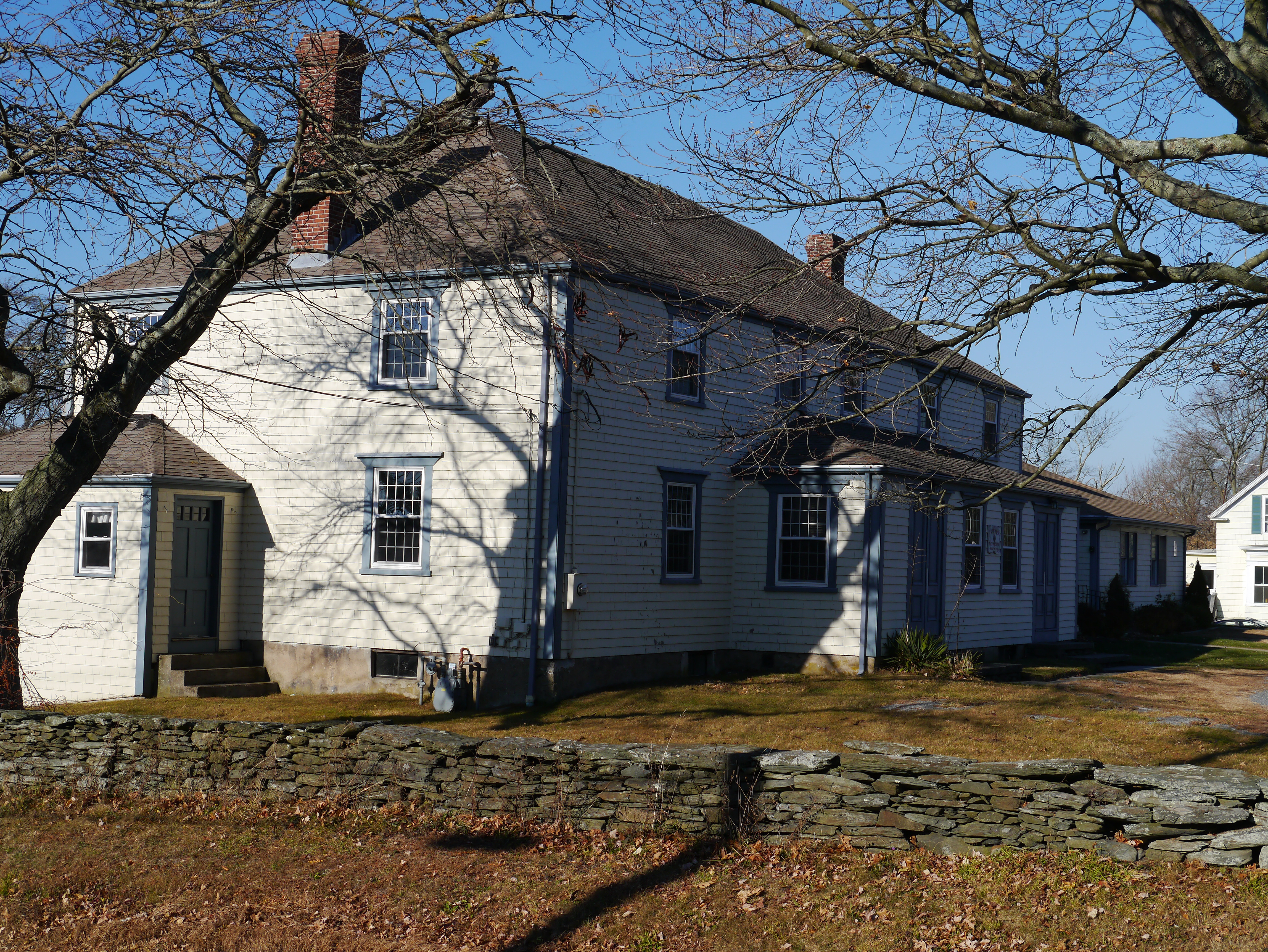
Southermost School on the grounds of the Portsmouth Historical Society.

Preston’s books:

Norwoods Epitomy of Navigation, Cockers Decimal Arithmetic, Mariners Compass Rectified, Seamans Kelender or an Ephemerides, The Art of Measuring, Marriners New Calendar, The Great English and Latin Dictionary and Gumbers Scale.

Preston’s book titles lead me to believe that Preston was trained as a navigator, not a teacher. Attracting a well trained teacher would have been difficult in the small town of Portsmouth. Town records show that in 1724 it was voted that “that the schoolhouse erected and built in said town be improved by the freemen of said town and will hire and settle a schoolmaster in each house for the benefit of all children as shall be sent to be instructed therein.” The Southermost School would serve the children in the south end of the town and the Northermost School would be built to serve the students in the more settled area of the north part of town. By the next year at least the Southermost School was open.

Historian Edward West was able to go through town records to write an article about Portsmouth’s early schools and schoolmasters. He found that our first school teachers were mostly poor, had large families and with the little salary they received they had a hard time providing for their families. West believed that Southermost School was built to house the families of the schoolmasters because it was constructed with an oven in the cellar. West found a mention in the town records that “James Preston (school master) present at this meeting Engaged upon his word that he would Remove himself and his family out of the School House by the first day of September next except the Freemen of the Town should see cause to Improve him to keep school there after the Expiration of said Term.”

Although Preston and his family had lived in the cellar of Southermost School, it was clear from the records that they also boarded with parents of students. West found records that it was the town’s responsibility to keep the schools in repair, but that the parents of the children who attended the school paid for the expenses of the school.

The town had responsibility for the poor and there were few public buildings to house someone who was down on his luck. In December of 1727 the Town Council heard that James Preston was sick and helpless. Two men were appointed to “take care for his relief,” to find a place of residence for him and his family and to provide a nurse for his wife (who was pregnant?). All that James Preston had, including his books and his cow, were sold to contribute to his upkeep. When James Strange refused to house Preston any longer, it was ordered the the family be relocated to Southermost School in the cellar. By 1729 the Town Council ordered ” that James Preston and his family be removed out of the School house wherein they now live…” His wife was ordered to “bind out” her oldest children so they would no longer be a burden on the town.
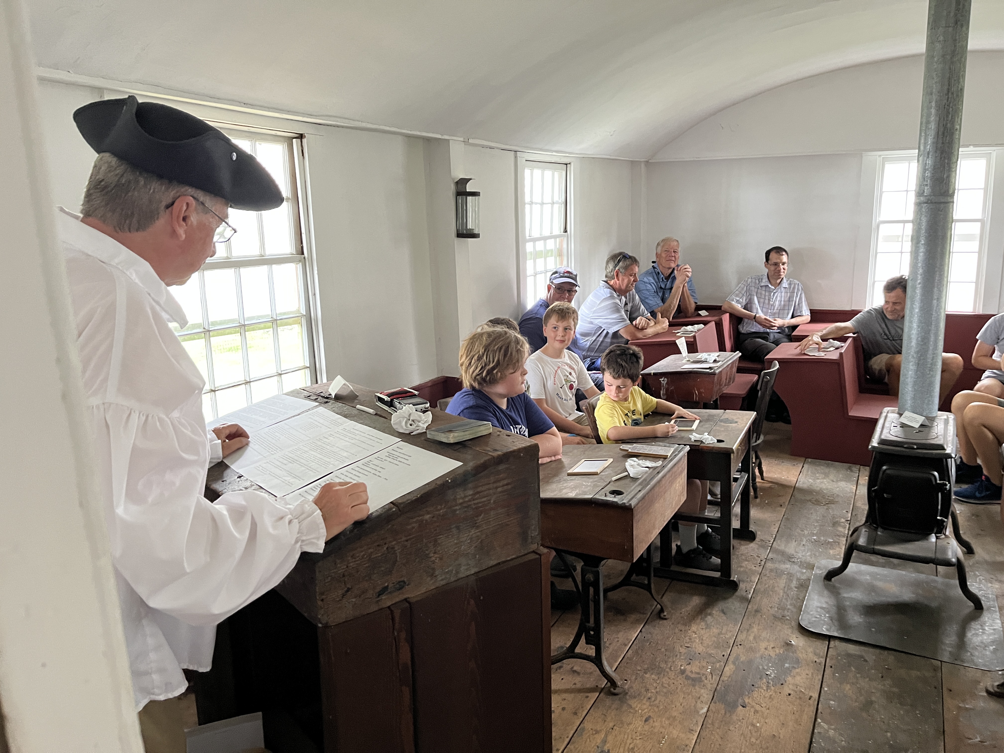
Richard Schmidt portrays James Preston at a Portsmouth Historical family day.

Credit to the work of Edward H. West: Early Schoolhouses and Schoolmasters of Portsmouth, Rhode Island. In the files of the Portsmouth Historical Society

This blog is a reprise of an earlier blog.
Southermost’s Journey on Union Street – Part 2

Leave a comment

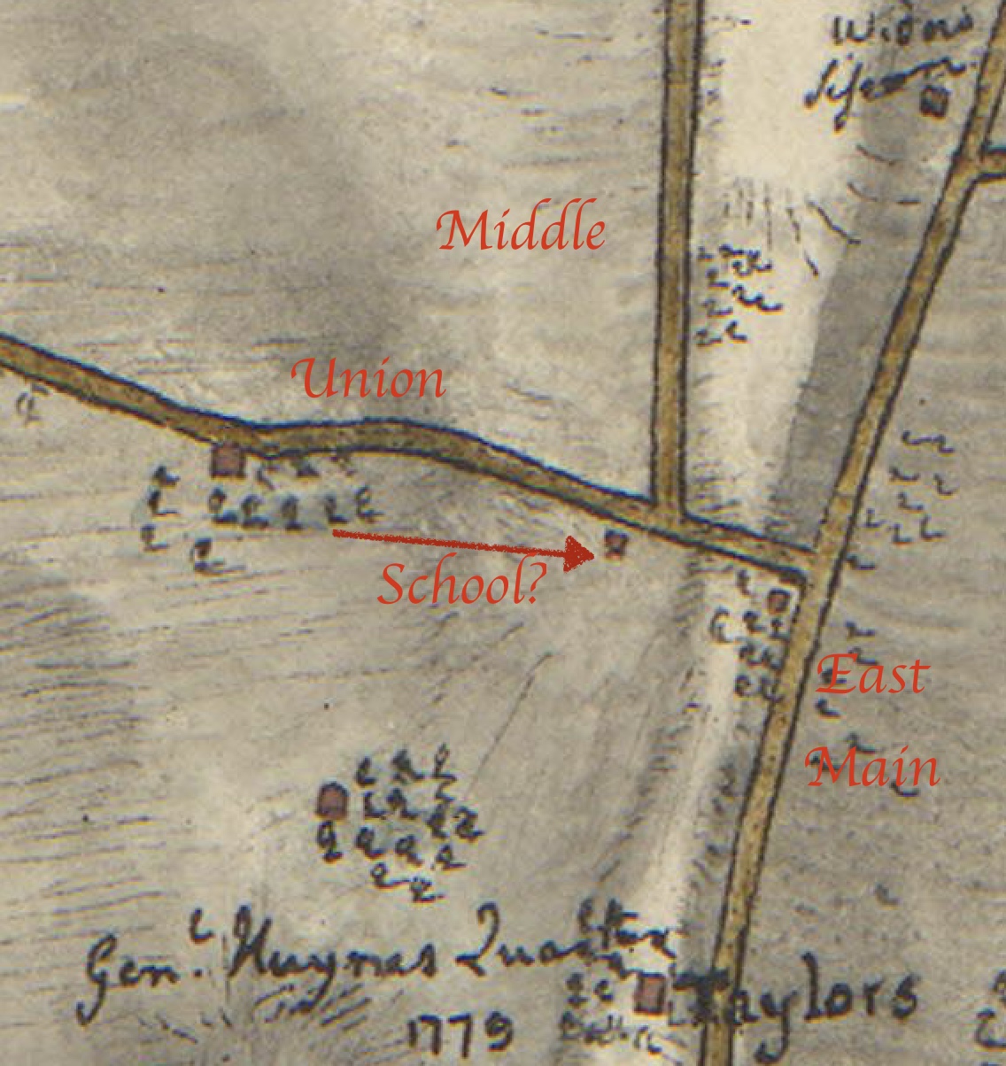
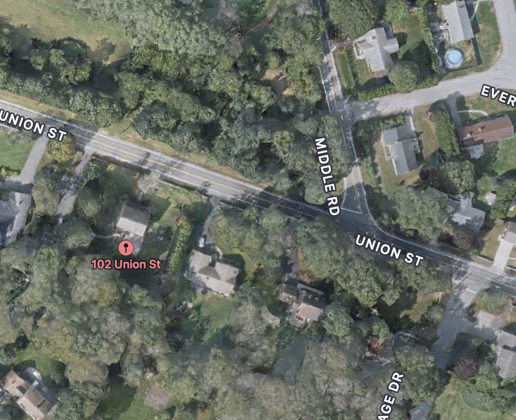
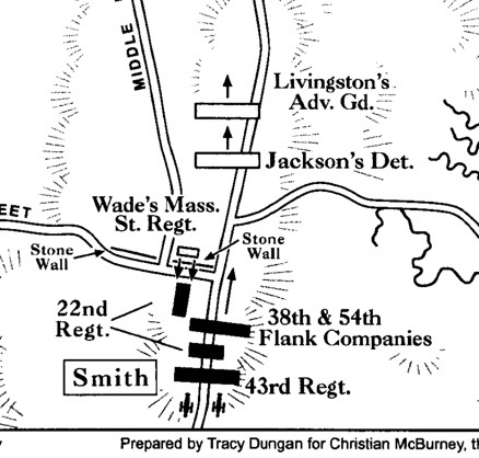
The original location of Southermost School may have been on Union Street near Middle Road. Edward West’s land grant maps are interesting, but may not be precise. A newspaper article quotes past Historical Society President Herb Hall as 102 Union Street as the location. That is slightly different from the land grant maps, but it still puts the building close to the action of the second skirmish of the Battle of Rhode Island. It would have been directly across from the stone walls where Wade’s men were hiding.

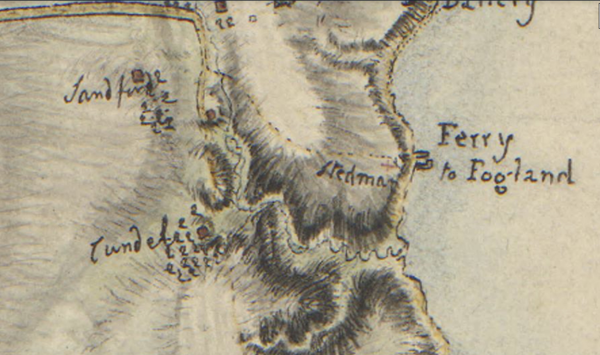
Another Revolutionary map (Fage 1779) shows a building that might be the school. The building on the corner of Union and East Main may have been the home of the Strange family. West’s maps show that was a small land grant to that family.

Fage Map – 1779

Based on Google Maps


Portsmouth followed the example of Newport and Providence in wanting education for their children. Once Sanford had donated the necessary land, the town freemen “having considered how excellent an ornament learning is to mankind,” made in 1716 an appropriation for building a school-house. The experiment was successful, and six years later two others were built— one of them sixteen feet square, the other thirty by twenty-five.

Southermost School becomes a home.

Upstairs in the school room there was a hearth that provided warmth for the classroom. The town was to support the building and the students’ families provided room and board for the schoolmaster and his family. Schoolmaster James Preston and his family stayed close by at the home of the Strange family. As one of the few public buildings here in town it is also used for many purposes such as town meetings, church services and sheltering needy families. When the schoolmaster Preston became ill and later died, the Strange family refused to board Preston’s family. Schoolmaster James Preston was reported as being sick and helpless in 1727. In the early days it was the families of the school children that were responsible for the room and board of the schoolmaster and his family. In an article on “Relief Problems of Old New England,” West reports on Portsmouth Town Council decisions. “James Strange (Sarah’s husband) refuses to entertain James Preston and his family any longer in his dwelling house it is agreed by this council that said Preston and his family be settled in the Southermost School house in the town for the present, that is in the cellar part thereof…” The Town Council agreed to pay Preston’s wife money weekly to provide for the family. Now the building at that time was twenty-two feet by fourteen feet – not large at all to house a family and the school children.

In 1730 it was ordered “that James Preston and his family be removed out of the School house wherein they now dwell and that Rebecca his wife pay the charges of their removal and house rent out of the weekly allowance.” Rebecca was forced to “bind out her two eldest children otherwise the said council will put out the said Children in order for the lessening the Towns Charges therein.” Soon afterwards James Preston died and the town paid his funeral charges. There is no further mention of the family in town records.

In a turnabout, the Strange family ended up living at Southermost School. From the lands of Portsmouth – article by Edward West. pg 75

“Continuing along this road we come to the site of the Southern School House, where the widow Sarah Strange took up her residence after the death of her husband; for at a Town Meeting in 1746, she and her family were ordered out, so that the school house might be improved in the use for which it was built.”

Southermost School Travels Up and Down Union Street. Part 1

1 Comment

Would the Southermost School have been witness to the early skirmishes in the Battle of Rhode Island?

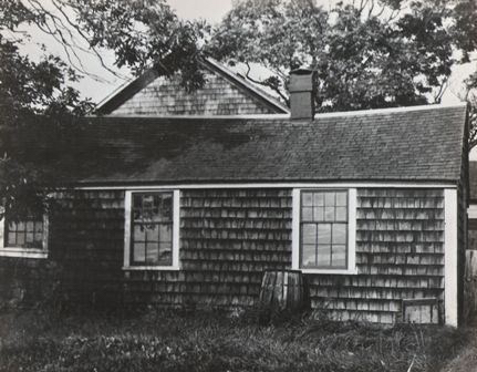
Southemost School before restoration

The Southermost School traveled up and down Union Street. Where was it located at times?

With the coming celebration of the 300th Anniversary of the Southermost School, I am revisiting the information I have gathered in the past. Maps, histories, and documents help us to answer those questions.

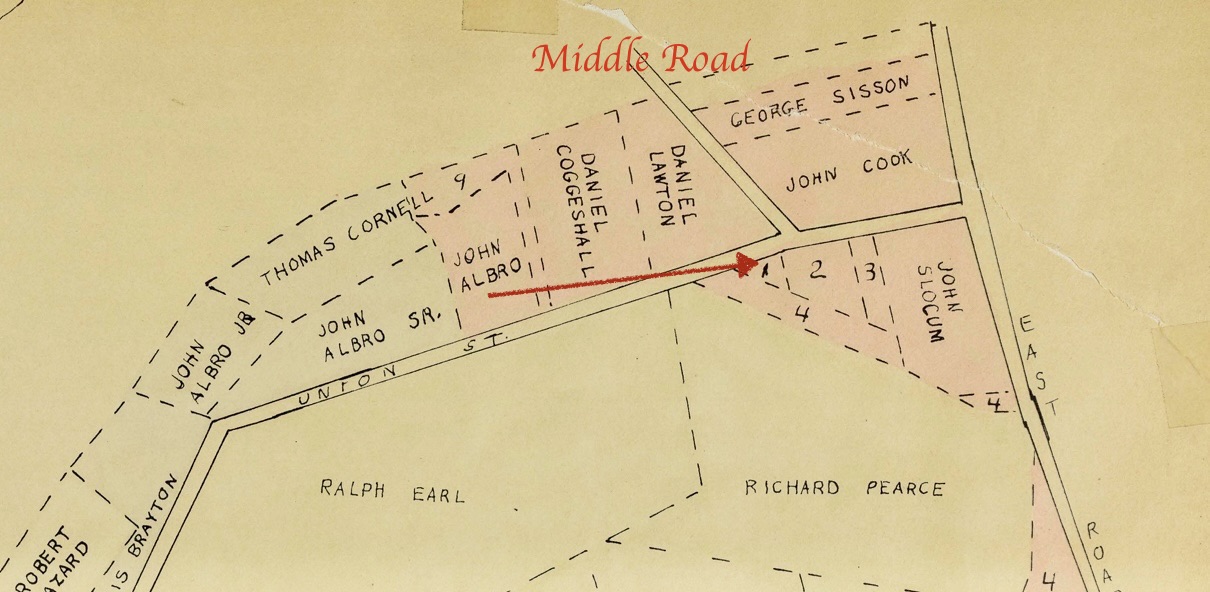
According to Portsmouth historian Edward West in his History of Portsmouth 1638-1936, in August of 1716 a school won approval at the Town Meetings. It was to be located on public land between Child Street and Church Lane. The other was approved on September 10th. It would be build on land donated by William Sanford. This was a small triangluar shaped parcel granted to him in 1713. West’s land grant maps help us visualize the location.

I have placed an arrow pointing to this piece of land Sanford Donated. It was labeled as 1. It is on the south side of Union Street and just past Middle Road.

The Portsmouth Historical Society today would be in part of the land of John Cook.

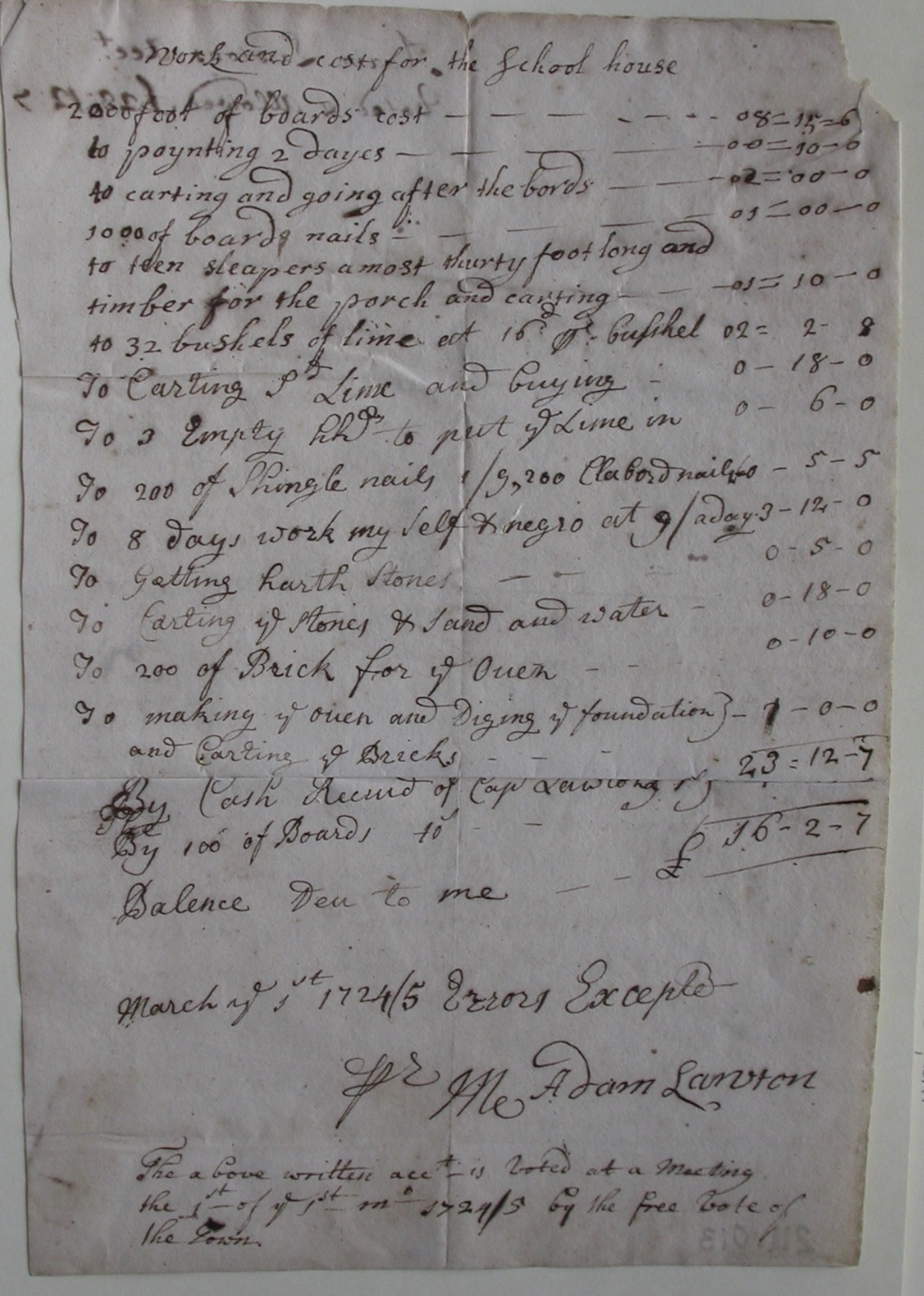
It took nine years for the school to actually be built. The Portsmouth Historical Society has a copy of the bill.

This document gives us some interesting details about what the schoolhouse looked like in its original form.

It had an oven made of 200 bricks. It had a stone hearth. Adam Lawton and a “negro” worked for 8 days on the building. It was completed in March 1725. It is listed as 24/25 because of the change over in the calendar. There was a porch. Lots of lime was used in the building. It took 2 days to paint. Some of the boards were as long as 30 feet.

More about Southermost in coming days.

A Children’s Book on Butts Hill

Leave a comment

There are not many books for children on the Battle of Rhode Island or on Butts Hill. There are bound to be corrections, so I haven’t printed many.

Portsmouth Census of 1730: Some stories about John Butts and Joseph Cundall

Leave a comment

I recognized the names of a number of those listed on the 1730 census. Some of them I have already researched, so I can give some information about them. So many of these families are inter-related.

John Butts

A son, John, was born to Zaccheus and Sarah in Little Compton in 1691. The family history is complicated, but John would have had his grandfather (Thomas Cornell, Jr.) hung for murder and his great grandmother (Alice Lake) hung for witchcraft. He moved to Portsmouth and is recorded to have had two wives. One of his wives was from the Wordell family and the other, Abigail, was from the Briggs Family. This Briggs connection is interesting because what we call Butts Hill was once called Briggs Hill. On January 15, 1725 John bought from Caleb Bennett a windmill and about one rood (about a quarter of an acre) of land on Windmill Hill (now called Butts Hill). He erected a house by the windmill. He must have owned other land in Portsmouth since he had been considered a freeman for some time. A 1726 map of the Newtown area of Portsmouth shows him having a small parcel of land on what would be the East Path (East Main Road today). John is recorded as being a tavern keeper. He was accused in 1747 of allowing card playing at his tavern and his future son-in-law Thomas Cook was called as a witness against him. John’s daughter Sarah married Cook in 1763. When John died in 1768 he left his daughter, Sarah Butts Cook, “my dwelling house and land, bounded southerly on land from my father-in-law Enoch Briggs, next to David Lake.” This is as far as I can trace the Butts presence on this Windmill Hill (Butts Hill). Some of Butts land was passed down through the Cook family. One Butts family genealogist wrote that the War for Independence had ruined the family fortunes. They lost their land and their business interests.

Joseph Cundall

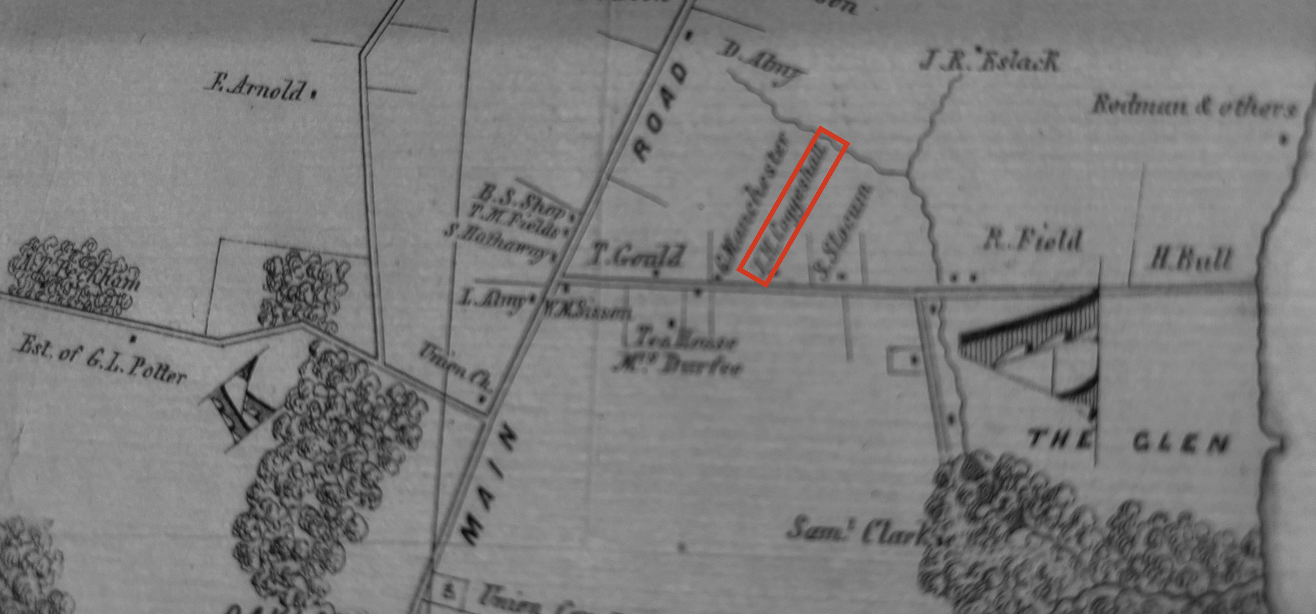
In 1706 Joseph Cundall had left his native England to become an indentured servant in America. Becoming an indentured servant was a way a young person could learn a trade and get an education in exchange for working for seven years or more. Cundall seems to have learned his trade well and was in a good position to buy land as an adult. James Sisson sold his grist mill and 46 acres around the brook to Joseph Cundall. What we call “the Glen” becames commonly known as Cundall’s Mills. Water from the stream powered the carding and fulling mills to wash and pull woolen fibers. Joseph Cundall added almost a hundred more acres to his land around the Glen before he died in 1760.

A note: Joseph Cundall married Elizabeth Butts

“Plan of Rhode-Island / Surveyed and drawn by Edw: Fage, captn. Royal Artillery, in the years 1777, 78 & 79.”. https://quod.lib.umich.edu/w/wcl1ic/x-828/wcl000922. In the digital collection William L. Clements Library Image Bank. William L. Clements Library, University of Michigan Library Digital Collections. March 10, 2025.

Portsmouth in 1730: Gleanings from the Census

Leave a comment

What kinds of information does a census give us about Portsmouth? I have worked with other census documents and within the names and numbers there is a great deal that can be learned from them. An article by Christian McBurney in his blog Small State Big History encouraged me to find the 1730 census for Portsmouth. McBurney’s article, “South Kingstown’s Partial Census for 1730, Whites, Indians and Blacks” noted that the Portsmouth census had been posted in Rhode Island Roots magazine by Ruth Sherman. DAR genealogist Laurie Greaney was kind enough to find it for me.

Quaker Meeting House – dating from 1700.

The census is headed with the note: “The number of Inhabitants, whites, etc. belonging to ye town of Portsmouth 1730.” It goes on to say ” A true Account of the number of the Inhabentantans [sic] of the Town of Portsmouth Taken by me John Freeborn, Sargant –. whites 643, blacks etc 170. Unlike the South Kingston census, Freeborn did not list “Indians” separately but counted them with the “blacks, etc.” That makes the total inhabitants to be 813.

Many of the names remind us of the founding families. They are familiar to us in the street names of Portsmouth. Freeborn, Burden (Borden), Durfee, Shearman (Sherman), Anthony, Lawton, Hall, Earl, Cornell, Slocum, Coggeshall, are just a few of those familiar names.

Working with the census, you can get an idea of life in Portsmouth households. Rhode Island legally abolished slavery in 1652, but the Gradual Emancipation Act of 1784 did more to abolish slavery. Children born after March 1, 1784 could not be enslaved, but children born of an enslaved mother would be supported by the master until they reached adulthood. The census records help us understand who the people of Portsmouth were as a whole. Whites made up to 90.5% of the town residents in 1774 and 93.5% in 1782. In 2020 the white population is about 95%. According to the census of 1730, whites accounted for 79% of inhabitants. After the War for Independence the Quakers (Society of Friends) in Portsmouth began to free their slaves. Among Portsmouth citizens who freed their slaves for religious reasons were William Anthony (1 slave 1775), Thomas Brownell (1 slave 1775), James Coggeshall (3 slaves 1775), Cornell Walter (2 slaves, 1775). Weston Hicks (1 slave 1775), Isaac Lawton (1 slave 1775), James Sisson (3 slaves, 1775). I recognized the family names of several whose ancestors are listed as having blacks in 1730. The idea of “all” being created equal had an effect. In 1730 the situation was different. Out of the 123 households, more than half (68) had blacks in their household. Thomas Hix (Hicks) with 8 had the largest number of blacks. Joseph Martin had 7 and George Cornell had 6.

The average number of people (white and black) in a Portsmouth household was 6.6. Daniel Pears had the largest household with 12 whites and 4 blacks. Others with large households were Abral (Able) Tripp, John Alen, Gideon Freeborn, William and Nathanael Hall, William, Benjamin and Job Lawton, Jacob Mott Jr. and Abraham Anthony.

There were a few women listed as head of household. Abigail Shearman, Mary Hefland, Marah Lawton, Joan Taylor, Patience Durfie, Hanah Tallman, and Mary Burden (Borden). Only two – Marah Lawton and Hanah Tallman – had blacks in their household.

Below is a list copied from the census. Some figures had been crossed out and those are marked with XX. These were not included in Freeborn’s totals.

W = WHITES, B= BLACKS, (ETC)

Pears, John W-09 B-03
Pears, Daniel W-12. B-04
Hill, Jothan W-05, B-06
Sweet, James W-08, B-00
Alen, John W-10, B-02
Alen, Willim W-05 B-03
Rementon, Josias W-0X, B-00
Smith, Ebnezer W-10, B-04
Alen, Mathew W-0x B-XX
Remington, William W-0X, B-XX
Freeborn, Gideon W-10, B-04
Freeborn, Gideon, Jr. W-03, B-02
Denis, Joseph W-06, B-03
Earl, William W-06, B-01
Thomas, Joseph W-08, B-00
Corey, Thomas W-06, B-00
Shref, William W-02, B-00
Almory, Daniel W-07 B-02
Manchester, Nathaniel W-07, B-00
Bennett, Caleb W-02 B-00
Tallman, Peter W-04, B-00
Buts, John W-07, B-00
Durfie, Gideon W-06, B-01
Buranton, John W-03, B-01
Arnold, William W-07, B-00
Wing, John W-04, B-02
Burden, Thomas W-04, B-03
Bengman, Tallman W-08, B-01
Durfie, Thomas W-04, B-01
Tripp, Abial W-10, B-01
Earl, John W-06, B-01
Hall, William W-11, B-01
Tallman, Hanah W-06, B-01
Shearman, Ebnzer W-02, B-01
Fish, Thomas W-05, B-00
Anthony, Abraham W-10, B-00
Durfie, Patience W-08, B-00
Shearman, Pelick W-08, B-05
Shearman, Thomas W-03, B-02
Lawton, William W-10, B-04
Shearman, Joseph W-08, B-00
Sisel, Richard W-09, B-00
Sisel, George W-06, B-00
Fish, Prasuared W-06, B-00
Cook, Joseph W-01, B-02
Cook, Willam W-05, B-01
Sisel, James W-07, B-01
Cook, John W-05, B-03
Cornell, Gideon W-01, B-02
Hall, Pashans W-06, B-00
Taylor, Joan W-05, B-00
Thomas, George W-05 B-00
Hix, Thomas W-10 B-08
Sanford, Wm. W-06 B-01
Shearman, Abigail W- 05, B-00
Slocumb, John W-08, B-01
Cornell, George W-03, B-01
Lawton, Thomas W-06. B-00
Cornell, Willam W-06, B-02
Allen, Ralph w-06
Brown, William W-05, B-02
Freeborn, John W-04. B-02
Sanford, John W-06, B-01
Hunt, Adam W-02, B-03
Ward, Joseph W-05, B-02
Lawton, Adam W-05 – B-03
Earl, Joseph W-03, B-01
Lawton, Jeremiah W-04, B-00
Lawton, JeremiahJR W-09, B-00
Strang, James W-07, B-00
Albrow, John W-06, B-00
Shearman, John W-05, B-03
Lawton, Bengeman W-12, B-00
Wilbour, William W-8, B-00
Counsel, Joseph W-06. B-00
Tyler, William W-07, B-00
Lawton, George W-06, B-00
Brghtmon, William w-08, B-00
Lawton, Robert W-06, B-06
Cornell, Wator W-03, B-01
Cogshel, Joshey W-03, B-02
Martin, Joseph W-07, B-07
Lawton, John W-02, B-04
Sisel, John W-08. B-00
Anthony, John W-04, B-00
Andros, John W-03, B-00
Sodrick, Solomon W-05, B-00
Peteface, Samuel W-07, B-00
Shref, Caleb W-06, B-00
Lawton, Isaacs W-08, B-04
Braeton, Francis W-06, B-01
Hefland, Mary W-04, B-00
Cook, Thomas W-03, B-02
Springer, Bengeman W-XX B-00
Presen, Rabecker W-03, B-00
Mott, Jacpb W-03. B-00
Dexter, John W-08, B-02
Lawton, Job W-12, B-04
Albrow, Samuel W-06, B-00
Hall, Nathaniel W-10, B-03
Lawton, Marah W-06, B-02
Mott, Jacob Jr W-10, B-00
Cornell, George W-09, B-06
Fish, Daniel W-05, B-03
Tallman, Stephen w-06, B-03
Brownell, Stephen W-04, B-02
Brownell, Joseph W-02, B-03
Brigs, Eneck W-04, B-02
Lake, David W-08, B-00
Howland, Daniel W-04, B-03
Corey, Mikel W-05, B-00
Burenton, William W-02, B-01
Burenton, Roger W-06, B-01
Anthony, William W-09, B-01
Slocomb, Gils W-07, B-02
Arnald, Jesias W-04, B-01
Burden, Mary W-01. B-00
Anthony, Jacob W-09. B-00
Fish, Jothan W-05, B-00
Sref, John W-07, B-00
Coggeshel, William W-08, B-02
Wilcox, Joseph W-07, B-00

As twenty-first century residents of Portsmouth, it is hard for us to imagine how common slavery was in Colonial Portsmouth.

Sources:

This is a link to Christian McBurney’s blog which focuses on Rhode Island history.

South Kingstown’s Partial Census for 1730: Whites, Indians and Blacks

The 1730 Portsmouth census can be found in an article by Ruth W. Sherman, “1730 Census, Portsmouth, R.I.,” Rhode Island Roots, vol 7, no. 2 (June 1981), p.16.

A New Walking Guide

Leave a comment

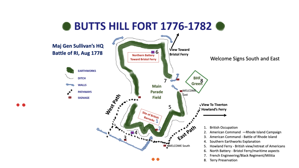
It is time for a new walking guide to Butts Hill Fort. I wrote one two years ago. However thanks to the scholarship of historians sponsored by the Battle of Rhode Island Association, we have added information. I am working on a grant for QR markers for a trail and I started by working with Butts Hill Fort Restoration Committee’s Paul Murphy about where information stations should be and what the topic of each site should be. As I was writing scripts for my husband to do audio clips, it seemed to me that those drafts would work into a book. I am a retired librarian and I have a soft spot for “hard copies.”

The self-publishing company I deal with offers downloadable pdfs and that is what I am posting here.

I hope readers will understand:

That although my husband and I have proofed this there are probably many corrections needed. I appreciate feedback to make corrections. I have only ordered a few copies and there is opportunity for changes.

That this is not a comprehensive tour. Each of the sites has a short introduction to the fort and phases of the Rhode Island Campaign.

That this was written for a tour with short audio clips. Some pages – timeline, glossary, etc. are in the booklet but will not be in the tour.

With grant funding tenuous these days, I have to think of other ways to finance signage for a walk.

Portsmouth’s African American Heritage: The Ayler Family

Leave a comment

At a Portsmouth Historical Society Open House, someone asked me about Portsmouth’s African American families. There was nothing in the exhibits that spoke to that question and Marge Webster and I decided to take on that question as a research topic. The stories we found were exciting and this blog is a short summary of what we found about one of the families.

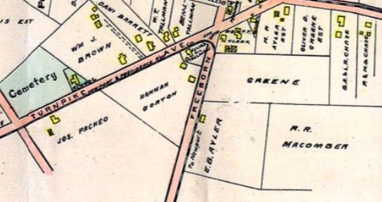
Much of Portsmouth history is farm history and the Ayler family represents the best in Portsmouth farming. In 1870, Morgan Ayler, his wife Matilda and three of his children are listed as residing on the farm of Joseph Macomber off East Main Road in Portsmouth.   Macomber went to Washington after the Civil War and brought back 16 former slaves to live in Portsmouth. We don’t know the reason he brought the 16 with him, but Macomber was a devout Quaker and aiding former slaves was an important activity for members of the Society of Friends. Morgan moved from being a farm laborer on the Macomber farm to owning his own farm. He won awards for his produce at the Newport County Fair.

Morgan’s son Edward went on to farm 80 years in Portsmouth. Edward Ayler’s obituary (published in the Newport Mercury in June of 1935) provides some clues to understanding their success in Portsmouth life. “Edward Ayler, one of the oldest and best known citizens of Portsmouth, died last Friday at his home on Freeborn Street.” Edward was one of the founders of the Portsmouth Free Public Library.

The Ayler family was very involved in Portsmouth activities.  Edward Ayler’s wife (Louise Jackson Ayler)  was active in the Woman’s Christian Temperance Union.  She often hosted meetings at her home.  She was active in the Friends Missionary Society.  The early generations of the Aylers were strong Quakers, but there seems to be a split among the third generation.  Edward’s sons Raymond and Emerson and daughter Alice Ayler Morris were known for their singing in the Friends Church before World War I.  During the war, however,  Raymond H. Ayler was commissioned as Second Lieutenant after having been drafted “with the colored boys” (Mercury, 9/13/18) while brother Osceola received a deferment because of his Quaker faith.  In the 1920s Raymond would be on the executive board of the American Legion along with William Vanderbilt and Bradford Norman.

There is little left in Portsmouth as reminders of the Ayler family. Macomber’s farm has been sold and his house torn down. Morgan Ayler’s farm at Cozy Corners has become commercial property and Edward Ayler’s home is only foundations left on Freeborn Street. The family moved on to Newport and to the Boston area. They came to Portsmouth and they made a difference.

Lost to Time: The Home of Artemas Fish, Revolutionary Soldier

Leave a comment

I have to go back to my blog on places Lafayette stayed during the Rhode Island Campaign and make a note that the 1760 farm house associated with Lafayette in Tiverton has been torn down. Through the years Portsmouth has lost many historic buildings. One of Jim Garman’s early books was on historic Portsmouth homes and he has noted when one of the houses he studied are lost to us.

Within the last few years the Artemas Fish house on Glen Road (built circa 1760) was torn down to facilitate the building of new homes. Fish received a pension at Newport, Rhode Island, for eighteen months active service in Babcock’s Regiment, Rhode Island Militia during the American Revolutionary War. Babcock’s/Lippitt’s Regiment was a regiment raised for the defense of Rhode Island during the American Revolution. The regiment was one of two formed by the state of Rhode Island between November 1775 and January 1776 to deter an attack by the British against Rhode Island.

The regiment was again authorized by the Rhode Island General Assembly on January 8, 1776 with 12 companies under the command of Colonel Henry Babcock. The regiment was originally located on Aquidneck Island and along with Richmond’s Regiment left the island at the time of the British invasion.

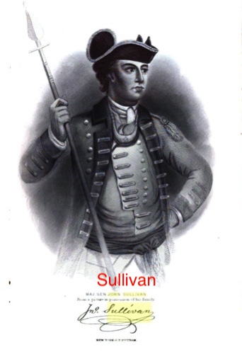
In his pension application when he was in his seventies, Fish listed his service during the Battle of Rhode Island – which he calls the Battle of Quaker Hill. Three witnesses for his pension application stated that Fish was part of Sullivan’s Life Guard. Sullivan sent this elite group into the thick of the battle at Quaker Hill.

..in the year 1778 he was employed, at least for six months, in the service in Capt. Joseph Knight’s company in the same regiment. He was much under Capt. Knight towards Sullivan’s expedition against Rhode Island – that he recollects that in the battle on Quaker Hill, besides the man who shot under him (near him?), & that on the evening of the second day after the battle, according to the best of his recollection, they retreated to Tiverton – that he also was a volunteer in Spencer’s expedition under the same Capt. Knight towards East Greenwich. Mentioned – that after the British left Rhode Island, he was often called out to guard, & in 1780 served for two months under Capt. Isaac Knight – that he was employed in actual service during the Revolutionary war for about twenty-six months. ” (Fish’s testimony in application for a pension can be found online – Fold3)

Artemas Fish had a long life. He served as Postmaster of Portsmouth 1808-1810. He died in February of 1834 in Rhode Island. His grave is in Fish Cemetery, Portsmouth, Newport County, Rhode Island, USA, Died at 90 in 1834,

The house became the property of Dr. Peter Wales, Portsmouth’s first doctor. The house was passed down to his granddaughter, Lydia, who was married to one of Portsmouth’s best builders – John Coggeshall. Coggeshall was the builder for the Christian Union Church, now the headquarters of the Portsmouth Historical Society.

Glen and South Portsmouth Neighborhood: Early History

Leave a comment

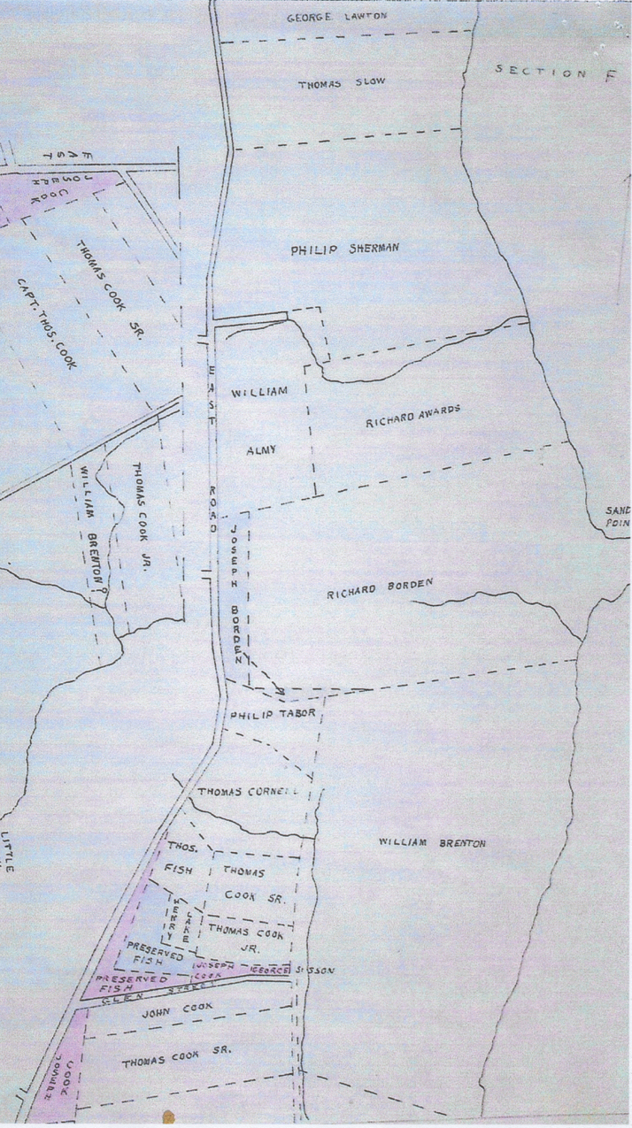
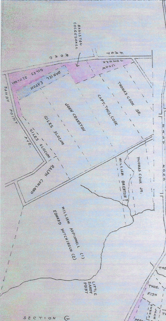
This blog is part of a study of Portsmouth neighborhoods. Some areas have a very rich history and the history of the Glen Farm area and South Portsmouth is an example. There will be a few articles to get us through the centuries. Information about this early land grant period for the Glen/South Portsmouth comes from historian Edward West’s article on the “Lands of Portsmouth” in the Rhode Island Historical Society Journal. West drew these land grant maps by going through the property records and there is some question about accuracy. However they give us a good start in learning about the various neighborhoods in town.

From the Lands of Portsmouth: A Glimpse of Its People. Edward West. Rhode Island Historical Society Journal, July 1932

“Let us now turn down the Newport path (East Main Road) until we come
to a road, nearly to the line,(Sandy Point?) which was laid out in 1713. Turning east through this road we come to what has been for many years known as Wapping Road. This road was mentioned in the list of 1661, and ran between many of the large farm grants. In the 1717 list of highways mention is made of the “Great Rock” near the line, a great mass of pudding stone. (Perhaps the great puddingstone at the corner of Wapping Road and Mill Road).

The farms here belonged to Bartholomew West, Samuel Hutchinson, and John Sanford. On the west side of the road was the Long Swamp farm of Thomas Lawton, made
up of several grants which he purchased of the grantees. On the east side was the farm of Thomas Burton, granted in 1640, to run from the middle of the first water south of
the second sandy point to the middle of the fourth water. In 1648, in a grant to Thomas Cook, mention is made of Mr. Burton’s ferry. I have never been able to find any
other mention of this ferry. I suppose it was probably the first ferry to Fogland. Turning east through a former road we come to Sandy Point first granted to William Aspinwall, and after he left, to Edward Hutchinson.

We will now take a cart path to the north, passing the grants, on the right, to Ralph Cowland, Giles Slocum, John Cranston and Thomas Cook. We now come to what
has been called for many years, the Glen. This was granted. to William Brenton but was acquired by Giles Slocum, who built a fulling mill on the bank of the stream.

North of this was the farm of William Brenton, called by him Middleford Farm. There was a broad approach to this farm… Returning to the Newport path we come to a brook, now
called Mint Water Brook, which crosses the road and runs into what was known in 1657 as Briggs Swamp, when Phillip Sherman was granteci 30 acres here. To the north
of this, on the east side of the road, was more of Phillip Sherman’s land, in what was known as Birch Swamp. Here, also, was the land of William Almy, who fenced in the
road to the watering place and was compelled by the court to open it again.

References: This is a link to the Edward West article: https://archive.org/details/rhodeislandhisto11rhod/page/n435/mode/2up

Older Entries Newer Entries